| Andante's Sailing
Blog November 2012 Back to Andante Table of Contents |
|
| Back to October 2012 Ahead to December 2012 | |
| November 1, 2012 Thursday -- Elizabeth City to southern end of Alligator River near Alligator River - Pungo River Canal | |
| Just for the record, in 2000 when we were
southbound we got stuck in Elizabeth City for several days due to the weather.
History has a habit of repeating itself. Also, the following April/May when
Christopher and I were bringing Adagio north we got stuck at the north end of the
Alligator-Pungo Canal because the swing bridge on the Alligator River was not opening due
to high winds.This year with the passage of Hurricane Sandy the bridge didn't open for a
couple of days (it didn't affect me since I was hunkered down in Elizabeth City). Anyway, today I left Elizabeth City at the tail end of the flock of Canadian Geese that are traveling together. Due to the storm of the preceding five days there were many boats that chose today to start the dash south. This makes for crowded anchorages for the next few days until the many boats get sorted out and pursue somewhat different schedules. There are a couple of places south of Beaufort, NC where this flock could cause problems in finding places to stop for the night. Fly south quickly my little canadian geese. Leaving Elizabeth City I sailed on a beam reach down the length of the Pasquotank River in the southwest wind. The speed over the ground never dropped below 6 knots. The wind in Albemarle Sound was still SW, but the course to the mouth of the Alligator River necessitated sailing a close reach in somewhat strobnger wind. While out on the Sound the speed over the ground was 6.8 - 7.2 knots. A rousing great sail. Once past Middle Ground, a shoal at the entrance to the Alligaotor River, it was still a close reach down to the swing bridge. Once through the bridge the course mandated sailing closer to the wind, which was also blowing harder. With the first reef in the main and the genoa rolled down to 2nd reef size I was still making more than six knots close hauled. What a day of sailing! This is what I came on this trip for. But, ...
|
|
| November 2, 2012 Alligator River to Bellhaven, NC | |
| In my chosen anchorage there were 4 or 5 other
boats, all Canadian. I got up early to make the long run to Bellhaven. All motoring after
a great day of sailing. The Canadians must have been dialed into my thinking. No sooner
did I have the anchor up than three of the Canadian boats were racing by me to get ahead
of me into the creek that leads to the Alligator - Pungo Canal. As soon as they were lined
up in front of me they slowed down! On the long stretch of the canal they would slow
periodically to admire the scenery. They even slowed to 2 knots to go under two of the 65'
high fixed bridges. Don't these people understand that the bridges are 65 feet high and
their masts are a good 10 feet short of that? This morning before departing I made a thermos of tea for later in the morning. By the time I fetched the thermos the tea inside was stone cold. I poured it into a saucepan to heat it up. You have to understand that I do this in quick 5-10 second bursts down from the cockpit, leaving the autopilot to keep the boat running straight in the center of the canal. In one burst I ducked down and turned on the solenoid for the propane stove. As I headed back to the cockpit I felt the boat begin to turn. Uh oh. I got on deck to find us headed for the stumps lining the edge of the canal. Turn off the autopilot and get back on course! I had forgotten that the solenoid has a strong electro-magnet and some genius mounted the fluxgate compass for the autopilot right next to it. When the solenoid comes on it disturbs the fluxgate compass and the autopilot goes nuts. Almost a very costly oversight on my part. Now to the end of the day's story. As we neared the end of the canal the Canadians had slowed to 4.5 knots. Suddenly one of their buddies came up from behind to pass us all. As I put the pedal to the metal to follow suit the three in front suddenly picked up their speed to more than 6 knots. What is it with these people? In the end none of them were headed for Bellhaven so there was no need to try to race on to the next anchorage.
|
|
| November 3, 2012 - Saturday - Bellhaven to Whittaker Creek, Oriental, NC | |
| Since the Canadians went well beyond Bellhaven
yesterday I didn't have to be a aprt of their little flock. Remember that in Elizabeth City I had planned to change my engine oil, but my oil extraction cnotraption woudn't work and there are no marine stores in that fair city to find a replacement. While in Bellhaven I called the West Marine store in Oriental to see if they had a device that I could use. It should be hand operated with no parts that can corrode and render it useless. They did indeed have something to fill the bill, but their closing time was 4 PM everyday. What is it with West Marine? Don't they understand that the snow bird migration means that we need parts well into the fall and that 4 PM is a little early to be shuttering the doors. All that is by way of saying that I left Bellhaven EARLY to
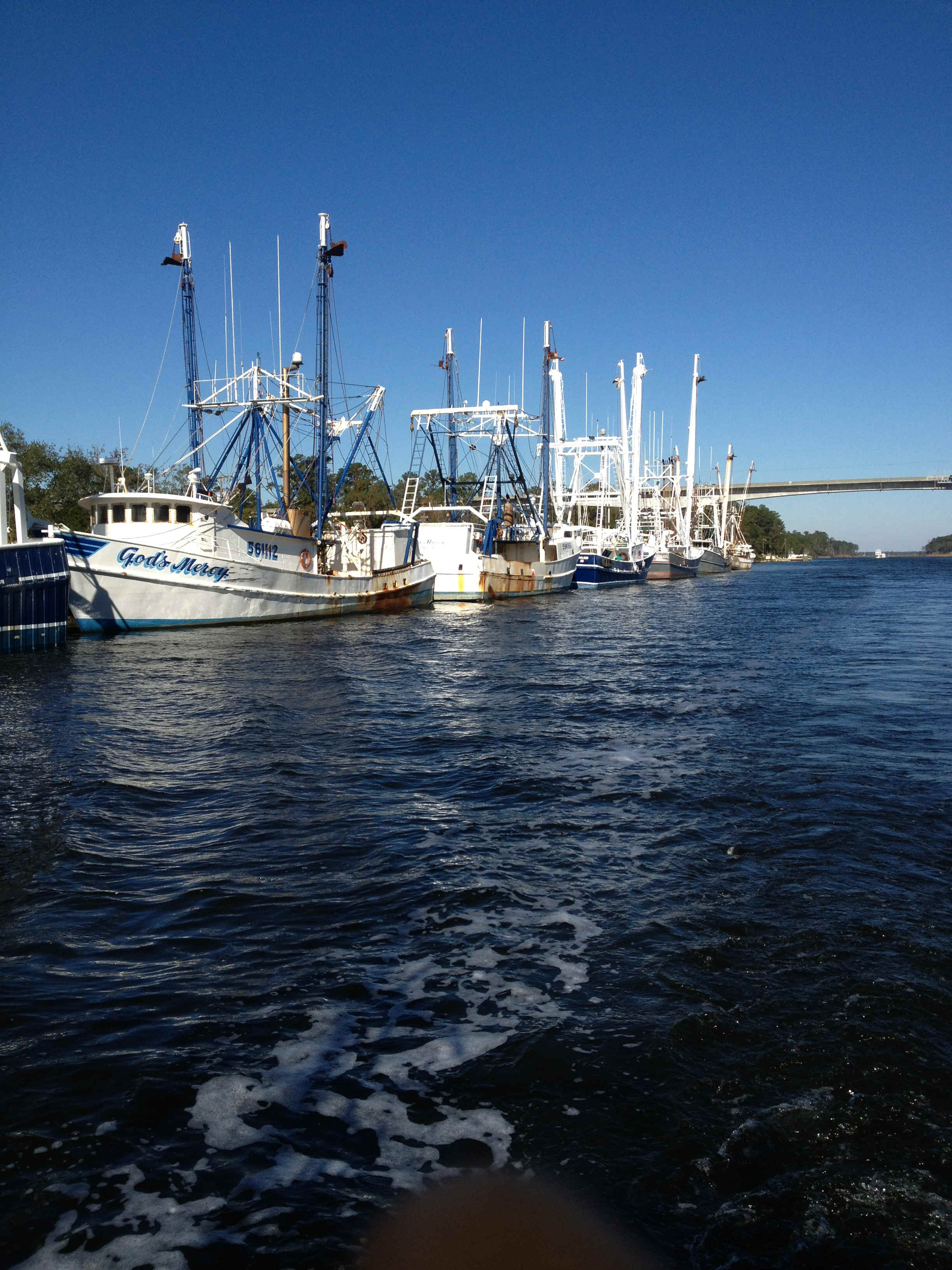
be sure that I could make it to Oriental in time to visit West Marine. Along the way there was another canal to traverse. At the Hobucken Bridge the fishing fleet was in port. These are ocean going trawlers; over 60 feet long. This last little guy is rigged like the big boys, but is probably only about 30 feet long. Guess he didn't take his vitamins when he was young. Thinking that Oriental would be crowded with the Canadians that have been shadowing my progress, or is it the other way around, I opted for Whittaker Creek instead. Turned out that the flock of Canadian geese all rushed past Oriental toward Beaufort. All is well that ends well. Turns out that I know the dock master at Whittaker Pointe Marina. We met Ashley and Carol Irwin at Chub Cay, Bahamas when we cleared in in 2000. Ashley and Carol stayed down in the islands for another 7 years and moved to Oriental about 5 years ago. I endorse Whitaker Pointe Marina as an alternative to trying to squeeze into Oriental. The marina is new, clean, has laundry facility and the price is right. Oriental itself, the self-proclaimed sailing capitol of North Carolina, has little space for transient boats.
|
|
| November 4, 2012 Sunday -- Whitaker Pointe Marina, Oriental, NC to Swansboro, NC | |
| This morning I didn't jump out of bed early
because the plan was to only go as far as Morehead City. Skipper Bob's Guide to ICW
Anchorages alleges that there is room to anchor between Morehead City and what the locals
know as Sugarloaf Island. This was my anchorage of choice because Beaufort City is
always crowded with transient boats and there are always a few derelict boats in the
anchorage as well. And finally, 12 years ago we ran aground there trying to anchor
off the City. So I departed Whitaker Creek and sailed across Pamlico Sound to Adams Creek. Motoring down to Beaufort is bucolic. Many pretty homes pepper the creek side. Once down in the vicinity of Beaufort an Island Packet yacht came roaring by me (keep in mind that when you are in a sailboat roaring by is a slight exaggeration). "Navigator" was steering as though he was either drunk or couldn't read his charts and the markers on the water. At one point I was sure he was about to go aground so called him on the VHF. Although he didn't answer he did change course. Shortly after the incident with the drunken sailor, I went into the supposed anchorage at Morehead City. Skipper Bob needs to update this part of his guide. Although there are no channel markers off Morehead there is an implied channel since one can enter the bight from either end and there are many boats tied to the docks at Morehead City. The area that is clearly not in the implied channel is filled with mooring balls with decrepit sailboats attached to most of them. NO PLACE TO ANCHOR. No choice but to press on. A perusal of the charts and cruising guide showed a few choices south of Morehead City. I went by Peletier Creek and Spooner's Creek. Skipper Bob is not altogether clear about how much water is in these places so I didn't go in to look. That left Swansboro, making it a long day and a last resort. It would be there, or? Now that I have anchored there I think Skipper Bob under rates this location as an anchorage. If the weather was better and I didn't have a constraint to get to Charleston I might have spent another day to poke around in the little town.
|
|
November 5, 2012 Monday -- Swansboro to Wrightsville Beach, NC |
|
| This morning I again did not jump out of bed
thinking that it would be a short day. The other four boats in Swansboro with me
were all gone before I had finished my coffee. The morning was clear and cold.
However the weather forecast was for a Nor' Easter coming up the coast. The plan was
to go as far as Mile Hammock Bay at Camp Lejeune. Upon leaving Swansboro I saw my first porpoise of the trip. One poor fellow must have been hit by a boat propeller. The tip of his dorsal fin was hanging like it had been cut by a propeller. It is no wonder when considering how fast the locals drive their fishing skiffs. There would be no way for a dolphin to get out of the way or for a skff to avoid the dolphin upon sighting one. 12 years ago we saw the first dolphins on our way into Beaufort. 2 years ago when bringing the boat north we didn't see any dolphins at all. Shortly after the dolphin ecncounter the catamaran Cadenza overtook me. This is an uncommon name and the make of catamaran is also not common. A few days earlier I had heard Cadenza on the VHF so I knew them to be of British descent. All-in-all I had my suspicion that I knew the owners of Cadenza. When they hailed me on the VHF to come by me I asked them whether they had cleared into the Bahamas 12 years ago at Chub Cay. Sure enough, they were one and the same. Small world encounter number two in just a couple of days. I got to Mile Hammock Bay by 10 AM; very early in the day. In the meantime the weather forecast was continuing to deteriorate in dribs and drabs. The last place I wanted to be for a couple of days was Mile Hammock Bay in the middle of the Marine Corps reservation with no phone and no internet serivce, so I slogged onward with genoa out and riding the current south. Cadenza decided that they would stop at Sloop Point and go into Topsail Sound. They felt they didn't have the speed to make it to Wrightsville Beach before dark. I started to go in also but didn't like what I saw on the water, or on the chartplotter, or what I read in the anchorage guide so once again I went on. With the motor and genoa with the NW breeze I was making well over 6 knots so I was sure I could get to Wrightsville Beach before sunset at 5:17 PM. Not long after leaving Cadenza in my rear view mirror I was coming up on the navigational buoy "G99A" when the bottom started coming up very quickly. Now for a digression. While on the water I leave the radio on VHF 16, the hailing channel. From the traffic on the radio I knew that the fleet of Canadians was having a tough day running aground or narrowly avoiding shoals. Because they stay so close to one another they don't identify the navigational mark where they are having trouble. In one case they did identify the the location as R92. Once I got there I couldn't see how one of them could run aground there. The channel was clear and there was no inlet from which shoaling could occur. A bit later there was more chatter about running aground, but no identification of the location. Back to the narrative. As I saw the depth sounder showing shallow water I thought I was too far to starboard and so headed further out toward the G99A. All of a suddent 'bam' and I was on a sand bar shoaling beyond G99A and into the channel. With the rushing current I was quickly healed over. A couple of locals coming in through the inlet from the bay between me and the barrier islands finally understood my arm waving and came over to find out what was going on. They graciously agreed to help get me off. Their initial inclination was to use one of their tiny docklines for the effort. Instead I told them we would use one of mine. On the first try they didn't tie their end of the line to their boat properly and it just pulled off under load. I encouraged them to re-tie it and try it again. On this second attempt they were pulling in the wrong direction and were ready to give up. Staying on this bar would be a disaster for me so I asked them to try again and told them the direction to pull. As they say, the third time was a charm. But they didn't have enough control over their boat to get some slack in the line so that they could untie their granny knot. For fear that they would pull me back onto the shoal I told them to just cut the line. This struck them as the height of folly. I insisted. Then they couldn't find a knife in their fishing gear. Finally they cut the line. When I asked them to point out the deep water they looked at me as though I was from another planet. Eventually they did a little arm wave and said 'Over there.' Thanks a lot for the informaton; but they were good samaritans to have helped me get off the sandbar. On my way again I could make the Figure Eight Island Bridge opening at 4 PM and then the Wrightsville Beach Bridge opening at 5 PM if I could keep my speed up. With a little wind in my favor and the tide turning in my favor I made both openings right on schedule. Actually I was a little ealry for Wrightsville, but that was OK by me. When I got to the Wrightsville Bridge there was a boat up on the shoal on the east side of the ICW on my side of the bridge. The current here runs very fast and mistakes are easy to make. That guy was a good reminder to me of the fate of one of the boats we had traveled along with when we got here in 2000.
|
|
| November 6, 2012 Tuesday, Election Day -- Wrightsville Beach | |
| As they say in Philadlephia, vote early and
vote often. Today is a layover day. It is cold again today and with rain thrown into the mix. Even at anchor it is miserable. I have on my blue jeans and sweat pants, along with four layers on top, and a hat. It has been cold every day since Hurricane Sandy passed. It is as though the storm opened the door for cold air from Canada. I need someone to close that door, SOON. In the evening I spent some time on the phone with George and Joan Pidot. He hired a whole cohort of us when he was chairman of the department of econ at Temple. He and Joan retired to Wilmington, NC from his job as Chancellor of the Chicago Community College system (300,000 students I think). |
|
| November 7, 2012 Wednesday, Wrightsville Beach -- Southport, NC | |
| Obama has been reelected. Whew. While
fivethirtyeight.com was confident that he would be re-elected I was not always so
sanguine. This is a great relief to me since I felt that Romney was a man totally devoid
of principle. The only policy stance about which he was consistent was tax cuts for the
uber-affluent. About the only other thing about which he has been steadfast is that he
wants to lead. This was a short day, comparatively speaking; only 5 hours of motoring. I came down here so that I could go off shore to Charleston tomorrow. Southport is quite prosperous. There doesn't seem to be much evidence of the recession as in Elizabeth City and Rock Hall. |
|
| November 8, 2012 and November 9, 2012 -- Southport, NC to Charleston, SC | |
| This leg is my first offshore, overnight
passage. It was hard work. I started on the 8th sailing a fast beam reach. As the wind
shifted I went to a close reach, then by late afternoon was close hauled. As the wind
speed rose and fell through the day and night I alternatley rolled the genoa up part way,
let it back out, put a reef in the main, then shook it out. I went through this routine
three times in the 19 hours I was under sail. The entry into Charleston Harbor in the dark
was scary. The harbor pilot boats, taking pilots out to the big ships, are very fast and
don't use AIS. When they are heading out it is difficult to see their nav lights agains
the background lights of the harbor. In the channel between the jetties there were four or
five fishing boats trawling for shrimp and/or fish. Although they are well lit, it is hard
to interpret their lights agains the background of the city. And of course they also do
not use AIS. On my way in I encoutered a container ship coming out. Their nav lights are
high above the level of my line of sight so it took me awhile to understand what was
blocking out the lights from the City. After those encounters I was concentrating very
hard on what was ahead of me when I heard 'BLAAH, BLAAH'. Looking over my should I saw
another container ship coming into my part of the channel so he could make his turn into
the harbor I quickly turned 90 degrees and stepped on the gas to get out of his way. As soon as I had the anchor down I fell asleep in the cockpit, enjoying the warm sun after a cold night on the water and a nerve wracking entry into Charleston. |
|
| November 10, 2012, Saturday, Charleston, SC | |
| AM: Cleaned up the boat a bit more. Tightened
the fan belt. Checked the coupling bolts between the transmission and propeller shaft. PM:
I spent four hours walking about the City of Charleston. Very pretty and very
properous. Walked through the campus of the College of Charleston. Unlike my
early walks through St. Mary's College in MD and Hampton University, VA there were many
students out and about.
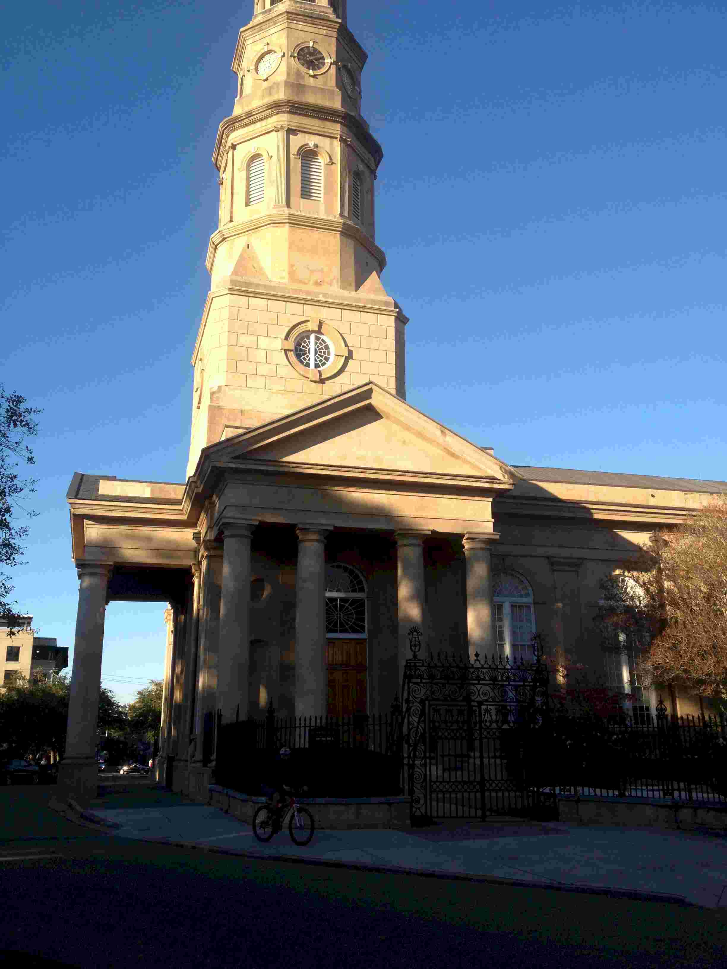
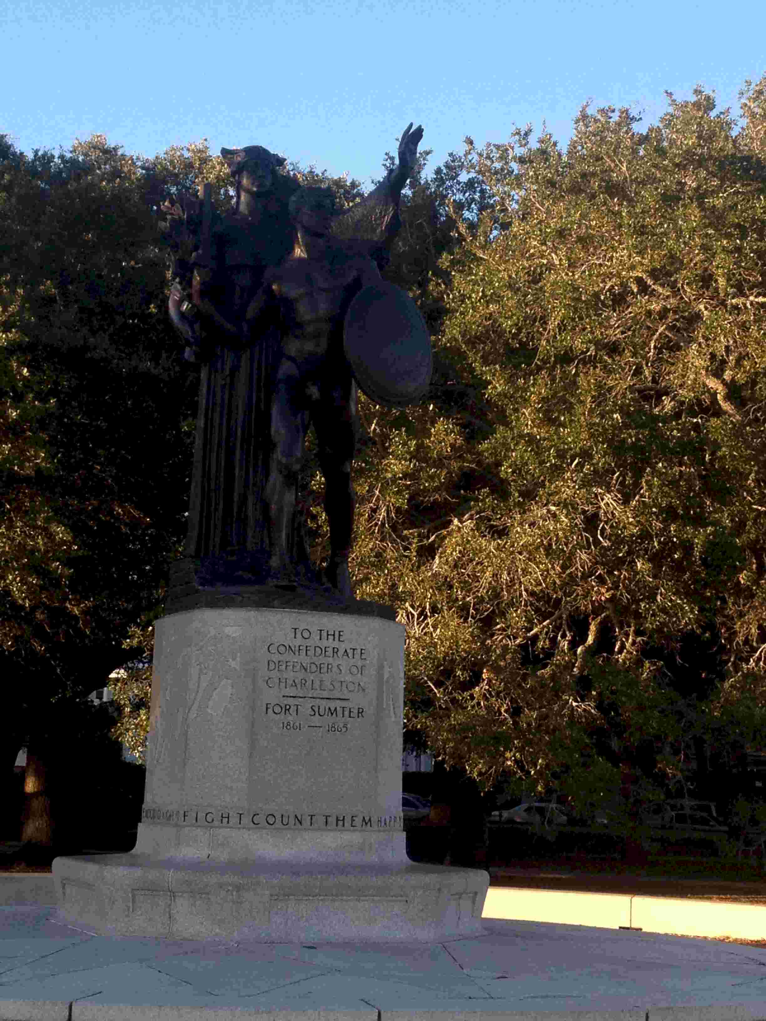
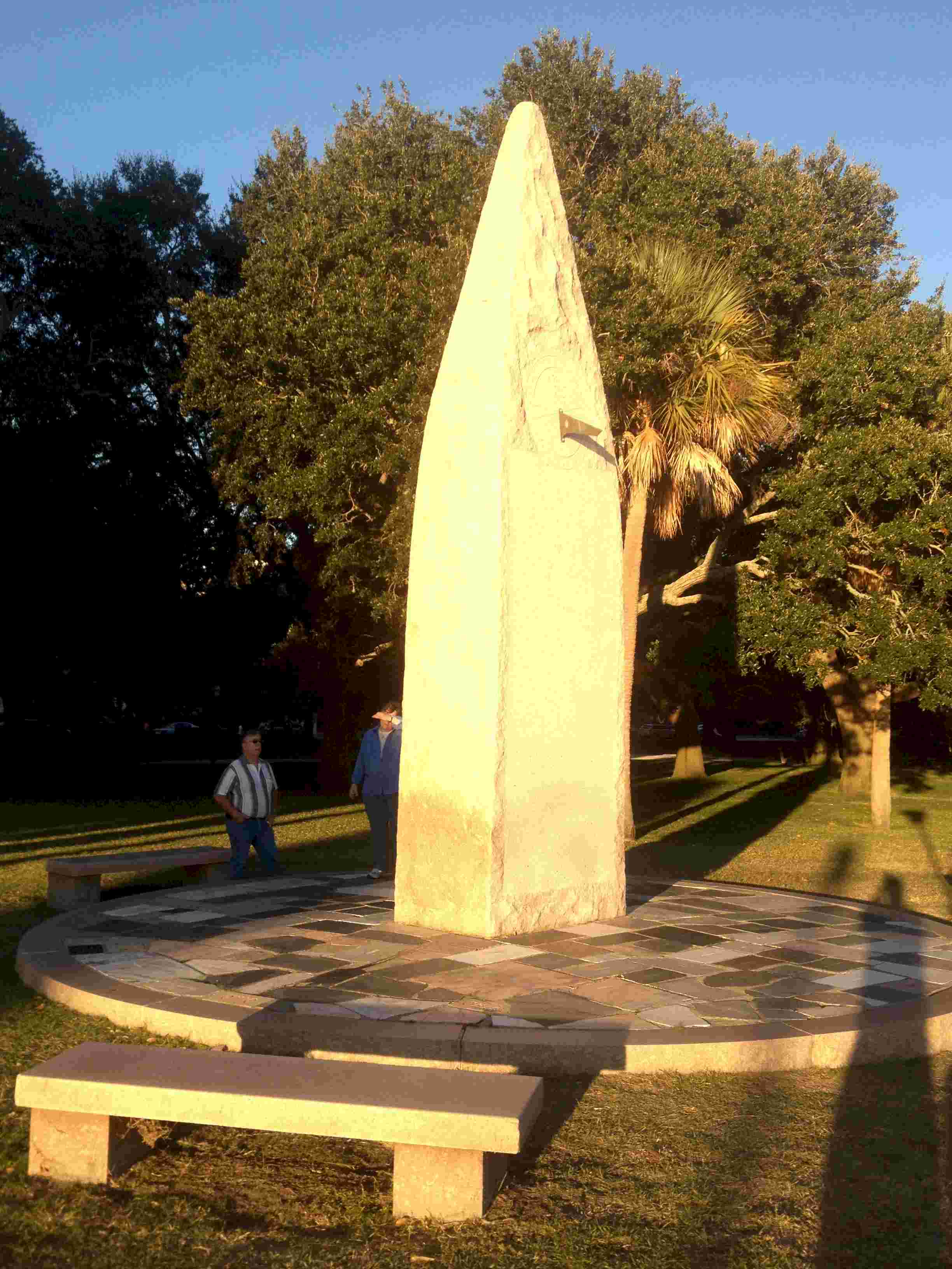
The above shots are just a few of the sights around Charleston. |
|
| November 11, 2012 Sunday Charleston, SC | |
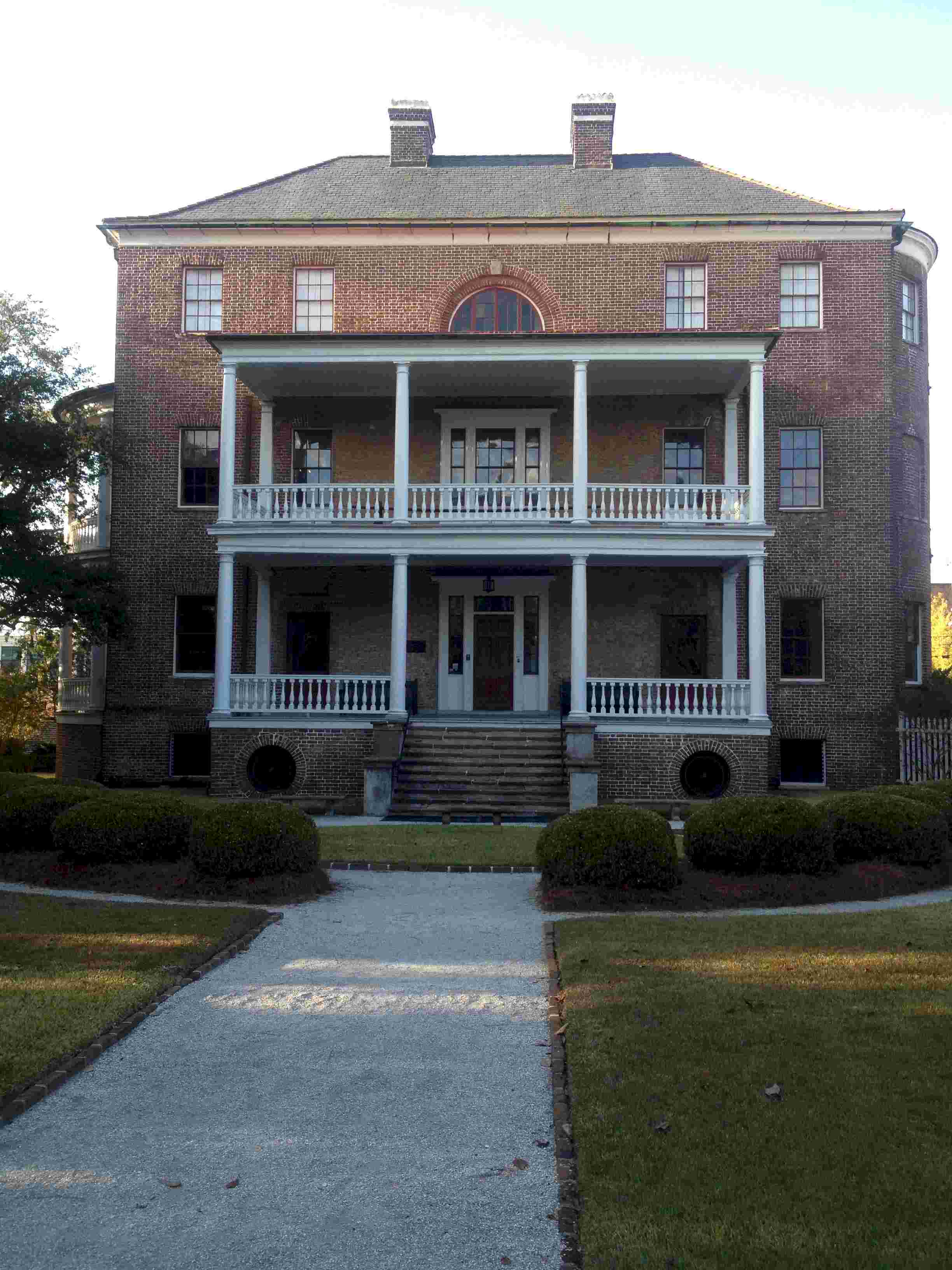
| Today I went out walking again. From the
Visitor's Center I walked south along Museum Mile. I include here two photos of buildings
that are quite distinctive in the degree to which they differ from the usual
"single" architecture of so many old Charleston homes.
While I was out walking I stopped to talk to a local woman out walking her dog. I asked about the economic base that drives the apparent propserity of Charleston. Apart from mentioning the effects of BMW and Boeing, she seemed to think that professional services accounted for a lot of the economic activity. Almost off-handedly she mentioned that there are a lot of northern retirees that have relocated to Charleston, but she quickly added that many of them flee back north during the hot and humid summer months. |
|
| November 18, 2012 Sunday -- Charleston, SC | |
| So, I have been here nine days. Day after
tomorrow I will be leaving for CA to spend Thanksgiving with Diana and other family
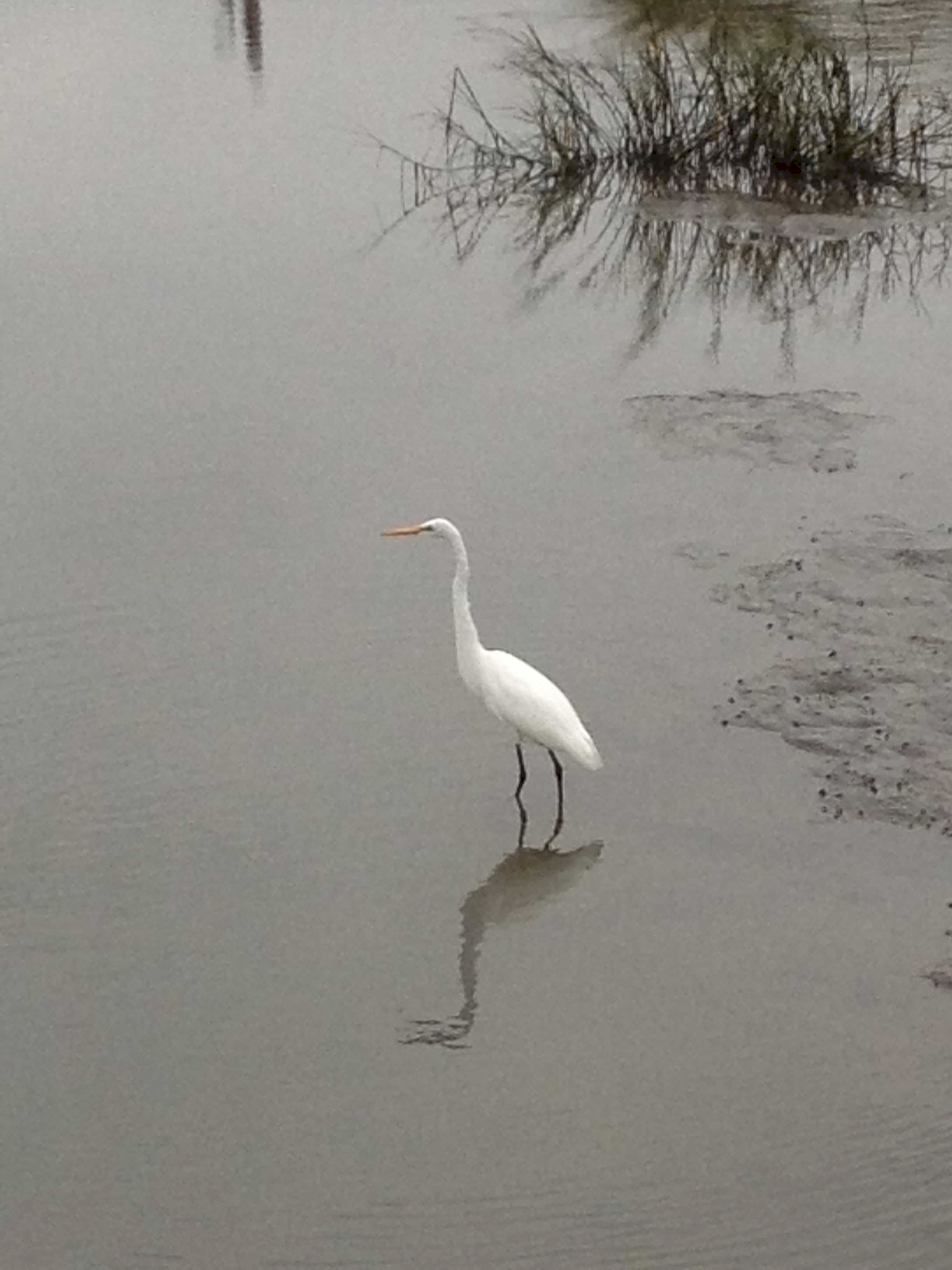
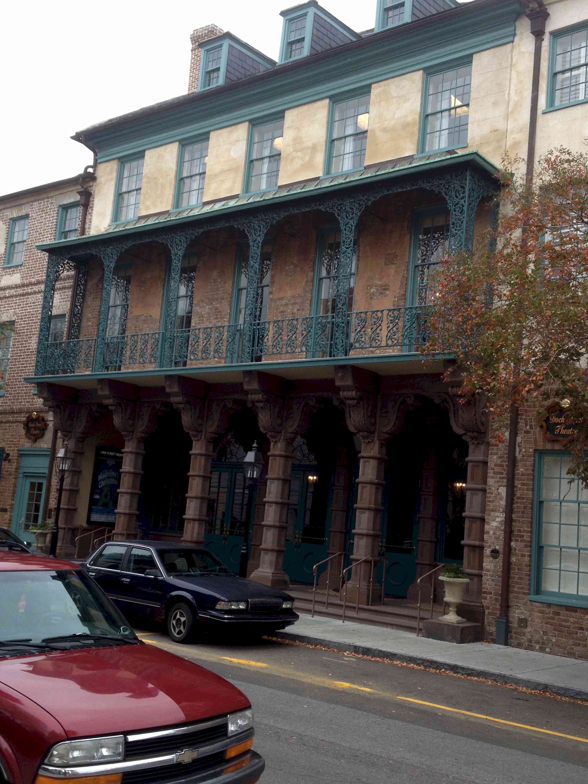
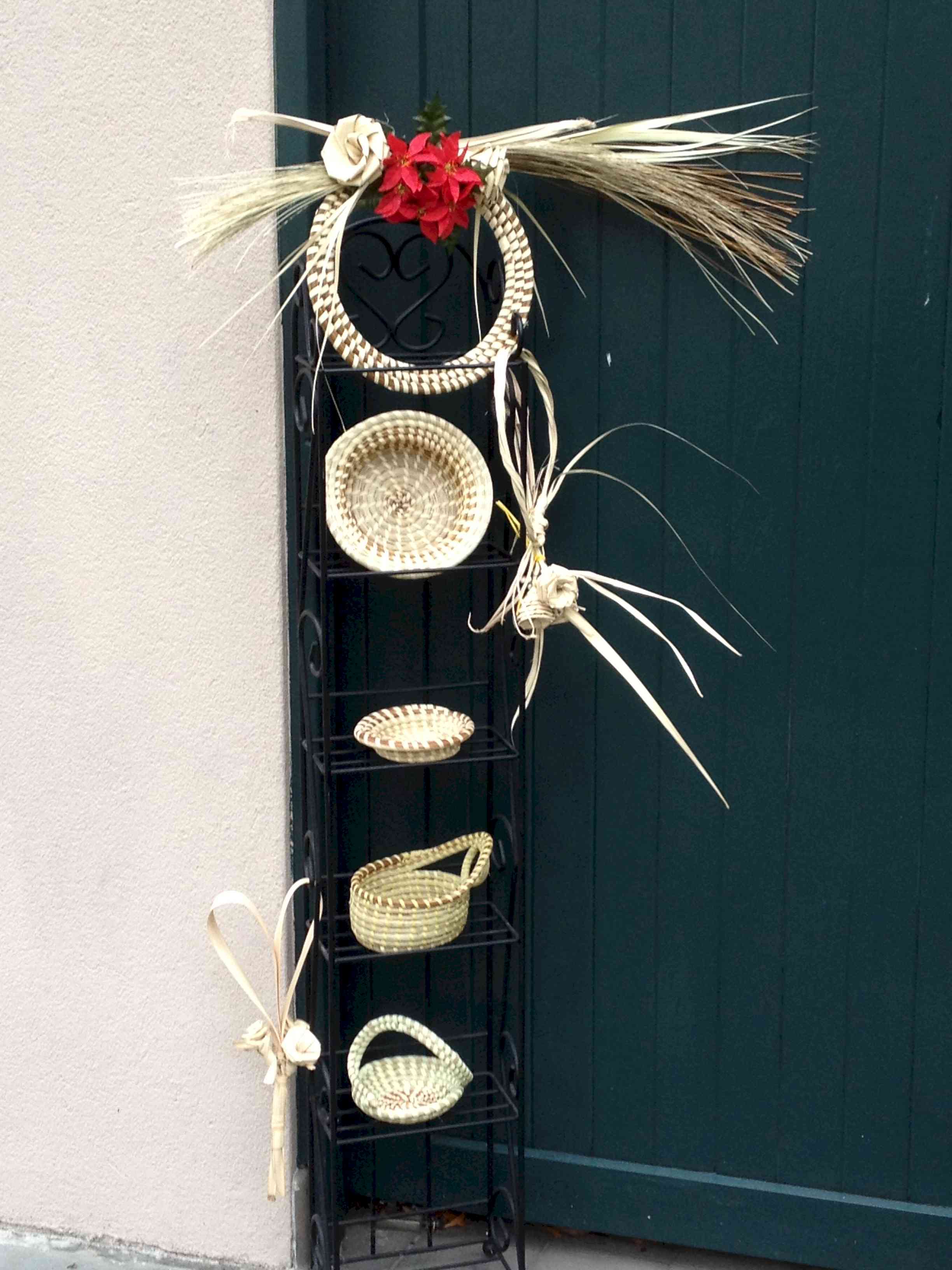
members. Until today I was anchored on the other side of the Ashley river opposite the Charleston City Marina where I am now tied up. After getting into the marina and tied up i immediately plugged in the little space heater I have and turned on the hot water heater. Aahh, luxury. It has been raining and blowing all day, rocking the boat even while tied at the dock. Glad I am not out in the achorage for this storm. The current flow through the anchorage is fierce. On the flood, when it is running against the river current it is more than 1.5 knots. On the ebb the tidal current and river current reinforce each other and the flow rate rises to 2.5 - 3 knots. That is a fast enough current that even this morning when the wind speed was 15 knots the boat sat to the current rather than the wind. The only other place I have ever experienced this is in Joe's Sound, Long Island, Bahamas. What this means is that the boat swings through 1800 between flood and ebb tides. How does the anchor hold as the boat swings through such I huge arc? Got me; but mine held for nine days without mishap. A few more photos from my time here in Charleston. Clockwise from the top left -- The new bridge over the Cooper River. This bridge was expected to take 5 years to complete, but the contractor brought finished it in just four years. The Dock Street Theater. For its size Charleston has an active performing arts community. This theater is reminiscent of New Orleans. On returning to the waterfront after one of my excursions I found the white egret fishing on the mud flats at low tide. Very pretty bird. And speaking of mud flats, when I came across the egret I had my 1/2 pint of local oysters in hand for that night's dinner; Hhhmm, hhmm, hhmmm. In the group of four photos are some example of weaving from the local sweet grass done by a Gullah woman. The Gullah date even from the antebellum period, but most of them trace their routes to immediately after the Civil War. With emancipation many of the freed African Americans made communtiies for themselves in coastal South Carolina and Georgia in remote farmlands and fishing areas. Between their accent and vocabualry adopted from their original African countries of origin they can be said to have their own dialect of english.
One afternoon Carl and Joyce and I went across to Mt. Pleasant to visit the USS Yorktown, an aircraft carrier that was built in 1943 and served into the 1970's when she was the retrieval vessel for Apollo 8. The Apollo 8 mission was the first manned flight to circle the moon and return.
|
|
| November 20 - November 26, 2012 -- Berkeley, San Francisco, Mill Valley, CA | |
| For Thanksgiving I flew out to CA to be with
my daughter for Thanksgiving. My sister's son and his family are in Mill Valley, so
Cathy and Paul flew in also. And to round things out the family matriarch flew in
from Atlanta. We arrived in a torrential rain, but the remainder of the week has been
marvelous. One day while there we followed the road tour around SF. To see the route of the 49 mile road tour through San Francisco click here.
|
|
 This egret was fishing in the tidal pools behind our motel
in MIll Valley - Sausalito. This egret was fishing in the tidal pools behind our motel
in MIll Valley - Sausalito.
|
|
| November 28, 2012 Wednesday | This morning we left on the overnight passsage for Fernandina Beach, Florida. |
| Back to October 2012 Ahead to December 2012 | |
 Baby it's cold outside and the path south is crowded. There a few
small places to anchor where the Alligator River turns west to the entrance to the canal.
Since I counted a dozen boats ahead of me I didn't bother to make the turn but anchored in
the small bay just south of the western turn. This offers good protection from the
WSW wind with little or no chop since there is no fetch to create wind driven waves. Good
protection is a relative idea. Since this part of the Alligator River is a cypress swamp
there are no trees or high land to speak of, so the best you can ask for is some
moderation in wind and no wind driven chop.
Baby it's cold outside and the path south is crowded. There a few
small places to anchor where the Alligator River turns west to the entrance to the canal.
Since I counted a dozen boats ahead of me I didn't bother to make the turn but anchored in
the small bay just south of the western turn. This offers good protection from the
WSW wind with little or no chop since there is no fetch to create wind driven waves. Good
protection is a relative idea. Since this part of the Alligator River is a cypress swamp
there are no trees or high land to speak of, so the best you can ask for is some
moderation in wind and no wind driven chop. 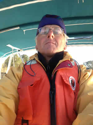 Since leaving Chesapeake Bay I have been wearing my Mustang Survival life vest.
In the cold water and cold air I wouldn't last long without it if I fell in the water. In
addition it is great insulation for keeping warm when on deck. The self-portrait is me
modeling the life vest.
Since leaving Chesapeake Bay I have been wearing my Mustang Survival life vest.
In the cold water and cold air I wouldn't last long without it if I fell in the water. In
addition it is great insulation for keeping warm when on deck. The self-portrait is me
modeling the life vest.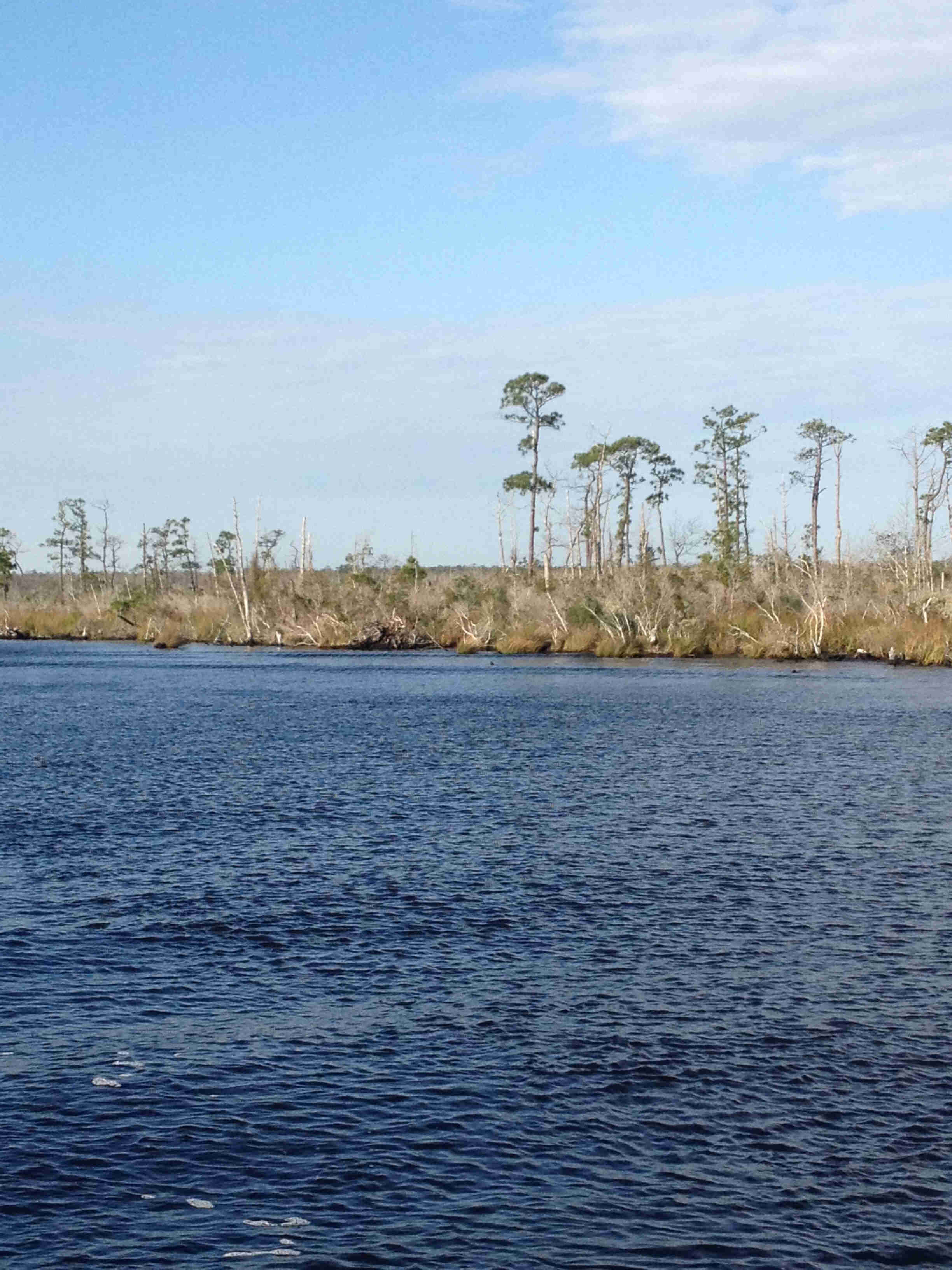 This is a scene along the Alligator - Pungo Canal. Very pretty in
its austere swampitude.
This is a scene along the Alligator - Pungo Canal. Very pretty in
its austere swampitude.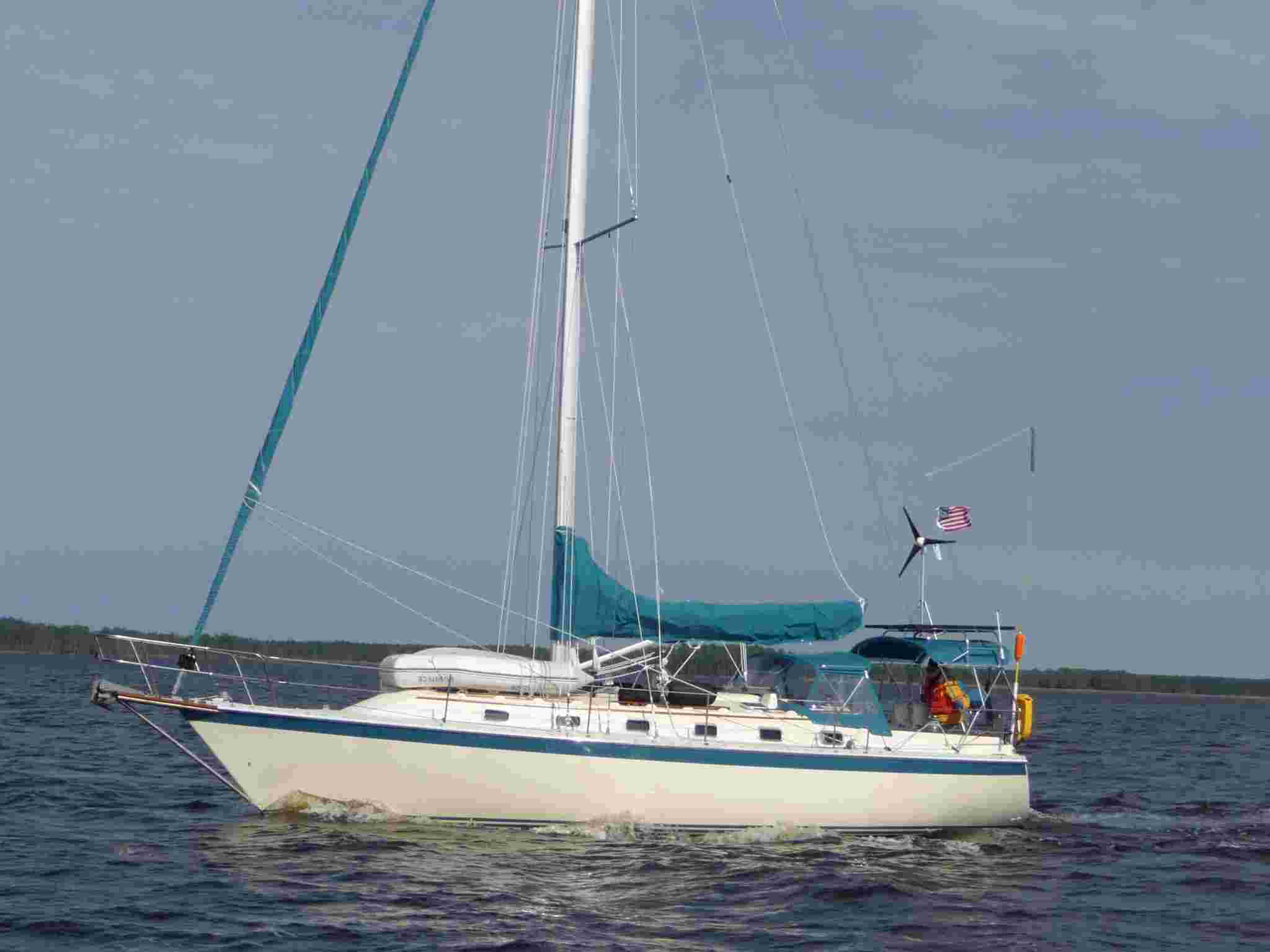 Motoring down the Pungo River toward Bellhaven.
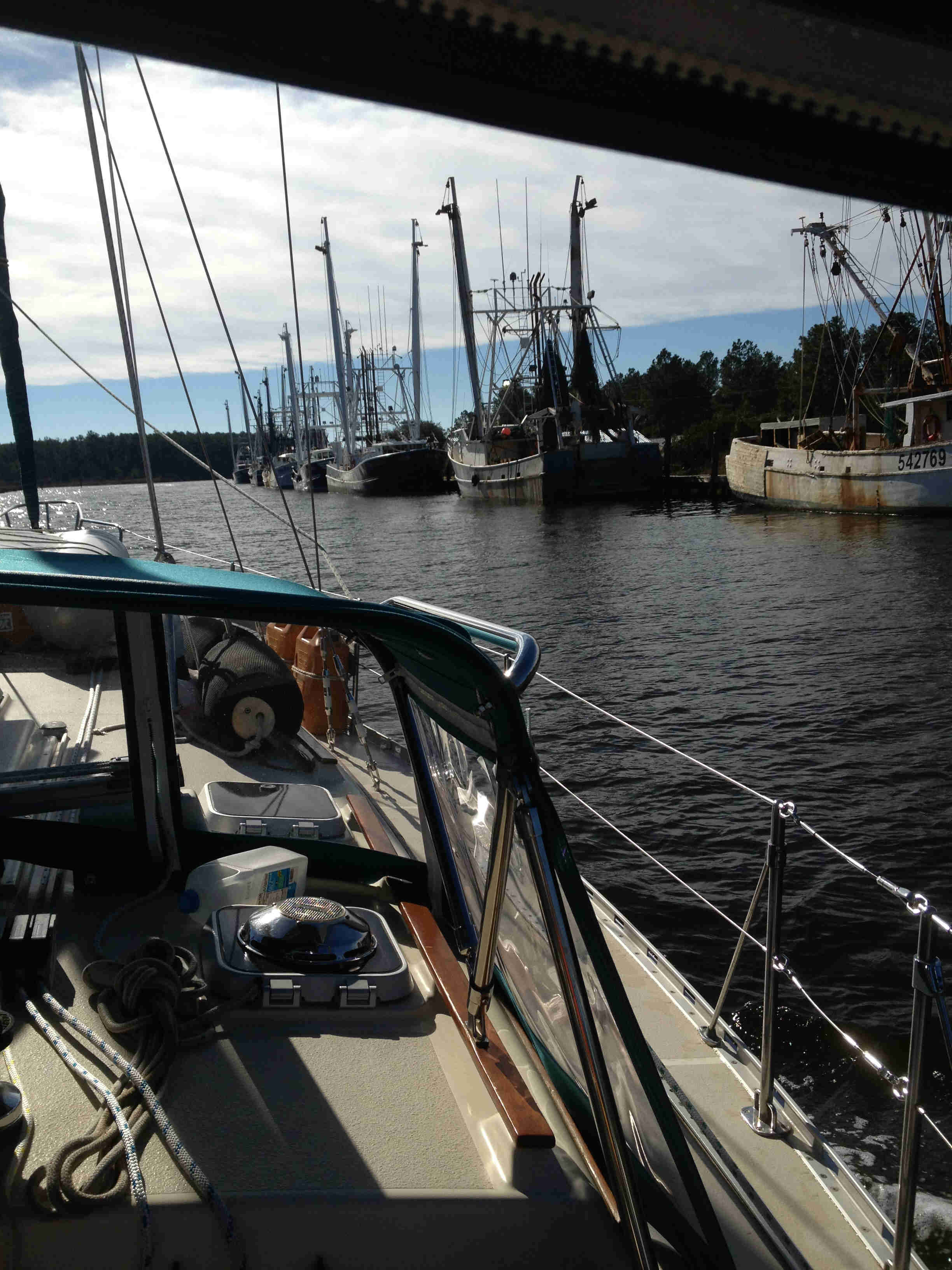
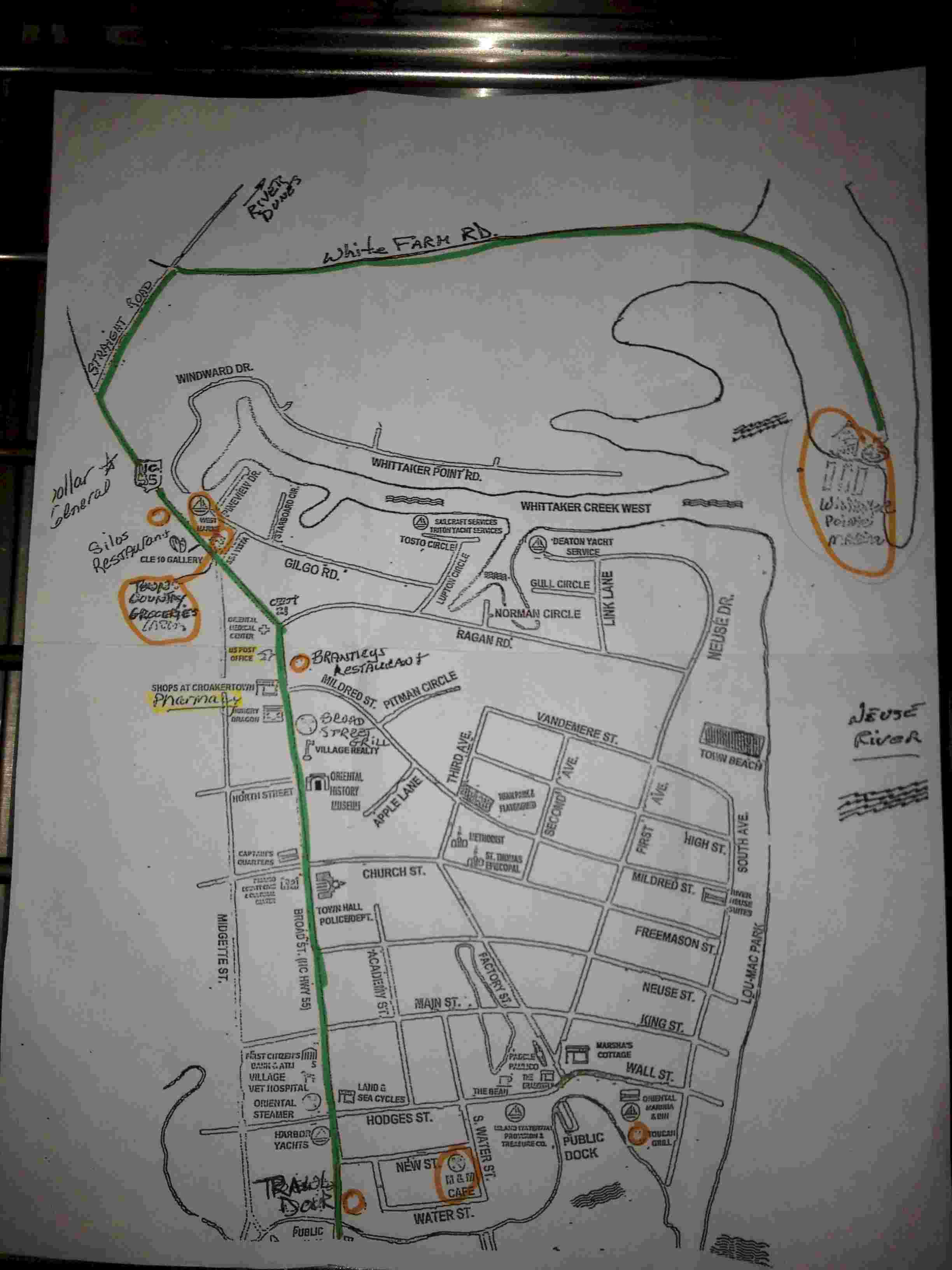 A little sketch of Oriental and Whittaker Point
Marina. The entrance to Oriental is at the bottom edge of the page. The entrance to
Whittaker Creek starts about the middle of the page on the right where it says Neuse
River. Whittaker Pointe Marina is circled in orange and the creek goes to the west.
Rather than drive around to Oriental from the marina one could just run their dinghy up
the creek.
A little sketch of Oriental and Whittaker Point
Marina. The entrance to Oriental is at the bottom edge of the page. The entrance to
Whittaker Creek starts about the middle of the page on the right where it says Neuse
River. Whittaker Pointe Marina is circled in orange and the creek goes to the west.
Rather than drive around to Oriental from the marina one could just run their dinghy up
the creek. 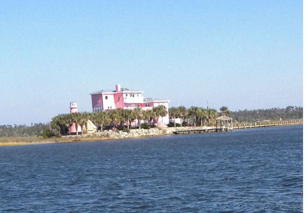 This entire house
was painted hot pink! There are a lot of beautiful homes on the ICW, but I can't say that
this is one of them.
This entire house
was painted hot pink! There are a lot of beautiful homes on the ICW, but I can't say that
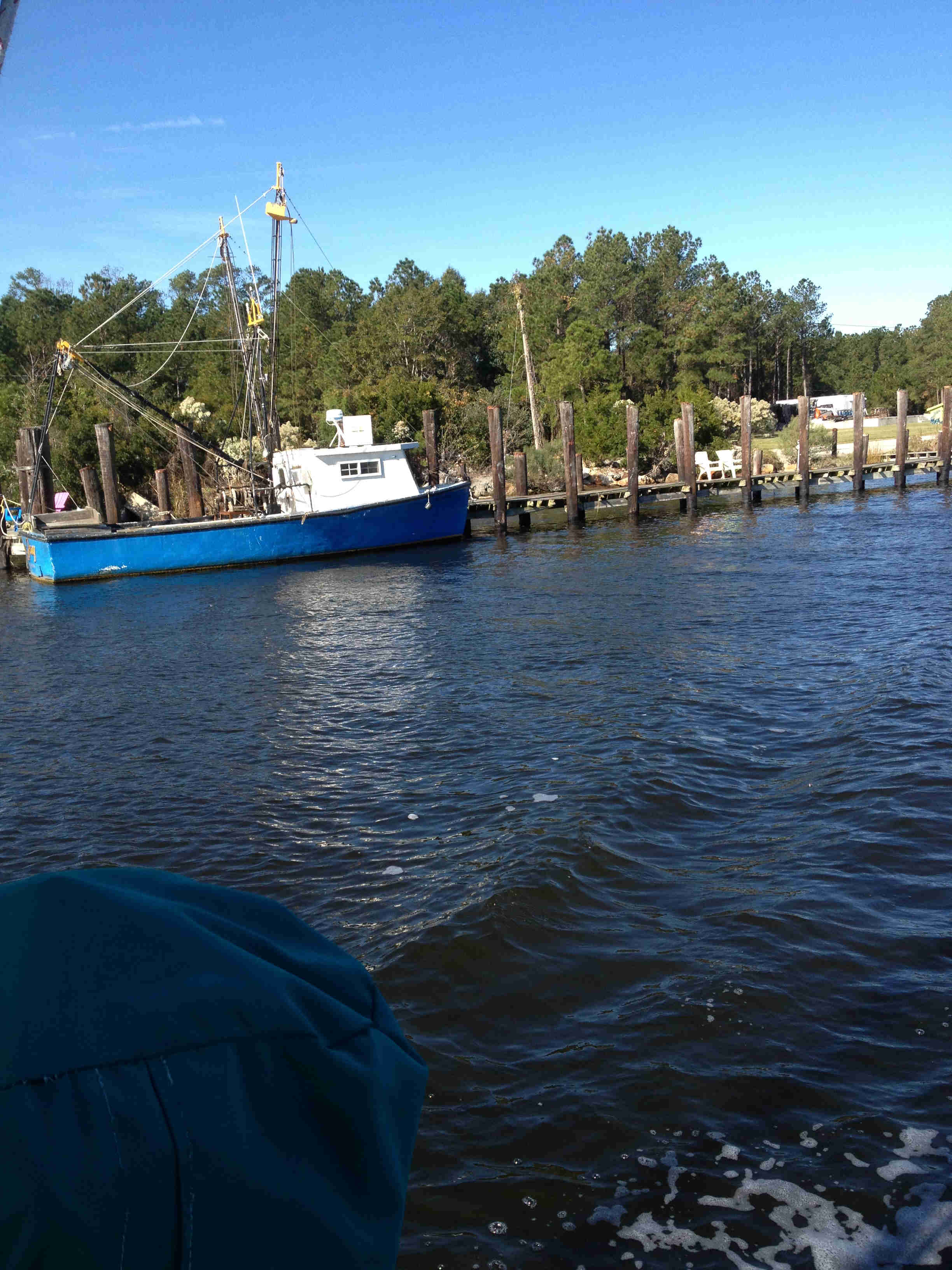
this is one of them.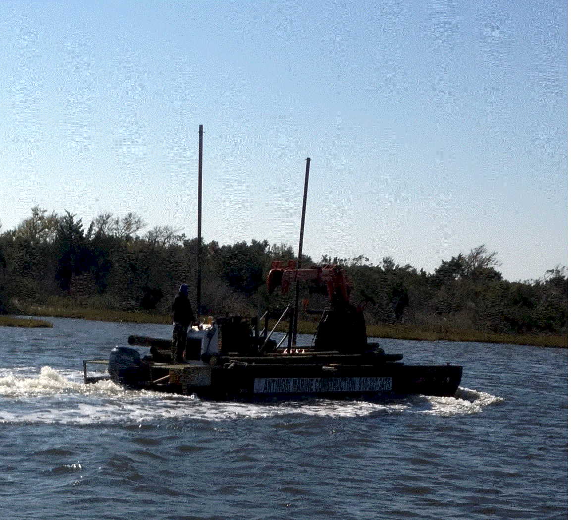 This is a little
mini-crane and dredge that I passed along the way. Like the pint sized fishing boat,
he didn't take his vitamins when he was young.
This is a little
mini-crane and dredge that I passed along the way. Like the pint sized fishing boat,
he didn't take his vitamins when he was young.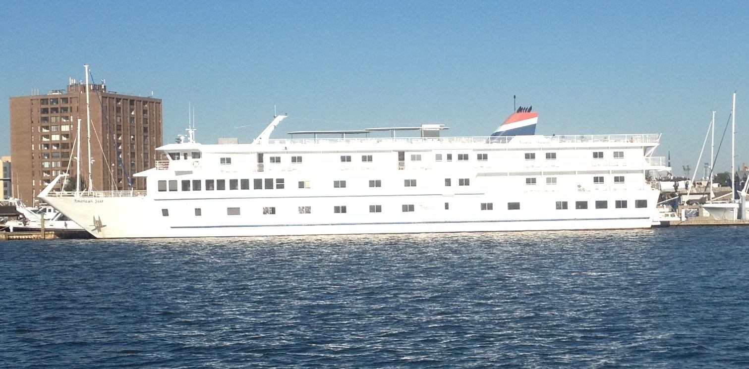 American
Star is a little coastal cruise ship that plies the east coast. I saw her two years ago
when I brought Andante north from Florida.
American
Star is a little coastal cruise ship that plies the east coast. I saw her two years ago
when I brought Andante north from Florida.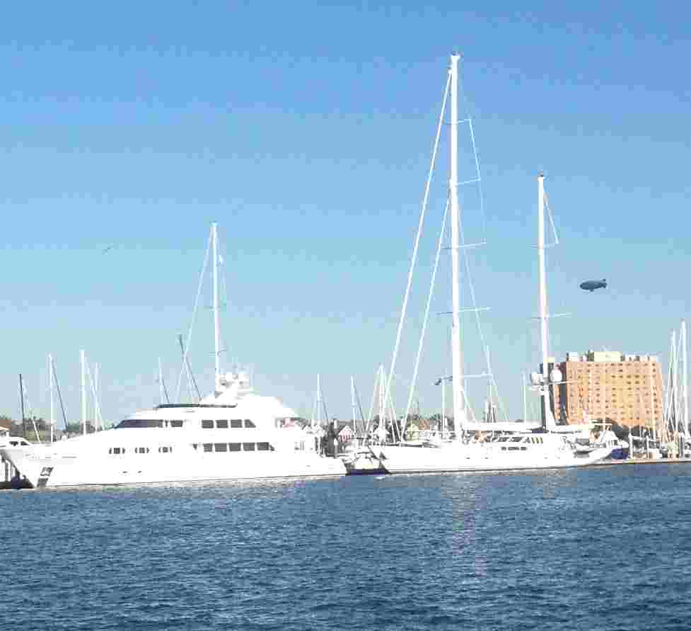 Themis is the power
boat. She is as tall as a three story house and is 156 feet long. Estimated cost is $15
million. She is owned by Ron Motley who made his fortune suing the tobacco companies.
Timoneer is the sailboat. She is 146 feet, is also privately owned is not avaialble for
charter. The main mast is probably 2 1/2 times taller than mine.
Themis is the power
boat. She is as tall as a three story house and is 156 feet long. Estimated cost is $15
million. She is owned by Ron Motley who made his fortune suing the tobacco companies.
Timoneer is the sailboat. She is 146 feet, is also privately owned is not avaialble for
charter. The main mast is probably 2 1/2 times taller than mine.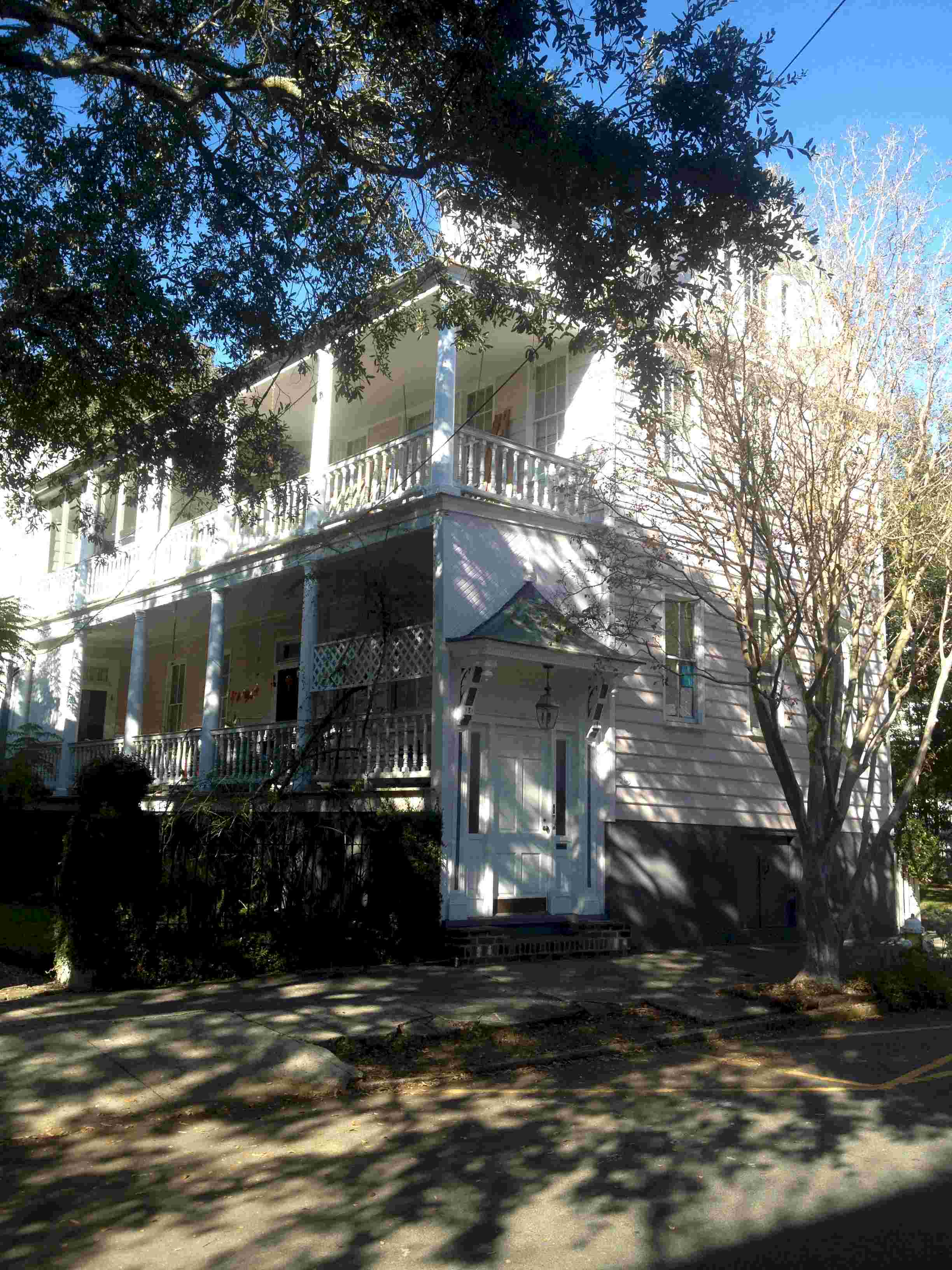
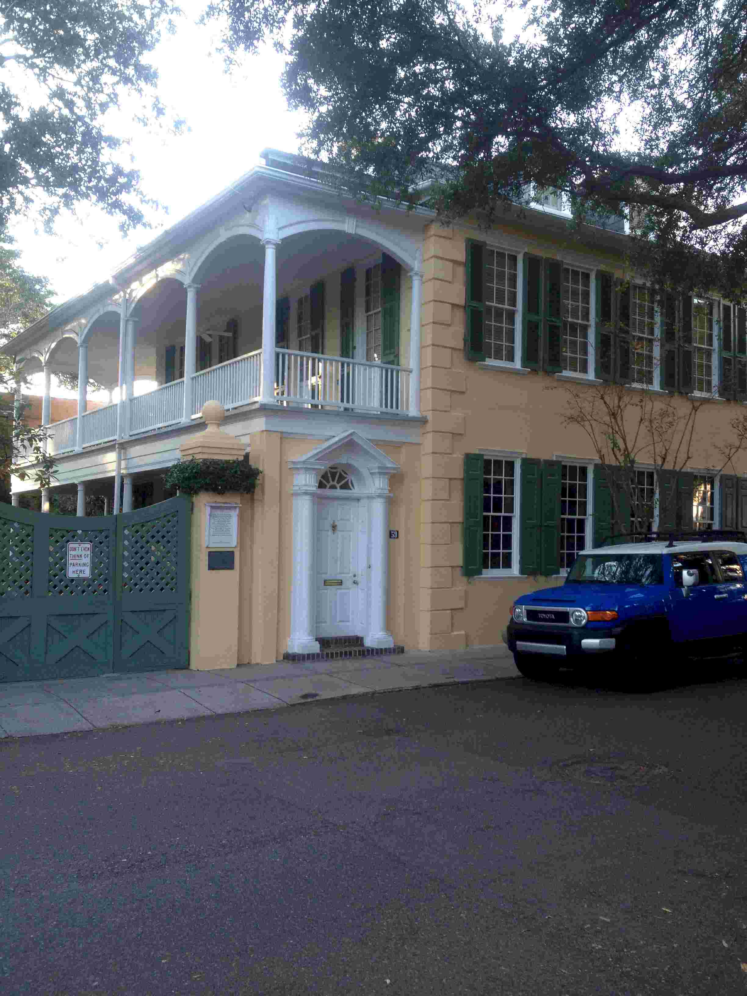
 Joseph Manigault House
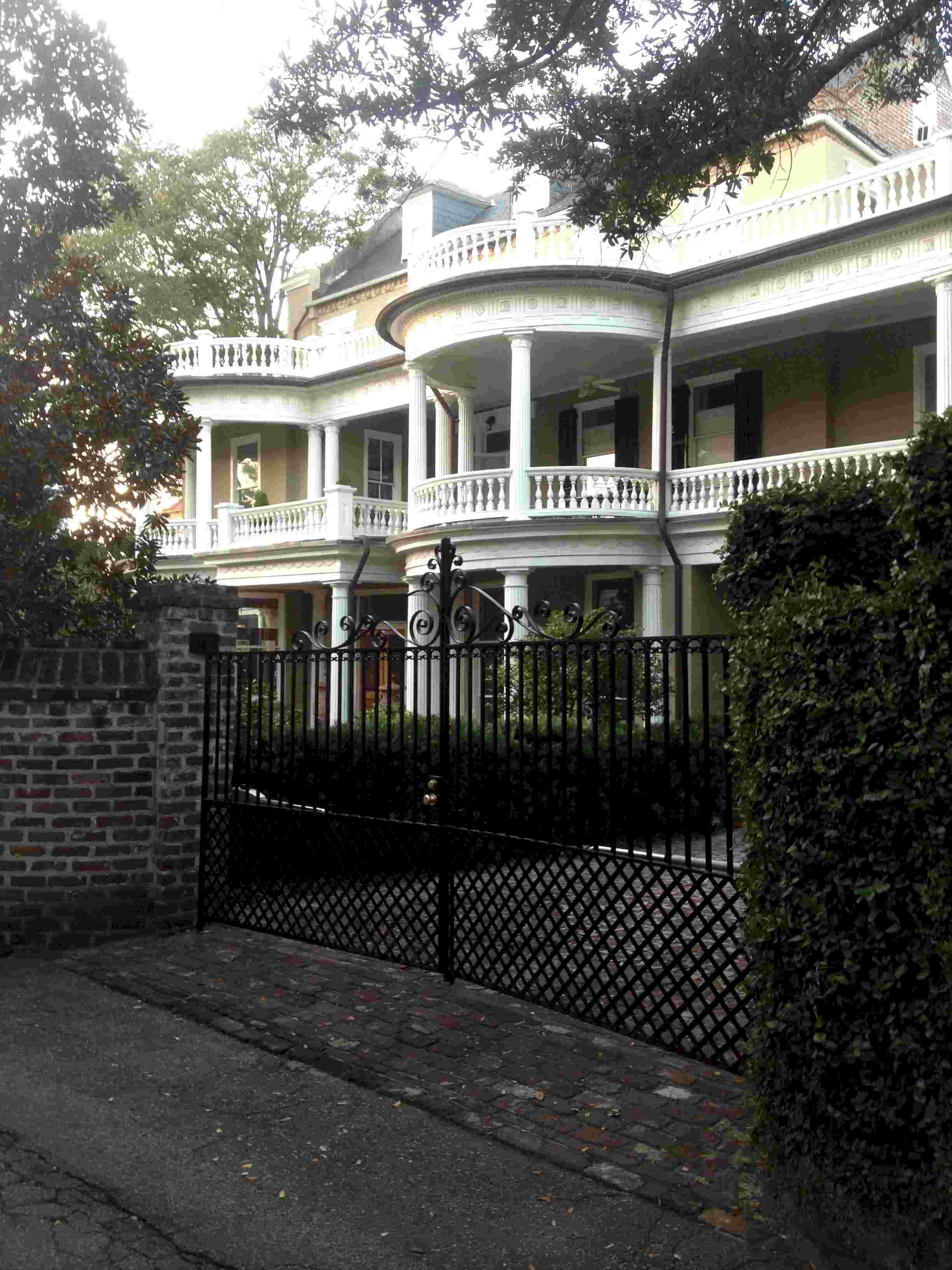 To
take this picture I walked up the alley. This house, more than 200 years old, is
distinctive because of the bumpouts on the verandas.
To
take this picture I walked up the alley. This house, more than 200 years old, is
distinctive because of the bumpouts on the verandas. 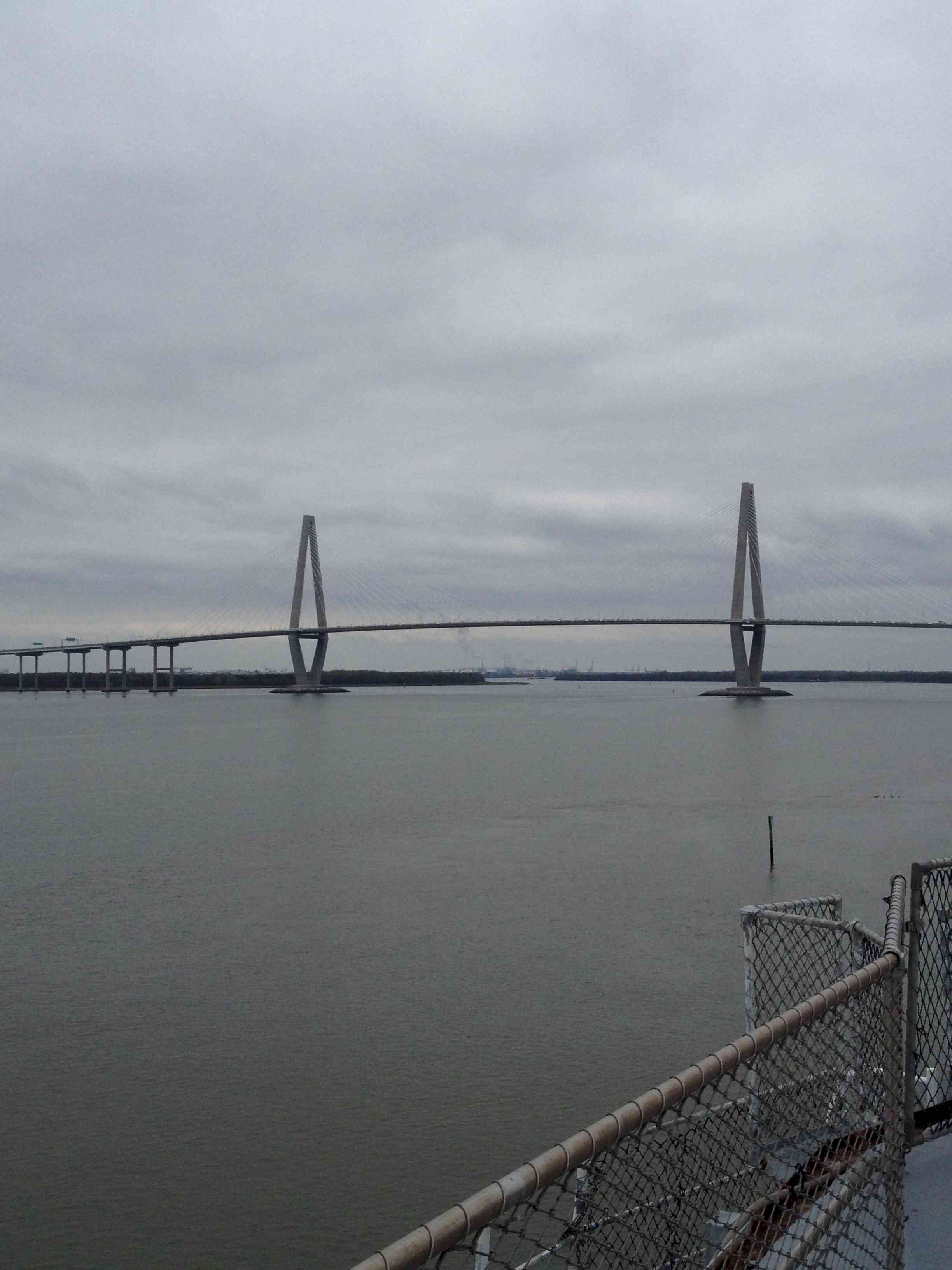
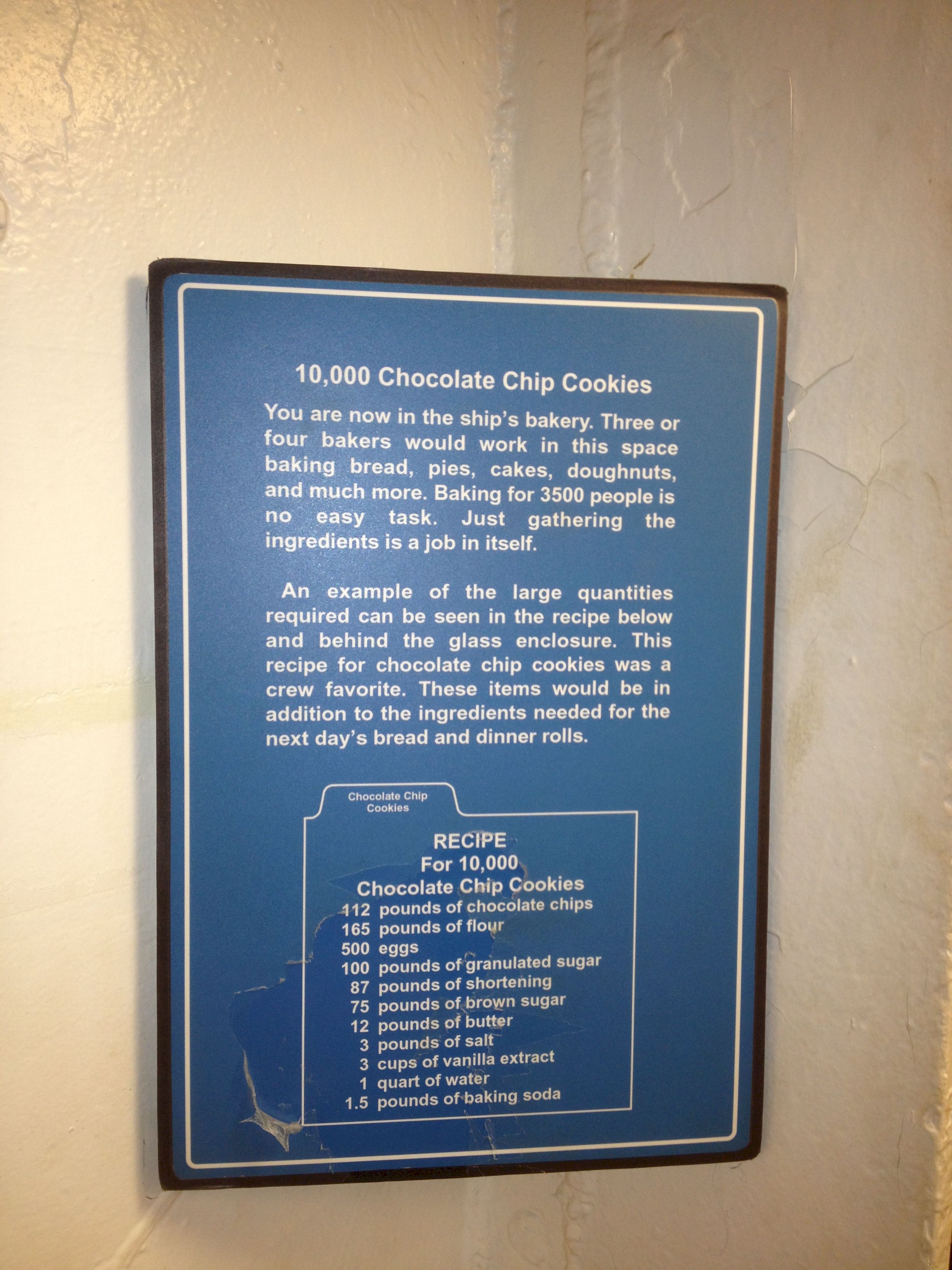 The crew of a warship is
predominantly under 25 and all have a voracious appetite. This is a recipe for a batch of
chocolate chip cookies for the 3500 crewmen of the USS Yorktown. To experience a bit
of history one can have lunch in the Petty Officers' mess, which we did. I sure hope
that the sailors' cooks were better than those working the day we were on the Yorktown.
The crew of a warship is
predominantly under 25 and all have a voracious appetite. This is a recipe for a batch of
chocolate chip cookies for the 3500 crewmen of the USS Yorktown. To experience a bit
of history one can have lunch in the Petty Officers' mess, which we did. I sure hope
that the sailors' cooks were better than those working the day we were on the Yorktown.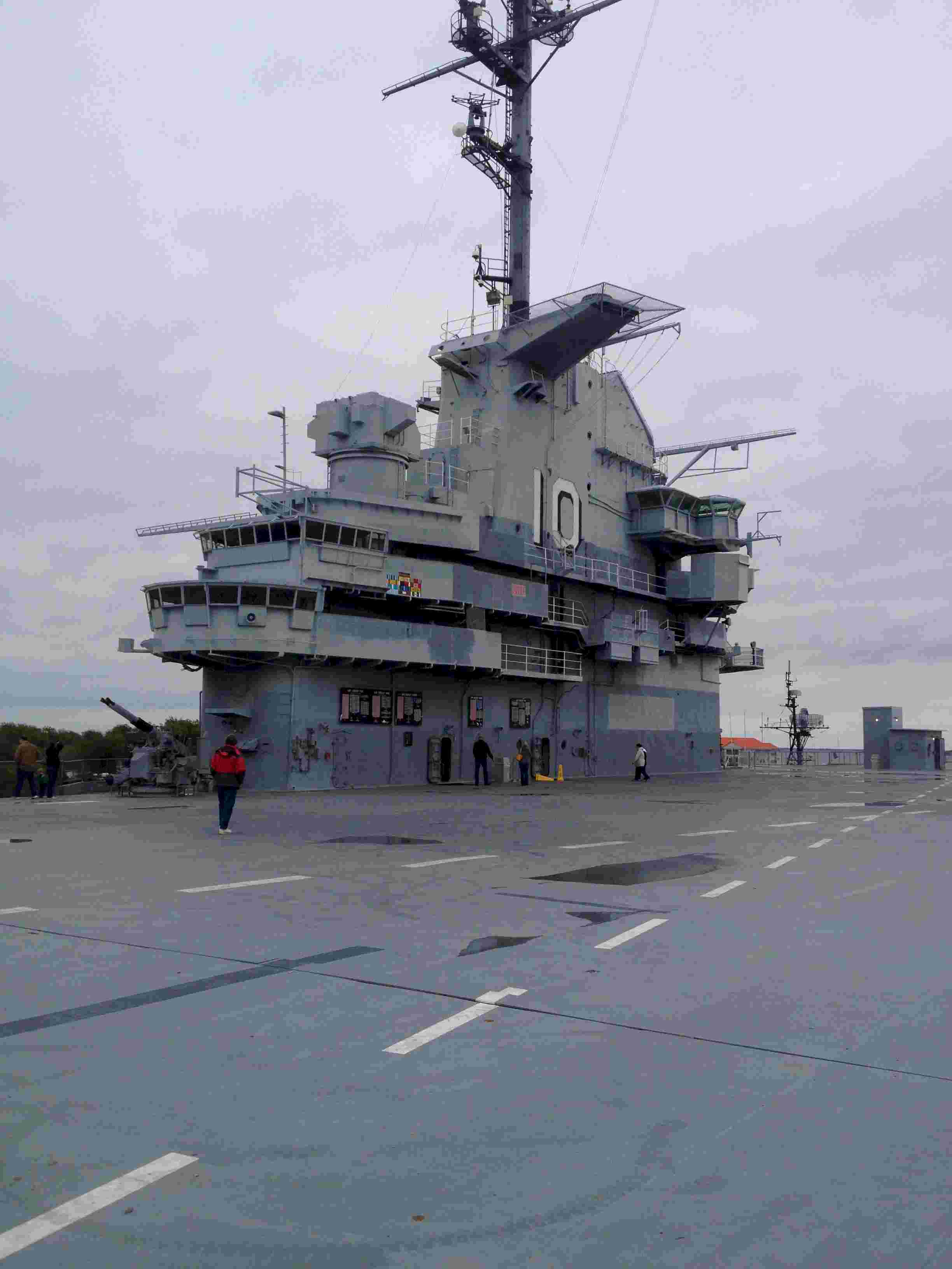 The 'island' is the brain of the ship. It is really quite small
given the size of the ship: ~3,500 crew, 90 planes and 880 feet long. Come to think
of it, a runway only 880 feet long? Taking off and landing on that, sometimes in the dark
would turn anyone gray.
The 'island' is the brain of the ship. It is really quite small
given the size of the ship: ~3,500 crew, 90 planes and 880 feet long. Come to think
of it, a runway only 880 feet long? Taking off and landing on that, sometimes in the dark
would turn anyone gray.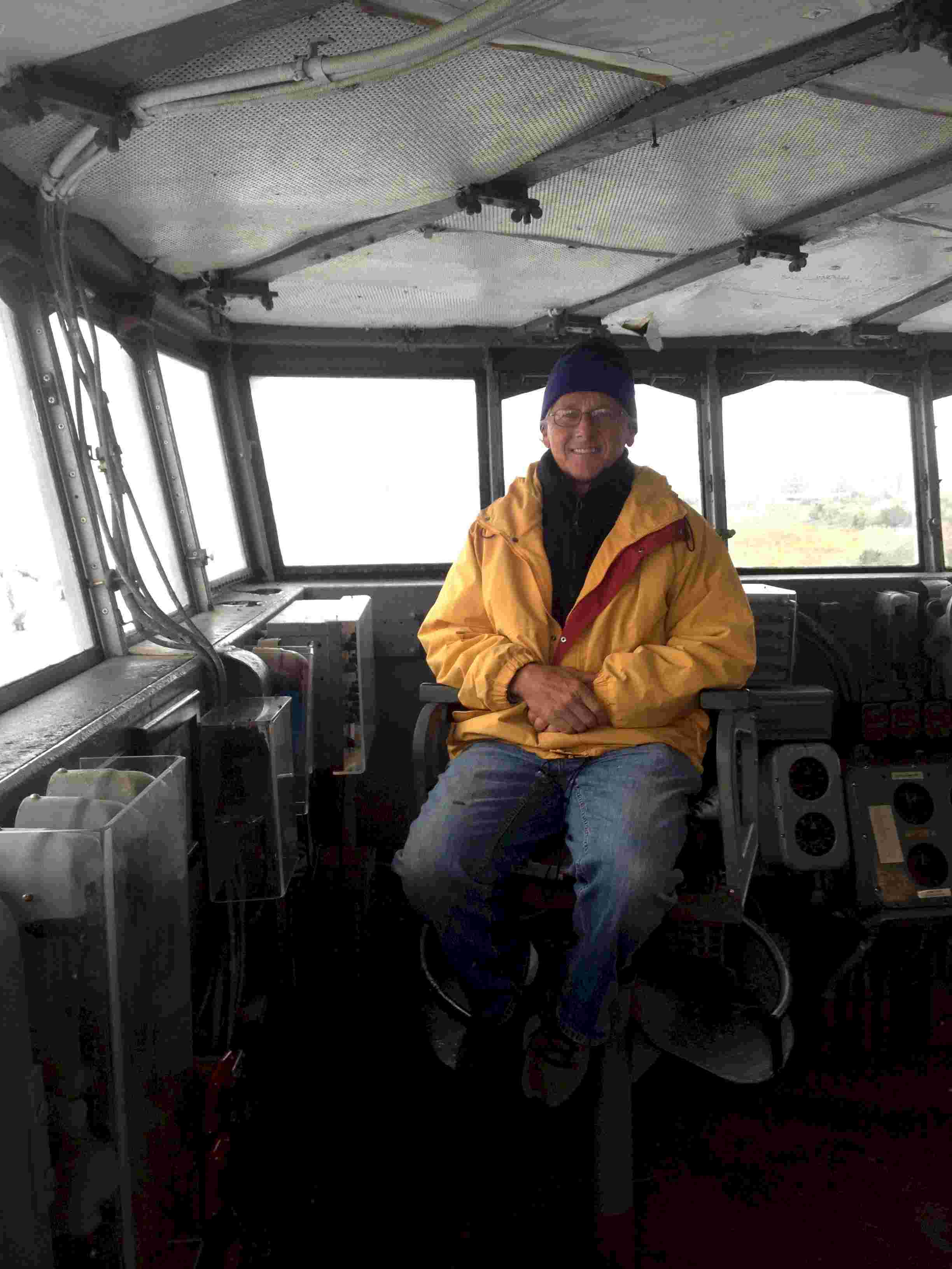 Yours truly
sitting on the bridge deck. After my experience trying to command the Economics Department
at Temple University for three years I can't imagine commanding a ship like this. Oh
yea, the Captain of the Yorktown had one ace up his sleeve for use with uncooperative
personnel that I didn't have: the brig, see below.
Yours truly
sitting on the bridge deck. After my experience trying to command the Economics Department
at Temple University for three years I can't imagine commanding a ship like this. Oh
yea, the Captain of the Yorktown had one ace up his sleeve for use with uncooperative
personnel that I didn't have: the brig, see below.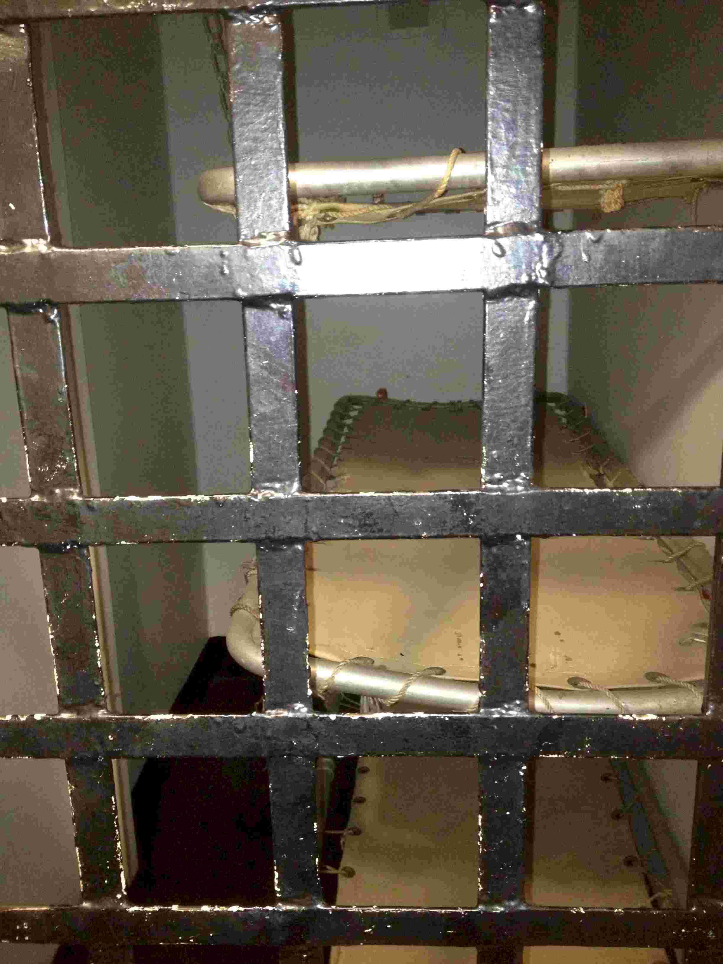 The ship has three cells
on it with three cots in each. Each cot is just about the width of a body and is
exactly the lenght of the cell. The space between the cot and the opposing wall is
just about wide enough to squeeze a person into the cell. Wow, what I could have
accomplished at TU if only I could have offered accommodations like these!
The ship has three cells
on it with three cots in each. Each cot is just about the width of a body and is
exactly the lenght of the cell. The space between the cot and the opposing wall is
just about wide enough to squeeze a person into the cell. Wow, what I could have
accomplished at TU if only I could have offered accommodations like these!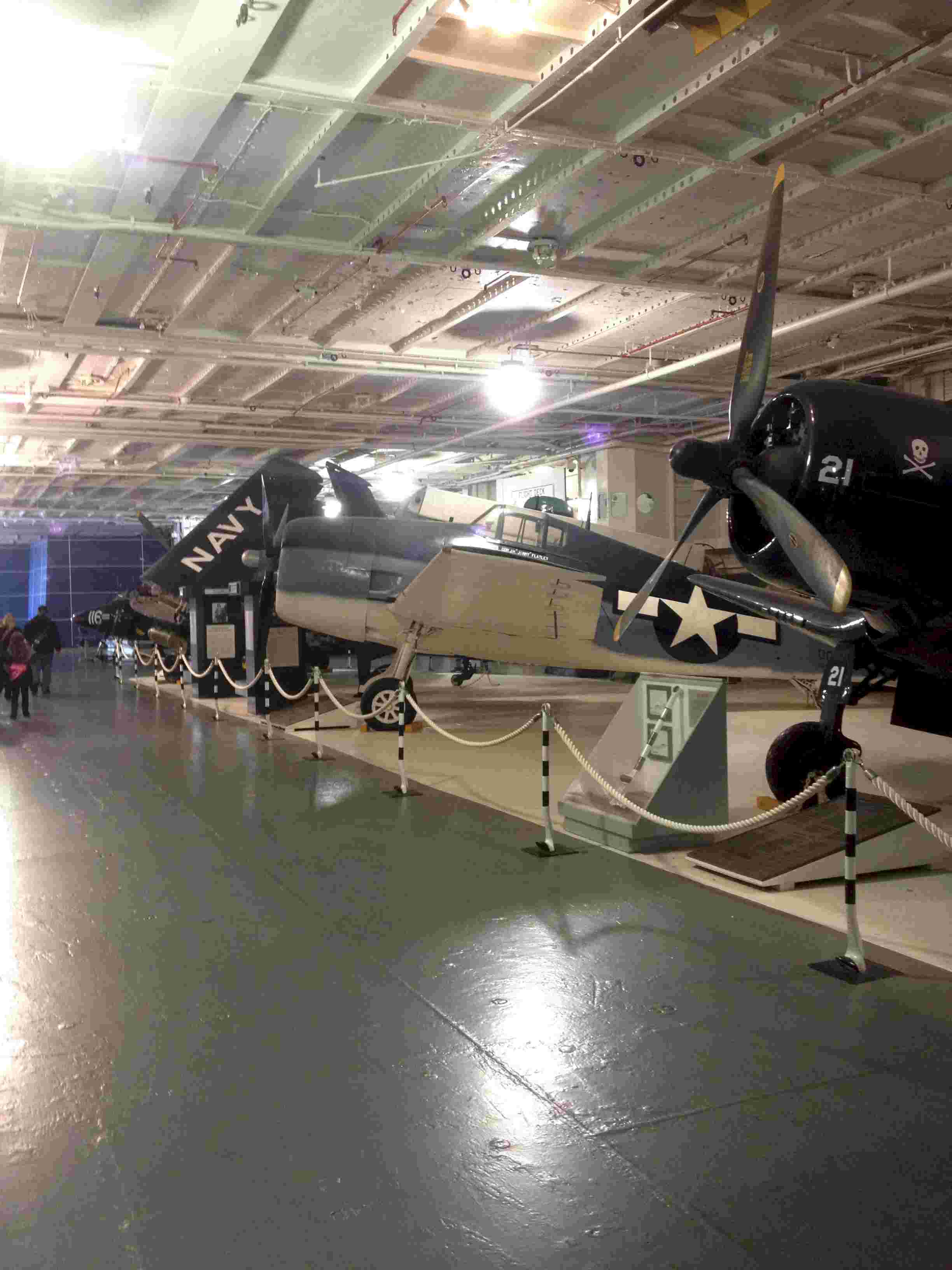 These last two photos show some of the different types of planes
that flew off the deck of the Yorktown during her working life.
These last two photos show some of the different types of planes
that flew off the deck of the Yorktown during her working life.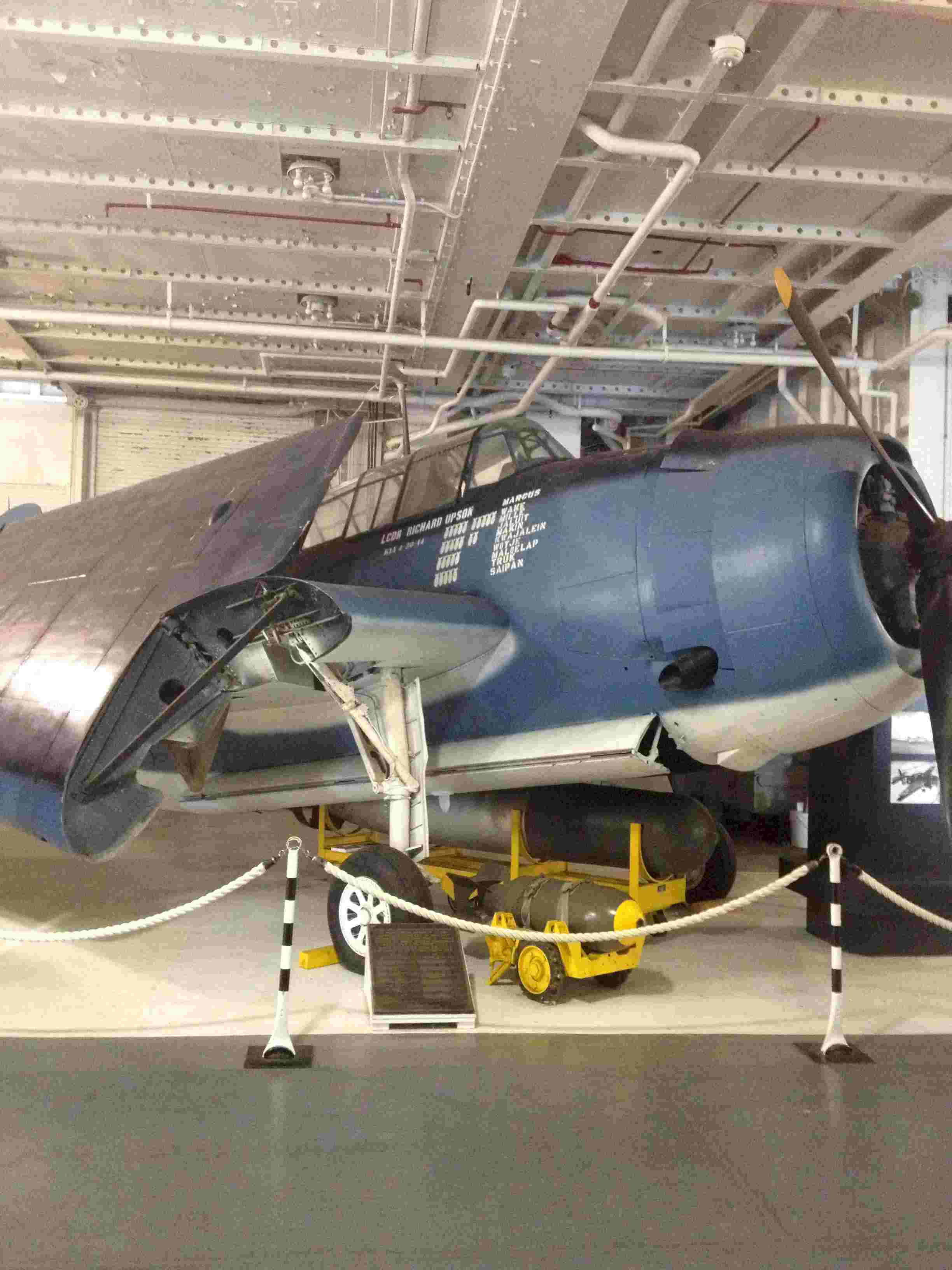
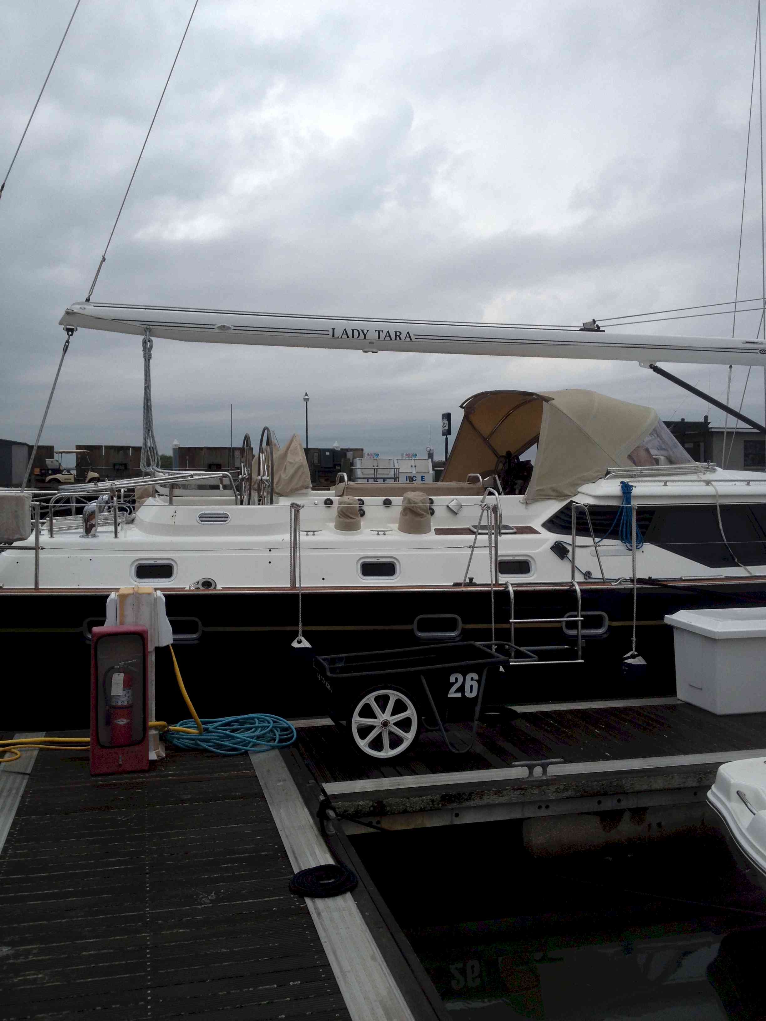
 Just
before I left for California the sailing vessel Lady Tara came into the Marina. When
I got back she was docked astern of Andante. Like her namesake, my daughter-in-law,
Lady Tara is beautiful. She dwarfs Andante.
Just
before I left for California the sailing vessel Lady Tara came into the Marina. When
I got back she was docked astern of Andante. Like her namesake, my daughter-in-law,
Lady Tara is beautiful. She dwarfs Andante.
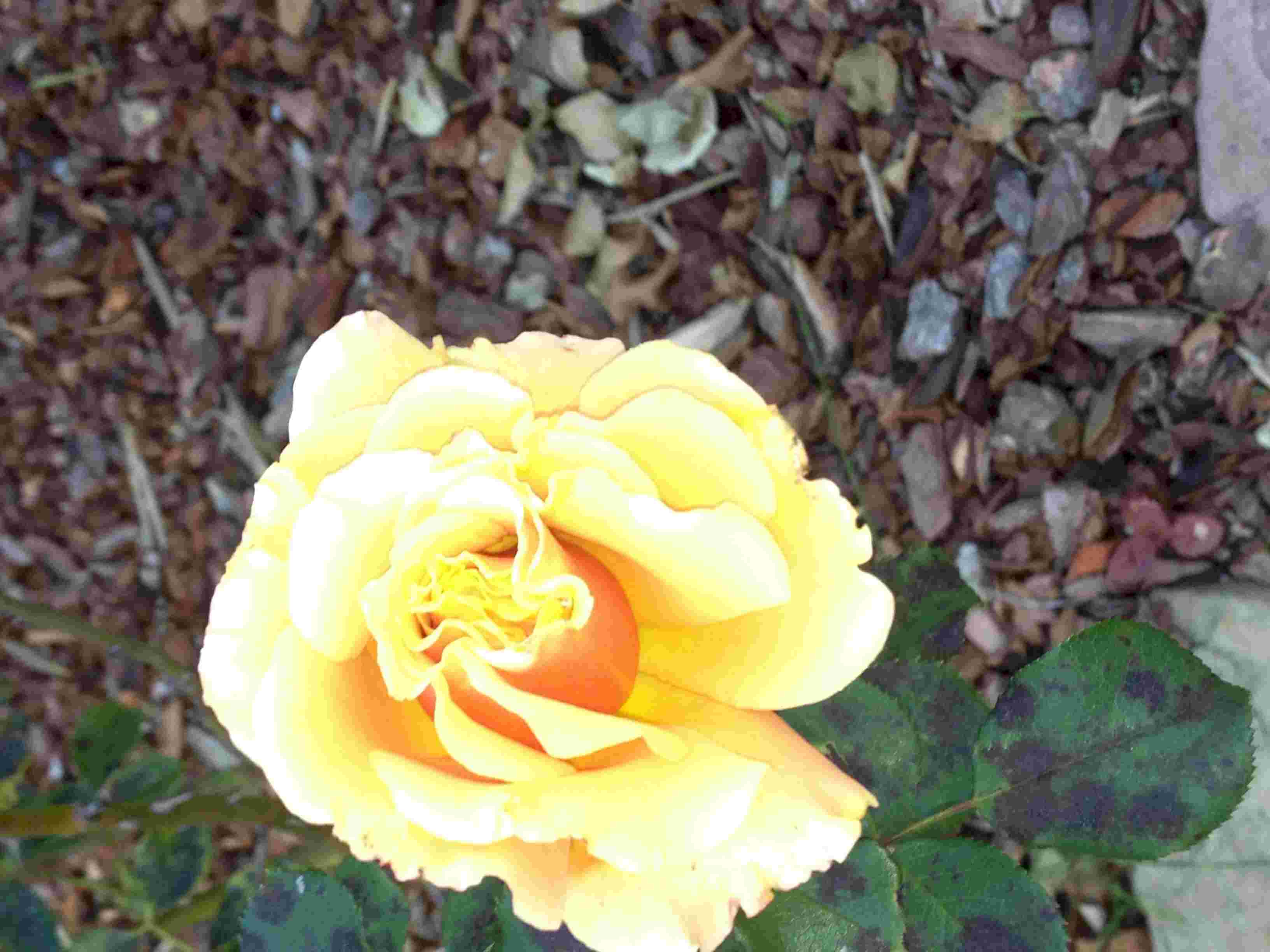
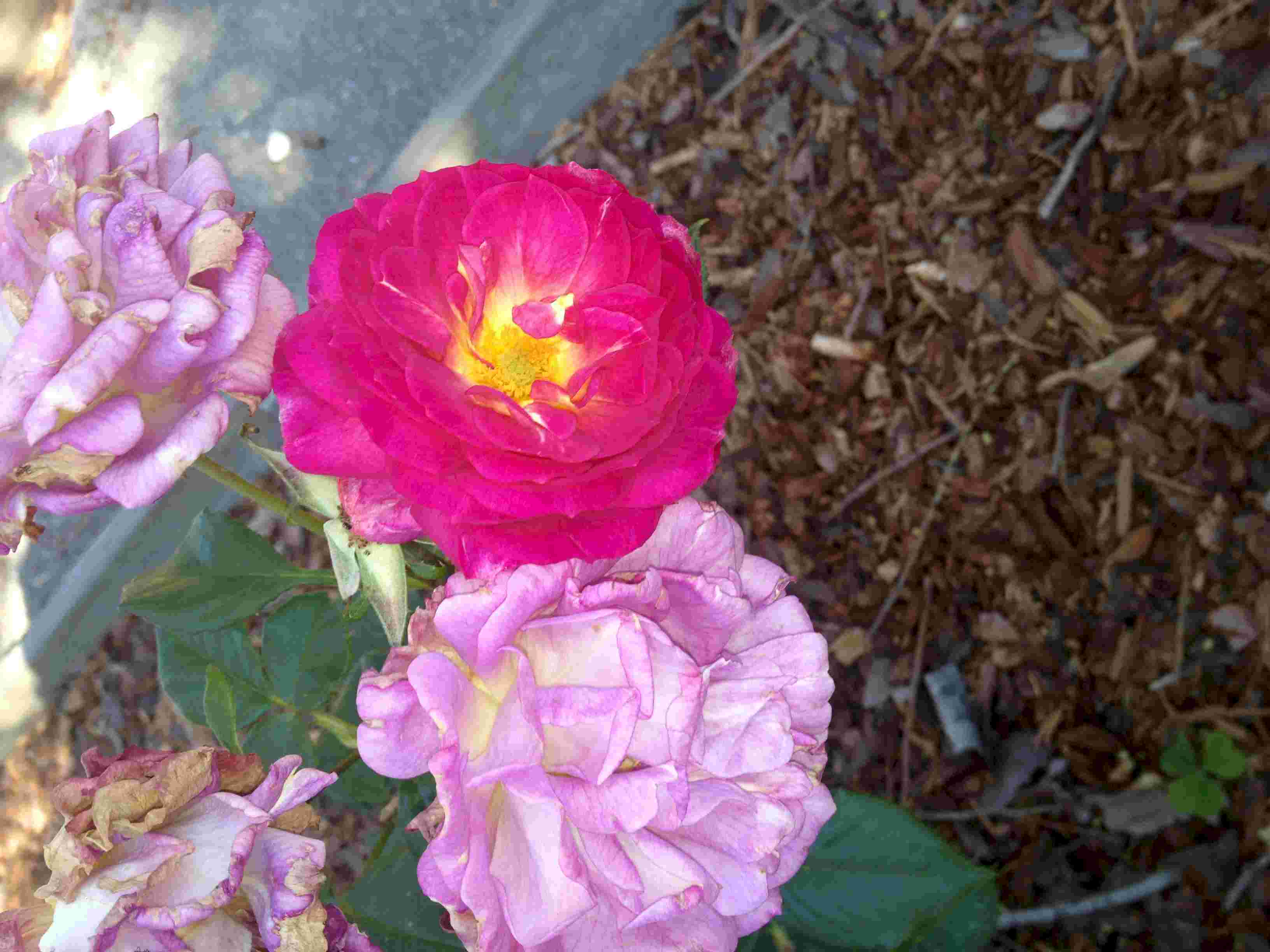 One afternoon we took a quick turn through the
Berkeley Roaw Garden. In the photo at the left you will see two distinclty different
blooms on the same plant.
One afternoon we took a quick turn through the
Berkeley Roaw Garden. In the photo at the left you will see two distinclty different
blooms on the same plant.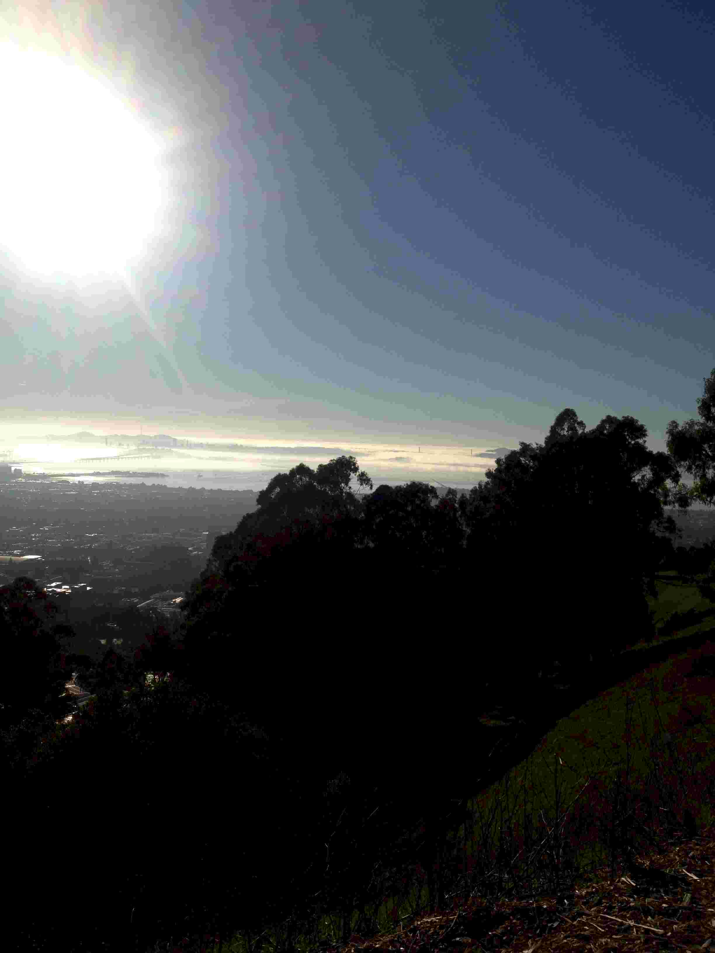 This photo was taken from the top of the hill above the Berkeley
campus. It doesn't do justice to the fog on the Bay and the lighting that morning.
If you look closely in the upper right quadrant you can see the towers of the
Golden Gate Bridge poking up from the mists.
This photo was taken from the top of the hill above the Berkeley
campus. It doesn't do justice to the fog on the Bay and the lighting that morning.
If you look closely in the upper right quadrant you can see the towers of the
Golden Gate Bridge poking up from the mists.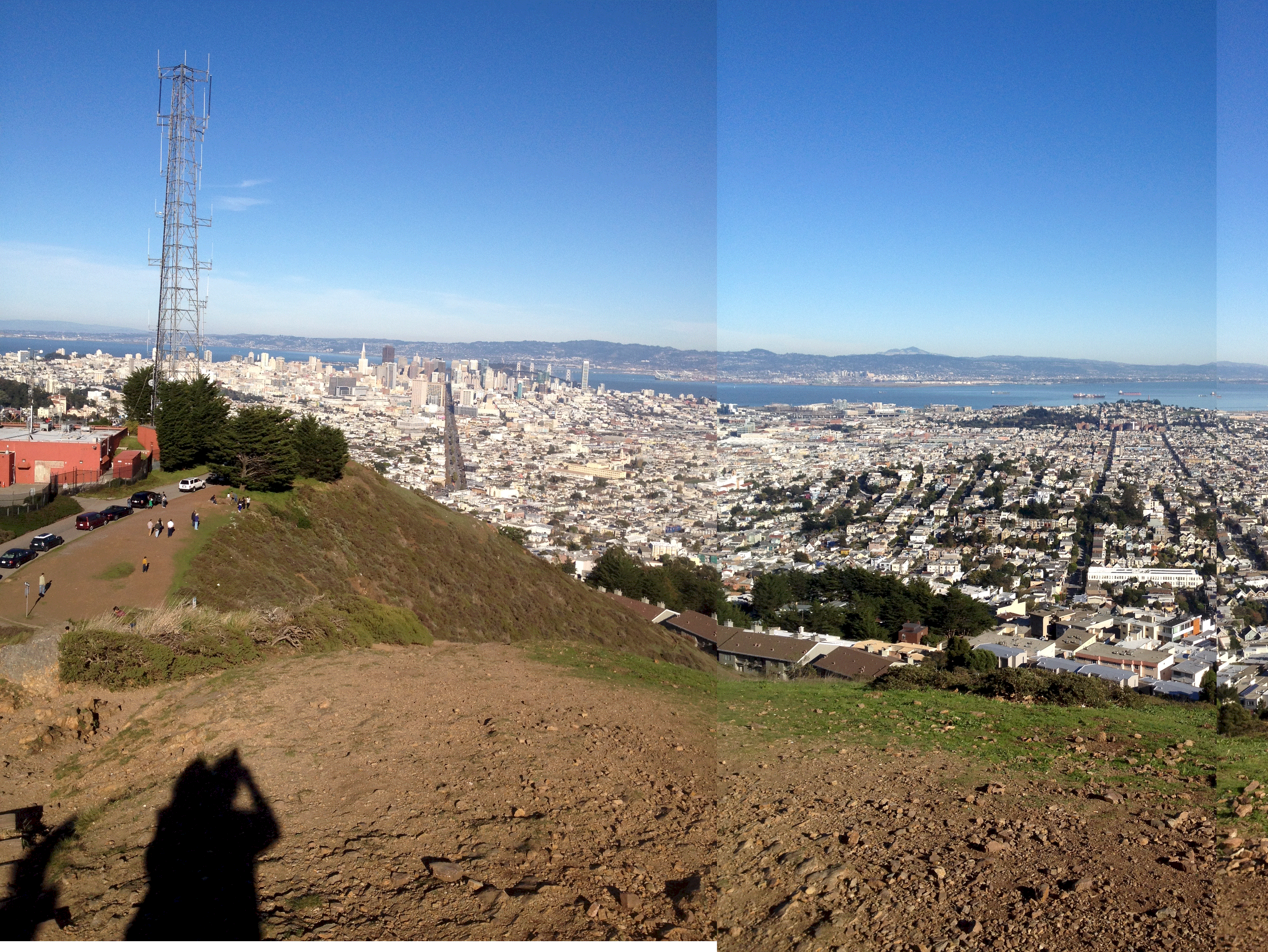 A view of San
Francisco from one of the Twin Peaks.
A view of San
Francisco from one of the Twin Peaks.