 |
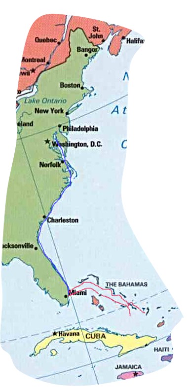
Start on the eastern shore of Maryland in Rock Hall and follow the blue line down the ICW to Miami. Sometime in December we'll cross the Gulf Stream to the Bahamas. The line is red in the Bahamas since we don't know exactly which islands we'll visit. The two loose shoe laces at the south east end reflect even more uncertainty. |
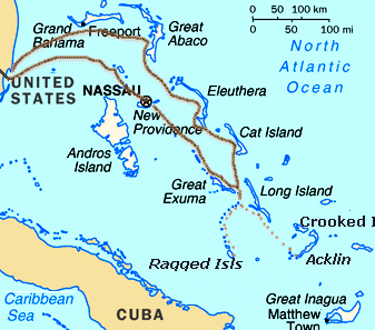 |
This shows more detail of the Bahamas. The dotted lines show two possibilities for us: Either the Jumentos or a visit to the bight of Acklin Island. For even more detail go to the Charts and Maps Page. |