 |
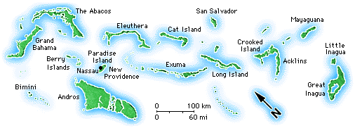
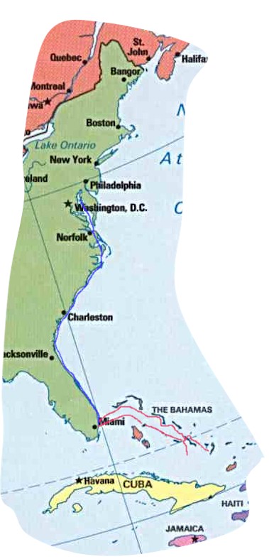
The thin blue line shows our course down the east coat of the United States. The southern-most red line out of Miami shows our trip out to the Bahamas. If you follow the red lines out to where they look like two loose shoe laces you'll see where we didn't go. The line pointing south goes through the Ragged Islands. The other one goes around the eastern side of Long Island to Crooked and Acklin Islands. We just didn't have the weather or ambition to go on to those places. We did, however, visit Long Island and Concepcion Island. On the way home we did follow the course through Cat Island, Eleuthera and the Abacos. |