| Andante's Sailing Blog February 2013 Blog Table of Contents |
|
| Back to January 2013 Ahead to March 2013 | |
| February 1, 2013, Friday, Land and Sea Park | |
| Today was my third day of volunteer work.
As a reward for the backbreaking hours I spent on the sea wall I was given a really
cushy assignment. Using one of the Park skiffs I visited the western beaches of the
island to repair, inventory, and replace signage, pick up litter and otherwise marvel at
the scenery. Of the dozen or so beaches I only missed two. In the middle of
the afternoon the N wind picked up, the temperature dropped and the clouds grew ominous as
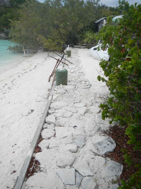
cold front rolled through. If things settle down by tomorrow I'll take my own dinghy down to Beryl's Beach to see the ruins of one of the old homesteads, then further on to Bush Basher Beach to hike across the island and take a look at Pirate's Lair. My itinerary after leaving the Park is to stop Pipe Cay, Staniel Cay, Black Point on Great Guana Cay, Little Farmer's Cay, then use various cuts to visit Rudder Cut Cay and Lee Stocking Island before going on to George Town. In the three following pictures you can see the fruits of my labors. In the first pic my board work is at the left end of the picture.
The two sea anchors are from Haitian refuge boats and are made from rebar. The logs at the bottom of the wall are masts from the same boats.
My stone work starts from just short of the first piling and runs out to the very end by the far bush.
|
|
| February 2, 2013, Saturday, Land and Sea Park | |
| Had thought I would head back down island in
my dinghy to do some hiking on the southern end of the island. The weather has other
plans. The wind has been howling from the NNE since yesterday afternoon. Yesterday when I
made the northbound journey from the southern beaches in the Park's 15 feet Boston Whaler
it was a wet trip, and a little chilly. The same trip in my little dinghy would be misery.
Looks like I will stay on board to read and plan the next few stops on my journey. And
besides, all those many wheelbarrow trips in my Teva sandals moving rock has rubbed some
raw spots in my feet, so who wants to go hiking around anyway. This evening there was the traditional cocktail party on the beach by the whale skeleton. Since the mooring field is full right now there were many attendees. The crews from two boats are still out here doing the cruising thing in their 7's. One of those crews is Colin and Ruth on Cadenza, whom I mentioned back in the North Carolina entries of the blog; and whom we met 12 years ago. It was noted by someone at the gathering that the wind has been blowing much harder this year than last. I must add that i think that it didn't blow as hard on such a consistent basis 12 years ago. Also in attendance was a marauding hoard of Hutia. The hutia are indigenous to the Bahamas. It is important to know that they are an endangered species. It is also important to know that they are a rodent and look like a cross between a large guinea pig and a rat. With no natural predators they are overrunning Warderick Wells and having a huge impact on the island's vegetation. And as a protected species nothing is being done to control their population in the Park. It seems to me that evening a protected park there should be some effort to manage different species populations. |
|
| February 3, 2013 Sunday -- Warderick Wells to Cambridge Cay | |
| Today I made my first foray out into Exuma
Sound. My destination was Cambridge Cay, still in the Park boundaries. This
was the location of our "you can never have too much chocolate party" and our
sighting of the green flash 12 years ago. The too much chocolate line we attribute
to Diana. I chose this destination since it affords good protection from the wind
from just about any direction. The trip was made outisde in the Sound because I was not
confident of water depths on the Banks side. On arrival I discovered that the Park has
filled the prime anchorage with mooring balls. Well, I guess I understand this since
there has to be some way to wring some financial support from the many cruisers that come
through and would not otherwise support the Park. Unlike my effort at Warderick
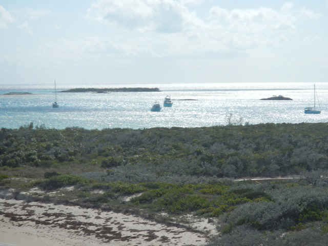
Wells, today it took me two tries to pick up my mooring ball. This afternoon I walked across the island to the Sound side. The following are some of the pictures I took on my walk. They are necessarily in chronological order. The first picture is from a hill overlooking the anchorage; another beautiful location with just a few boats. Andante is the sailboat at the far left. The nearer smaller power boat is Adirondack, the bigger power boat is Mavourneen with Mike and Betty on board. The sailboat at the right is Tehani from Rock Hall.
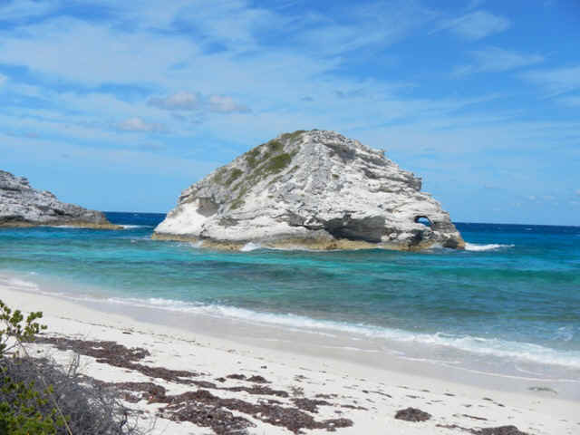
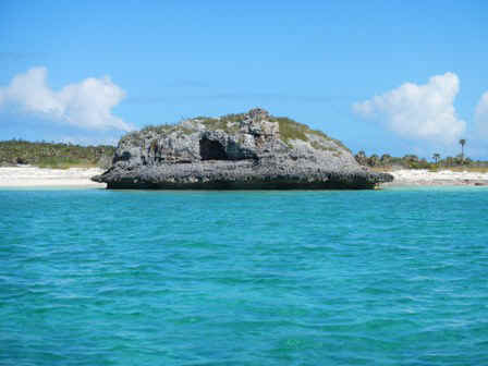
A landmark for all visitors to Cambridge Cay is Bell Rock. It sits on the Sound side and can be picked out from miles away.
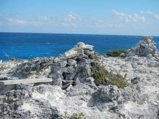
On my hike I came across several of these rock cairns with a piece of driftwood along side for a bench to sit and admire the view.
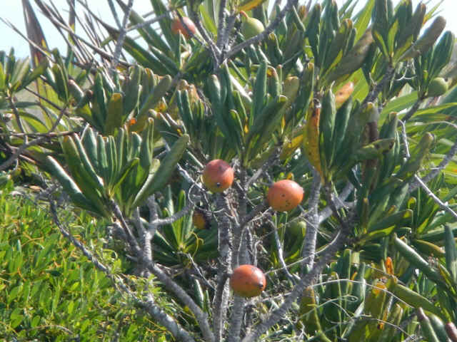
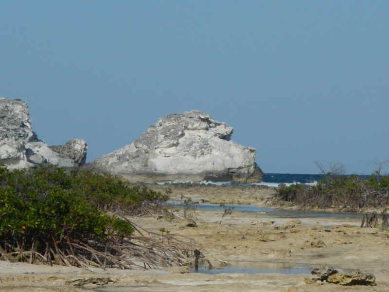
The bush in the picture below is the size and shape of a rhodedendron with similarly shaped waxy leaves. I have seen these throughout my explorations on the different islands. This was the first time I saw one bearing fruit. Can a naturalist out there find its name for me? Is the fruit edible? Five (Seven?) Year Apple some say.
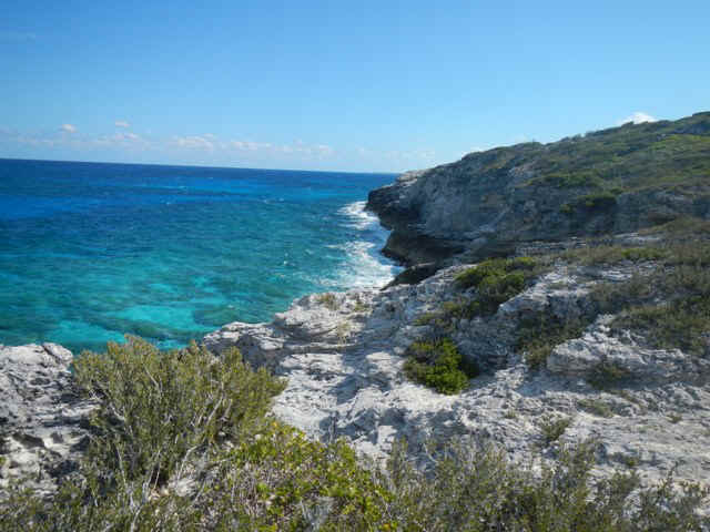
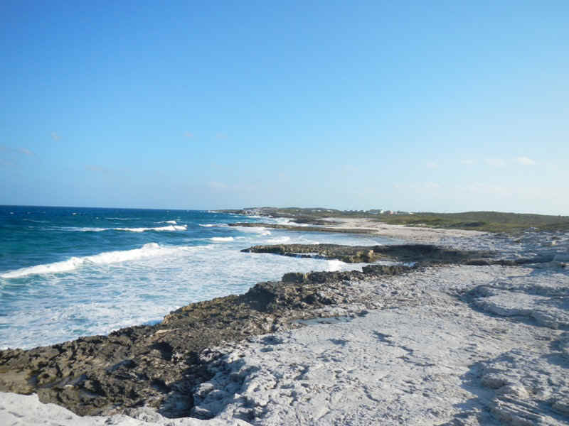
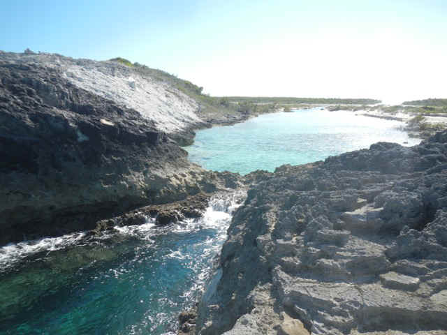
On my hike I stopped to take this picture of the cut between O'Brien's Cay and Cambdridge Cay. It doesn't look nearly as forbidding in the picture as in real life. The camera and image compression flatten out the waves and white caps.
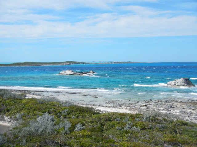
From the top of one of the hills I took this picture of the coast on the Sound side of the Cay. It shows the many colors of the Bahamian waters. Again, the picture doesn't capture the waves crashing on the rocks.
|
|
| February 4 - 5, 2013 -- Monday and Tuesday, Cambridge Cay | |
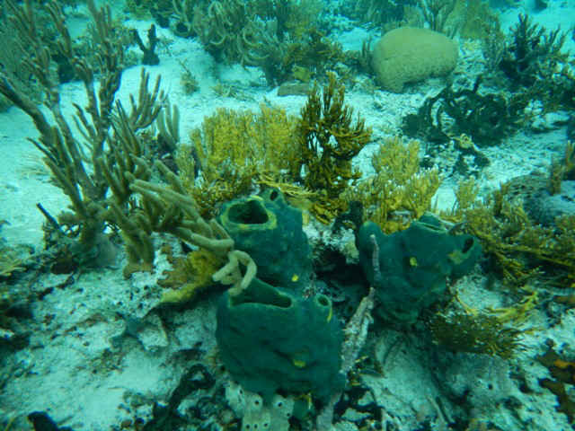
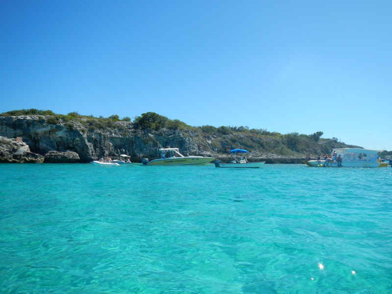
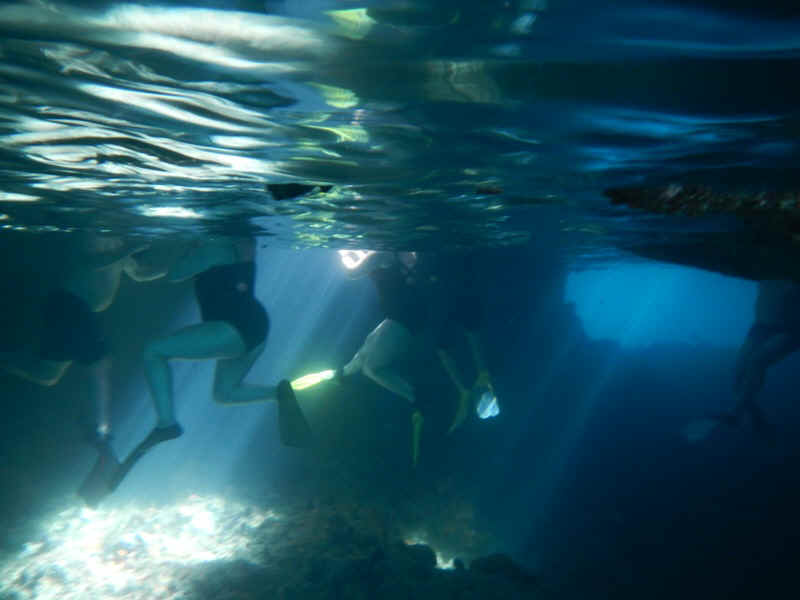
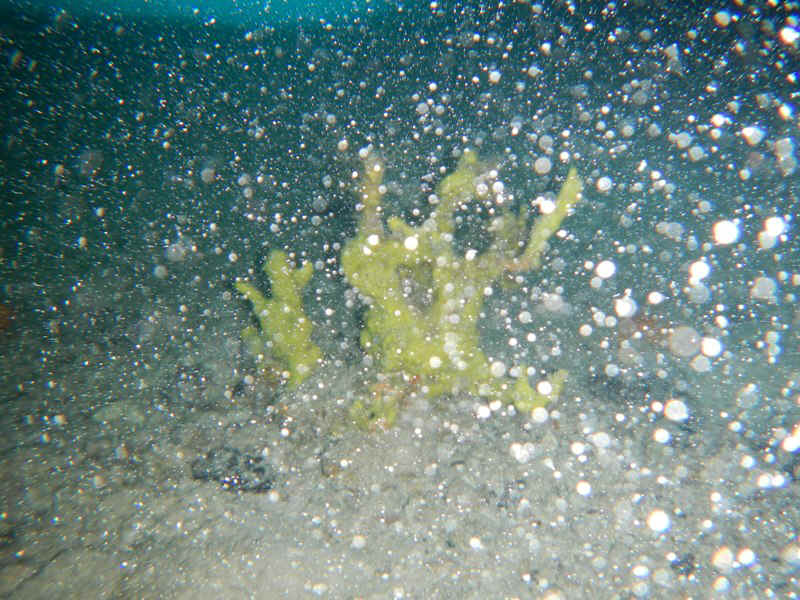
| On Monday I went snorkeling with Jeff and
Sally. For our first expedition in the morning we went in our dinghies a couple of
miles north to the Sea Aquarium at the north end of OBrien' Cay. I have only one
underwater photo because my camera battery was completely discharged after that one photo.
In any case this location surpassed the reef at Warderick Wells for coral health
and variety and quantity of fish. There was one lobster here and no lion fish.
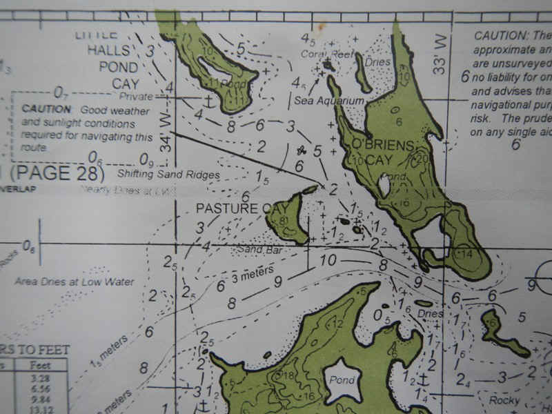
The map below shows the location of the sea aquarium. To the left of the Sea Aquarium label you can see the south end of Little Hall's Pond Cay. At the beach to the right of the label 'Pond' someone was flying a huge Jolly Roger. On seeing this I wondered to myself "what jerk would spoil such a beautiful scene with that flag?" Later I learned that Little Hall's Pond is Johnny Depp's private island. In addition to diving on the Sea Aquarium we also dove on the little airplane shown near the 5 meter depth marking between Hall's Pond, O'Brien's and Pasture Cays. A real confidence builder for those having relatives fly into places like Staniel Cay. Actually, this plane was probably a little 2-4 seater and privtely owned; but still, there seem to be a bunch of these scattered around the Bahamas.
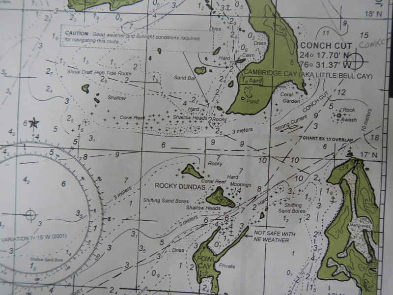
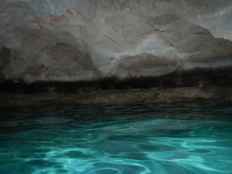
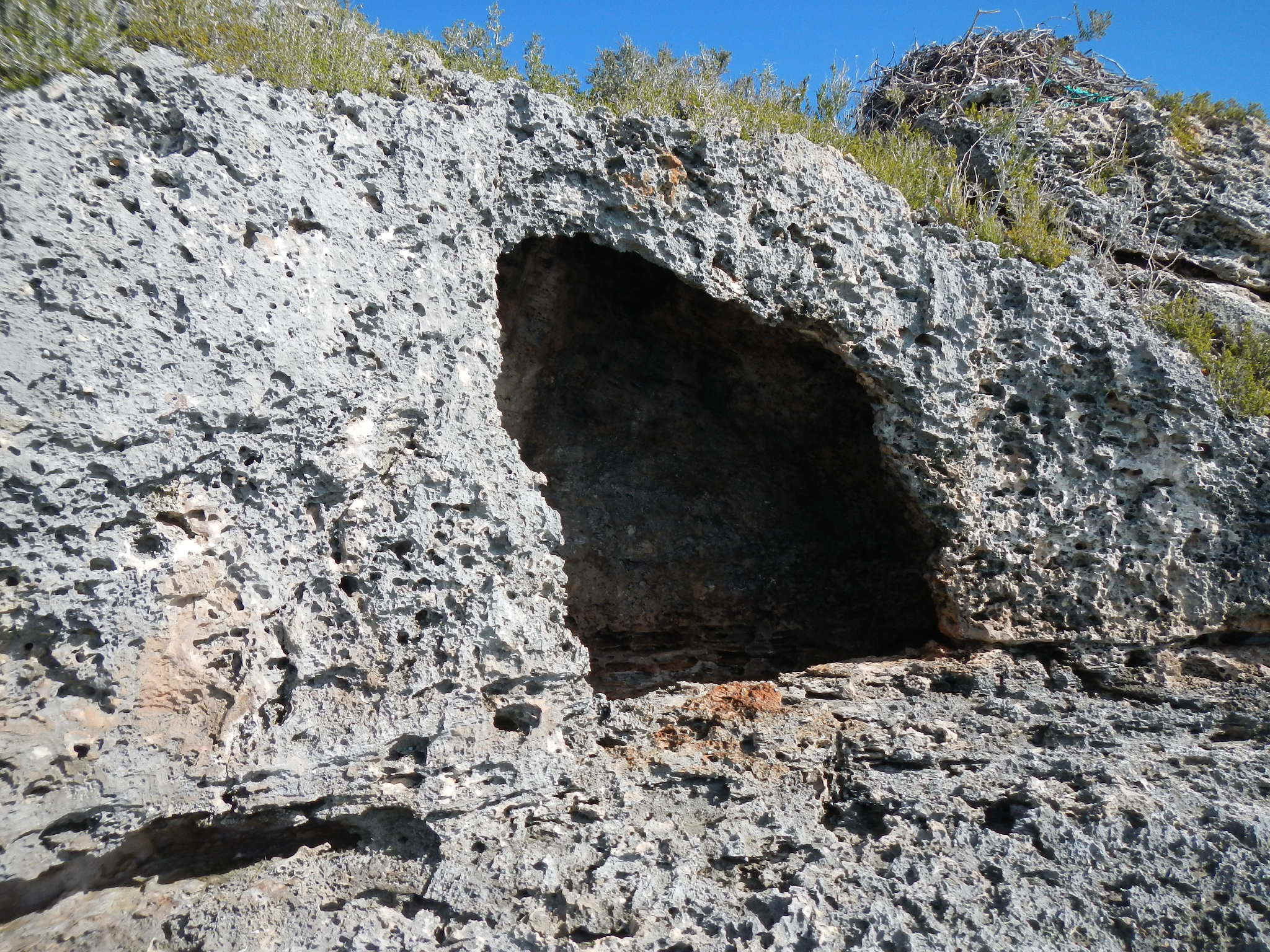
After lunch our intent was to go south in our dinghies to visit the Rocky Dundas and check out the caves. See the map below. When we got there the sea state was such that we didn't bother to get in the water. The northeast breeze and tidal current combined to make the NE side where the moorings were located just untenable for swimming. Instead we went back across Conch Cut to the Coral Garden. Here we found some really beautiful, large staghorn coral.
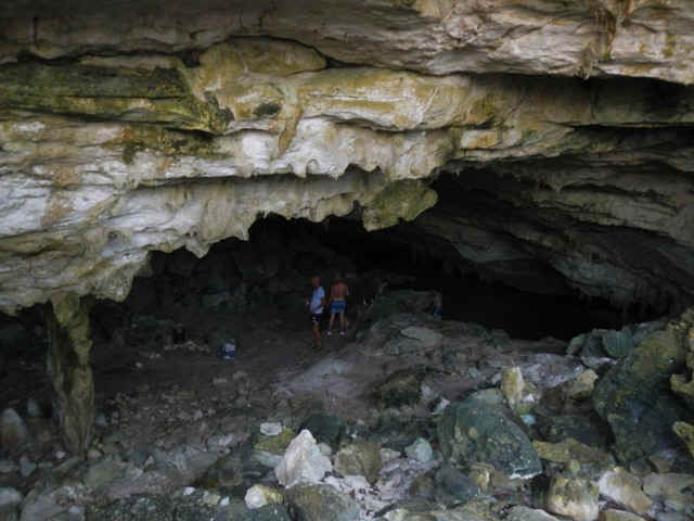
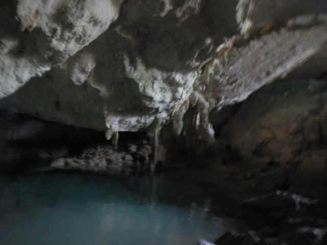
On the 5th, after the wind and waves had had another 24 hours to lessen, we went back to the Rocky Dundas. Even on a much calmer day we had to be very cautious about getting in close to the Cay with the caves. The best we could do was swim close and then look up into one of the caves. Inside you can see stalagmites and stalactites. All-in-all I was underwhelmed. The history is that thousands of years ago the sea level was a few hundred feet lower and these caves with their formations were formed as the rain and water ran through the limestone. |
|
| February 5, 2013 Tuesday -- Cambridge Cay to Pipe Cay | |
| This was a very short trip. In the last
map of the previous entry you can see the exit from the anchorage behind Cambridge Cay
into the Conch Channel. Three of us, Adirondack, Mavourneen and Andante in that
order departed this way. The soudings are in meters and show the depth at low tide.
We went out on the rising tide in the order of increasing draft. No one had a
problem. Adirondack went to an anchorage on Pipe Creek behind Compass Cay. Mavourneen and I both turned up at Pipe Creek. Pipe Creek has an abandoned US Navy DECCA station on it. DECCA was an electronic navigation system that came between Loran and GPS. It never saw civilian use. The DECCA channel runs from Pipe Cay almost due west to Miami and one can be assured of deep water and no coral heads all the way. This route is on the charts and was used by the Navy. Occasionally you will here of cruisers that use this course to come to the Exumas from Florida. |
|
| February 6, 2013 Wednesday -- Pipe Cay | |
| In the morning I went snorkeling, spear in
hand, with Mike and Betty from Mavourneen. I swam around the little Cay just to the
west of the DECCA station. No luck. Although I saw many colorful fish and some
nice coral on the east side, I saw only one small Nassau grouper, which is out of season
anyway. We also tried some rocky and reefy areas just to the north of the marked
channel into the DECCA station. Again, no luck. In the afternoon I went on shore to
explore. As is the wont of people visiting abandoned and noteworthy sites, there was lots of graffiti. The earliest date I saw was 1989. There was also lots of detritus suggesting that plenty of people have used the area around the DECCA station for parties: There was a big trash dump filled with empty Kalik cans and a few firepits here and there.
One evening at the DECCA station we had cocktails aboard Mavourneen, a Hatteras 54 motor yacht. Some people do klive differently. Mike had a firepit on the aft deck of his boat, to go along with his full sized refrigerator, washer and dryer, and water maker.
|
|
| February 7, 2013 Thursday -- Pipe Cay to Staniel Cay | |
| Nothing exciting to report. The wind varied from light to nonexistent so I only sailed about a third of the five miles. Staniel Cay is as busy as Times Square on New Years Eve. On neither of my previous two visits, which spanned several days each, have I seen so many boats here. As in 2011 I am anchored on the east side of the little cay that houses Thunderball Grotto. It is a little rolly, but reasonably protected from just about every direction of wind. | |
| February 8, 2013 Friday -- Staniel Cay | |
| The weather forecast is reporting winds
somewhat stronger than I have seen the last several days. Moreover, they will veer around
from east to southwest on Wednesday. This is a small problem since it is hard to
find protection from strong S and SW winds. Among other things today I snorkeled and
took photos in Thunderball Grotto, took the garbage, 16 days worth, in to the dump,
bought gasoline for the outboard, and stopped by the Blue Grocery and Isles General Store.
Neither location rivals even a good Wawa or 7-11 at home. Neither grocery is
in a space much more than 12 by 15 feet. You make do with what they have or what you have
on the boat. At least Isles General Store has ripe plantains that I love to sautee
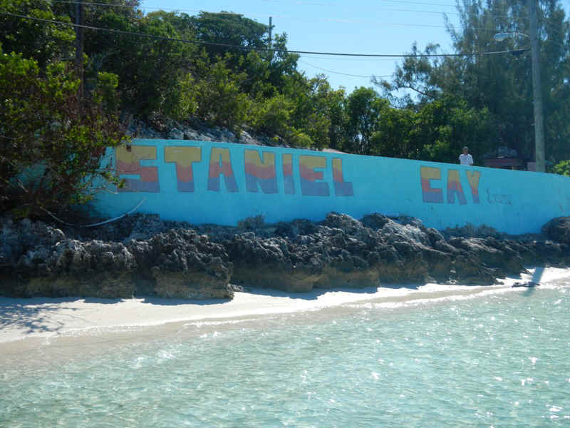
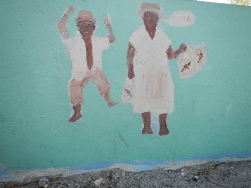
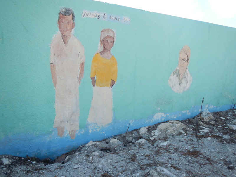
in butter. When bringing one's dighy into the beach you are welomed to Staniel Cay by this sea wall.
On the interior side of the sea wall are paintings of some of the island's luminaries.
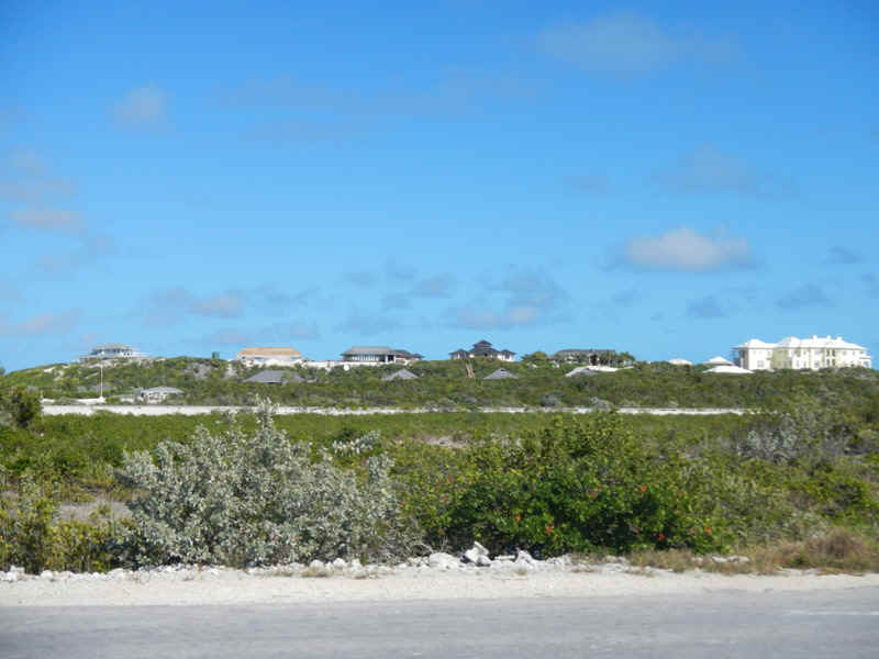
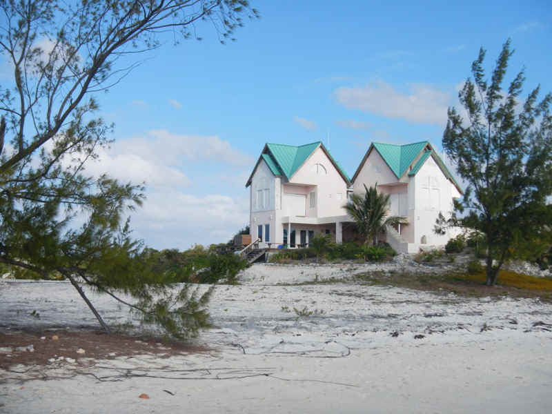
Don't weep for the wealthy Americans who are holding the feetof the Repubolican Party to the fire over the issue of taxe rates. Below is a picture of a couple of some of the mega houses owned by these people on Staniel. The yellow house on the right end of the picture is easily more than 15000 square feet overlooking Exuma Sound. The other houses to the left are owned by such people as the man who owns the Chicago Blackhawks. Actually he owns two of the houses. One he uses himself a few weeks of the year and the other he rents. With this arrangment he gets very favorable tax treatment on both properties. Again, don't weep for these people when they whine and complain about tax rates and being job creators.
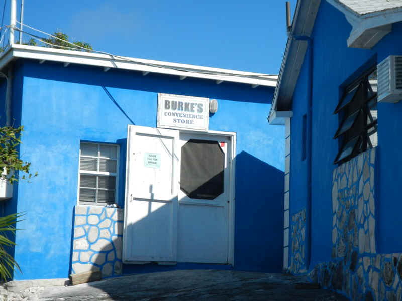
On the trip 12 years ago there were two grocery stores in town, Burke's Blue Store and the Pink Store. Both of them just did groceries. The Pink Store is now closed. There is another store in the suburbs called Isles General Store. Isles General is on a creek going into a mangrove swamp so is accessible by dinghy, even at low tide if you are mindful of the rocks. Isles does groceries, some marine supplies, will refill your propane tank, and dispose of your garbage.
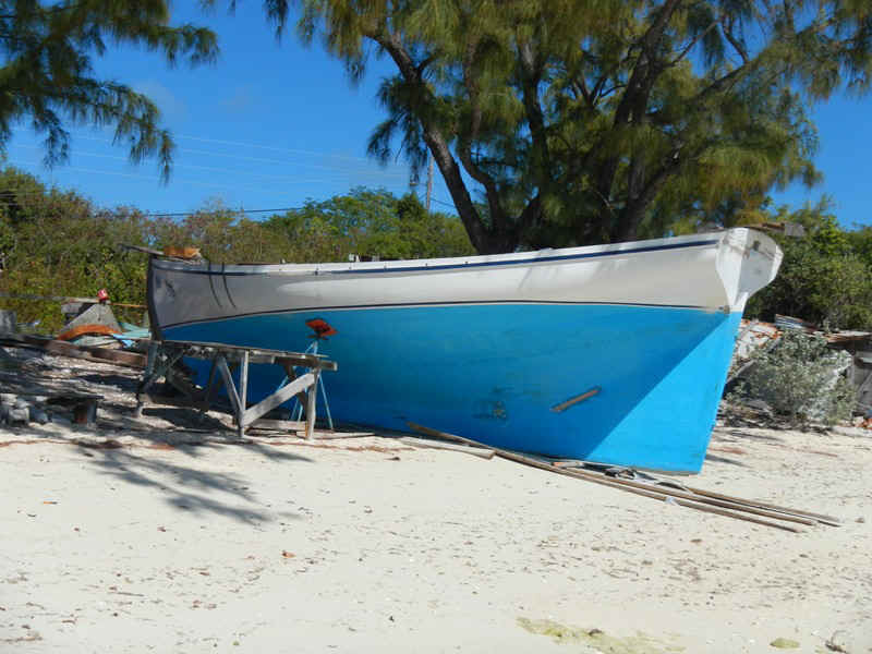
Staniel Cay is home to some of the most famous racing sloops in the Bahamas. Below is one being worked on. Along the road by the church are a couple of masts and booms, which are huge. For racing these sloops are deliberately over-canvassed so that when beating to windward the crew hikes out on long boards, sort of like the racing log canoes up on the Chesapeake.
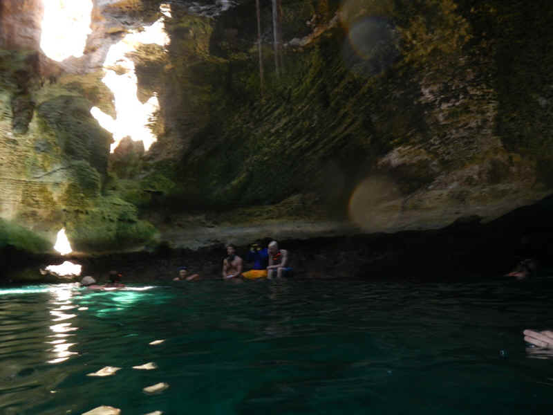
The best time to enter Thunderball Grotto is at slack low tide. Below is a picture of the mob jumping into the water to go into the cave.
In this next photo you can see the light streaming in through the entrace to the cave. Also, note the bathing beauties trying to stay vertical in the water and only accomplishing the effect of churning up the sand on the bottom and stirring bubbles in to the water thereby making it hard to get decent photos: see my attempt to get a picture of one of the few pieces of coral thriving in the cave..
The next couple of photos show the ledges inside the cave that were used in the Thuderball movie. They seemed MUCH bigger in the movie. I guess that is what professional photographers are paid to do.
|
|
| February 9, 2013 Saturday -- Staniel Cay to Black Point Settlement | |
| Listened to Chris Parker in the AM, thought
about my anchorage to the east of the Thunderball Grotto cay-let and its exposure to the
northeast, the mob scene on the west side of Big Major Spot and decided that I would go
down to Black Point Settlement. It sprinkled a little and looked ominous so I waited
for the sky to clear then took off. A very fast sail down to Black Point where there
are 20+ boats in the big anchorage. Did laundry at the best laundromat I have seen
since I started the live-aboard thing at the beginning of July. In the afternoon "Sloop John Dee" came in and anchored almost on top of me in a harbor that encompasses a couple of square miles. Go figure. About 9:30 PM my anchor began to drag in the increasing wind. I don't know if I didn't get it set correctly or if Sloop John Dee disturbed it when they were dragging around trying to get their anchor set earlier. Anyway, I got my anchor up and reset quickly enough, and further away from Sloop John Dee. It made for a less than restful night since I woke up every two hours to check be sure that I wasn't dragging again. |
|
| February 10, 2013 Sunday -- Black Point Settlement | |
| On Sunday's Chris Parker doesn't do his
weather routine so I try to pick up Nick Wardle out of Nassau or the Waterway Cruisers
Net. I couldn't hear Nick, but surmised from those reporting in to him that
conditions were pretty much as Parker had forecast. The Waterway Net reads the NOAA
NWS synopsis, most of which I could catch. Basically NOAA says we will have strong
winds from the E and ESE through Monday, a little lighter Tuesday, and shifting to the W
and SW on Wednesday as Parker predicted on Saturday. After Puffin arrived a group of us walked down to a beach on the Sound side where it was alleged we would find sea beans. These are seeds that wash up on the beaches from Central and South America. The pickins were pretty slim; all we found was lots of plastic litter. Further on we crossed to the west side of Guana Cay to visit a development project that had been started some years ago, but was abandoned almost as soon as it was started. In its current state it consists of a basmenet that has been dug out of the limestone but not opened to the Banks and this sole house. This was an investor that was sold on the idea, bought a lot and built a house in anticipation of the droves of the affluent that would surely follow.
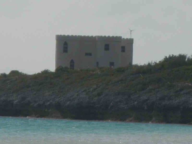
Another interesting house south of the settlement. Yes, those are the teeth of a castles battlements along the roof line. When will your significant other be buiding a castle for you?
|
|
| February 11, 2013 Monday -- Black Point Settlement | |
| After spending the morning bringing fresh
water from town out to the boat (I used about 27 gallons of water in 18 days) I went for a
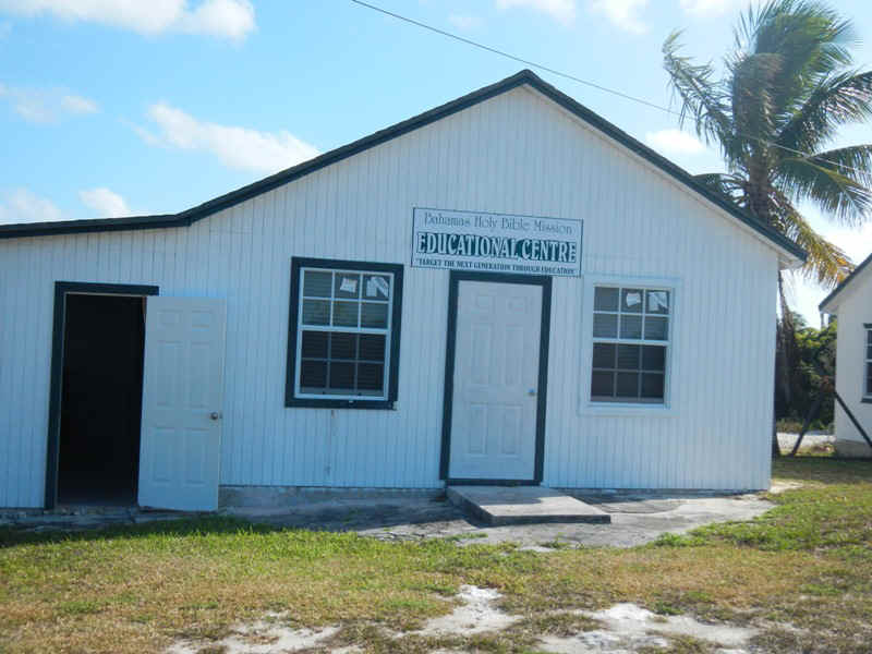
walk in the afternoon. This is what I found: During his tenure in office 43, aka W, got hung up on constitutional niceties only when it came to gun control One of his initiatives was to start fudning so-called faith based community development projects that would provide educational and training opportunities for America's youth. Apparently this line of thinking was not original or confined to the US. Below is the Bahamas Holy Bible MIssion Educational Center whose mission is "Reach the next generation through education."
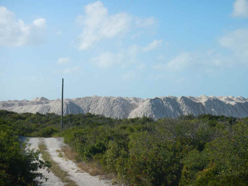
In my post about my visit to Cambridge Cay I mentioned the marina - resort that is being constructed on Bell Island. When I asked about this huge pile of sand, limestone and gravel at the north end of Guana Cay I was told that it is the spoil from the project being undertaken on Cambridge Cay. There must be tens of thousands of cubic yards of this stuff that has been brought the ten miles or so from Bell Island. In exchange for getting permission to dump their spoil on Guana Cay the developers, in their generosity, built a little medical clinic for the people of Black Point Settlement. That clinic is less than a drop in the bucket relative the millions being spent on Bell Island.
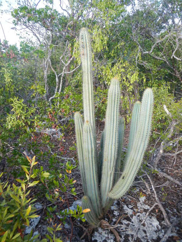
On my trek, and in the shadow of the mountains of spoil, I saw a small number of cactus that I would have associated with the desert. One is shown below. So far I have not seen this cactus elsewhere in the Exumas. I have, however, seen prickly pear cactus so it may be that this particular cactus is not something introduced to the Exumas.
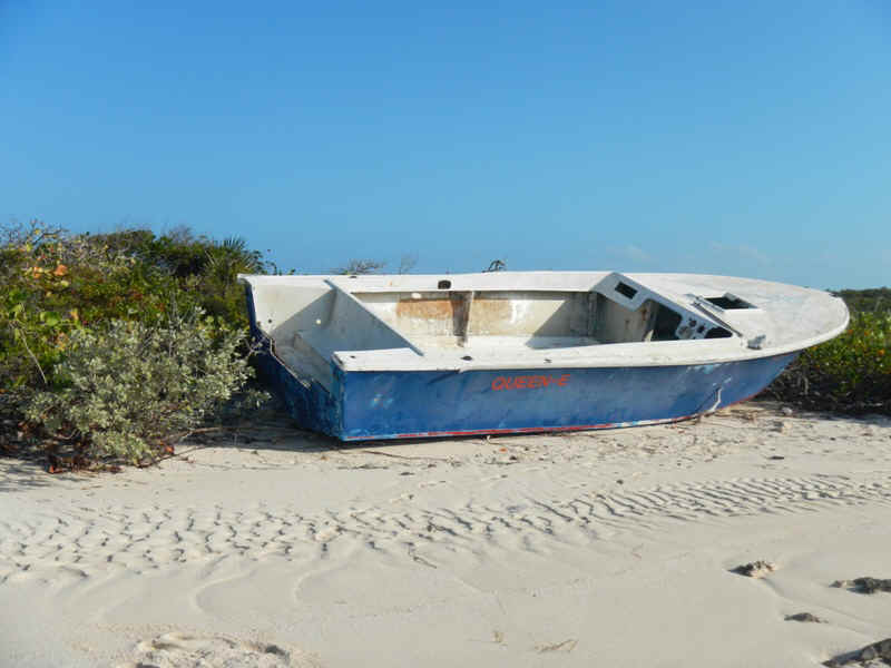
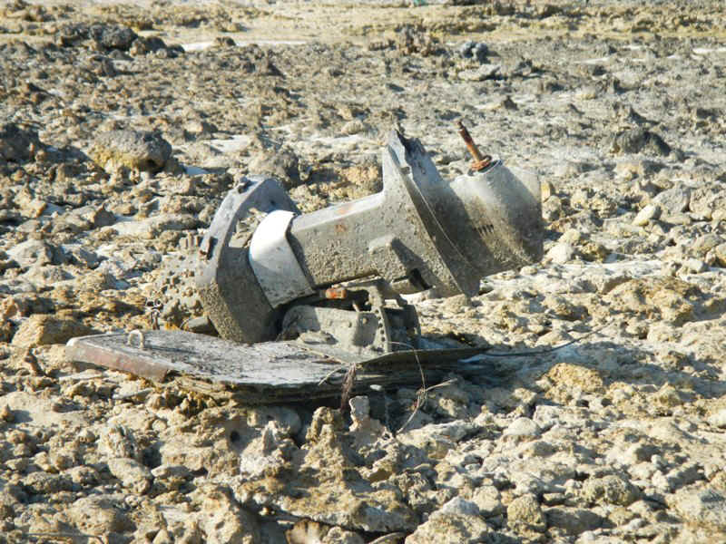
After being shocked by the mountain of spoil I decided to walk out to the Sound side of things to check out the White Horses and the little beach nearby. Along the way I had to walk across a creek and mangrove swamp and came across this boat that was many hundreds of yards inland and up the creek from the Sound. It must have broken loose elsewhere and been carried in here on a storm. Note that the transom has been broken out of the boat. In the photo next to it you can see what is left of its outboard and transom after bouncing around on the rocky entrance to the creek..
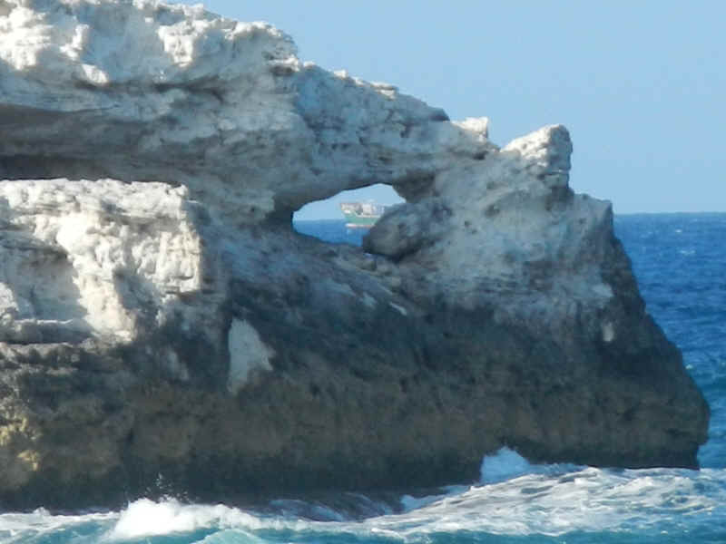
Not too much further on from the boat I came to the White Horses. In the below left photo you can see, with a little imagination, two horse heads. It may be that from the Sound these formations look more like horses. The right photo is another view of the same rock formation. You can just see an inter-island freighter through the hole in the rock.
Just south of the White Horses rocks is a little beach with a natural formaton rock sea wall protecting it from the Sound; the photo below left. I then turned 180 degrees and shot the other picture looking south. If you look closely you can see rock fingers sticking out from the beach. They look very much like the rock jetties that you see on the beaches of the south shore of Long Island or the New Jersey beaches. Do you suppose that this is where the idea for jetties as a means of beach preservation came from?
|
|
| February 12, 2013 Tuesday Black Point Settlement back to Staniel Cay | |
| Today is fat Tuesday; Mardi Gras! Let's see,
this lifestyle has resulted in not being able to watch the Super Bowl and missing the
parties associated with Mardi Gras. And, oh yes, due to the weather, I will not be
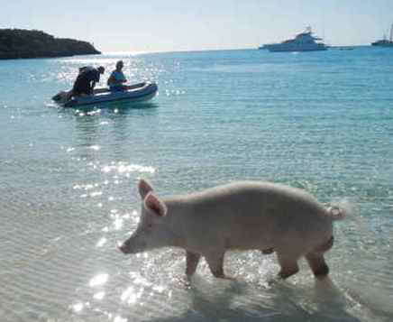
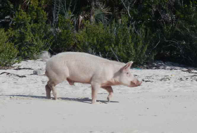
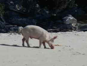
in a location where I can bring anyone a few long stem roses. Boo-hoo, weep, weep. After getting settled into a protected anchorage on the north side of Fowl Cay but below Gaulin Cay I paid a visit to Pig Beach on Big Major Spot. There was only one hungry pig and it took awhile for him to show up. My guess is that many people had visited the beach earlier in the day and the pigs were sated and sleeping off their indulgences.
|
|
| February 13, 2013 Wednesday -- Fowl Cay / Gaulin Cay to Cambridge Cay | |
| Another day of great sailing. I think today I may have sailed close to ten miles. While on a broad reach I was only able to squeeze out 5.5 knots, but as I turned the corner at the Rocky Dundas Sand Bore and headed onto a close reach my speed went to 6.8 - 7.1 knots. At mid-tide I saw no less than 9 feet while coming into the southern, shallow and scary entrance to the Cambridge Cay mooring field. Thursday and Friday the weather should be good for some exploration, then the excitement begins on Saturday afternoon through Sunday night. | |
| February 14, 2010 Thursday -- Cambridge Cay | |
| Today we went down to Rachel's Bubble Bath at
the north end of Compass Cay. This natural wonder is on the west side of Compass
Cay. At Conch Channel Cut look for the anchorage at the northwest side of Compass.
There is a tidal creek that runs from the northern end of the beach eastward
through a small mangrove swamp. Follow the creek to the beautiful pool just inside
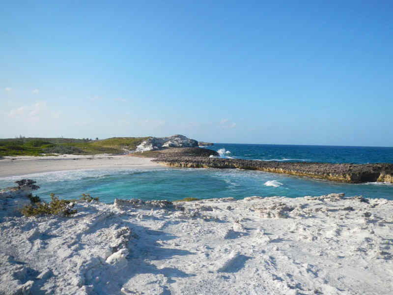
the rocks on the Sound side of the Cay. When the tide is up the waves crash over the rocks in the middle of the picture. The rock formation is such that the wave foams and bubbles into the pool. We were there somewhat after high tide so there weren't very many waves that washed over the rocks into the pool creating the bubble bath effect. The few that we did get were quite fun.
To take the picture below I climbed up on the rocks with my back to the Sound, so this is the view looking toward the beach where one lands one's dinghy. The blue water in the lower left of the picture is the Sound and you can see the water rushing back after a wave has washed up onto the rocks.
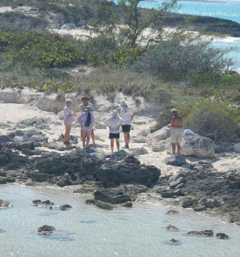
The crews from Puffin, Sundancer V, and Spartina (Mark and Marlene, Phil and Sara, Ross and Rosemary). It is a small world out here and in which one could play 6 degrees to Kevin Bacon. Turns out all three crews are only one degree away from Jeff and Sally on Adirondack. In addition, Mark and Marlene met Patti Haase on Lutra a couple of weeks ago at Little Farmer's Cay. I met Patti about four years ago through Bob and Claudia Black, a couple of cycling buddies from the Lehigh Valley Velodrome.
|
|
| February 15, 2013 Friday -- Cambridge Cay | |
| In the AM I went snorkeling with Sara
(Spartina) and Mark (Puffin) off one of the rocks on the southwest corner of the mooring
field. It was a little reef, but I saw a fish (a small Coney) I had not seen before
and also found a large ... with the spiral shell. After lunch I landed on Cambridge
Cay down near the rock with the stone cairn on it and walked down to the southern end of
the Cay until I could easily cross over to one of the beaches and look out to Conch
Channel Cut and Compass Cay. My intent had been to find the path that crossed over
to Honeymoon beach. It wasn't until I got back to the dinghy about the same time
that Phil and Sara got to theirs that I learned from them where the trail head
started. They admitted that they too had walked by it twice without finding it, and
they had been there in a previous visit to Cambridge Cay.
|
|
| February 16, 2013 Saturday -- Cambridge Cay | |
| This morning I went for two walks. The
first was back down to the beach by the cay/rock with the stone cairn on it. Now
that I knew how to find it I wanted to follow the path over to honeymoon beach. So that
others might find the trail more easily I built the little cairn you can see near the base
of the Casuarina Pine in the middle of the picture. If you ever come here look for
the four Casuarina on the beach just north of the rock with the big stone cairn on it that
marks the channel for the southern entrance to the mooring field.
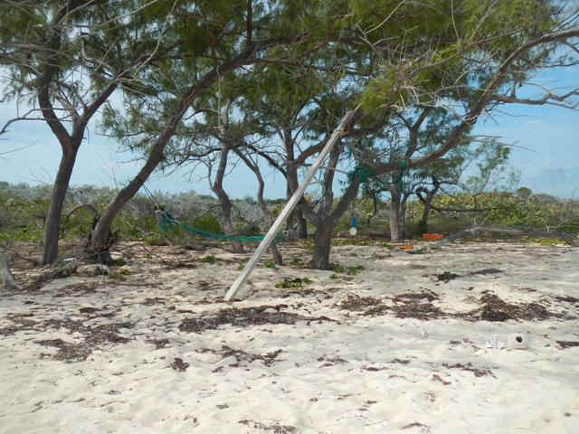
My second walk of the day was back to the beach at Bell Rock on the Sound side of Cambridge Cay. If you walk down to the south end of that beach you will find a little playground built from the detritus folks have found on the beach. The playground consists of a double hammock (green rope strung between the trees), a steep wooden slide, a swing (hard to pick out, but it is hanging to the right of the white ball hanging in the tree), and an orange kids' toybox in the background.
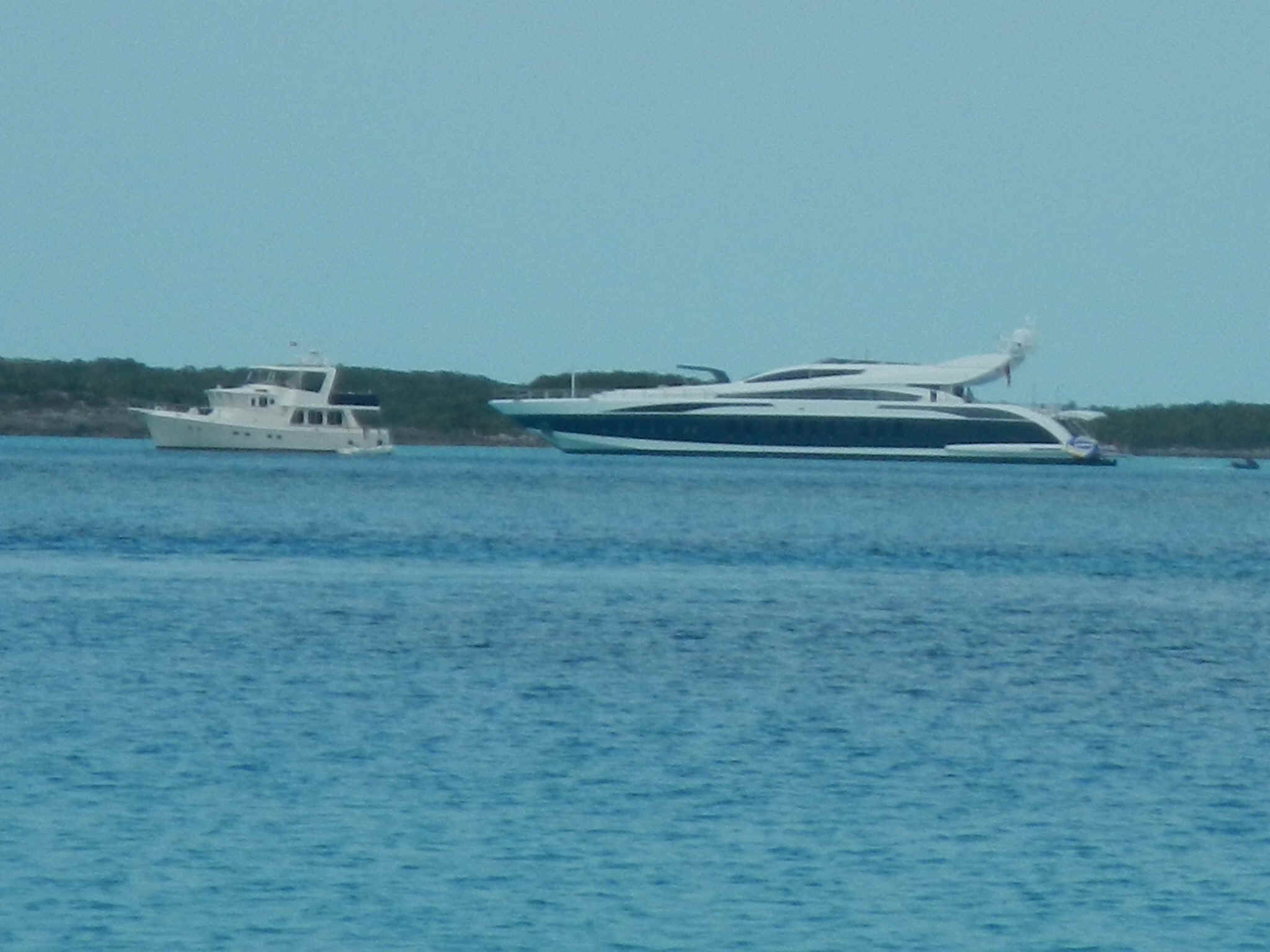
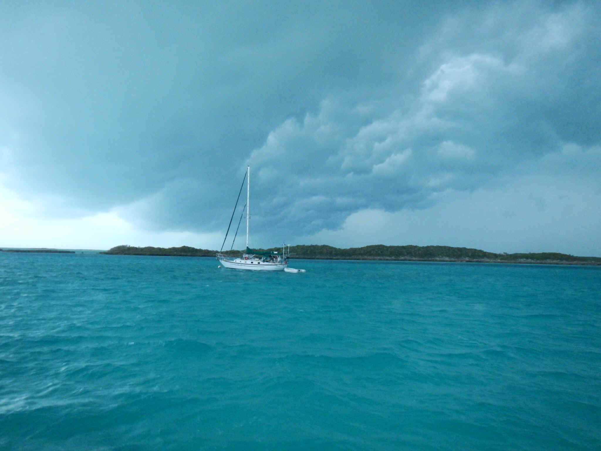
I made sure that I was back to the boat by shortly past noon. Chris Parker's forecast was that the cold front, a euphemism for a winter storm, would be moving into the area during the afternoon with lots of wind. In the first picture below you can see a mega-yacht in the neighborhood also seeking shelter. The white hulled trawler is about 55 feet long, so you can imagine how big the mega-yacht is. If you look closely at the stern of the blue hulled boat you can see that they have the garage door open. That is where they keep their ~20 foot run-about when they are underway.
By nearly sunset the low pressure trough was beginning to pass over us. It was the approach of this low that brought us several days of S wind in the neighborhood of 5 -12 knots. Once it came over us it would pull in 25+ knots of wind from the north. The picture below shows the sky as the trough made its way to and over us. The sky was much blacker than it appears in the picture. It surely rivaled some of the black skies I saw when in grad school in Champaign-Urbana. It brought lots of both wind and rain. The rain was welcome since it rinsed off all the salt that had been accumulating on the boat.
|
|
| February 17, 2013 Sunday -- Cambridge Cay | |
| This morning the cloud cover is moving out and the sun is making an appearance. There is lots of wind! This morning at 7 AM it was blowing NNW at a sustained 25 knots with higher gusts. Between yesterday morning and this morning the barometer dropped 7 millibars and then rose more than 7 millibars by morning as the low pressure trough passed over us. And this morning the air is noticeably cooler and drier. Even though it is clear today, the wind is blowing hard enough that I probably won't bother getting in the dinghy; anywhere I went would be a wet trip. | |
| February 18, 2013 Monday -- Cambridge Cay to Black Point Settlement | |
| What a rollicking good sail. I raised
the main even before I dropped the mooring. Between an ingine idle, the tidal current and
the main I rocketed out of the mooring field at about five knots. Once I turned the
corner westbound into Conch Cut channel I was on a broad reach. With full main, full
genoa and a bit of tidal current I did a steady 8 - 8.3 knots out to the Exuma Banks.
Unheard of! Turning to port I went to a close reach, still running over 7
knots. Unfortunately the wind built to 20 knots apparent and veered more south of
east so I had to sail close hauled. When close hauled even with all that wind my
speed fell to 5.5 - 6 knots; still not to shabby. I must be the only sailor out here who has trouble getting attached to the bottom at Black Point. Today I again couldn't get the anchor set on the first few sides. Since the wind was rising and predicted to go still higher it was important that I be really firmly attached to the bottom. The wind blew hard enough that I never got off the boat; so much chop in the bay that I would have gotten soaked going into town. |
|
| February 19, 2013 Tuesday -- Black Point | |
| Tasks today: hauling 10 gallons of water,
grocery shopping at Adderly's Friendly Store, diving under the boat to spin the knot log
(it wasn't working because something must have gotten caught in paddle wheel up at
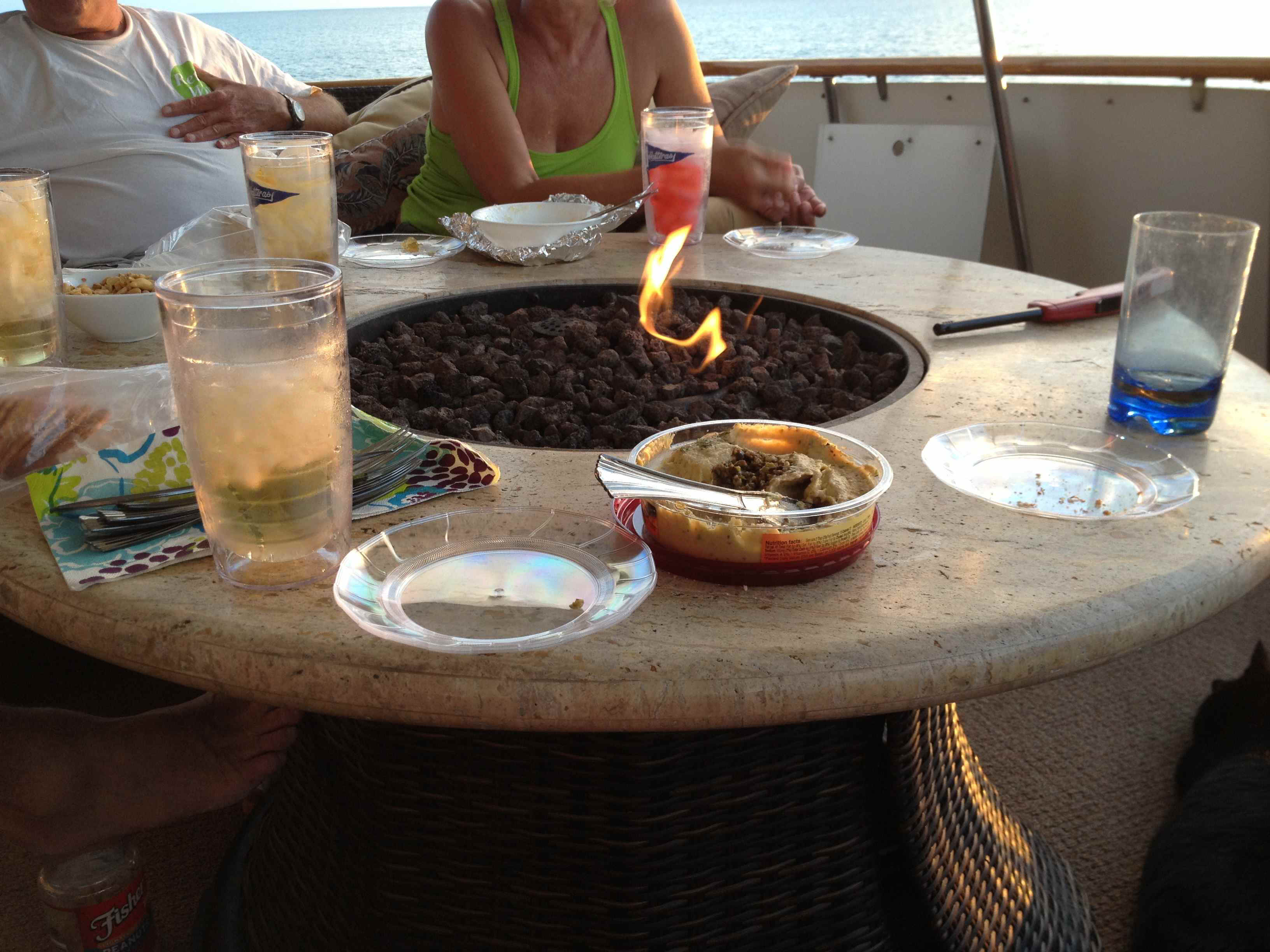
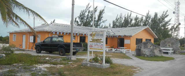
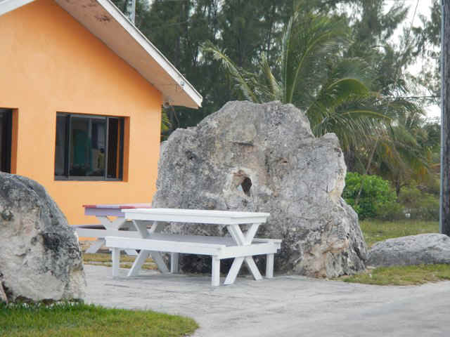
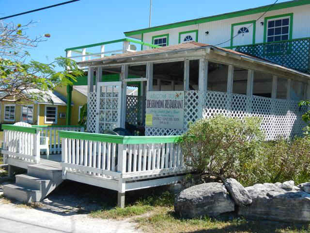
Cambridge Cay). A big day for boat chores. In the evening I went to Scorpio for Happier Hour with Jeff, Sally, Dennis and Mary. After a rum puinch we adjourned to DeShamon's Restaurant for her $15 BBQ ribs night. The first picture below is Scorpio's. At the right of the picture you can see what looks like a mill stone behind the picnic table. I include a better picture of the stone below. The face of it is quite smooth, but since it is either sandstone or limestone I am sure it could never be used to grind grain. Life is good.
|
|
| February 20, 2013 Wednesday Black Point | |
| When you come into Black Point town dock you
are greeeted by this welcome sign. It says "Here is the point. Stick to the
point." At the foot of the dock is a small structure that is of indeterminant use, but is another welcoming feature.
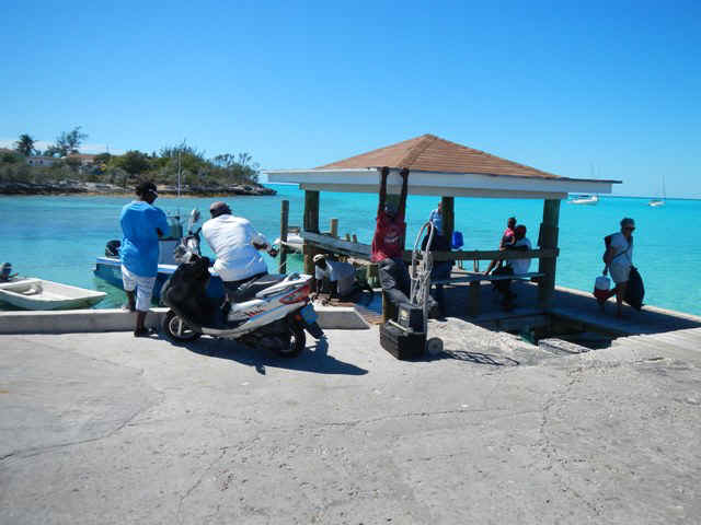
One morning when I went into town one of the local guys had brought in a load of conch and was making conch salad. The locals and a few cruisers bought containers of his salad before he took the larger bowl full off to one of the restaurants, where the price would double. In part of the background conversation I learned that the availability of conch salad in town doesn't occur too often. Talk about being in the right place at the right time.
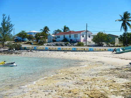
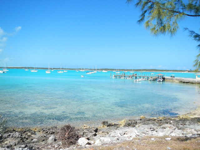
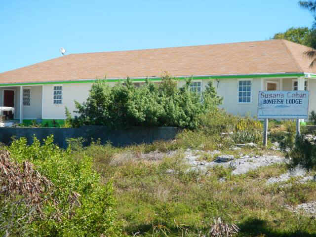
The picture above gives some sense of the beautiful color of water in the harbor. This panoramic pciture says it even better . . The following sequence of photos is what you will find as you walk through the thriving metropolis of downtown Black Point Settlement. The first photo is of Susan's Cabin: Bonefish Lodge. Bonefish are a popular game fish seen throughout the Bahamas. I think there must be a season to this since Susan's is well maintained although I didn't see any guests.
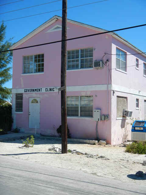
On the same street, well OK so there is really only one street, you will also find the government clinic. This one is about four times as large as the clinic at Staniel Cay, which has several times the population of Black Point. Go figure. Remember I told you that the developers at BellIsland bribed the locals so that they could dump their construction spoil on the island. Also, Black Point is the administrative center for the Exuma chain. So maybe there is an accounting for the size of the clinic. On the other hand, the exterior needs some attention, which leads me to discount the story that this was built by the Bell Island developers.
Deshamone's Restaurant
Lorraine's Restaurant
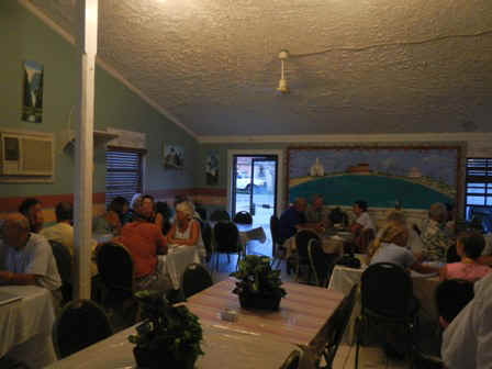
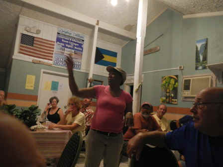
The crowd at the Wednesday night buffet at Lorraine's. I've been to two of these and both affairs were packed with cruisers. Lorraine is the one in the pink t-shirt in the lower right photo. She gets a couple of family members to help her with the crowd.
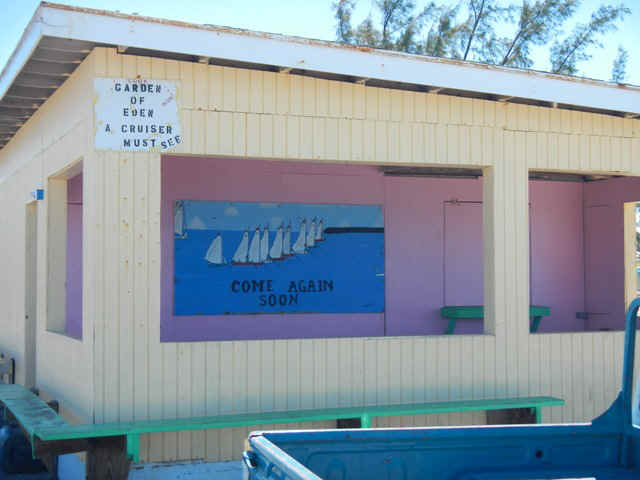
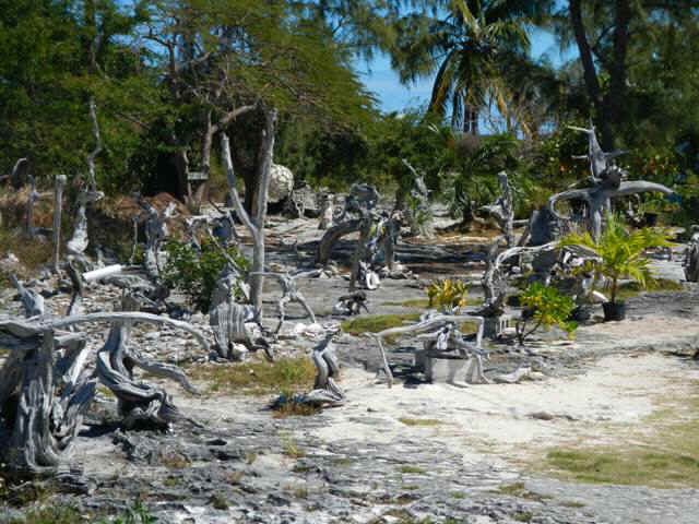
A full on view of the Garden of Eden driftwood sculpture garden. For a gallery of photos click here.
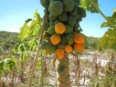
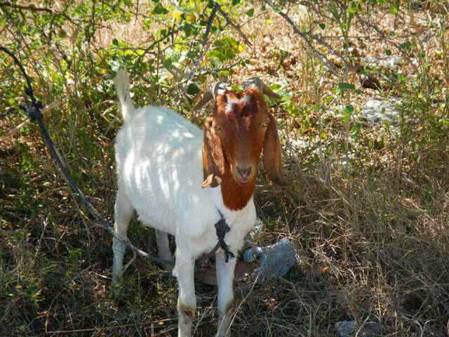
Some of the flora outside of town. During the summer, when there is more rain, the locals plant corn and tomatoes in the small patches of top soil that they can find. The photos are of papaya.
Some of the local fauna. This fellow, with some of his brothers and sisters, lives up the street from the Garden of Eden.
|
|
| February 21, 2013 Thursday Black Point to Oven Rock | |
| This is Oven Rock, just north of Little
Farmer's Cay. This looks like a dome shaped Bahamian stone oven, although it could
just as easily be an italian pizza oven. On the Banks side you can see the opening
for slipping your bread or pizza inside.
The next two shots are of the interior of the cave in one of the hills on Great Guana behind oven rock. To find the path to the cave land on the bit of beach just to the north (left in the photo) of Oven Rock. Walk north along the beach and rock shore until you come to the path going across the island and up the hill to the entrance.
|
|
| February 22, 2013 Friday Oven Rock back to Black Point | |
| Wonderful broad reach back to Black Point today; over 6.5 knots all the way. In the evening I went into Scorpio Inn with Mark and Marlene for the Happier Hour. Good crowd dropping some coin on the local population,. but they made short work of the free chicken wings and salsa. | |
| February 23, 2013 -- Black Point | |
| On the 23rd I went out to the airport, which
we visited 12 years ago. In anticipation of future development the airport has been
expanded from the gazebo we saw to include a terminal and a hanger.
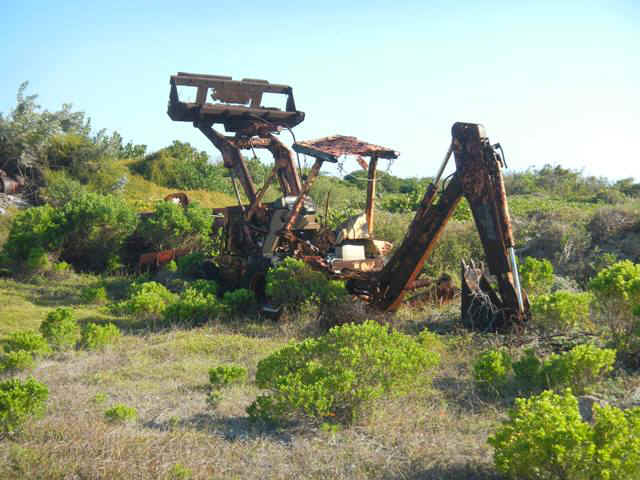
The same day I spent more than a little time in the Garden of Eden, mentioned above and shown in its own gallery. 02/24/2013 - AM - It was so humid last night that the decks and exterior canvas look like it rained. Inside the boat everything, including me, feels soggy. PM - Three hour walk south of town. My intent was to get a much better shot of the sand castle house, but no luck. There was a privaye property sign well before I could get close to the house so the best I could do is shown below. One of the cruisers met an owner of the sand castle house. The explanantion for the design was "When you were little what was the first thing you did when you got to the beach?" One of the locals told me that there isn't any heavy equipment on the island to aid in building their houses. I did find some scattered in different places along my walk. The worst of it is shown below. Much of the rest that I saw looked as though it had been sitting idle for quite some time; the death knell in this salty environment. I think what happens is that a developer brings the stuff in, uses it until they run out of money and then abandons the machinery. Once the developer fails and a bank is involved then there is no way to get the equipment into the hands of the locals. The banks would rather operate under the fiction that they are going to get their money out of the developer or out of someone who takes over the project. Can't they understand that down here they should sell off at fire sale prices whatever assets remain and then go after the developer?
02/25/2013 AM Long three hour walk out to the northen point of Great Guana Cay. Getting there meant wading across the creek that cuts off the northeast corner of Great Guana. You should be able to see it on maps.google.com or on Google Earth. While out there I watched a LARGE motoryacht come in through Dotham Cut while the tide was running against the wind. They were so big that the standing waves and chop had almost no effect on them. PM I had cocktails with Jeff and Sally on Adirondack as we watched the sun go down. Green flash; just a small one. No lie. Jeff is now a believer. Some interesting scenes from the walk:
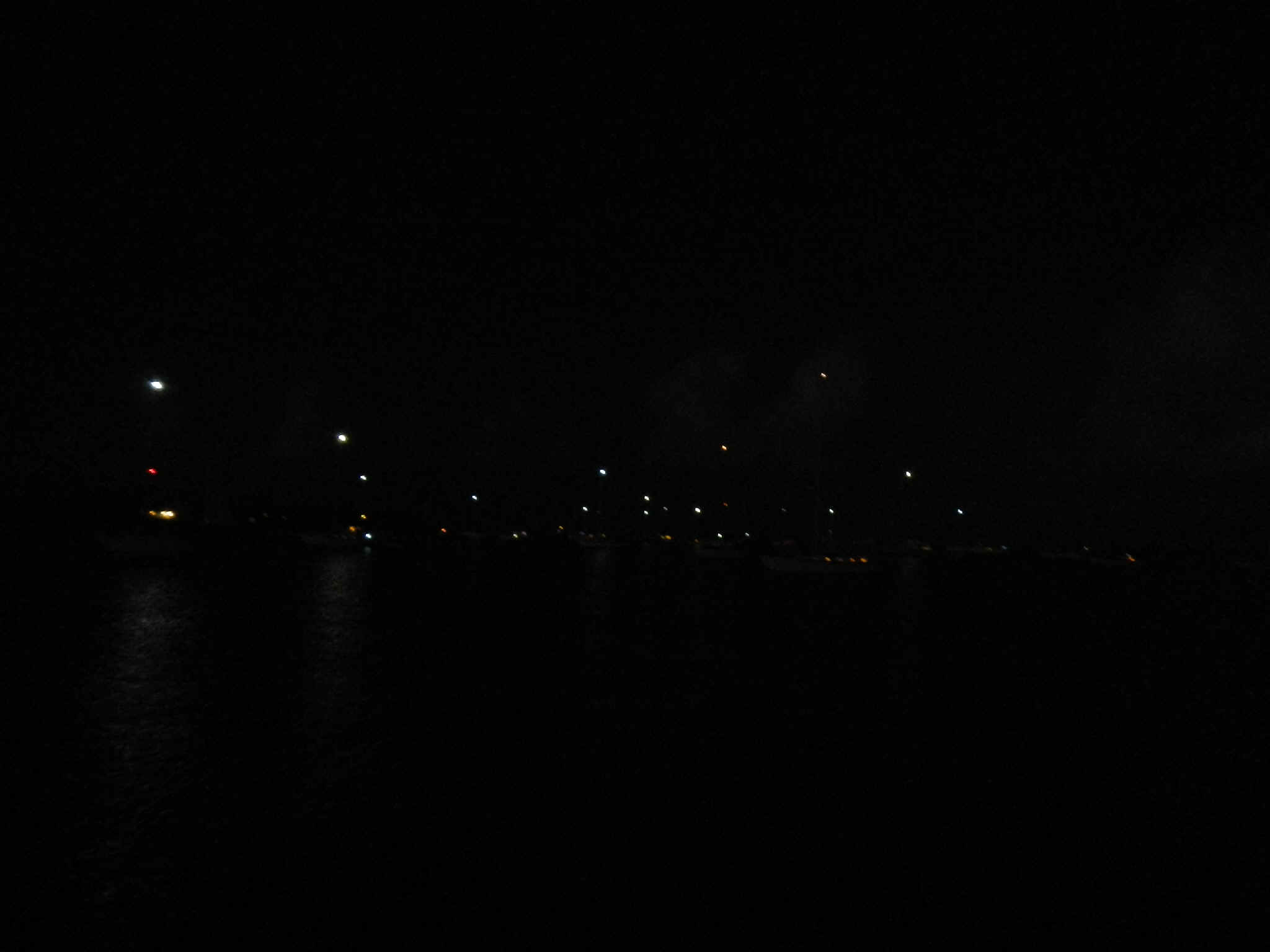
Those speckles of light are not stars in the nighttime sky. They are the anchor lights of all the boats in the harbor.
02/26/2013 My to do list was laundry, water, garbage and buy bread. What should have been a couple of hours turned into an all day affair. Getting rid of the garbage was easy since the haul away trailer is right at the town dock. The water spigot was not running at its usual rate. Turned out that the island had lost electricity. Fortunately the public spigot is down hill from the storage tanks. Anyway, getting 15 gallons took longer than expected. Given the lack of electricity I stopped along the way to the laundromat to talk to whoever would stand still long enough for me to get my lips flapping. Shortly after I go to the laundromat the electricity came back on. But, since there hadn't been any electricity to run the water works, the low water pressure meant that the wash cycle took inordinatley long. When the wash cycle finished I loaded the drier and put in my token and sat down to read. From past experience I know that the driers are HOT and run for a long time. After forty minutes I got up to check the drier only to find that my clothes were stone cold. Apparently the propane tank supplying the driers was empty. It then took several attemts to attach a tank that had propane in it. Even with propane I finally gave up and dragged the damp clothes out to the boat to hang things on the lifelines. Five hours later I finally got back to the boat, only to remember the bread. After the bread run I had to begin to prepare for tomorrow's departure. It is now 5 PM and time to bring in the laundry and drink a beer.
|
|
| 02/27/2013 Wednesday -- Black Point to Adderly Cut | |
| The wind was again a little bit north of east, but not
enough to do anything but motorsail. My exit from Dotham Cut was a little better
timed. This morning I left within about an hour of slack tide so there was no hobyy
horsing like last week when I tried to leave Black Point. The cut at Lee Stocking is wider than Dotham Cut and there are other little exits on and off the banks that can be used by the rising and falling tides. Therefore, even though I arrived not to far off mid-tide the passage back onto the Banks was pretty smooth. Since the site of the former Caribbean Marine Research Station is open to the south I chose to turn norht and anchor in between Hall's Pond Cay amd Leaf Cay. There were already some boats in here, and they had already taken the best spots to anchor. After I got the hook down I dove on my anchor and ended up having to move it by hand to a spot of sand in between the rocks on the bottom. Even then I had a nervous night hoping that the wind wouldn't pipe up and challenge my anchor in this iffy bottom. In anchoring I also discovered that my windlass was slipping. After I was settled I got out the manual to find out how to tighten the clutch on it. A simple fix, but the test will be tomorrow morning. In the evening I discovered that my fancy LED masthead light (anchor light and tri-color) is not working. This is pretty disappointing since it cost a pretty penny to have this instead of the traditional incandescent light of yesteryear. |
|
| 02/28/2013 Thursday -- Adderly Cut to George Town | |
| In the morning the anchor windlass worked fine after
tightening the clutch yesterday. What a day for sailing. What a difference a day can make. The wind was from a more favorable direction and with the westerly component to the wind the swell didn't run against me like yesterday. The wind was from just enough west of south so that I could sail a close reach all the way to George Town. The wind speed was mostly 13 - 15 knots. The slowest boat speed I saw on the knot log was 6.8, most of the day was well over 7 knots. As I closed on Conch Cay Cut the wind became very gusty, ranging from a low of 10 knots to a high of a hair over 20. When the wind gusts that high it overpowers the boat, but since it is just a short lived gust it isn't worth slowing to put in a reef. Also as I closed on the cut a French Canadian catamaran raced ahead of me into the cut. A dangrous thing to do for both of us. Later as I was picking a place to anchor off Sand Dollar Beach he again raced in front of me, but this time I yelled at him and he moved on. In my experience down here the French Canandians are worse than the French. It is said that Quebecoise don't bother to go through the immigration/customs process whent they transit the US; they figure the likelihood of being stopped is low and they will just claim a language problem and then pay the fine. They do the same thing when coming into the Bahamas; they fly the Bahamian courtesy flag as though they had cleared in and paid their visa fee, again figuring that they won't get caught, and if they do c'est la vie. After anchoring off Sand Dollar Beach I didn't leave the boat since I wanted to see how I would swing to the breeze and be sure I was attached to the bottom. This year there are just under 300 boats in Elizabeth Harbor, down a lot from the peak years. Everyone is trying to anchor off town and off Volleyball Beach. By comparison the anchorage off Sand Dollar is empty. And as it happens, although no place here offers good protection from NW wind, Sand Dollar is second best after Red Shanks. |
|
Back to January 2013 Ahead to March 2013 |
|
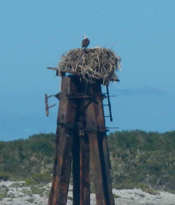 This osprey
is guarding the entry into the little harbor at the DECCA station. From the size of
the nest she has been there for a long time.
This osprey
is guarding the entry into the little harbor at the DECCA station. From the size of
the nest she has been there for a long time.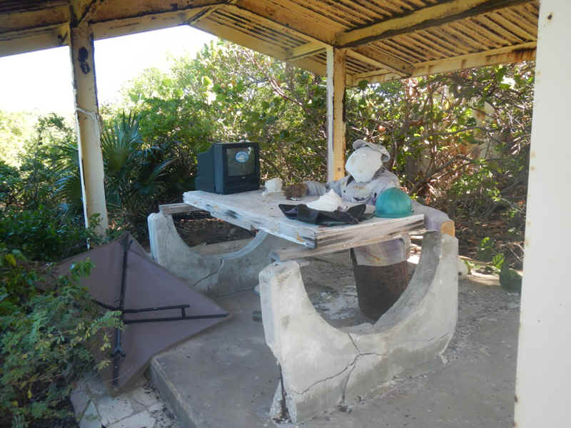 For the time being
this is the only personnel stationed at the DECCA facility. He's got his hardhat,
his wetsuit under the conch shell, and his TV. What more could he ask for?
For the time being
this is the only personnel stationed at the DECCA facility. He's got his hardhat,
his wetsuit under the conch shell, and his TV. What more could he ask for?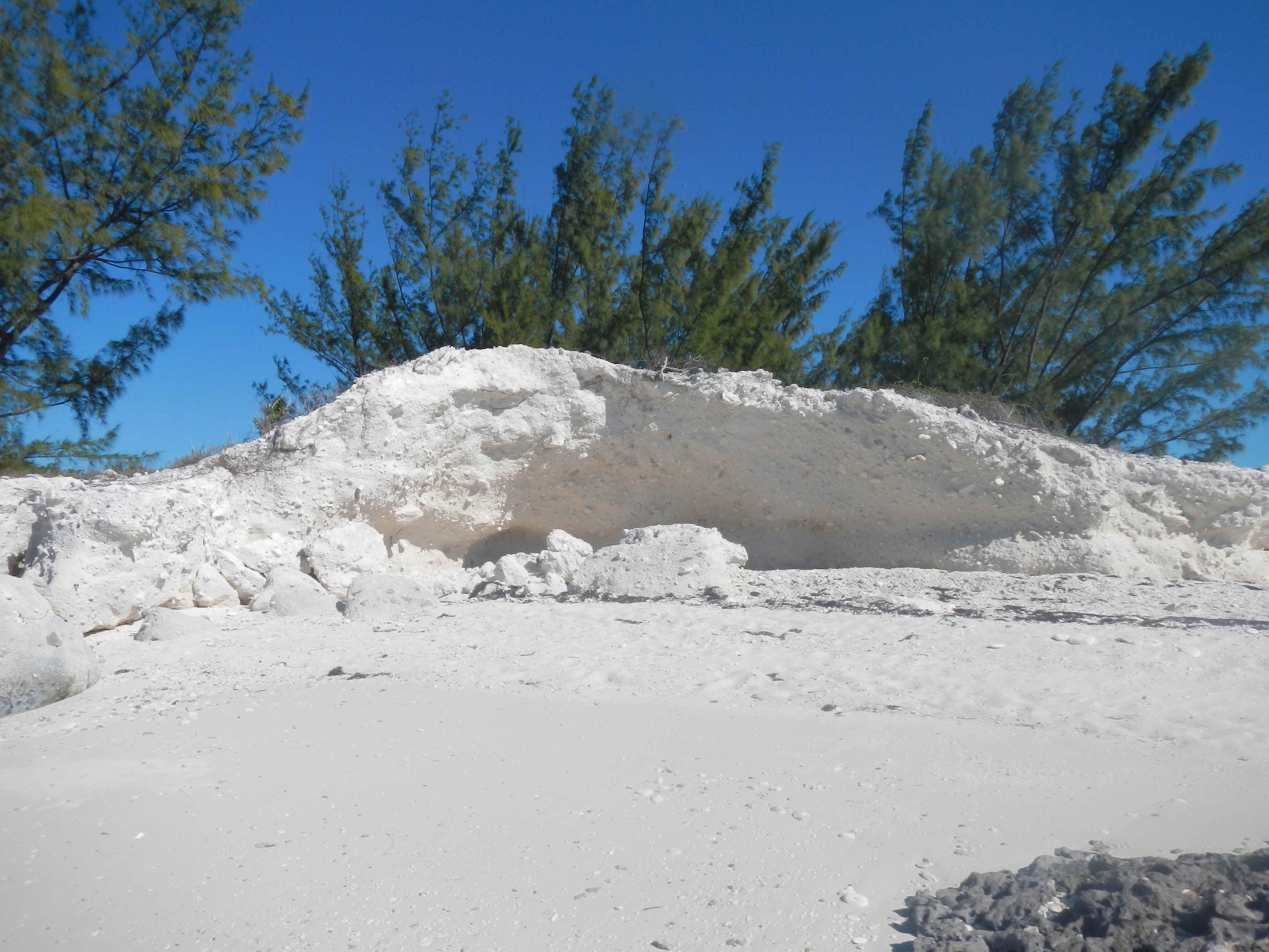 This eroded
sandstone reminds me of the pictures I have seen of the Symphony Hall in the harbor in
Sydney, Australia. Or maybe it is an alter in a cathedral?
This eroded
sandstone reminds me of the pictures I have seen of the Symphony Hall in the harbor in
Sydney, Australia. Or maybe it is an alter in a cathedral?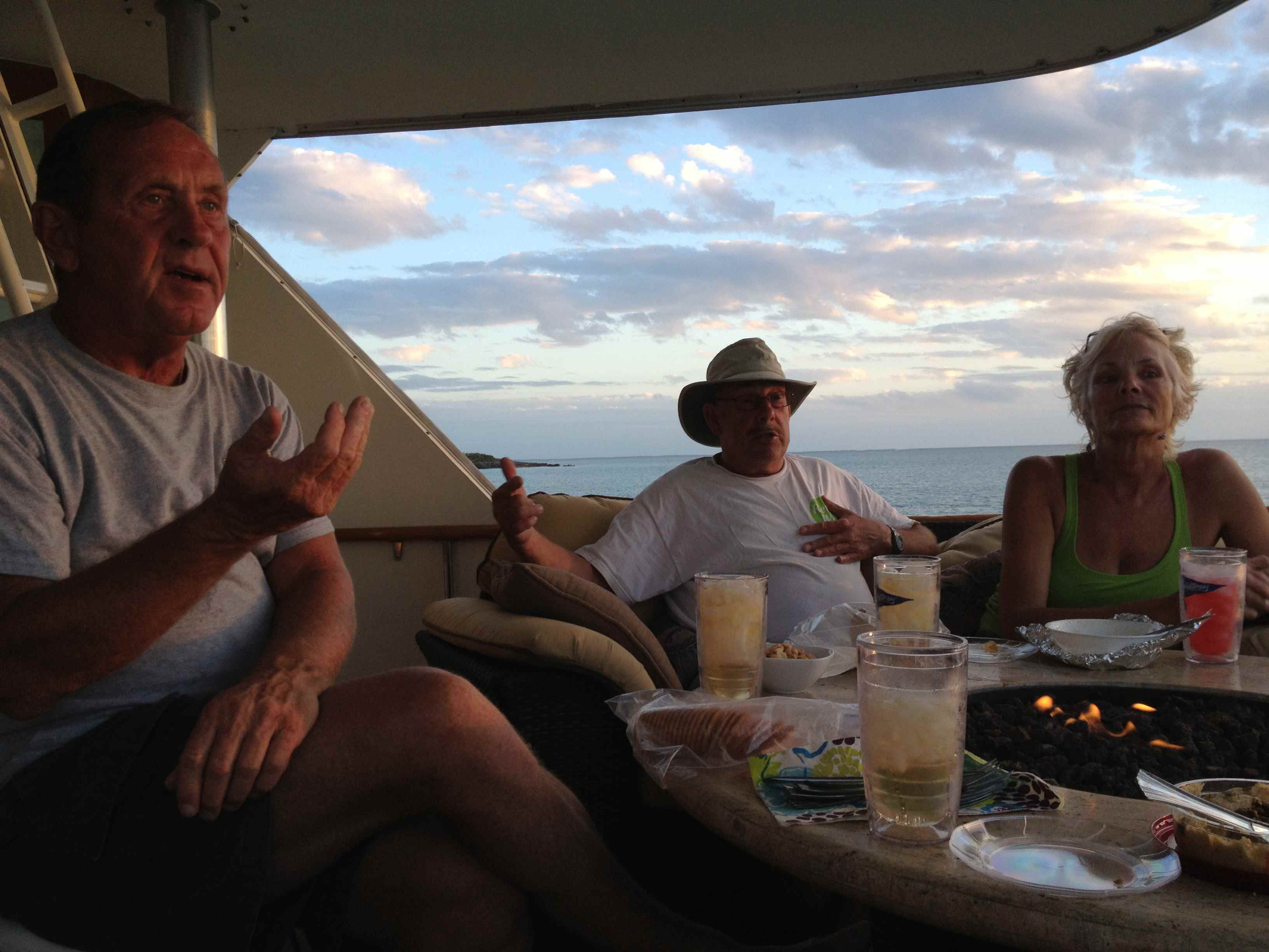
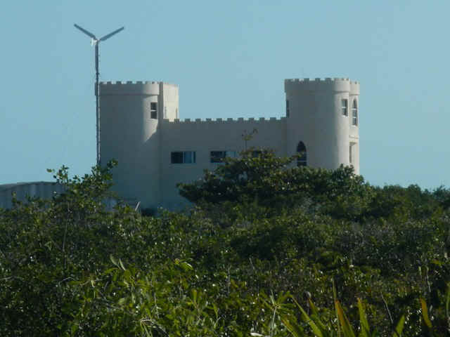
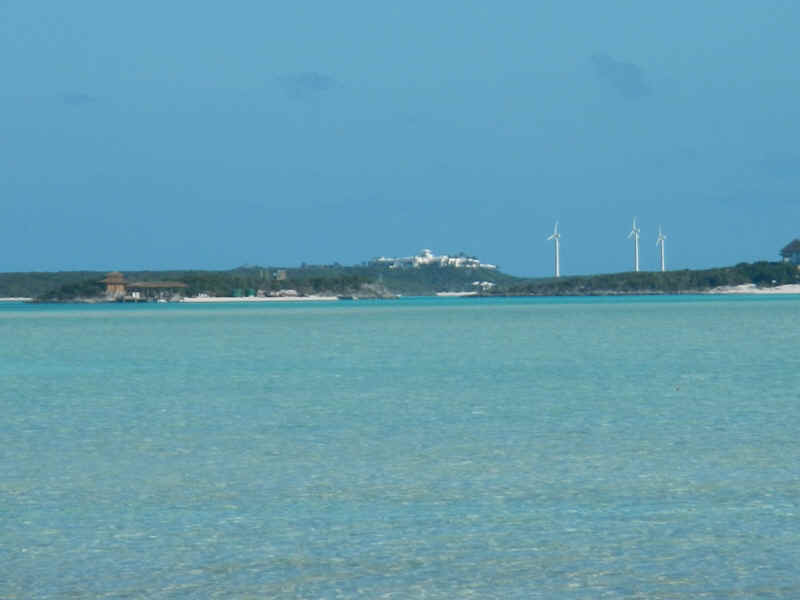 These are the
first wind turbines I have seen in the Bahamas. One can see them from a long way
off, although I took the picture standing on the beach of the bight on the east side of
Pipe Cay. The buildings mark the entrance to the Compass Cay Marina. Contrary
to the sign on the dock, casual guests are not welcome. There is a fee of $10 per
person just to set foot on the marina grounds for the day. Access to the marina is
necessary to hike on the island or walk across to the beach on the Sound side of the
Island.
These are the
first wind turbines I have seen in the Bahamas. One can see them from a long way
off, although I took the picture standing on the beach of the bight on the east side of
Pipe Cay. The buildings mark the entrance to the Compass Cay Marina. Contrary
to the sign on the dock, casual guests are not welcome. There is a fee of $10 per
person just to set foot on the marina grounds for the day. Access to the marina is
necessary to hike on the island or walk across to the beach on the Sound side of the
Island.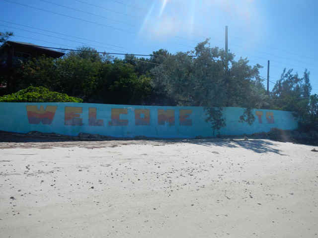
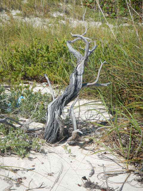
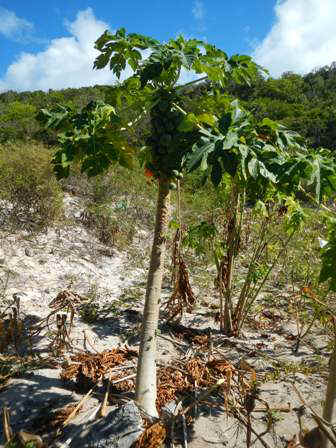
 A lovely
tree at the east end of Honeymoon Beach.
A lovely
tree at the east end of Honeymoon Beach.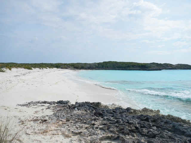 This picutre
and the one below are a pair of my trademark pictures in which I snap one photo and then
turn 180 degrees for the second. Both are on Honeymoon Beach.
This picutre
and the one below are a pair of my trademark pictures in which I snap one photo and then
turn 180 degrees for the second. Both are on Honeymoon Beach.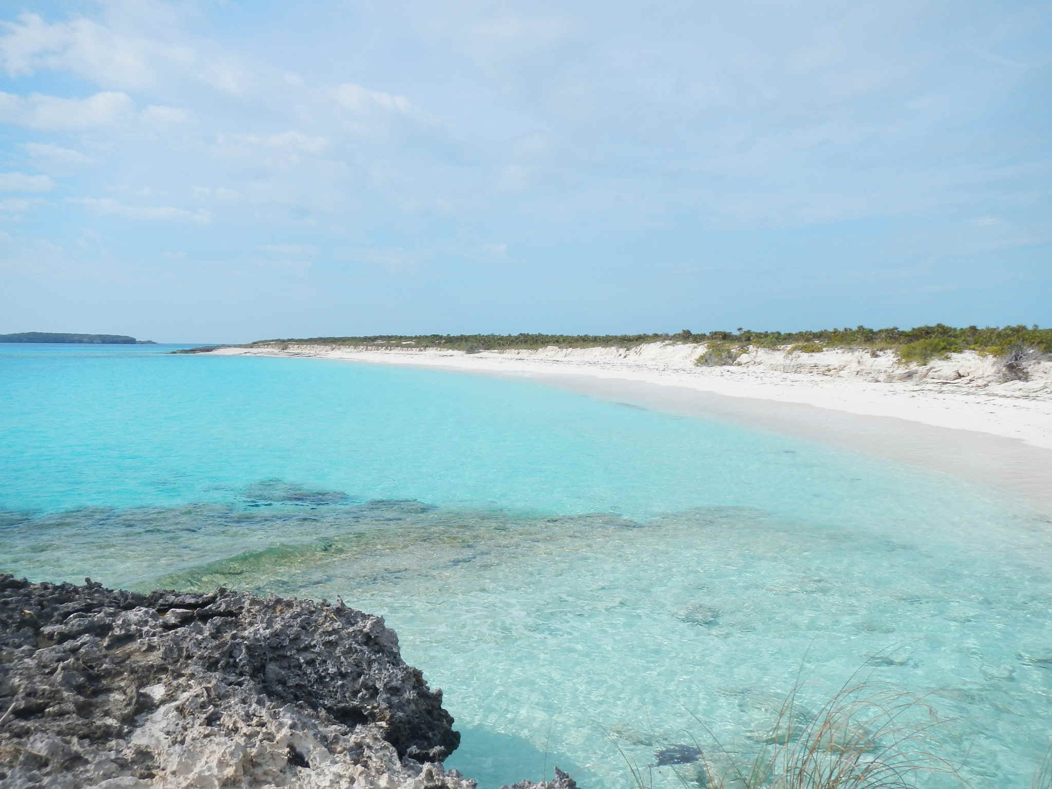
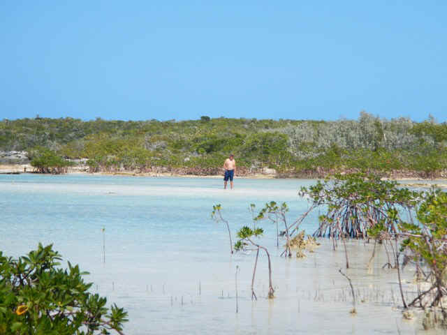 This fellow was
bonefishing in the creek at the north end of Great Guana. It is like flyfishing;
requiring skill and patience.
This fellow was
bonefishing in the creek at the north end of Great Guana. It is like flyfishing;
requiring skill and patience.