| Andante's Sailing Blog April 2013Blog Table of Contents |
|
| Back to March Ahead to May | |
| 04/01/2013 Monday -- Thompson Bay to |
|
 Andante
leaving Thompson Bay, Long Island Andante
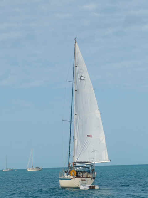
leaving Thompson Bay, Long IslandWonderful sail today. Cloud cover over Long Island and clear skies elsewhere and nice breeze. Up the west side of Long Island was a broad reach. Coming up on and rounding Cape santa Maria the point of sail went to beam reach, close reach and then close hauled. Before reaching Calabash Bay some in the fleet expressed some reservation about the clouds south and east of us. As we sailed on the clouds moved more south and east and the decision was made to carry on to Conception Island. The fleet of Andante, Indian Summer, Meltemi and Spartina was all in by 1600 - 1730 hours. Cocktails on Spartina and discussion of activities for tomorrow. |
|
| 04/02/2013 Tuesday -- Conception Island | |
| The weather forecast this morning is for
really severe weather up in the Abacos by Friday evening with squalls having winds
possibly as high as 60 knots. The forecast down in our neighborhood is less certain
so we are concerned. For now at least the plan is to stay at Conception until
Thursday morning and head for Cat Island. If it looks as though the squalls will
come our way then we will opt for Hawks Nest Marina instead of the road stead at New Bite
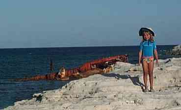
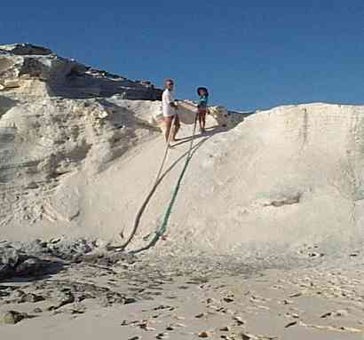
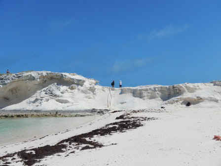
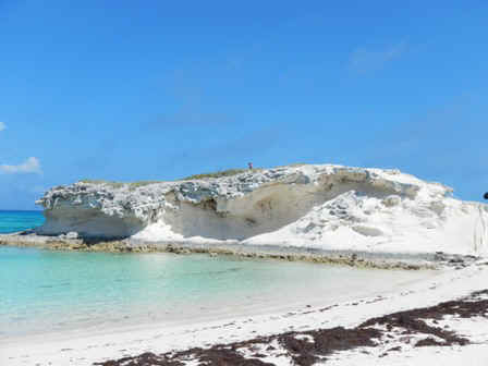
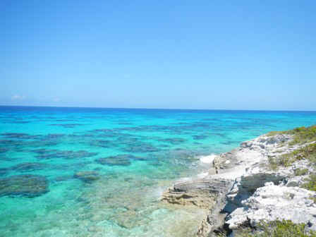
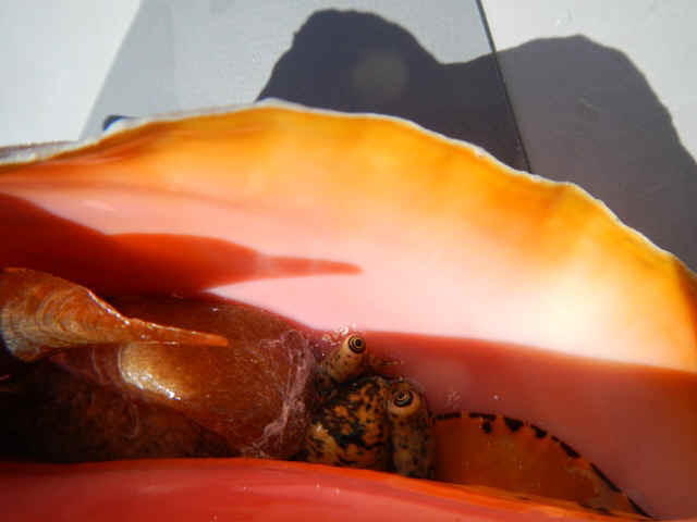
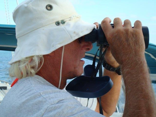
on Cat Island. In the AM we hiked the island, visiting the 'rope hill' then continuing on to the next beach south on the Atlantic side. The two images below are from 12 years ago. The island freighter is now gone, carried away by the storms. As you can see in the pictures below these two, all the sand on the 'rope hill' has been eroded.
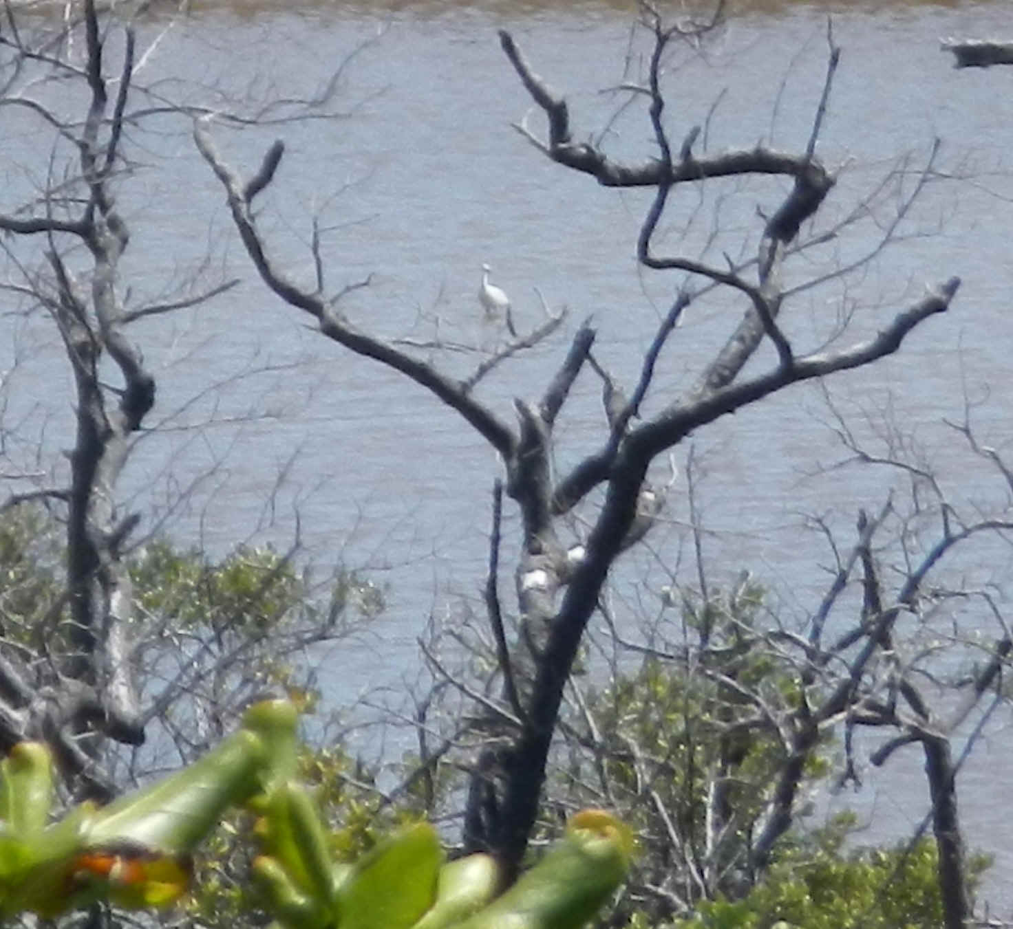
The white bird in this photo was fishing in the mangrove swamp on the interior of the island. Although you can't see it in the picture his beak is quite long. Any identification?
|
|
| 04/03/2013 Conception Island | |
| Spartina has been sailing the Bahamas for the
last four or five winters without ever finding weather to visit Conception. Their
holy grail had become this visit. Therefore the fleet decided to spend an extra day
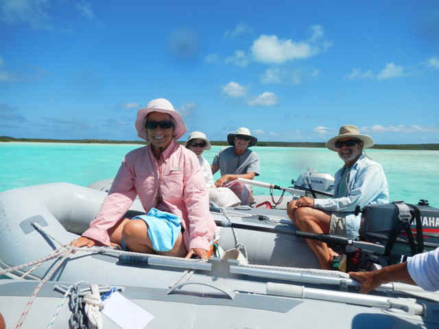
at Concpetion and use the time to take dinghies and explore the mangrove swamps. The
intrepid explorers are shown in the photos below: from left to right; Brian and Teddy Sue,
Susan, then Sarah and Phil in the background and Jeff on the right.
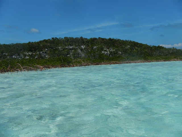
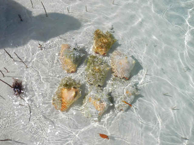
Conception Island is roughly speaking round. Below is a photo that doesn't begin to do justice the scenery. You can see the mangrove roots coming up out of the water then the green behind them. Now imagine that scene stretching for miles with a ridge running around the circumference of the island. Below right are some conch that Brian fished out of the grassy bed in one of the creeks.
Below is an interior view of the conch. We did not keep these conch although we were sorely tempted by the ample evidence that others have helped themselves. The island is supposed to be a part of the Park and is therefore a no-take zone
|
|
| 04/04/2013 Conception Island to New Bight, Cat Island | |
| The rhumb line put us nearly dead downwind
with a quartering roll. Spartina was first out of the anchorage, then Meltemi, then
Andante, then Island Summer. Il Sogno (a 56' Oyster) was last out by a considerable
amount of time. Spartina, Andante and Meltemi chose to head a little more east while
Island Summer and Il Sogno endured the roll and sailed the rhumb line. Turned out
that the rhumb line was the better choice. Island Summer was the first into the anchorage
at New Bight. Il Sogno passed Andante and Spartina while sailing across the bight on a
close reach in 15-17 knots of apparent wind, and Meltemi arrived at the back of the fleet,
but she is the smallest of the boats.
|
|
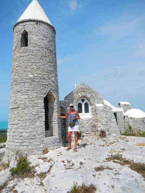
| 04/05/2013 New Bight, Long Island | |
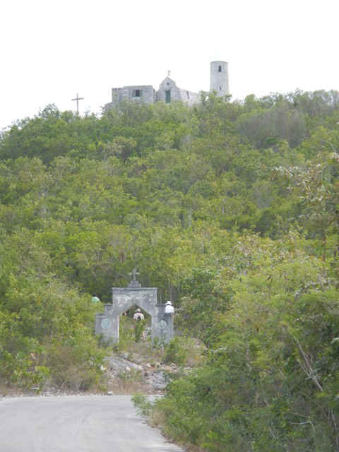
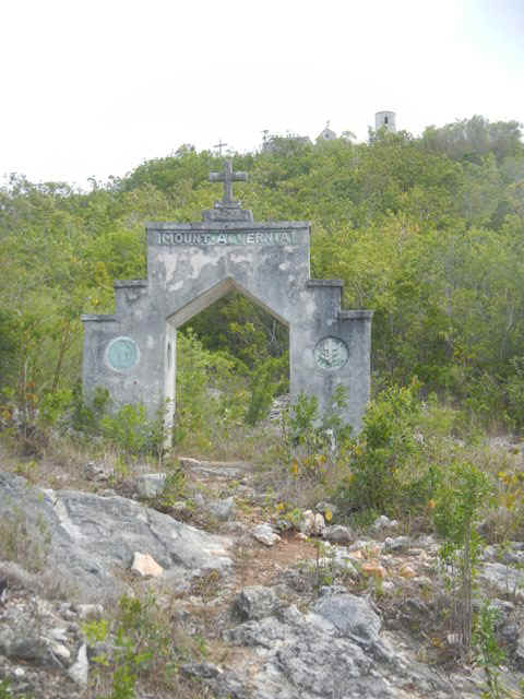
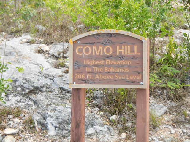
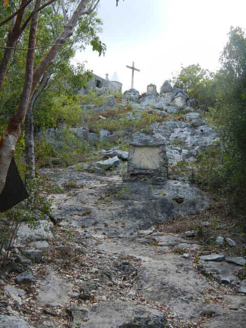
| Braving the wind and waves crashing on the
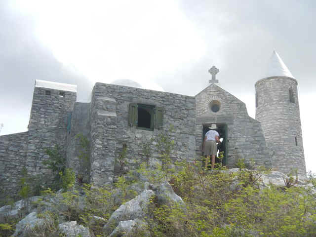
beach we went into New Bight to walk up Mount Alvernia to visit The Hermitage built by
Father Jerome Hawes. He came to the Bahamas as an architect and Anglican priest to
restore and build churches for people of that faith. Along the way he converted to
Catholicism and went on building chrches for his new faith. Recall back in Clarence
Town, Long Island he had built both Anglican and Catholic churches on the two hills
overlooking the town.
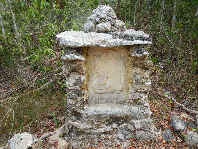
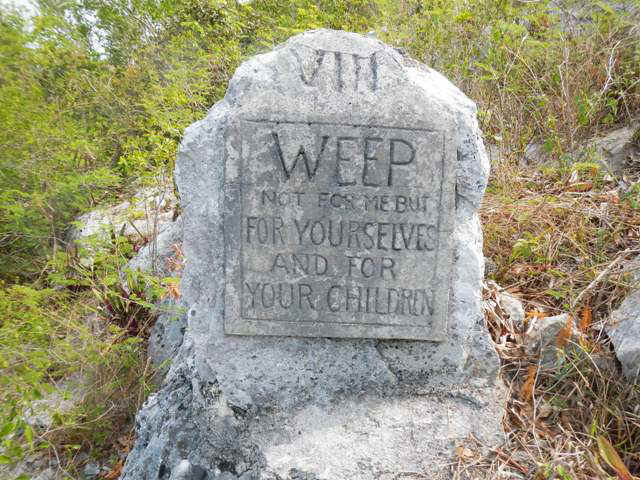
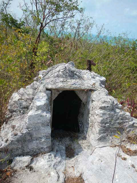
Going up the path on the hill to the Hermitage Father Jerome created the stations of the cross. Some examples follow:
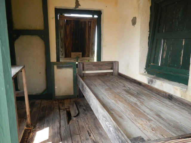
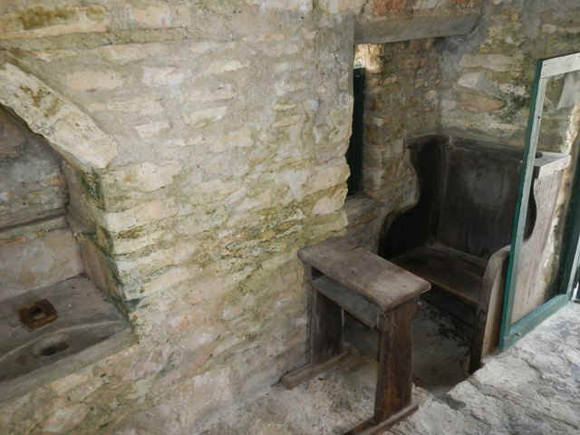
The next two photos give some idea of the scale of the Hermitage. Father Jerome must have been small in stature. On the left Corinne is about to enter the chapel, and she will have to bend to avoid bumping her head. On the right Teddy Sue is standing right next to the bell tower, although a tall woman she would be dwarfed by the Campanilla in Venice, yet here she is nearly 25% as tall as the tower.
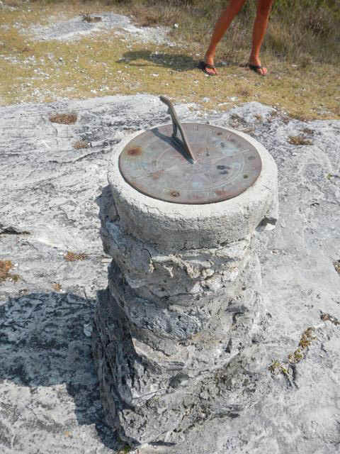
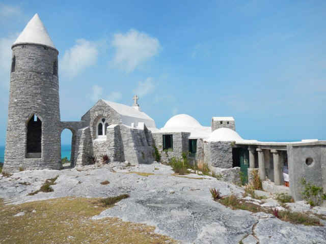
Father Jerome had to be concerned about the time of day and a water source. On the left is his cistern with the remnants of a hand pump on the top right corner of it. His sundial still marks the correct time. The photo below shows the whole complex of buildings that make up the Hermitage. His bedroom follows; again in miniature. I would find it very small to be in there even after living on my sailboat for 10 months.
Below is Fr Jerome's kicthen.
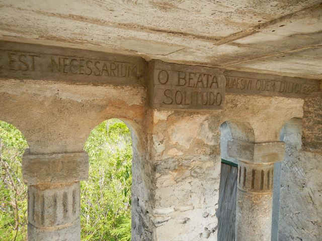
No monastery is complete without a colonnaded walk. Below is the inscription that Fr Jerome included on the interior of his.
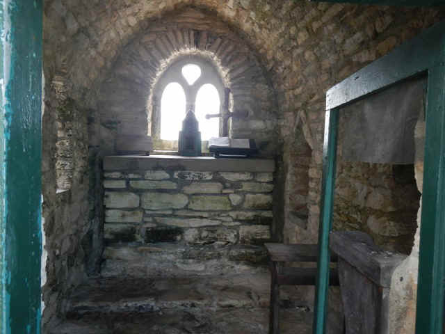
Two views of Fr Jerome's Chapel follow.
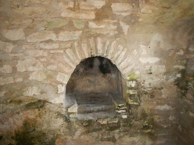
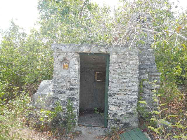
This last picture is of another fireplace and cooking facility. On the left end of the building is what appears to be a pizza oven! Well, OK, maybe it is a bread oven.
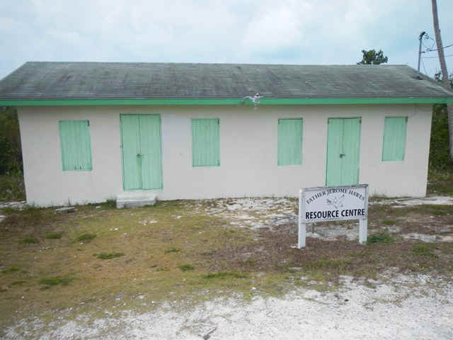
While waiting for Lula to cook our lunch at her place on the beach I wandered up the road to the last church built by Father Jerome. By the way, all his churches are full sized. The first photo is of the Father Jerome resource center. I have no idea what it houses and there was no one around to ask.
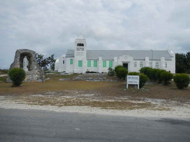
This Catholic Church is typical of the Jerome style. Note the buttresses and the unshuttered windows that are distinctively different from one another.
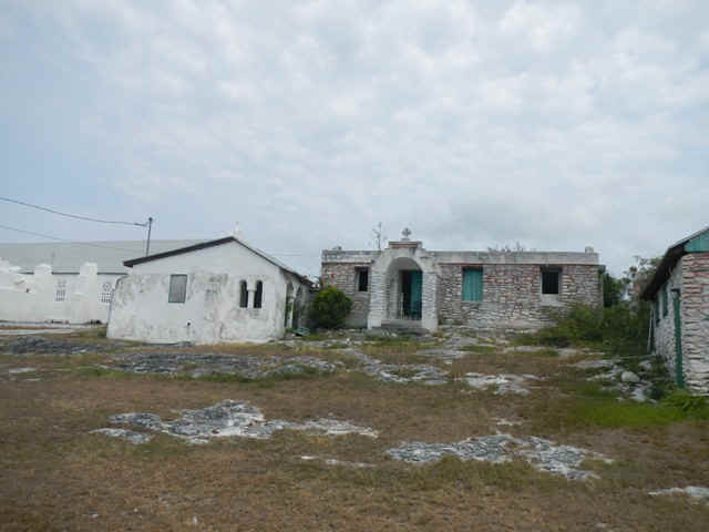
Below is the rectory or convent attached to the church. It is fast becoming a ruin. The white building seems unoccupied, but at least it has a roof, windows and door. The building on the right with the stonework pointing picked out in red has no roof. The front part of the building has a room all across it with three smaller rooms behind it and what appears to have been lavatory and kitchen facilities behind.
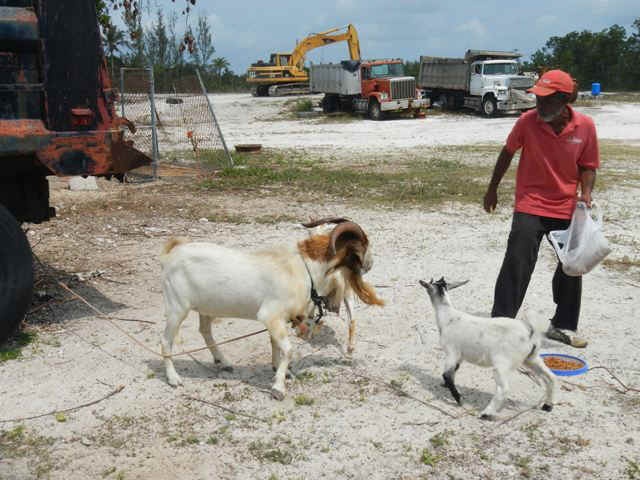
On my way over to Lula's I came across this man feeding his goats. They are in a lot behind the town gas station because of brush fires up in the hills where he normally keeps them. Check out the length of the beard on the billy goat.
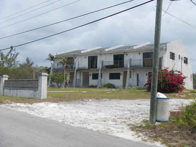
Even in Cat Island they need apartment buildings. There is a matching building behind it that is being restored. I am sure they will get to this one. Again, note the buttresses consistent with the style of Father Jerome.
After lunch we launched the dinghies into the surf rolling in to the beach. Everyone got wet to a greater or lesser degree. The surf was produced by the S wind running 18-20 knots. With the threat of sever weather during the night we all moved our boats and anchored east of the sandbar and coral area that hangs off Bonefish Point. It is alleged that there will be some protection from the W and N winds. |
|
| 04/06/2013 New Bight, Long Island | |
| The ominous weather did not materialize in all its fury last night. Today the wind is largely out of the north and very light. This mandates postponing departure for Little San Salvador. | |
| 04/07/2013 Sunday -- New Bight to Little San Salvador | |
| Beam reach in 10 knots of wind the first half
of the trip and then broad reach as the wind veered. Caught a yellow tail snapper en
route. Of course I forgot to take a picture before whacking off its head and tail
and gutting it to put it in the fridge. Even though I am not a filet master I did
get two dinners out of it. Delicious. Since there were no cruise ships present we could go ashore on Little San Salvador. This island is owned by Holland-America/Carnival Cruise Line. The ships put in for a day, disgorge their passengers for fun on the beach, assorted water activities and even hourseback riding if they wish.
|
|
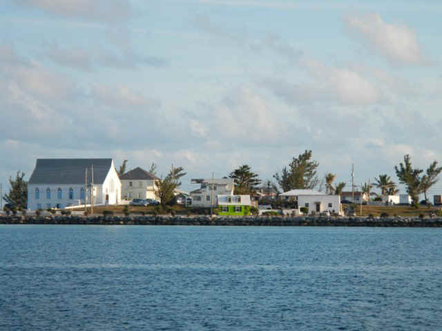
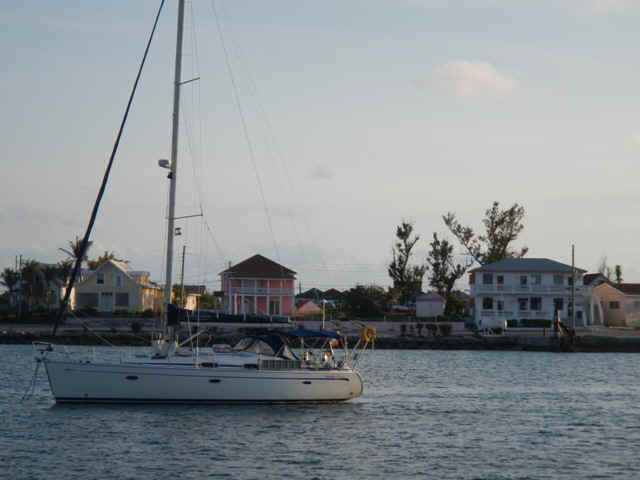
| 04/08/2013 Monday -- Little San Salvador to Governor's Harbor, Eleuthera | |
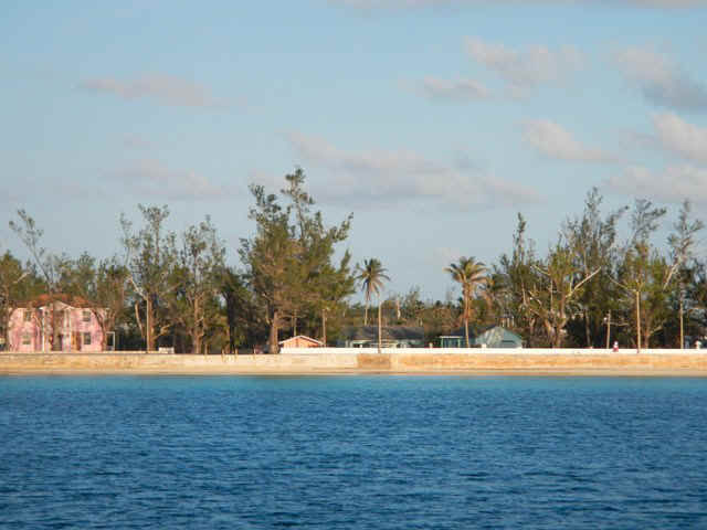
| No time to go ashore in Governor's Harbor, but
I offer these views around the harbor as consolation. Also, you could go to my web
site from 12
years ago and read about our shoreside adventures there.
|
|
| 04/09/2013 Tuesday -- Governor's Harbor to Royal Island | |
| Broad reach for 30 nm to Current Cut. Not deliberately I got there for the falling tide. A lucky thing since the tidal current runs so fast that I could not have gotten through on the full flood tide. On my way through the narrow cut my speed over the bottom hit 10.4 knots. Under power I can go at most about six knots, so going the opposite direction would have been slow and tricky. | |
| 04/10/2013 Wednesday -- Royal Island to the Abacos | |
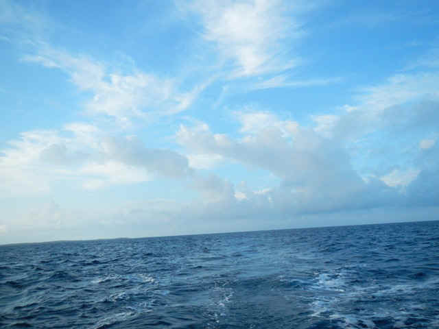 Just liked the cloud formations. They also say something about the weather. You can see the mare's tails top center and the anvils in the middle center. These indicate a high probability of rain. In fact, I did get a brief shower toward the end of the journey up near Abaco. Another great sailing day. From anchor to anchor I covered about 55 miles in 8 hours. The confused wind driven chop on top of the Atlantic Ocean swell mandated hand steering for almost the entire day. The good news was that it was essentially a beam reach; everyone's dream point of sail. |
|
| 04/11/2013 Lynyrd Cay, Abacos | |
| A veg out day working through 200 emails and putting together material for this blog | |
| 04/12/2013 Friday -- Lynyrd Cay to Marsh Harbor | |
| Back to sailing. Mostly today was a broad reach on either tack. When sailing on a broad reach and changing tack one has to be careful to keep the jibe of the boom under control. Dealing with the genoa on top of the main would have been too much; in a jibe you have to pull it through the fore triangle so I just left it rolled up. Wind speed was all over the place as I went along the cays on the east side of the Sea of Abaco and remained strong enough that I didn't miss the genoa. For maybe fifteen minutes my boat speed went down to five knots. The rest of the time I was in the neighborhood of 5.8 - 6.1 knots running before the wind with just the main. Those of you who sail know that this is great stuff. Once i turned west onto a beam reach to head for Marsh Harbor the wind piped up to 20+ knots apparent; glad I had just the main up. | |
| 04/13/2013 Saturday -- Marsh Harbor | |
| This is a chores day: Laundry, groceries,
reserve a slip for an incoming guest at the beginning of the week and again at the end of
the week before starting the departure from the Bahamas for the trip north. Today I met Christine Kling, novelist extra-ordinaire, on Talespinner. She is a Caliber owner and I have read some of her books so this was a pretty neat encounter. |
|
| 04/14/2013 Sunday -- Marsh Harbour | |
| Yesterday evening a passing thunderstorm brought the wind around 180 degrees in the sapce of 15 minutes. The gusts in this were over 20 knots. Over the course of the next hour the wind came around the remaining 180 degrees and by morning had settled back at SE and 10-15 knots. These kinds of shifts bring with them the strong possibility of anchor drags. Using my GPS I now know that my anchor did not move, although I was pretty anxious for a time. | |
| 04/15/2013 Monday -- Marsh Harbour | |
| Madhi's flight out of Philadelphia is delayed so he misses the one connection per day to Marsh Harbour. | |
| 04/16/2013 Tuesday -- Marsh Harbour | |
| Madhi arrives. We go through town to try to find him a bathing suit and visit the grocery store for a few last minute things. Apparently men in the Bahamas just wear there shorts inthe water. | |
| 04/17/2013 Wednesday -- Marsh Harbour to Hope Town | |
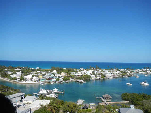 These two pix are views of
hope Town Harbour from the top of the lighthouse. These two pix are views of
hope Town Harbour from the top of the lighthouse.
|
|
| 04/18/2013 Thursday -- Hope Town to Sandy Cay and on to Lynyard Cay | |
 We went for a walk on Lynyard Cay. This is the beach on the Atlantic side. We went for a walk on Lynyard Cay. This is the beach on the Atlantic side. |
|
| 04/19/2013 Friday --Lynyard Cay to Tilloo Pond Anchorage | |
| The intent was to go down to Little Harbor to
visit Pete's Pub and the sculpture gallery. Because of the timing of high tide we
checked out the anchorage behind Tom Curry Point with the thought that we could dinghy
around to Little Harbor or beach the dinghy and then walk around. With the SSE wind the
roll in the anchorage quickly changed the plan. We motored up to the anchorage
behind Simpson Point, but there was still significant roll here. Motor sailed on up
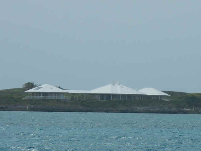
to Tilloo Pond where there was less roll when tucked up close to the Cay. A couple of houses on the cays. The first, with the castle keep, was built by a successful orthopaedic surgeon and inventor.
This second one looks more like a resort than a private home.
|
|
| 04/20/2013 Saturday Tilloo Pond to Marsh Harbor | |
| Down wind sail up through Lubbers Quarter to Hope Town then a beam reach over to Marsh Harbour in 20+ knots of wind the whole way. Movie night on Indian Summer. We watched 'Captain Ron.' | |
| 04/21/2013 Sunday -- Marsh Harbour | |
| Today Brian and Teddy Sue came for breakfast, we rigged their spinnaker so they could see how it goes together. It might get some use on the trip home in light airs. Madhi got his delayed flight out of Marsh Harbour; good old United airlines. It will be interesting to see if he gets home tonight. Late word was that he made the connection through West Palm, just barely. | |
| 04/22/2013 Monday -- Marsh Harbour | |
| Today the question was whether Wolfgang would
make his connection in West Palm for Marsh Harbour. Apparently the flight delays are not
weather but the tightening FAA budget that is a result of sequestration. On TV and
in news releases I have heard the pundits remark that the sums of money involved in the
budget sequestration impasse are just a small portion of the federal budget. What
those dopes don't understand is that in the short run there are fixed costs and variable
costs. Fixed costs are those that have to be paid no matter what, like heat and
light for the building and debt service for its construction. A variable cost covers
things like the paper clips and writing tablets. The sequestration money is coming
out of the variable costs column and is really a significant sum of money. Anyway, Wolfgang made it, just barely. The reunion with Teddy SUe and Brian was like old-home week. |
|
| 04/23/2013 Tuesday -- Marsh Harbour | |
| Boat chores -- Change oil and oil filter, change primary fuel filter, add water to tanks, check transmission fluid, check water level in batteries, check propeller shaft coupling, adjust stuffing box drip rate on propeller shaft, and tighten alternator belt. Lastly there was a trip to Maxwell's supermarket for the last major shopping expedition until the being back in the US. When you put it this way it doesn't seem like a strenuous day. But, the oil extraction depends on using a vacuum system that sucks the oil out through the dip stick hole. Checking and adding water to the batteries means climbing down into the cockpit locker and laying like a contortionist so that I can see into each cell of the six batteries on board. And so on. It is not at all like getting the vacuum cleaner out of the hall closet and running it down the hall carpet. | |
| 04/24/2013 Wednesday -- Marsh Harbour to Man-o-War Cay | |
| An easy windward sail, ~7 miles as the crow
flies.
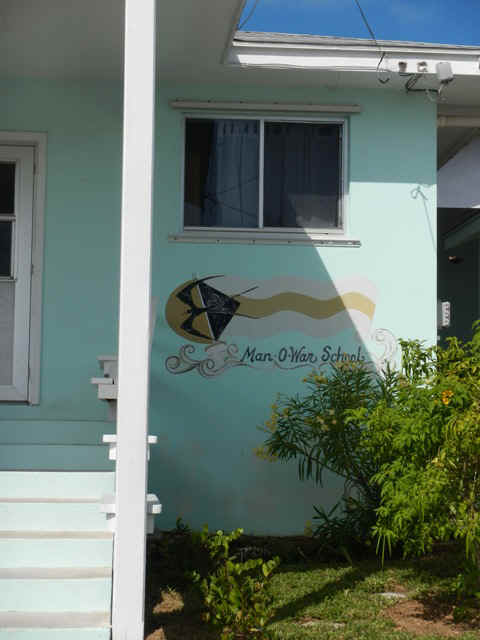
The pair of pictures below are of the public elementary school. The funny composition was so that I didn't have to include the ugly SUV parked in front of the building. An SUV on an island that is only a couple of miles long and a few hundred yards wide? Go figure.
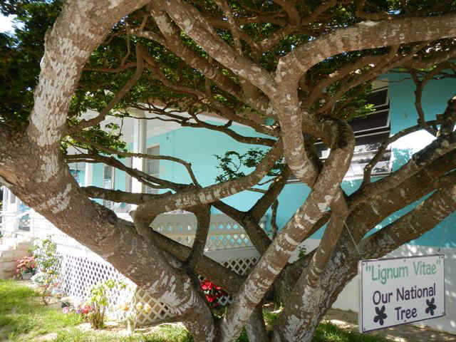
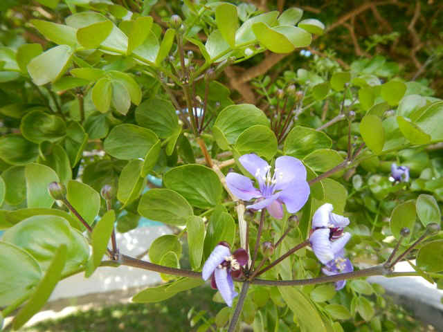
The national tree of the Bahamas is the Lignum Vitae and it has very pretty, delicate, purple flowers, but no scent.
|
|
| 04/25/2013 Man-o-War to Green Turtle Cay | |
| Another lovely day for a sail. The trip was about
21 miles. This stop is part of our staging for the 360 mile trip from Great Sale to South
Carolina, or if the we and the weather hold, on to North Carolina. 10 knots of NE wind and
sunshine. Today required us to go through the infamous Whale Cay Cut. When the
wind and sea state are just right then there is said to be a Rage (breaking waves) in the
cut and the prudent boater stays away. No Rage this day. The weather was quite
settled and benign. After arrival at Green Turtle we went into New Plymouth for a rum punch at the Blue Bee bar and restaurant. On the souithbound trip I stopped here and the proprietor told us she would have the restaurant up and running by spring after the hurricane damage. On this visit she says that within just another month or so. We all had dinner at Pineapples on the beach overlooking the town and harbor of New Plymouth. Indian Summer and Young at Heart underway. We first met Brenda and Glenn on Young at Heart while in Thompson Bay, LI. They are indeed young at heart, doing the cruising thing in their seventies. They'll be going on to Great Sale with us, but then go on to West End, Grand Bahama and then on to Fort Pierce.
The short weather window has caused us to reconsider how far north we'll get on our offshore trip. It looks like we'll have wind and weather to get to Fernandina Beach, FL. |
|
| 04/26/2013 Friday -- Green Turtle to Great Sale Cay | |
| A long trip of 59 miles, but the wind was
pretty good. We started out on a close reach and made good time. Upon turning
the corner at Crab Cay to start going west we went to a beam reach then to just aft of the
beam. As the day went on the wind got lighter. As the wind velocity dropped we
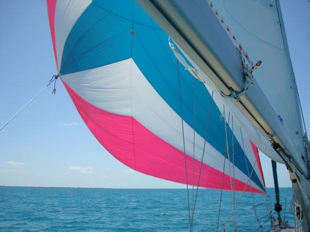
put up the spinnaker with the main for a few hours in order to keep the boat moving.
When the wind velocity increased again, went more NE and became gusty we had to
bring in the spinnaker. Upon the last turn to port to go down the west side of Great
Sale the wind was on the stern and we sailed wing and wing for about five miles, then
rounded to beam and close reach right into the anchorage. This is a great anchorage
at Great Sale with protection from every direction but SW: note to self: remember this
spot.
|
|
| 04/27/2013 Saturday through 04/29/2013 Monday -- Great Sale to Fernandina Beach, FL | |
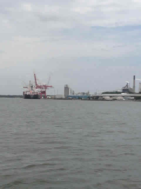
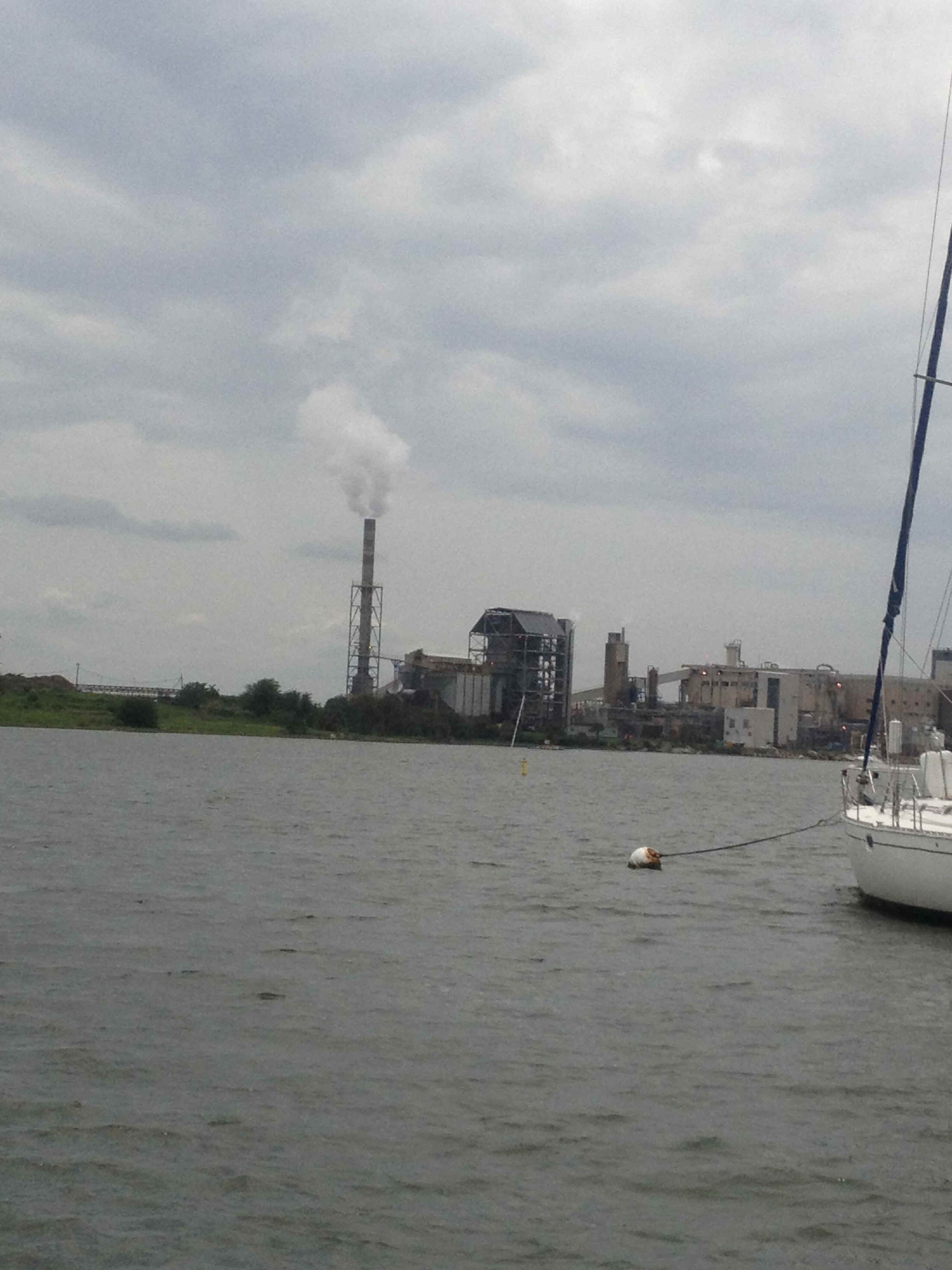
| Fernandina Beach is a cute little burg, but
with a seamy underbelly: two paper pulp plants bracket the city's watrefront.
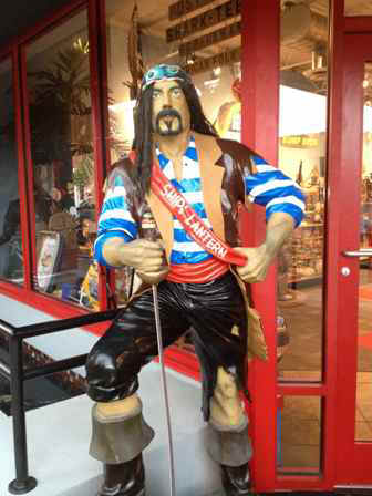
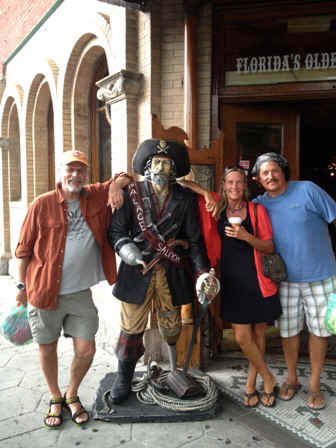
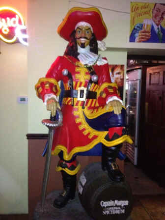
Like any number of waterfront towns, Fernandina has laid claim to a piratical heritage. I think this was spawned by the 'Pirates of the Caribbean' movies starring Johnny Depp.
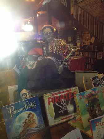
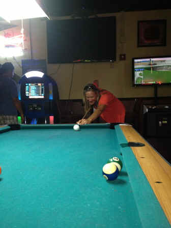
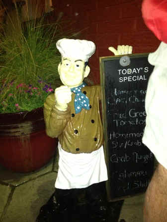
On making landfall we strolled the downtown. When the rain started to fall and wwe retreated to Florida's oldest bar for music and pool. Brian turned out to be the hustler in the crowd, with the other three of us far behind. The last photo is another bit of local statuary, although he is not a pirate; perhaps a pirate of cuisine.
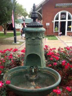
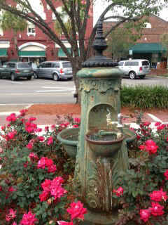
Lending new meaning to multi-tasking: On one side of this fountain you can water your horse and on the other side you can get refreshment for yourself.
At breakfast at T-Ray's greasy spoon, located in a building that was once an auto service station, lending new meaning to the concept of a greasy spoon. Maybe not so new. Back in grad school there was a renowned mexican restaurant on the outskirts of Champaign-Urbana that was located in a former gas station. The motto in both restaurants was "Eat here and get gas!"
A little local color from the car buff commuinity in Fernandina Beach.
|
|
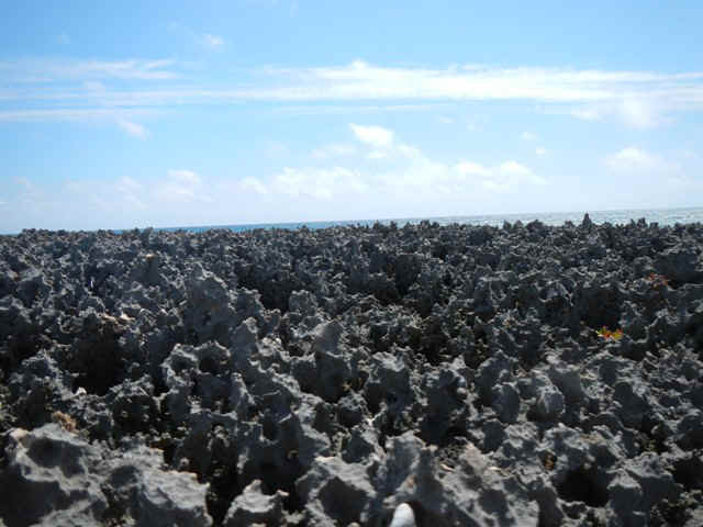
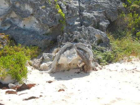 This combination of old rope and rock struck me as
worth taking a picture. To me it looks like a snapping turtle coming out of her lair. In
the pair below I am looking out north and south from one of the high spots overlooking the
Atlantic. We snorkeled some of the coral heads below the 'rope hill' Almost all of them
were dead and covered with algae, but the fish remain. We also snorkeled at the end
of the day at the north end of the anchorage where we agian found most of the coral dead
and covered with algae, but again plenty of fish. When we came back to the boats the
folks on a catamaran told us that they has seen a hammerhead cruising the anchorage; glad
he didn't see us.
This combination of old rope and rock struck me as
worth taking a picture. To me it looks like a snapping turtle coming out of her lair. In
the pair below I am looking out north and south from one of the high spots overlooking the
Atlantic. We snorkeled some of the coral heads below the 'rope hill' Almost all of them
were dead and covered with algae, but the fish remain. We also snorkeled at the end
of the day at the north end of the anchorage where we agian found most of the coral dead
and covered with algae, but again plenty of fish. When we came back to the boats the
folks on a catamaran told us that they has seen a hammerhead cruising the anchorage; glad
he didn't see us.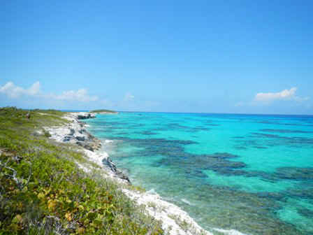
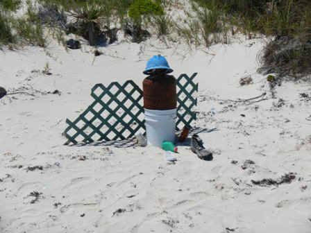 A little beach sculpture.
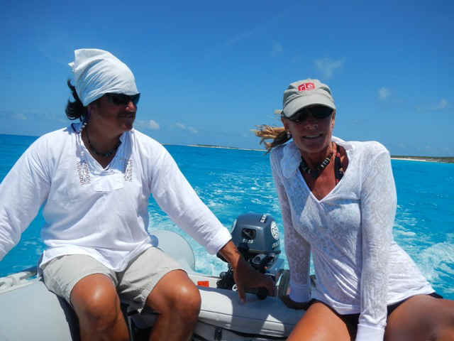
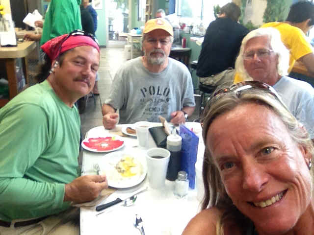
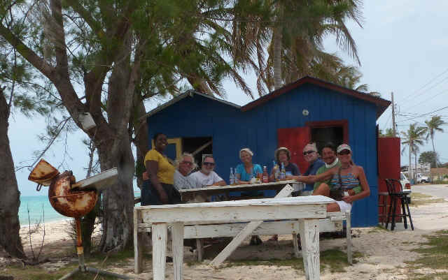 It turned out that our lunch was also a birthday party for Phil, celebrating
being one year short of two thirds of a century old. Ooops, guess I shouldn't have
let out that sensitive bit of information. From left to right: Lula, me, Jeff and Susan
Mahall (Meltemi), Sarah and Phil Sayre (Spartina), Brian and Teddy Sue White (Indian
Summer).
It turned out that our lunch was also a birthday party for Phil, celebrating
being one year short of two thirds of a century old. Ooops, guess I shouldn't have
let out that sensitive bit of information. From left to right: Lula, me, Jeff and Susan
Mahall (Meltemi), Sarah and Phil Sayre (Spartina), Brian and Teddy Sue White (Indian
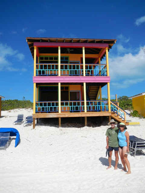
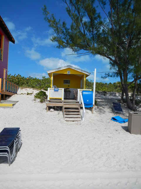
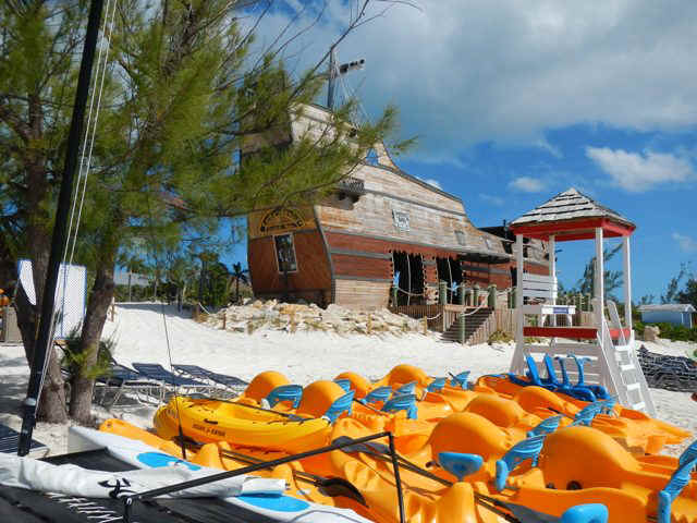
Summer).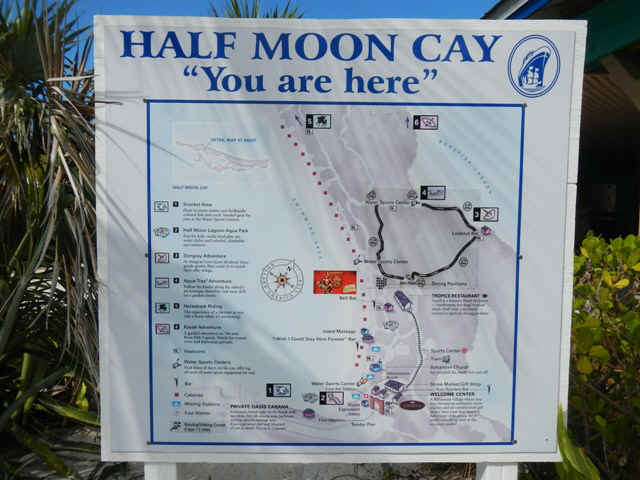 A map of the enterprise. The offerings include snorkeling, horseback
riding, laying on the beach, food, etc. The next three photos provide a glimpse of the
waterfront. I think the cabanas are meant to be remiscent of the cottages
overlooking the harbor at Staniel Cay, not that many of the cruise passengers would know
that. There were signs hanging on the cabanas offering them for sale!? Does that
make sense to you?
A map of the enterprise. The offerings include snorkeling, horseback
riding, laying on the beach, food, etc. The next three photos provide a glimpse of the
waterfront. I think the cabanas are meant to be remiscent of the cottages
overlooking the harbor at Staniel Cay, not that many of the cruise passengers would know
that. There were signs hanging on the cabanas offering them for sale!? Does that
make sense to you?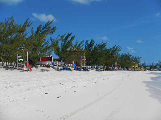
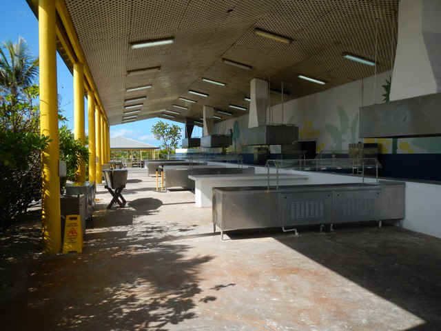 At meal time the thousands of cruise guests on shore are herded
through the lines at this outdoor buffet/kitchen.
At meal time the thousands of cruise guests on shore are herded
through the lines at this outdoor buffet/kitchen.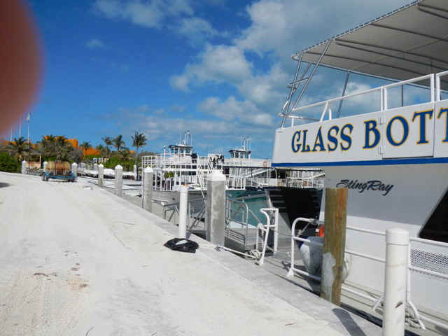 The glass bottom boat and the two behind it are used to ferry the
cruise ship passengers in to Little San Salvador.
The glass bottom boat and the two behind it are used to ferry the
cruise ship passengers in to Little San Salvador.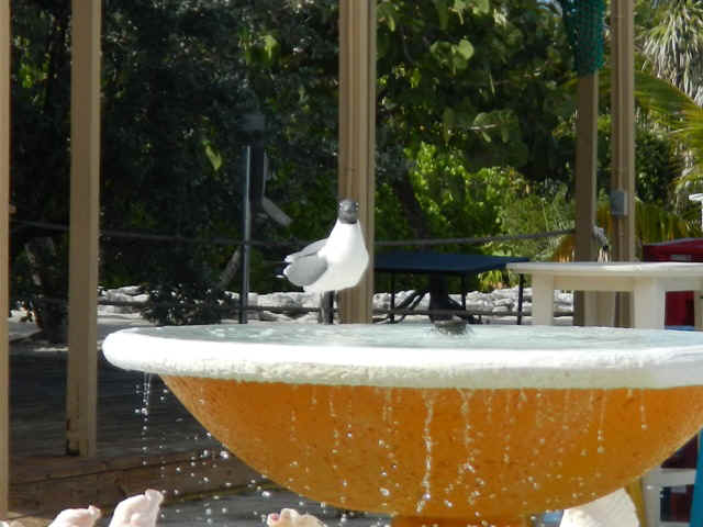 The Bahamian brand of sea gulls have discovered the fountain
at the mini-resort.
The Bahamian brand of sea gulls have discovered the fountain
at the mini-resort. You can renew your
wedding vows in the little chapel on the beach, or make Little San Salvador and your
cruise a destination wedding.
You can renew your
wedding vows in the little chapel on the beach, or make Little San Salvador and your
cruise a destination wedding.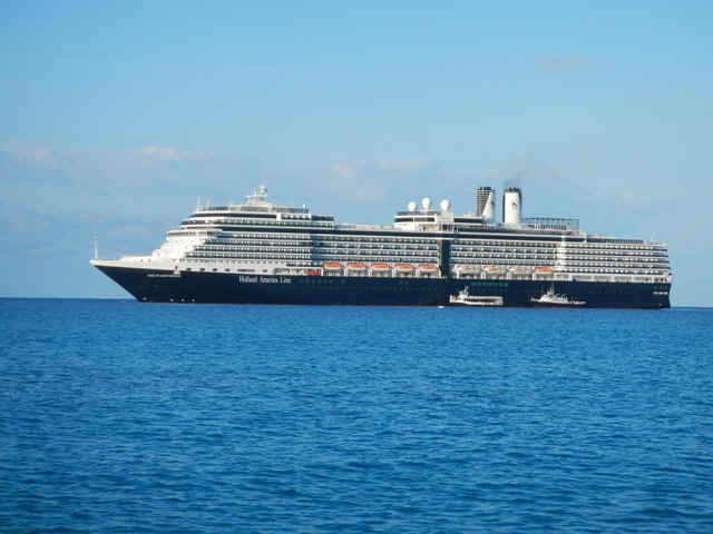 Two of the tenders
bringing passengers ashore for the day. The tenders are probably more than 60 feet long.
Two of the tenders
bringing passengers ashore for the day. The tenders are probably more than 60 feet long.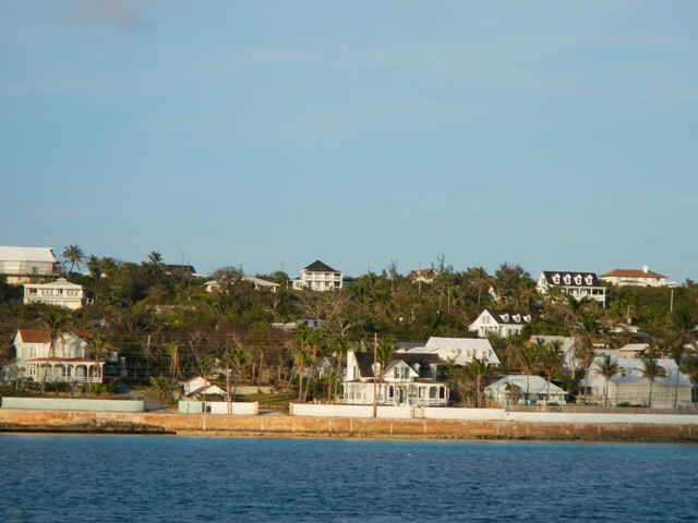
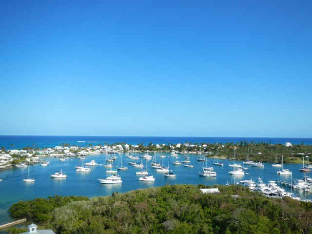
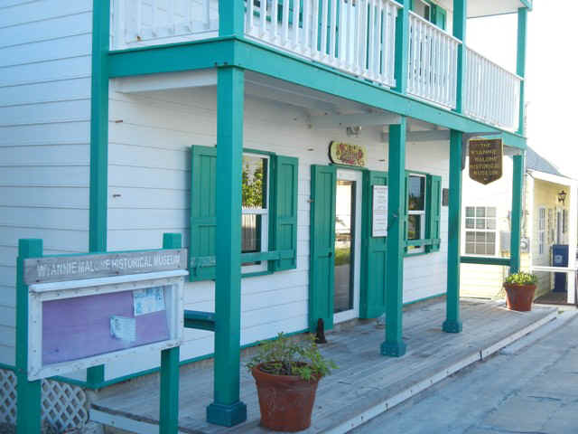 The Hope Town Museum;
closed when we were there.
The Hope Town Museum;
closed when we were there.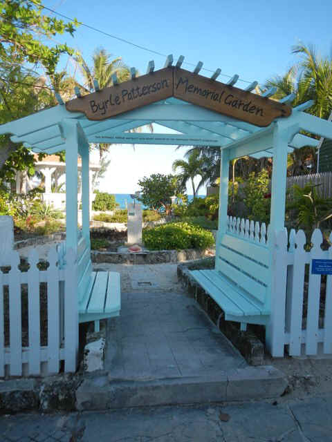 Although this ia a public garden it was built buy and is
maintained by Byrle Patterson. She and her husband live across the street in a
house/cottage named 'The Steps.' We got the lowdown on the garden from him.
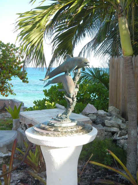
The next two pix are sculptures in the garden.
Although this ia a public garden it was built buy and is
maintained by Byrle Patterson. She and her husband live across the street in a
house/cottage named 'The Steps.' We got the lowdown on the garden from him.
The next two pix are sculptures in the garden.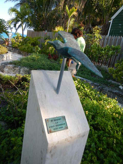
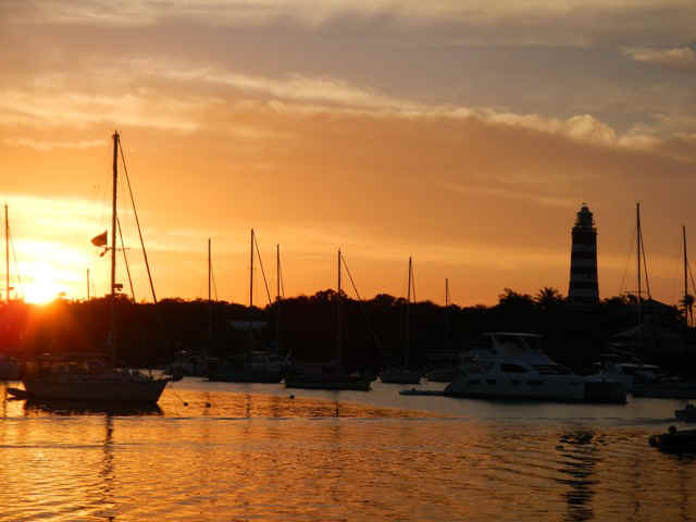
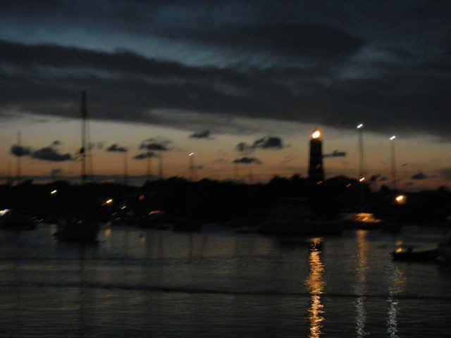
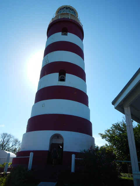 The Hope Town light house is an icon on the sea of Abaco.
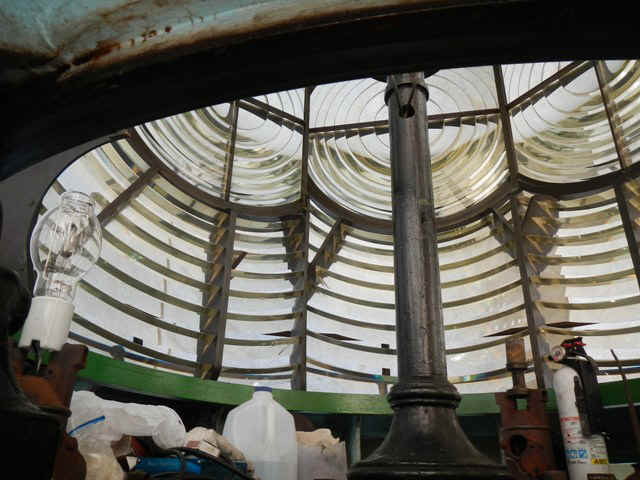
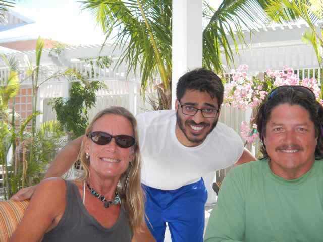 At lunch at
the Hope Town Marina and Inn. Teddy Sue, Madhi and Brian.
At lunch at
the Hope Town Marina and Inn. Teddy Sue, Madhi and Brian. 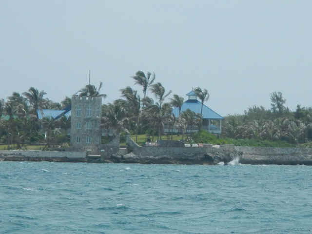
 Indian Summer underway to Man-o-War Cay,
and below we have Wolfgang at the helm with Indian Summer in the background.
Indian Summer underway to Man-o-War Cay,
and below we have Wolfgang at the helm with Indian Summer in the background.
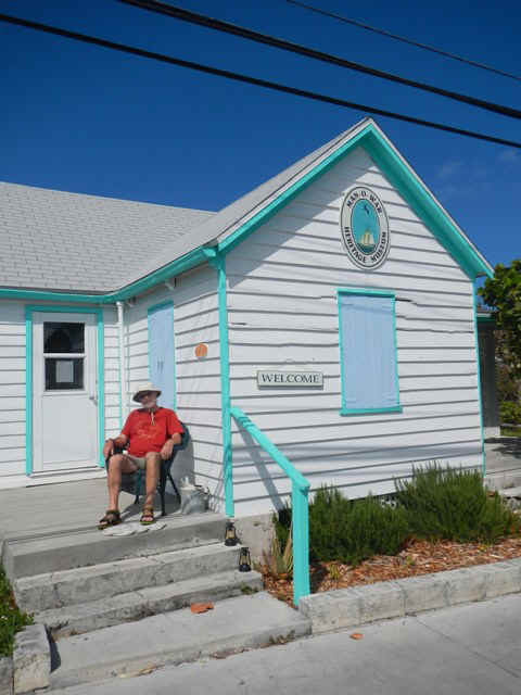 Man-o-War has its own museum, open four hours per week.
Unfortunately we would not be on shore for any of those four hours.
Man-o-War has its own museum, open four hours per week.
Unfortunately we would not be on shore for any of those four hours.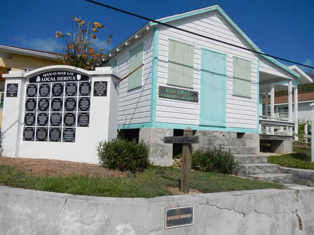 The Man-o-War public library. It is about the same
size as the public library that serves all of Long Island with a population several times
larger.
The Man-o-War public library. It is about the same
size as the public library that serves all of Long Island with a population several times
larger.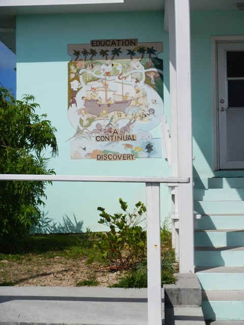
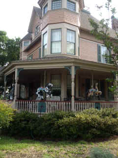 Notice the carousel
horses used as decor on the porch of this very pretty Victorian style house.
Notice the carousel
horses used as decor on the porch of this very pretty Victorian style house.