| Andante's Sailing Blog March 2013 Blog Table of Contents |
|
| Back toFebruary 2013
Ahead to April 2013
|
|
| March 1, 2013 Friday, George Town | |
| First trip across English Harbor. Gas
for the dinghy engine, pick up mail and visit to the Immigration Office. The dock behind Exuma Markets is as crowded as ever. All day long there was a line to get the free RO water on that little dock. Since there were never fewer than four people in line I suppose that the wait was about an hour. No one was getting more than about 25 gallons. Even at $0.40 it would cost them $10. What does this say about the opportunity cost of their time? The gasoline was not a problem, although it was $6.20 per gallon. The immigration officer told me to come back next week when I am closer to my expiration date. I had expected this, but I don't understand why it should make a difference, this week or next. One just doesn't argue with civil sewrvants from whom you want something. There is some construction around, but generally speaking the town is as rundown as it was 12 years ago. The little elementary school in town seems to have been closed. Maybe they opened a new one a little more removed from 'downtown.' Exuma Market is much better stocked with fresh food than I rememeber from 12 years ago. This is a big improvement. Had lunch with a group of other single handed sailors; all male, ten of them. There are probably a goodly number more who didn't attend. I know there are two solo women, but they didn't attend. Patty Haase on Lutra is over at Long Island and there was another solo woman that I think headed down here the day before I left Black Point. The point being that if you want to meet eligible women don't go sailing.
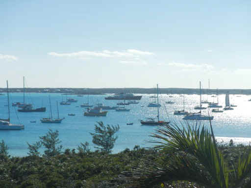
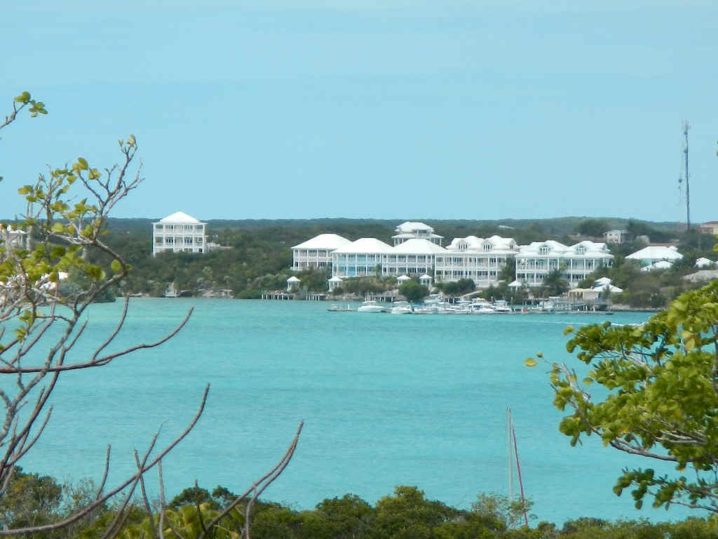
Below is a view of the anchorage at Sand Dollar Beach, just to give some idea of the number of cruisers in Elizabeth Harbor. This is just one of the five popular anchorages. Later in the week I heard that the boat count had increased to 311. Andante would be a speck at the right edge of the picture.
|
|
| 03/02/2013 Saturday -- George Town | |
| The schedule for the Cruisers' Regatta was
shifted off a few days and stretched out through Wednesday of the coming week. In the AM I put out a second anchor. Later I watched the start of the 'round Stocking Island Race from the boat. After the start I took the dinghy up to the hole behind Chat n Chill so I could watch the race from the beach on the Sound side of Stocking Island. After the racing boats had passed by I went and had lunch at Chat n Chill. There was too much raw garlic in the cole slaw; I ended up tasting it well into the evening. When I got back to the boat in mid afternoon a catamaran 'Outlandish' squeezed in to windward of me. On my way back to the boat I saw how close he had anchored to other boats off Volleyball Beach. I guess the others chased him away. His position and proximity made me very nervous. But, as the owner of a new big catamaran iassumed he was well insured. As predicted the wind came up to the NW - NNW and rose to 30 knots. The wind speed started to drop around midnite, but was well into the 20+ range through most of the night. The boaters here in Elizabeth Harbor don't seem to pay any regard to the implicit in-anchorage no wake rule when they race around in their over-powered dinghies. Really annoying. |
|
| 03/03/2013 Sunday -- George Town | |
| Early this morning Outlandish pulled anchor
and moved elsewhere. When the wind is strong out of the NW toward the end of the
week will they be back to try and squeeze in to windward of me again? In the big wind yesterday evening and last night I rode to the Dandorth anchor, on a mix of chain and rope rhode. This morning I spent a long time working on getting the Danforth back up in the boat. In the process I found that my primary anchor had dragged somewhat, but no big deal. At least I thought so. In diving on the anchors to see where they were I found that the primary rhode was not out straight. Even after getting the Danforth up (watch that hernia!) and the boat startinmg to swing to the primary anchor that rhode was not out strainght. But when in the water it looked securely in the sand and grass. Even though I have painted the primary chain rhode avery 25-30 feet I wasn't exactly sure how much I had out. Anyway, it took me a couple of hours to get the Danforth in and watch to see how I was riding to the primary. After the anchor job I did an inventory of all the foodstores on the boat. I had meant to do this way back when I first left so that I would have all the canned food of a given type in the same place. That job is now complete. It was chilly enough today, don't forget the wind has been from the north for three days, that I had soup for lunch and a cup of hot tea in the afternoon. In the evening, just as I was starting to cook dinner the wind, as predicted, came up from the NW again. Naturally the anchor chose this time to drag, or was it that I just had out far more scope then I thought. In any event I hauled anchor and reset it in a location that gave me more room amongst all the boats around me.
|
|
| 03/04/2013 Monday -- George Town | |
| Last night the wind was blowing from the NW
14-17 knots with gust into the low 20's. I am glad I reset the anchor. Since,
roughly speaking, Elizabeth Harbor is open from the NW to the SE it can get pretty rolly
even though I am tucked behind a little point. Given the drag yesterday at dinner
time and the stronger winds I woke up three or four times during the night to make sure
that the boat had not moved relative to the boats around me.
What is it with the wind this season? From about early to mid-January until I left Black Point to go to Adderly Cut the wind has been blowing consistently a little more strongly and a little more south of east then normal, with only a few short interludes when it swung around on passing fronts to include a westerly or northerly component. Now that I am in George Town and starting to think about the trip home the pattern has switched for at least the time being. Starting on February 28 the wind started to come around to include a strong northerly component through about March 11, with only a short break on March 6. It is said that gentlemen donot sail to windward, but I seem to have been doing a lot of sailing to windward; great sailing, but still.... A rogues gallery of the folks I have been hanging with in Black Point and George Town:
|
|
| 03/05/2013 Tuesday -- George Town | |
| The most mundane tasks of life ashore can be
major undertakings in the life of the cruising sailor. Today would be a case in
point. After listening to Chris Parker's weather forecast I transferred 5 gallons of
water from a jerry can to the water tank then put 10 gallons of diesel from jerry cans to
the fuel tank. Once the transfers were made I took the empty jugs the 2 miles by dinghy to
George Town. As early as I got to the RO water faucet behind Exuma Market (about
8:30 AM) I still was third in line for water. After water I went to fill the diesel
jugs. No waiting there, but 10 gallons of diesel is about $60, cash. But keep in
mind I have used only ten galons of fuel since January 23. On the way back to the
boat, about halfway across Elizabeth Harbor my outboard motor stopped. Oooops, out
of gas. No problem, I learned my lesson in Charleston and now always keep a jerry can with
me. Refill the tank and start the engine. Sounds simple right? Only the sucker
wouldn't start. A good samaritan going by took pity and towed me back to Andante.
After I got the jugs up on deck I then spent more than an hour and a half trying to
get the outboard to start and run. Again, I already knew that when the motor runs
out of gas it is very hard to start, but this time it was especially so. I pulled
the starter cord so often that I blistered the sides of three fingers. Eventually,
after a change of spark plug I did get it to start. Now that the outboard was running I went back across Elizabeth Harbor for lunch and internet at Eddie's Edgewater and groceries at Exuma Market. The curried chicken at Eddie's was good; the best part being that I didn't have to cook it or clean up afterwards. I spent $200+ on groceries. This was a major restocking, the first major restock since Charleston. At Eddie's I had with me only my iPhone so I could check email. Others at Eddie's had their PCs with them. Doing email with my iPhone went very quickly while those with Windows based PCs were cursing the slow crawl with their email server -- PC combination. Again, my hat is off to the Apple software engineers for making their products so efficient. And again, as I have done since the beginning, I disparage the MIcrsoft engineers for their inability to write a fast and efficient operating system for which application writers can create fast and efficient tools. Out here in the netherland of the internet fast and efficient is really, really important. In the evening some of us got together on board Spartine for cocktails and to discuss a change of venue. The initial proposal was to leave for Conception Island. This is park land administered by the Bahamas National Trust. As such it is pristine and unspoiled. Unfortunately the anchorage is viable only in winds with an easterly component. Given the weather forecast I proposed first going SE toward Thompson Bay on Long Island then working north along the west side of Long Island to Cape Santa Maria so that we could take advantage of the winds from the 'right' direction and still visit Conception. In the end we decided to not decide just yet.
|
|
| 03/06/2013 Wednesday -- George Town | |
| Went into town again today for a few items I
had forgotten at Exuma Markets, to post a couple of letters, and do email again at Eddie's
Edgewater and use thier wifi to look at the weather forecast on WindFinder and SailFlow
deeper into next week. Chris Parker seldom directly looks out as far as a week
unless someone on his net asks him directly. Running Free with Joyce and Carl came into the harbor today. They made pretty good time down from Nassau. Can Teddy Sue and Brian White on Indian Summer be far behind? |
|
| 03/07/2013 Thursday -- George Town to Thompson Bay, Long Island | |
| Sail from George Town's Sand Dollar Beach to
Thompson Bay, Long Island. At the start we had a VERY rolly VERY broad reach that
caused accidental jibes until I could rig a preventer. The reach was so broad that I
tried going wing and wing, but there was too much roll. Instead I went above the
rhumb line for awhile then jibed over to the other tack to bring the boat back on the
rhumb line and squeeze through the reefy patches off little Exuma. Eventually the
sea state settled down so it was possible to make about 5 knots and keep the sails filled.
Below Little Exuma there are houses on the outlying Cays. Talk about off the
beaten path. How do the owners get out to these houses, how do they get propane for
cooking, how do they get groceries? It would be a good 10 miles up to George Town.
With a fast runabout it would still take 1/2 hour, and if the weather wasn't right
you'd be stuck. At the waypoint for Hog Cay the course takes a bend more easterly so I had a fast beam reach for nearly 4 miles. This leg will go down in memory. For the first time ever I caught and passed a catamaran! After the beam reach we went back to a broad reach for the approach to Indian Hole Point. Much to my chagrin Spartina caught and passed me. Once they were on me I could see that for that point of sail I had my main sheeted in too tight. On easing the sheet my speed picked up to match theirs. Always learning.
What a relief from George Town. Although there are about 25 boats here it is very quiet.
|
|
| 03/08/2013 Thompson Bay, Long Island | |
| This morning I walked into town and out to
Atlantic side beach with Dave and Gail and Lee and Shelby. In the foreground of the below
picture are Shelby and Gail on Government Dock below the Island Breeze. Island
Breeze would be the site of happy hour later in the day.
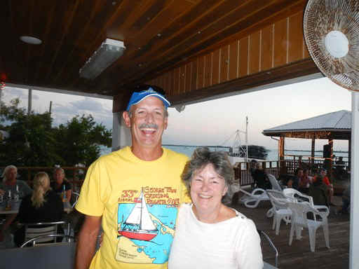
At the Island Breeze happy hour I came across Ralph and Sue from Copasetic. We met in George Town 12 years ago. Ralph was taking a hiatus from his engineering consulting business that he had started after leaving his faculty position at University of Delaware. Sue was on sabbatical from her job as a chemist at DuPont. Now Ralph is taking a second hiatus from his business and Sue has retired. They have their kids with them again. When I last saw them Nate and Marisa were the same age as Diana. The kids have deferred college for a year to spend the winter down here in the Bahamas. The Copasetic crew has crossed over to the dark side. 12 years ago they were sailing a catamaran. In planning for this trip Ralph looked at their old logs and realized that they had really only sailed 30 days in the span of 6-7 months so decided they might as well go with a power cat this time around.
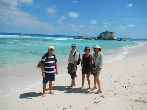
Below are Lee, Dave, Shelby and Gail on the atlantic side beach.
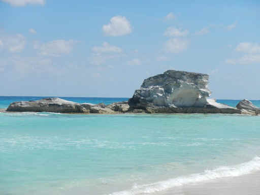
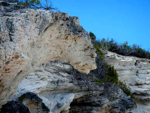
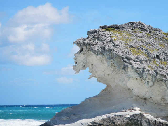
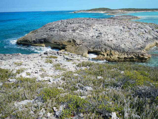
The rock in the background of the previous pic gets its own shot below. The limestone and sandstone rocks on the beaches erode to fantastical shapes and forms.
Look closely at the formation in the center of the picture below. You can see a lion's head framed by the sky, the scrub and the other rocks.
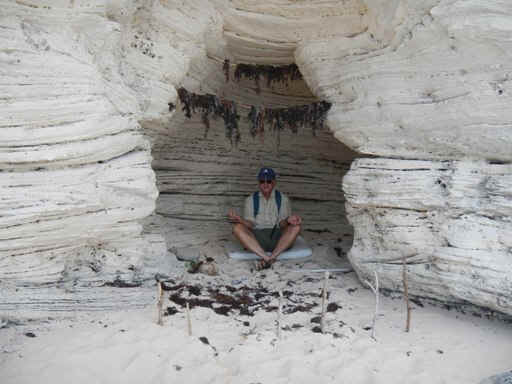
Nearby the lion's head we came across a small cave in the bluff overlooking the ocean. Dave couldn't resist posing as an ascetic framed in the entrance to the little cave.
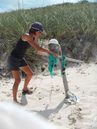
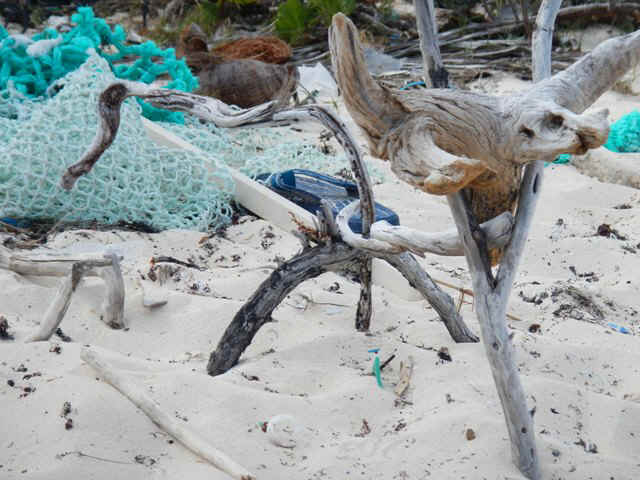
As with the Exuma Sound beaches, the Atlantic beaches are covered with litter that has washed up from other places. It is hard to resist creating sculptures from the detritus. Shelby is putting together a guard for the beach.
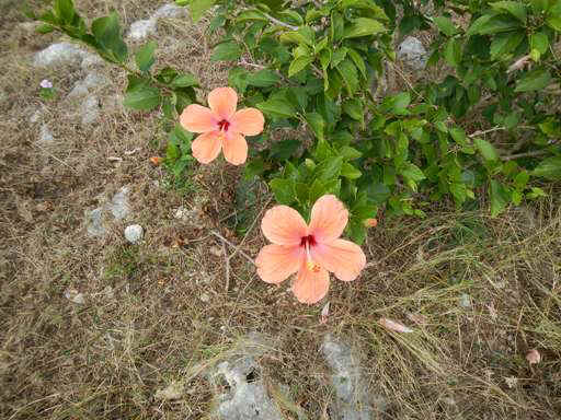
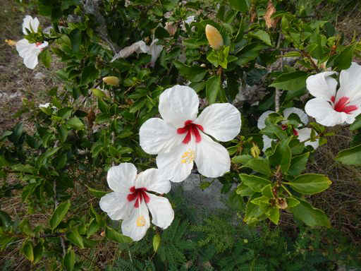
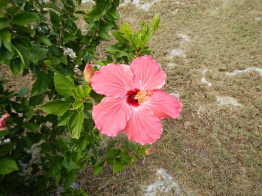
On the road back to the beach where we left the dinghy I found these four varieties of hibiscus in someone's front yard:
|
|
| 03/09/2013 Saturday -- Thompson Bay, Long Island | |
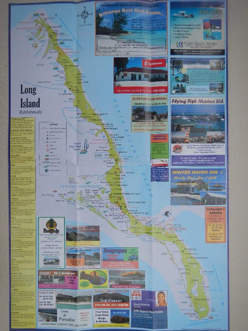
| Long Island is one of the largest islands and
one of the most interesting. At the north end is Cape Santa Maria where one of Columbus'
ships went aground. They floated it off, but it was heavily damaged and later lost in
Cuba. Long Island was an agricultural center until the Bahamas were opened up to the rest
of the world, whereupon the law of comparative advantage took over. Now the island's
primary industry is tourism. The names of some of the towns are pretty interesting. Starting in the north there is Burnt Ground. Then you come to Alligator Bay. Further south is Salt Pond, so named because of the salt production that used to occur there. One of the biggest settlements is Deadman's Cay. And way down south is Hard Bargain.
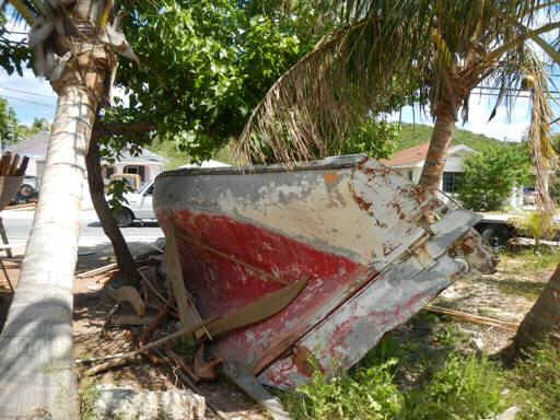
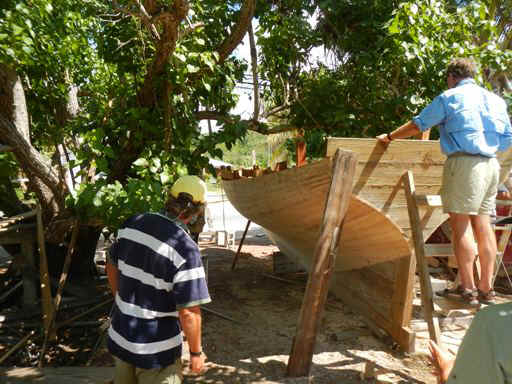
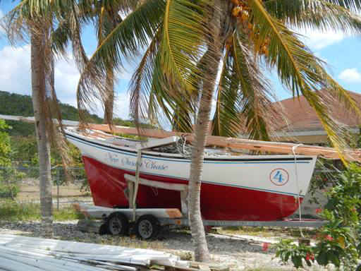
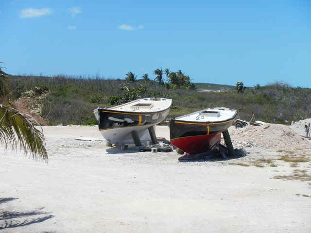
Today I shared a car rental with Dave, Gail, Lee and Shelby to tour the island. One of our very first stops was at the side of the road where spotted some men buildin a racing sloop to replace the one shown laying on it side.
Lee and Dave are giving the work the once over. This will be a Class B sloop. The classes are based on overall length. The A sloops are 28 feet and the C sloops (no longer raced) are 14 feet. The rating rule is very simple: they just measure length. Girth, beam and weight don't matter. Even with such a simple rating rule the boat designs and construction are constant, unlike the America's Cup boats that are always looking for ways around the complicated rules.
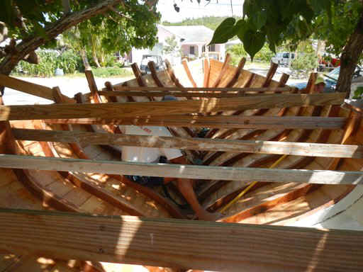
Below is a shot of the interior. The fellow inside is shaping the knees that are being fastened to the ribs and keel. To make the ribs and knees they cut the wood from local tree braches that already have the general shape that they need.
Number 4 was across the street from the boat that was under construction.
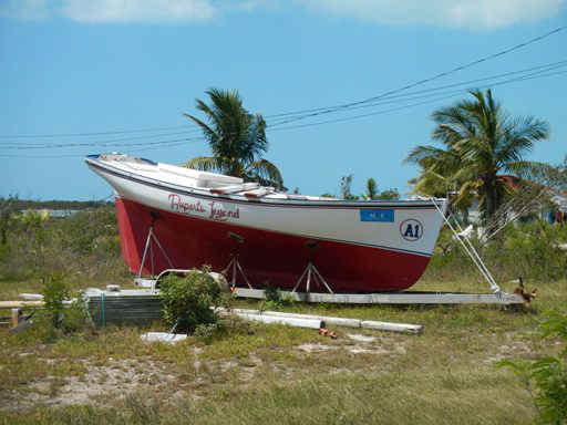
Number A1, below was up the road. It is a 28' A class sloop.
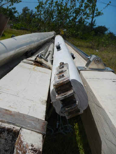
A1's mast and boom are shown below. Their are two of each. They are made from wood and there is a second set in case one set is broken in competition.
After stopping to watch the boat construction we went on to the Long Island library and museum. Long Island is about 80 miles long adn at its widest is about 4 miles. There are fewer than 4,000 people living on the island. So, that geographic area is served by a one room library with the museum below. Sorry, no pictures allowed. The museum exhibits consisted of artifacts from the last 100+ years. There also was some printed material on a table. One of the little books was a collection of pressed flora and discussion of their use in folk medicinet. The museum curator (?) told us that the electricity became available island wide only in the 1990s; same with phone service. This puts into perspective the short time span covered by their exhibits. |
|
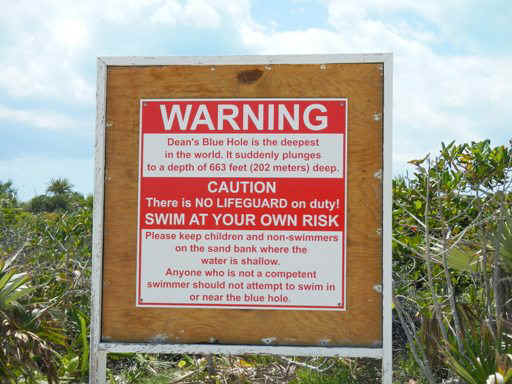
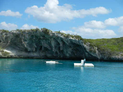
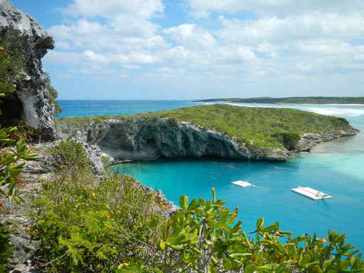
| Our major stop was at Dean's Blue Hole, where one is greeted by the sign below. A blue hole is a vertical, round hole of modest diamneter but going down into the sea hundreds of feet while the surrounding water may be very shallow. Or, the surround may be land.
Dean's hole is below. The platforms are used by those training for free diving competitions. Free divers try to see how deep they can swim without scuba, and still live to tell about it. Another view of the hole.
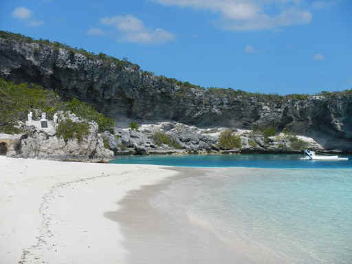
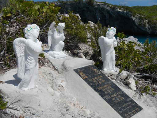
Another view. At the left of the below picture you can see a bronze plaque with what appear to be three little figures around it.
Not everyone survives their free dive swim in the blue hole. The little memorial is dedicated to 2 women and a 14 year old girl who all died at the blue hole on the same day.
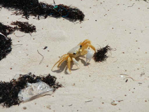
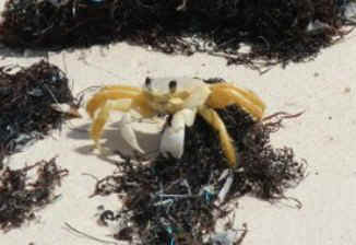
Before we departed from Dean's Blue Hole Shelby spotted this little guy making his way across the beach.
|
|
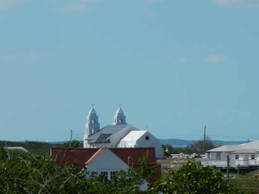
| The southern extremus of our tour was Clarence Town. Apart from a
small marina and a few shops there was not much to a town that is shown with prominence on
the map. Throughout the Bahamas Father Jerome had a huge impact through the
construction of churches. The two in Clarence Town are his work, are both Anglican,
and sit on two hills overlooking the town.
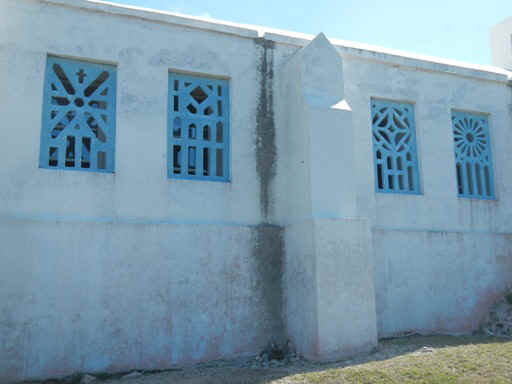
Some detail on the second church is shown below.
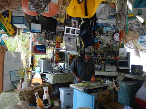
Our last productive stop of the day was at Max's Conch Bar in Deadman's Cay. Max is at work assembling a very tasty conch salad.
|
|
| 03/10/2013 Sunday -- Thompson Bay | |
| Looks like today is a lay day. To begin the
clock change for day light savings time meant losing an hour. Secondly, the wind is not
right for going back to George Town. Thirdly, although the original intent was to come
down here then head for Conception Island, the predicted large ocean swell coming in from
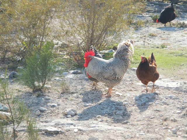
the northeast makes Conception Island untenable as an anchorage. Instead it was a day for another hike out along the Atlantic beaches. The condition of the beaches is a travesty. They are just covered with plastic litter. Until you see it you can't imagine how bad it is. The rooster below is the cock of the walk, watching over his flock of hens at an unfenced chicken coop along the road.
Below is a cobra raising its hooded head from out of the surf.
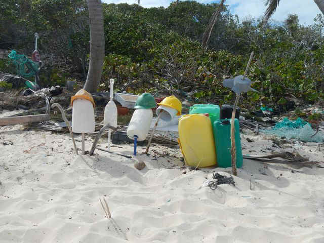
There is so much plastic on thebeach that we declared one of the beaches a hardhat zone so that strollers can protect their noggins from the hydrocarbons taking up residence along the beach.
Below is a sculpture that I did with driftwood. I think it looks like a very skinny pig. There are, in fact, feral pigs living on the island.
Lastly, this gargoyle was looking over the crashing surf out on one of the Atlantic beaches.
|
|
| 03/11/2013 Monday -- Thompson Bay | |
| Au revoir to Emerald Bay and Pathfinder.
They left today so that they could have two consecutive days for heading north.
Their first stop will be George Town, braving the ocean swell along the route
north, then the breaking swell at the North Channel Rocks cut. At the end of the day they
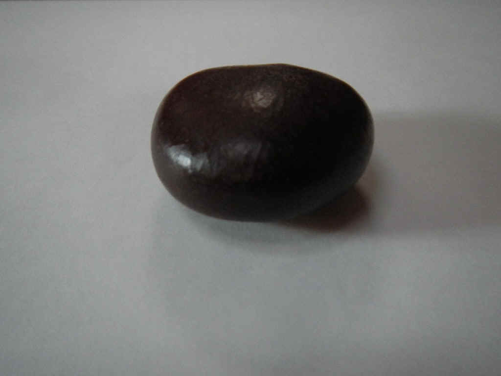
sent us a text letting us know that they had arrived safely in Elizabeth Harbor. Meanwhile it was another day of hiking on the Atlantic beaches. Today I found a couple of sea beans and Sara gave me a sea hamburger. The sea beans are seeds that wash up from the Caribbean and South America. They are about 1.5 inches across and a beautiful mahogany color. The sea hamburger, also a seed, is about an inch across and looks just like a miniature hamburger.
|
|
| 03/12/2013 Tuesday -- Thompson Bay to George Town | |
| The start of the day was a broad reach with
18-22 knots of apparent wind. After making the turn at White Cay Banks it was a
little closer to the beam. After the next turn at Hog Cay it was onto a dead run
sailing wing and wing. The speed over the ground was 5.5 to 6.5 knots all day;
pretty good boat speed for sailing downwind. On coming up on Pigeon Cays the ocean
swell rolling across and breaking on the reefs to starboard then bouncing off the cays to
port and back into the rhumb line made for a difficult rolly sail while wing and wing.
It wasn't until I was through North Channel Rocks cut that the swell became a
serious problem. After a breaking swell caused an accidental jibe I put the engine
in gear, rolled up the genoa, and sheeeted in the main to continue into Elizabeth Harbor.
If had had crew to trim while I steered then I could have sailed into harbor.
Better safe than sorry. On arrival I anchored off Sand Dollar Beach into a SE wind. This is important for the entry two days hence. |
|
| 03/13/2013 Wednesday -- George Town | |
| Today is a day of essentials: Propane,
laundry, trash, internet, book exchange, bank and visa renewal. Regarding the visa renewal, I went to immigration last week and was told to come back this week. Today I was told that the only person who can do renewals is off island, but they expect him tomorrow. The problem with tomorrow is that the wind will be blowing through Elizabeth Harbor at 20 -25 knots. The response was that the requisite officer might be in the office on Monday or Tuesday. Welcome to the Bahamas. |
|
| 03/14/2013 Thursday -- George Town | |
| The big wind came in last night and early this
morning from the north after clocking slowly and very light from the southeast. As
the wind clocked there was not enough wind to stretch out the anchor chain and reorient
the anchor. This morning when I woke up I was still firmly attached to the bottom where I had been when I went to bed. Yippee. No sooner had I finished listening to the weather and started to get breakfast then I happened to sense a change in boat motion and looked out the window. "Well, maybe it's just becasue the wind is just blowing harder." To my dismay I was dragging in a somewhat crowded anchorage. It took me an hour to get the anchor up and reset, all with the wind blowing in excess of 20 knots. Having dragged the decision was made that I would stay on the boat all day to make sure it doesn't drag in my absence. Now at 4:30 PM is still blowing steadily at 15 - 18 knots and gusting over 20. I am nervous and hope it eases off as the day goes on. |
|
| 03/15/2013 Friday -- George Town | |
| This morning I braved the wind and chop on
Elizabeth Harbor to go into town to try again to get my visa extended. Now it turns
out that I didn't completely understand the young officer I spoke with on Wednesday.
What I was meant to understand was that the only person able to renew visas was not
off-island for just Wednesday, but that he would not be back until a week Thursday. My
time and gallon of $6 gas wasn't completely wasted since I swapped my paperbacks for a
fresh supply. In the afternoon I went for a hike out on the beach with the crew of Spartina. For dinner I was on board Meltemi with Jeff and Susan. In the PM I watched Argo with Alan Arkin and Ben Affleck. Oh, it's a hard life. |
|
| 03/16/2013 Saturday -- George Town | |
| Brian and Teddy Sue are starting on their way
from Staniel Cay to George Town today. It will be a close hauled sail for them today
and tomorrow, provided Indian Summer can sail close enough to the wind, otherwise it may
be a motor sail for them. On the way down the ICW and in a few locations in the Bahamas I noticed that this year it seems common for folks to have brought their dogs with them. Until now I felt sorry for the dogs and owners. The dogs are confined to a small space. The owners have to drag the dogs ashore at all hours and in lousy weather so the dogs can do their thing; but all the inconvenience was the owners' choice. Yesterday the count of boats off Sand Dollar Beach with dogs aboard rose to three. Now dogs on board is a problem. Two of the boats are quite close to me and the owners leave the dogs out on deck all day to bark their fool heads off at anything and anyone that goes by. The third boat does the same, but they are a little further away. Why is it that so many dog owners think that everyone else enjoys listening to barking dogs as much as the owner? |
|
| 03/17/2013 Sunday -- George Town | |
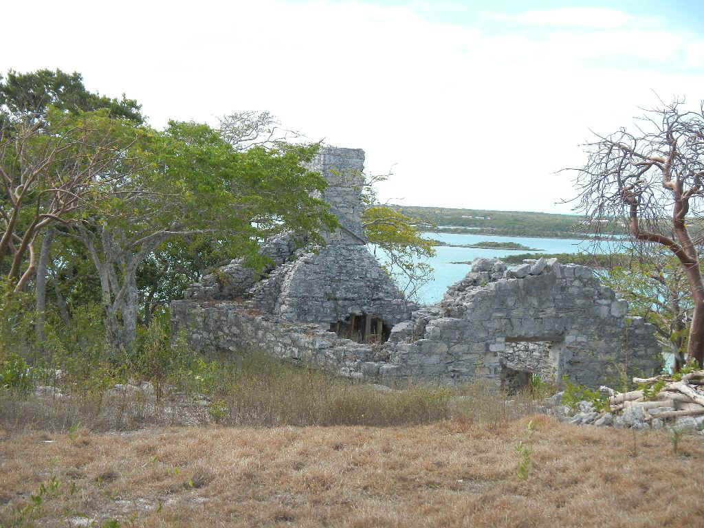
This AM Phil, Sara and I went over to check
out the loyalist plantation ruins on Crab Cay. The cay is now privately owned and
resort development began before the big financial meltdown in the US. To show you what the
developers had in mind checck out their web site: Crab Cay Resort. A photo of the bridge
that was built to access the cay is here: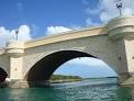 . Before they even sold a property they clearly had
an ambitious plan costing tens of millions of dollars. The reality, especially now
that the project has stopped, is something else. Below on the left is the little nursery
they planned to use between bringing in plants and then putting them in the ground. On the
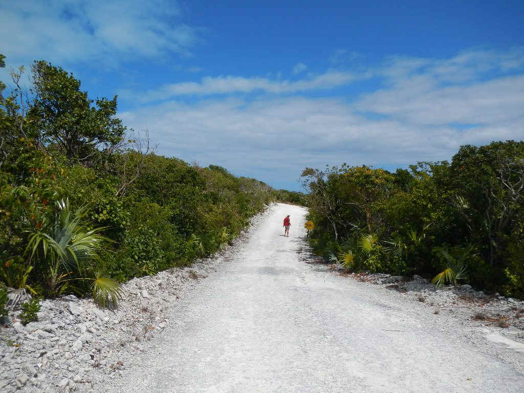
road is one of the half dozen roads they have cut. In some places they just
bulldozed the stone walls built by the loyalists in the 1780s. . Before they even sold a property they clearly had
an ambitious plan costing tens of millions of dollars. The reality, especially now
that the project has stopped, is something else. Below on the left is the little nursery
they planned to use between bringing in plants and then putting them in the ground. On the
road is one of the half dozen roads they have cut. In some places they just
bulldozed the stone walls built by the loyalists in the 1780s.
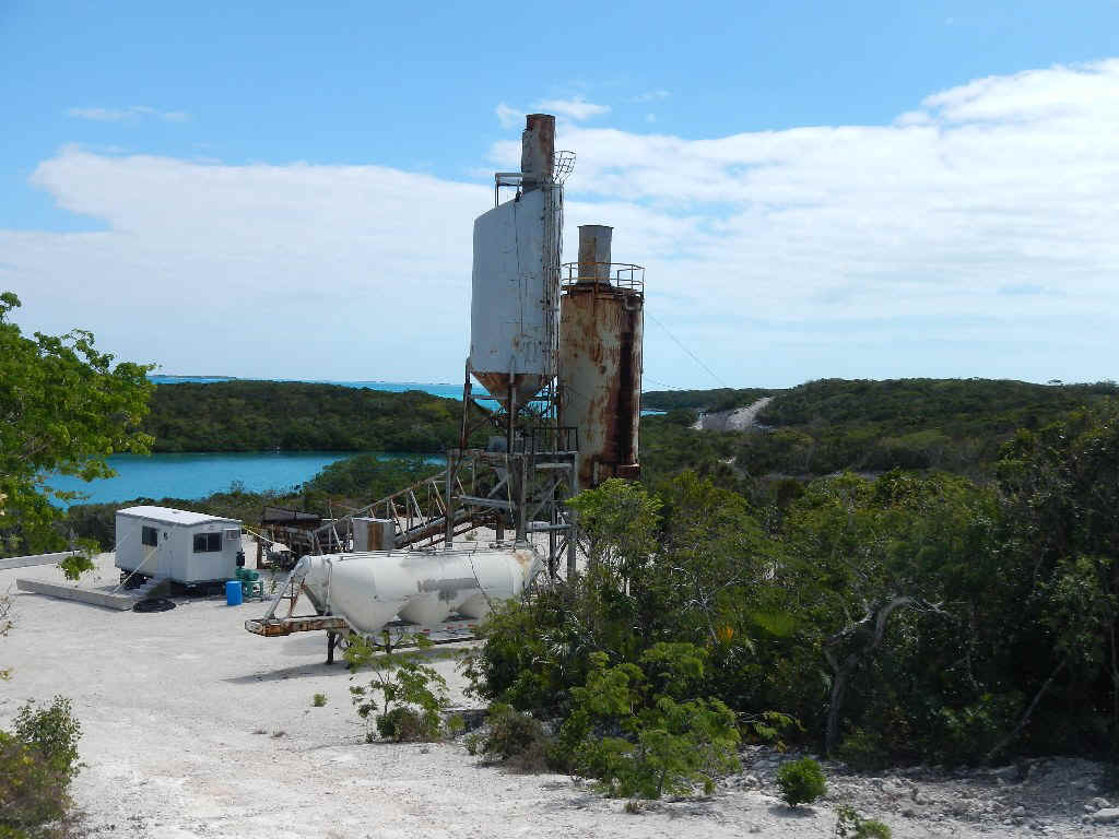
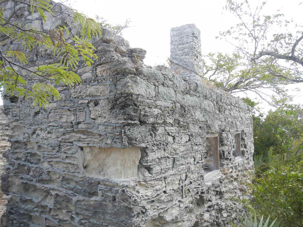
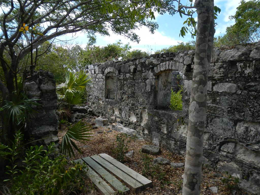
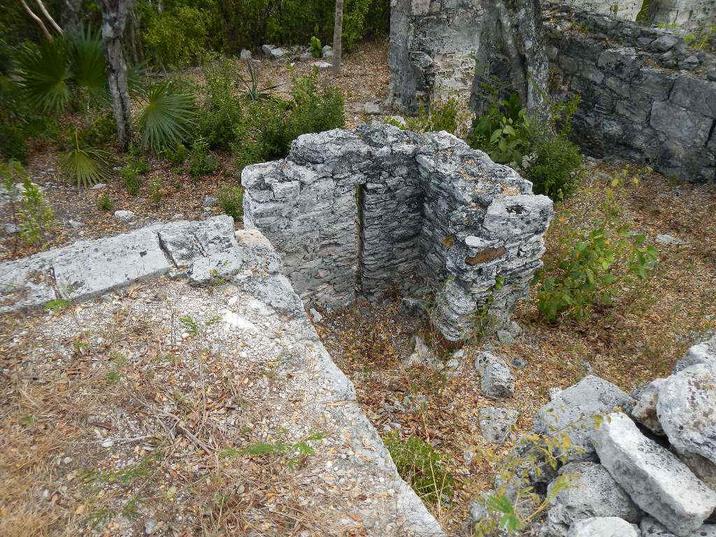
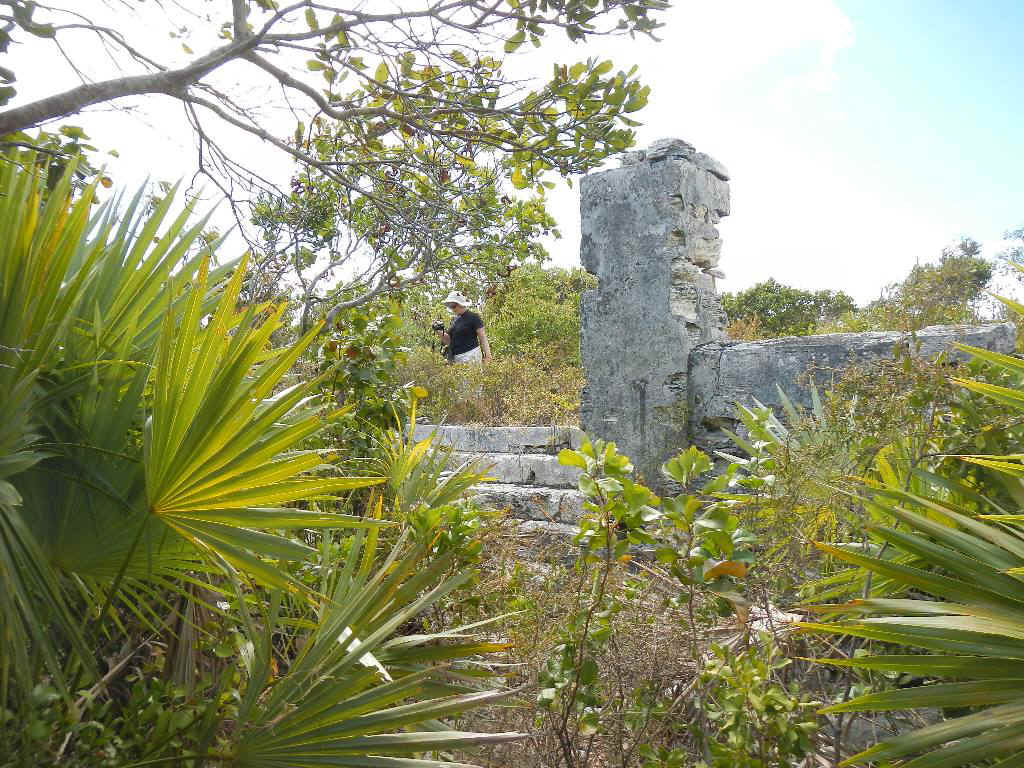
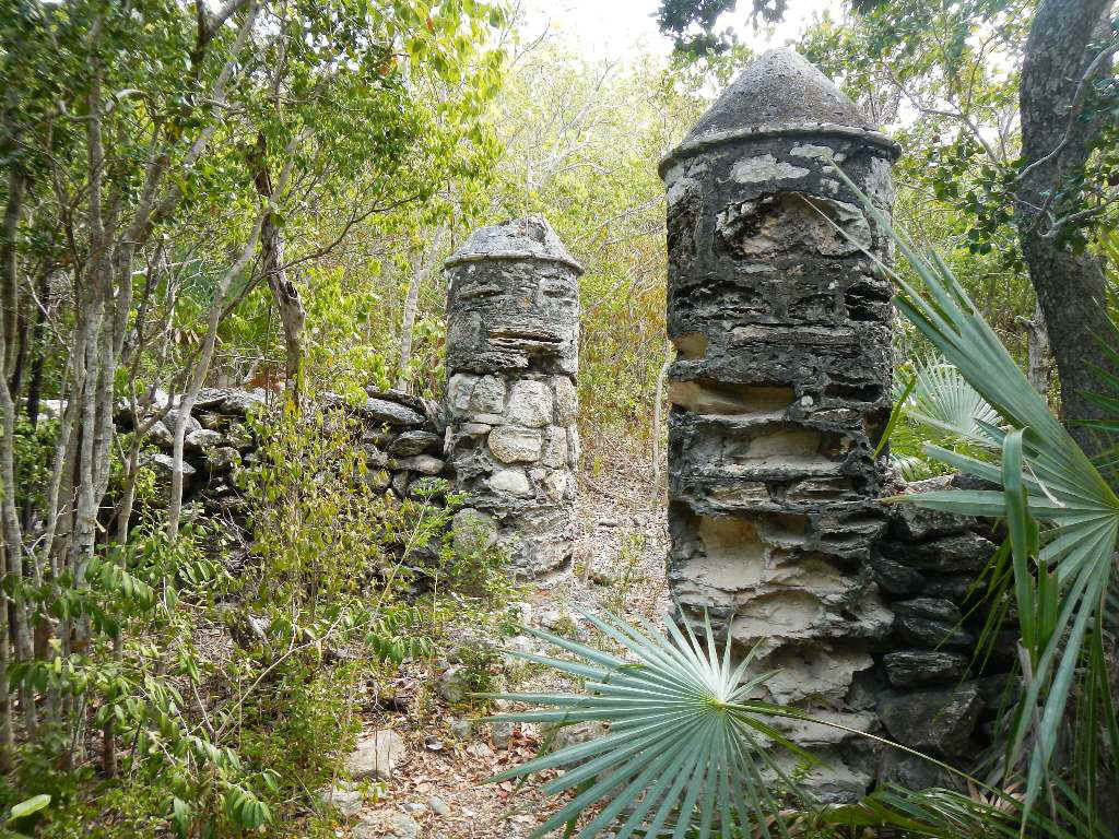
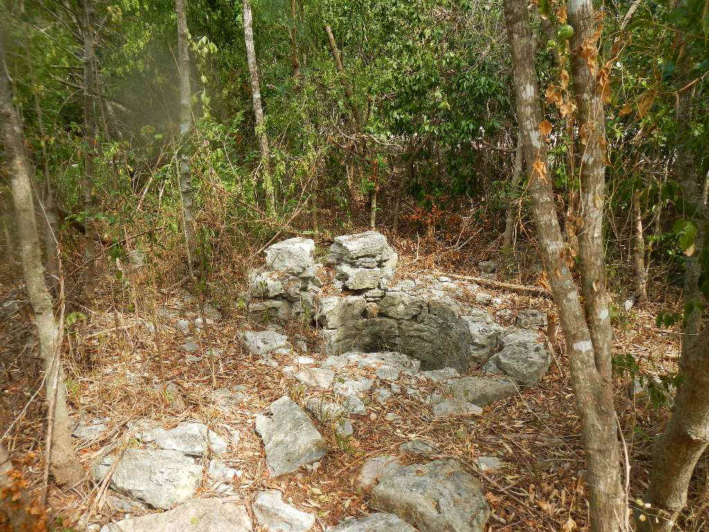
Below is the concrete plant they built on the island for the construction project. Now we turn to the plantation ruins. The central site on the top of the hill consists of the remains of three builings. The most intact building, below left and right, may have been the kitchen. On the below left is the side of one of the two buildings that sat behind and below the main house. All that is left of the main house is the foundation, the corner of which is in the below right photo. In the center of the picture is what I believe to be the base of the outhouse. At the bottom of the slit, on the ground, in the center of the stone work is a shallow stone "bowl." The purpose of the slit was too allow waste to drain out and run down the hillside.
On the east side of the remains of the three buildings and looking over Elizabeth harbor there is a flat paved yard. The below left photo shows the stairs and columns that lead up to that yard. The below right photo is the view of George Town from the site of the main house. The original residents would be surprised or shocked by what is happening to their island and the appearance of George Town.
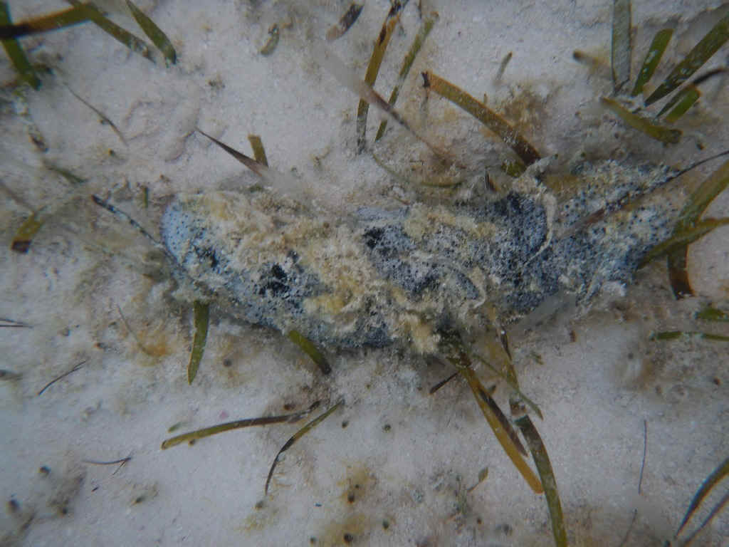
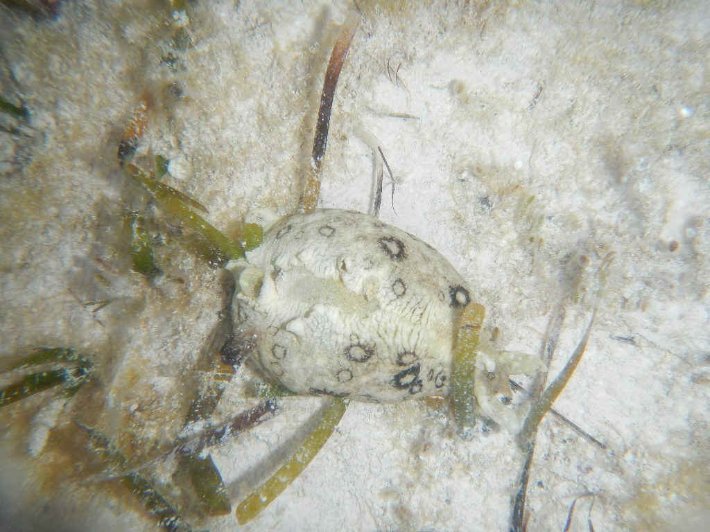
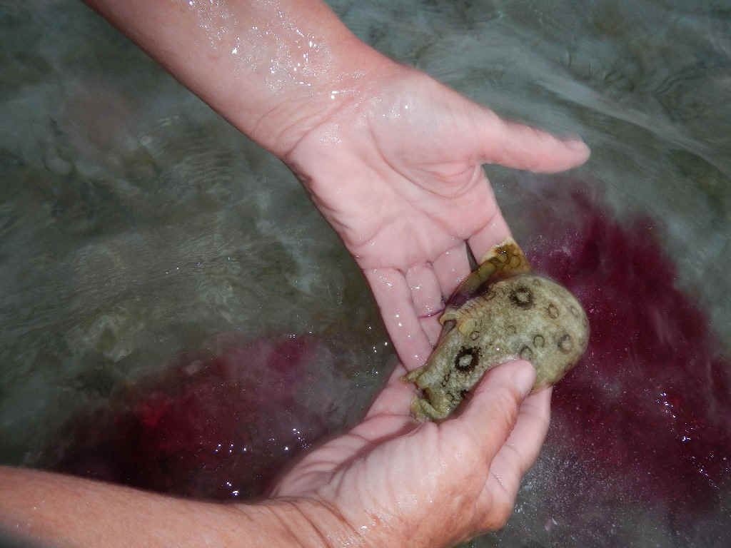
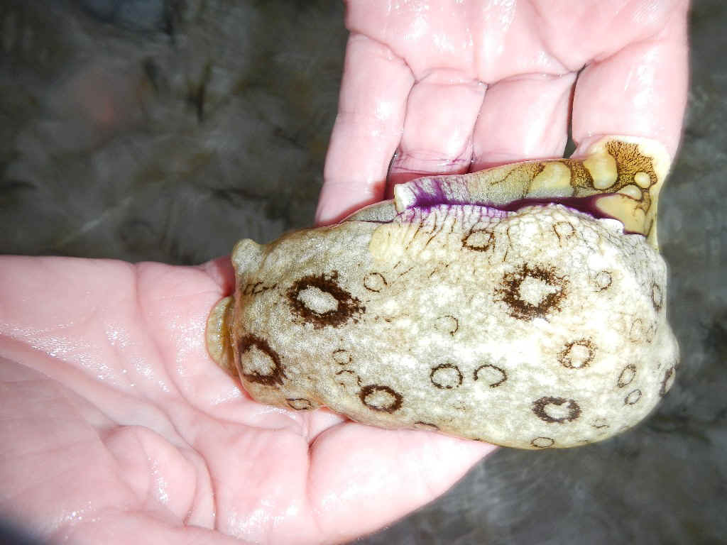
Below left are the gates on the path leading up to the plantation house. In the same vicinity there is a fresh water well, below right. After lunch the three of us went to a lecture on volleyball beach. The lecture was done by Cardell Williams, a local Exuma resident. Most of his talk was on folk tales passed down by the Bahamians. For generations the folk tales were passed down aurally because the Bahamians were largely illiterate into the modern era. A large collection was assembled by out of work writers and scholars under the auspices of the WPA created by FDR. That collection is now housed in the Library of Congress. The evening activity consisted of wading in the low tide shallows on a beach adjacent to Sand Dollar. Sara, a retired biology teacher, was the guide and had the keenest eye. The pair of pictures below are of a sea cucumber, although it is an animal. Its self defense mechanism entails ejecting its digestive tract in the face of its predator. It then crawls off to regenerate a new tract.
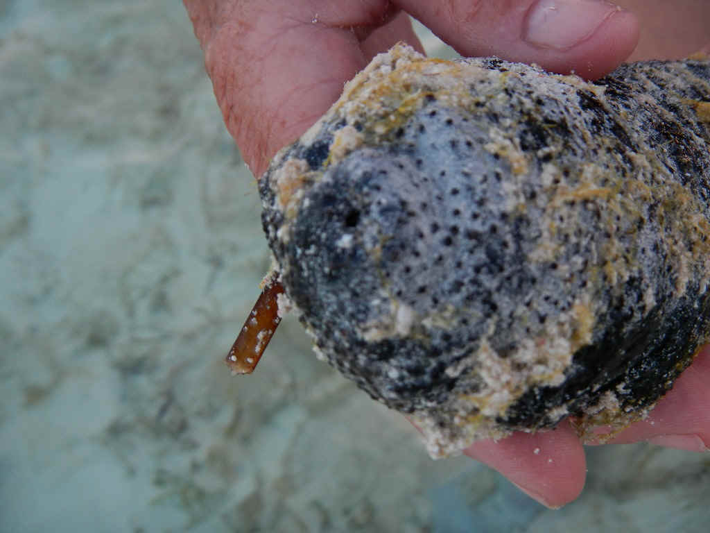
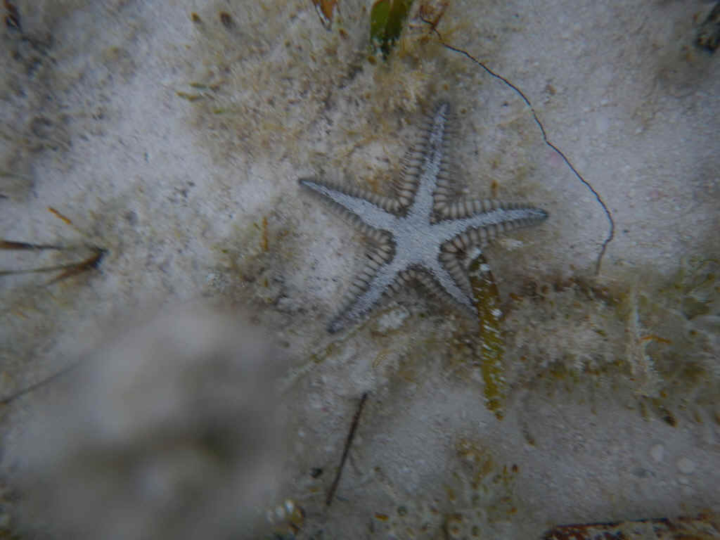
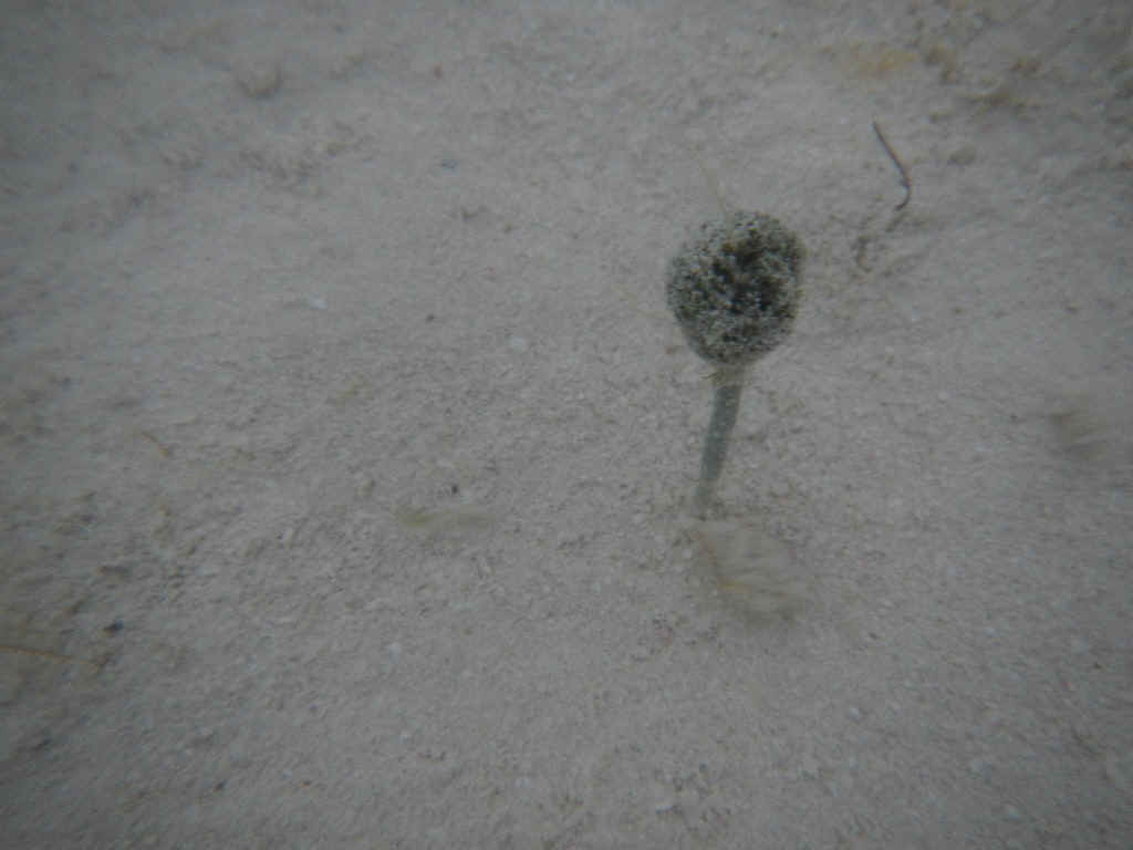
In the below left photo is a sea pen. This is a long narrow bivalve, like a clam, that stands vertically in the sand so that just the top inch or so can be seen. As soon as you touch it he closes up. On the right is a small starfish. Sara was confronted with a dilemma once she learned that starfish are a predator for conch: leave the small starfish in the water to prey on conch or throw it up on the beach? Her resolution was to pose the question: If I toss the starfish up on the beach what should I do about all the humans that partake of conch salad and conch fritters?
Below left is a little plant that looks like an underwater mushroom. Sara says it is a penicillium. On the right is a sea hare; So called because it has a couple of appendages on its head that look like the ears on a hare. This invertabrate is like a snail without its shell. Its defense mechanism when disturbed is to squirt out a purple ink, then crawl away on the bottom.
As soon as Sara picked up the sea hare he squirted his ink; see below left.You can see his size and the fold that forms his mantle in the below right photo. The mantel is in Sara's left hand.
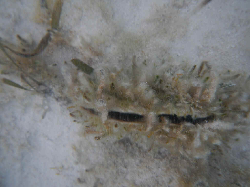
Sharped eyed Sara found everything for us, including the sea anemone below. By the time she found it the sun was setting and this was the best photo I could get. When touched the pull back below the sand.
|
|
| 03/18/2013 Monday - 03/27/2013 Wednesday -- George Town | |
| The last few days have been a blur. During
that time I spent a few days anchored off George Town proper as the wind veered into the
SW and W and went nearly dead calm. The G-Town anchorage off Kidd Cove offers
protection from these winds. There were a couple of significant events during the
period. First and foremost, on my fourth try, I finally had my length of stay visa
extended another 60 days. Everyone has tales of woe when it comes to this and no one
understands the policy. Also while off G-Town I found a couple of other locations
for internet. Pet's Place is a little cafe that has free wifi as long as you buy
your meal. Of course there was one knucklehead using Skype while I was there and
slowing things for everyone. The other place is JnK Productions. They provide
internet service, mobile device unlocking, computer repair and groceries. Their
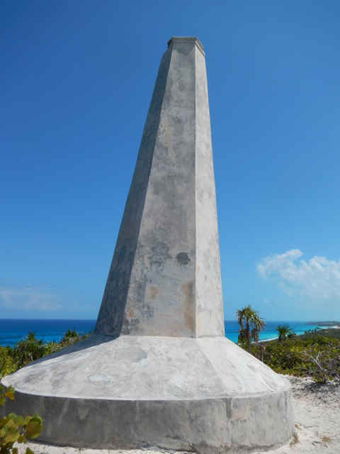
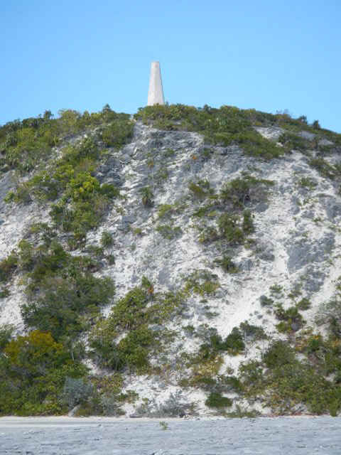
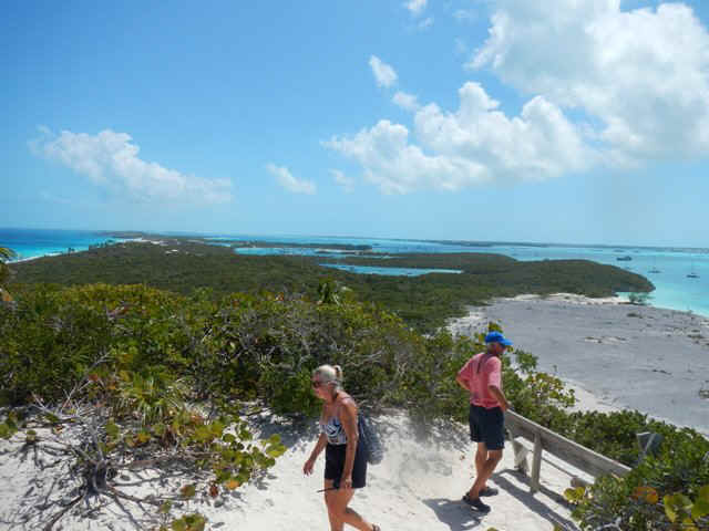
internet is $5 for the day and their motto is 'If we can't fix it, just throw it out.' Another day, while the boat was at Sand Dollar, I walked up the Sound side of Stocking Island so that I could visit the Monument and the harbor side beaches north of Chat-n-Chill.
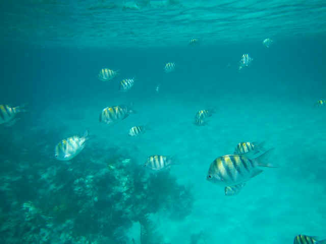
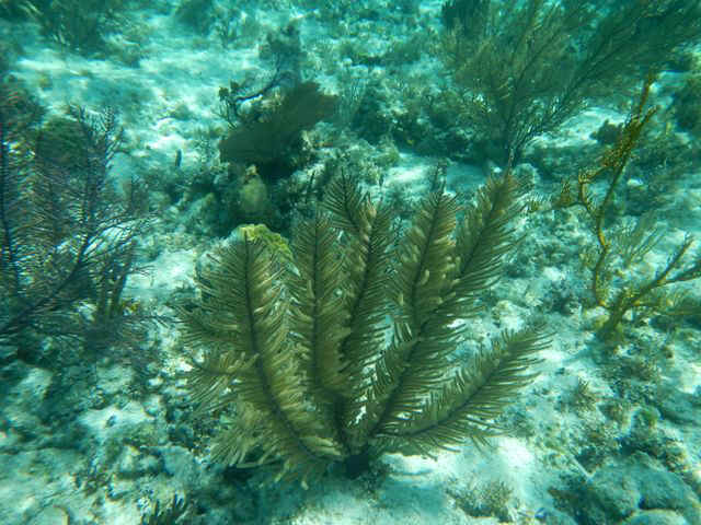
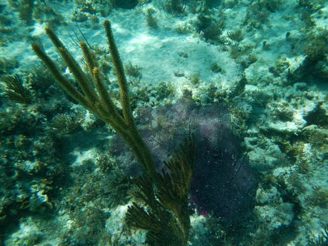
Yet another day was spent snorkeling with the Spartina crew in Elizabeth Harbor off Fowl Cay and off Crab Cay. Because of the current flow through the harbor the water clarity is not too great but I do have a few photos. The fish are Sargeant Majors.
At the three locations we explored there were many types of soft coral, some of which can be seen below.
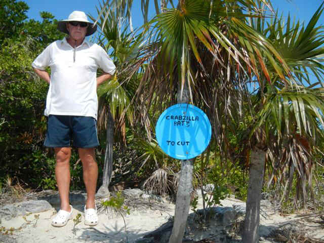
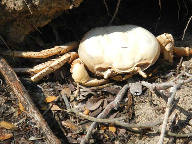
3/24 - Walked up to St Francis Resort for lunch with Brian and Teddy Sue. I haven't seen them since I left Rock Hall in Ocotber. They are trying to decide whether or nto to depart George Town with me about Thurs or Fri. They don't have any time pressure to get up to the Abacos so they may hang out down here longer. When I got back to Andante at 4:30 I found she had dragged and the crew from Swell Horizon was on board to try to take control. Scary. 3/25 - Sitting in the anchorage off Kidd Cove by town . Came over here to do some errands in anticipation of daprture in a few days.. Stayed on the boat while wind is blowing in this crowded anchorage. 3/26 - Came back to Sand Dollar Beach to sit out north winds that filled in early this morning. In the afternoon went for a walk over to see Crabzilla. Below we see Phil at the trail head.
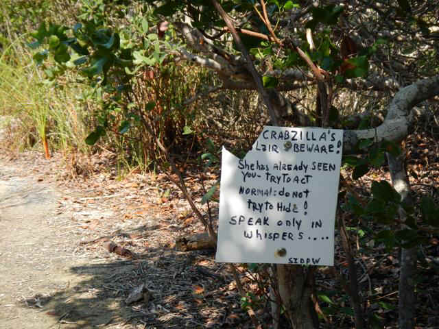
All visitors to Crabzilla's lair are given fair warning!
Crabzilla is the biggest land crab ever seen in the Bahamas. This is just his shell after having shed it to grow a bigger one. You never know what will be lurking in the brush of Stocking Island.
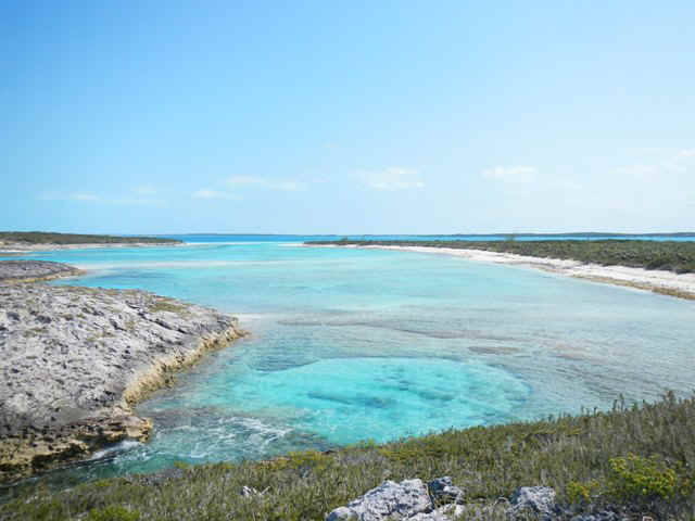
Looking south from Stocking Island down to Elizabeth Island. The two photos do fit together. On the right is a nice swimmming hole in the same location.
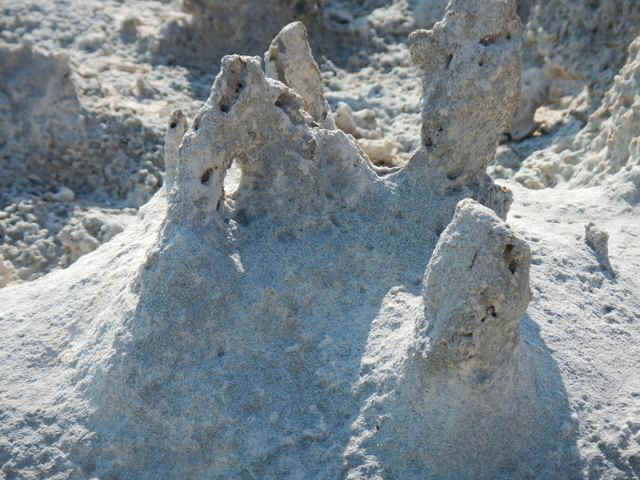
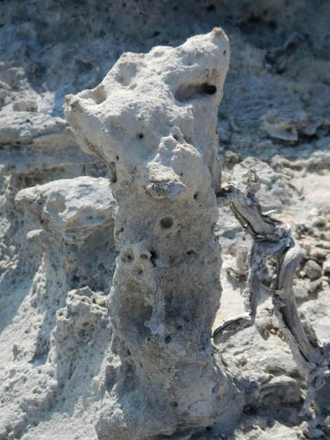
The funny formations in the next two photos are formed when a plant has grown in the sandy soil, then dies, and the soil erodes leaving behind these engaging rock-like structures.
|
|
| 03/28/2013 Thursday -- George Town to Thompson Bay, Long Island | |
| Finally, weather and a plan for exiting George
Town. With Paradigm Shift, Indian Summer and Spartina I sailed to Long Island today.
Nice wind for a close reach, then close hauled, then nearly a beam reach. There was
enough wind that the counter current was not a problem. The Bahama Current runs
through Exuma Sound from the southeast to the northwest, against the direction we were
sailing. For a time my speed through the water was well in excess of 7 knots, but
speed over the ground was 6 - 6.5 knots. Anyway, fun sail with cocktails with
Meltemi and Spartine on board Andante. The plan is Thompson Bay today, Calabash Bay on Sunday, Conception Island on Monday, Cat Island on Tuesday. Last time I was here with Emerald City, Pathfinder and Spartina that had been the plan, but the weather didn't cooperate. My fingers are crossed this time. |
|
| 03/29/2013 Good Friday -- Thompson Bay | |
| Most everything is closed today for Good
Friday. In the morning we walked out to one of the Atlantic Beaches to introduce
Simple Life and Paradigm Shift to the search for sea beans and sea hamburgers. In the afternoon we are going to a fish fry fundraiser for one of the local Anglican churches. |
|
| 03/30/2013 Saturday -- Thompson Bay | |
| Today I did another car rental, with Phil and
Sarah this time. Our first stop was Deans Blue Hole. No pictures this time, but see
the photos for 03/09/2013. We went down to the blue hole to watch the free divers in
training. Free divers go to great depths with no compressed air; that means they do
it on one breath of air with or without fins. The world records are in the
neighborhood of 100 meters; unbelievable depths. The day we were there to watch they
were only going to 100 feet or so. We donned our masks and flippers so that we could
watch underwater. All their gear is different. Their flippers are much longer
than a scuba diver's, their masks are smaller and fit closer to the face, and their
snorkels are shorter and fit closer to the skull. Our speculation is that these items are
kept small to reduce drag as they try to go deep as quickly as possible. One guy had
a mono-flipper. Both feet fit into a single wide flipper made from carbon fiber.
When I saw him dive he lookd just like a dolphin in his body and leg motion and
descended out of sight in an instant. While at the blue hole I climbed up and jumped
off the cliffs overlooking the hole; go back and look at the 03/09 pics again. From the blue hole we went down to Clarence Town to have lunch at Rowdy Boys, the home of a couple of the famous Long Island racing sloops. Their A and B class sloops are below.
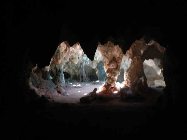
From Rowdy Boys we went up to take the cave tour up at Hamilton. Over the history of the island the caves have been used as hurricane refuges. There is even a fresh water spring in the caves.
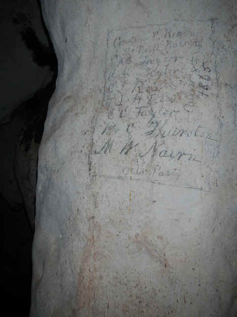
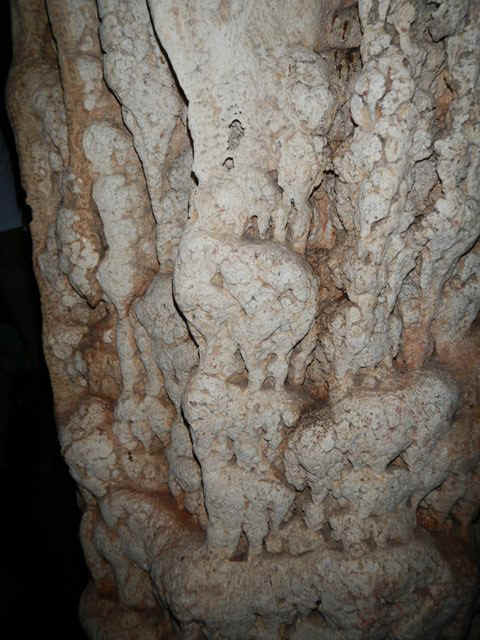
Below left is a list of names thought to date from the Loyalist era. In the center of the column pictured below right you can see elephants standing on each other's backs. I have something like this at home that was caved from ebony.
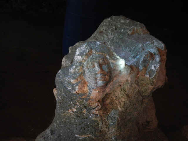
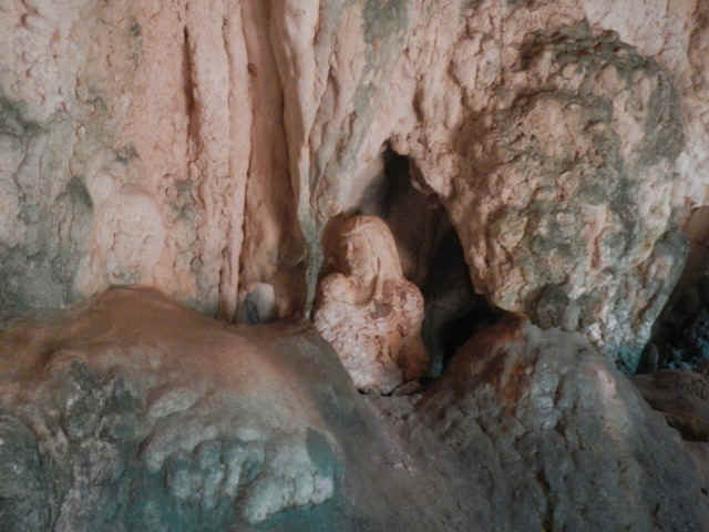
Again dating from the loyalist era are two photos of busts carved in the rock
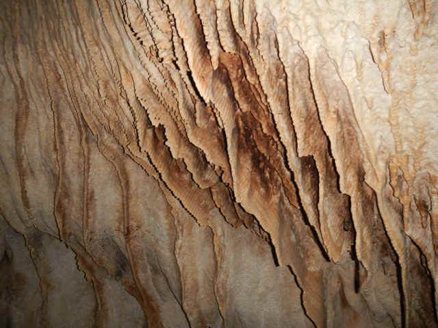
And of course the Hamilton caves have their share of veils formed by water dripping through the rock.
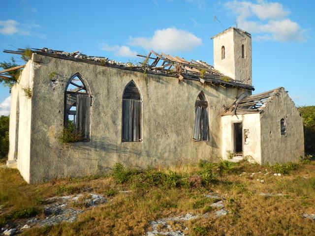
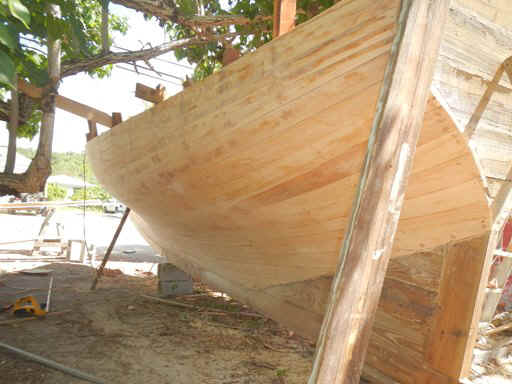
From the caves we stopped at the site where the locals were building a racing sloop by the road side two weeks ago. The outside of the hull has been epoxied and the deck is in place.As we were checking on the progress of the job a relative of the builder and crewmember stopped to chat with us. Mr. Knowles was quite loquacious. From the conversation I can tell you that the Bahamians take their racing VERY seriously. It also turns out that building these boats is a dying art and most of those competing in the Bahamas now are being built in just a couple of places on Long Island. Knowles was lamenting that his brother and uncle built the boat in George Town that beat them their last year in the Family Island Regatta (the Kentucky Derby of sloop racing in the Bahamas). On the last leg back to Thompson Bay we stopped at 'the Spanish Church,' the oldest still standing (barely) church in the Bahamas.
Before we turned in the car we stopped at the grocery and who should we find but Tammy and Paul. I met them on their boat San Pecaro in Nassau in January and talked to them on the VHF about a month ago when I first got to George Town and they were at Long Island (radio propagation was really good that day). This encounter today was a funny circumstance since we saw their boat when we were in Clarence Town. While we were driving south they had been travelling north! |
|
| 03/31/2013 Easter Sunday | |
| This morning I went to Easter Sunday Mass at the Anglican Church overlooking Thompson Bay. It is a small congregation and visitors made up a large percentage of those at Mass. At the end of the service the priest asked the visiting folks to stand up and introduce themselves to the rest of the congregation. A visiting family from Nassau and Bermuda went first, then me, then Spartina. After the introductions the congregation, visitor included, was invited to the community room for coffee and breakfast. The menu was Johnny Cake and what looked like vegetable soup. I didn't try the fare since I felt that as a visitor I should not consume what the parishioners had prepared for themselves, especially given the low incomes of Bahamians on the Out Islands. | |
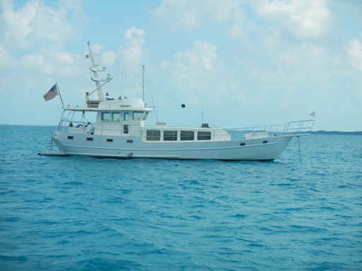 If you peer carefully at the communmications mast you cansee that
M/V Mosey has a crow's nest up there. But sheisn't the only one. Right next to her
was M/V Nomada with her crow's nest up on the bow.
If you peer carefully at the communmications mast you cansee that
M/V Mosey has a crow's nest up there. But sheisn't the only one. Right next to her
was M/V Nomada with her crow's nest up on the bow.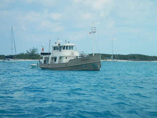
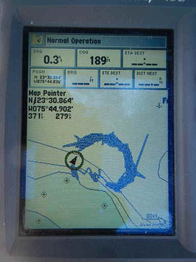 So
you can see what happens with the passage of a front I include the photo at the left. My
GPS shows the track of the boat as it moves. This circle shows the track of Andante
as she swing around in response to the wind shifts. The anchor would be in the center of
the plotted track. At the bottom of the 'circle' the wind was very light and
shifting around the compass very quickly so the track is not as tight. Leaving the
GPS on with its tracking capability is one way I make sure that I am not tracking.
Why would the boat drag with a wind shift? Well, the pull on the anchor is directional, so
as the wind goes around the compass it reverses the pull on the anchor to the 'wrong'
direction, or it could even wrap the chain around the shank and pull the anchor out.
So
you can see what happens with the passage of a front I include the photo at the left. My
GPS shows the track of the boat as it moves. This circle shows the track of Andante
as she swing around in response to the wind shifts. The anchor would be in the center of
the plotted track. At the bottom of the 'circle' the wind was very light and
shifting around the compass very quickly so the track is not as tight. Leaving the
GPS on with its tracking capability is one way I make sure that I am not tracking.
Why would the boat drag with a wind shift? Well, the pull on the anchor is directional, so
as the wind goes around the compass it reverses the pull on the anchor to the 'wrong'
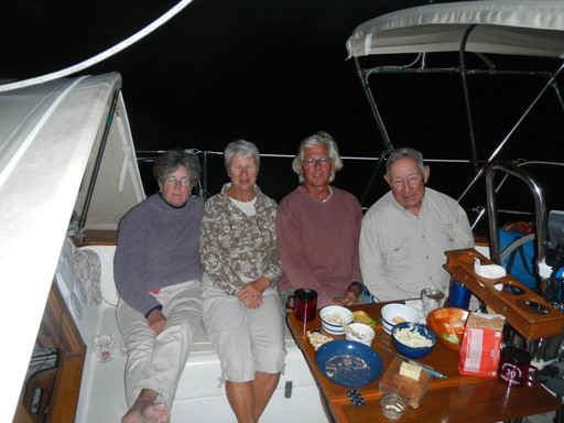
direction, or it could even wrap the chain around the shank and pull the anchor out.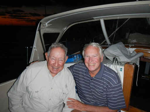 Ross (retired prof from
University of Waterloo) and Phil (retired dean of students from Western Maryland College)
and their wives Sara (retired Jr Coll and HS teacher, goes with Phil) and Rosemary
(retired Mom, goes with Ross).
Ross (retired prof from
University of Waterloo) and Phil (retired dean of students from Western Maryland College)
and their wives Sara (retired Jr Coll and HS teacher, goes with Phil) and Rosemary
(retired Mom, goes with Ross).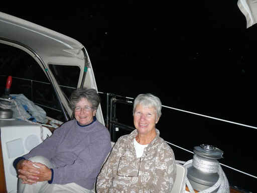
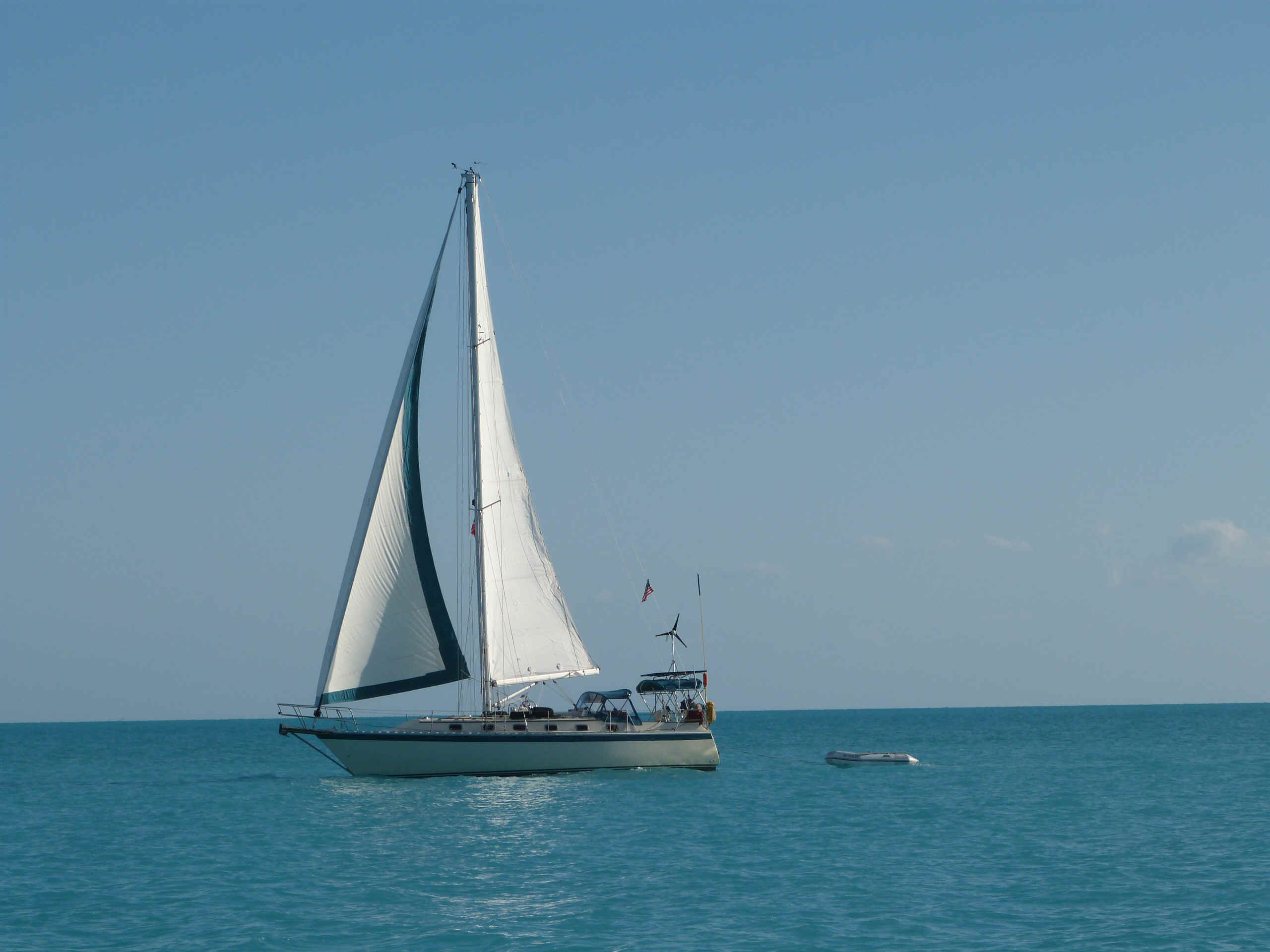
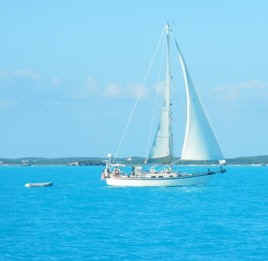 A picture of Spartina at the end of the trip from Geo Town to
Thompson Bay. And a couple of photos of Andante at the same point in the trip.
A picture of Spartina at the end of the trip from Geo Town to
Thompson Bay. And a couple of photos of Andante at the same point in the trip.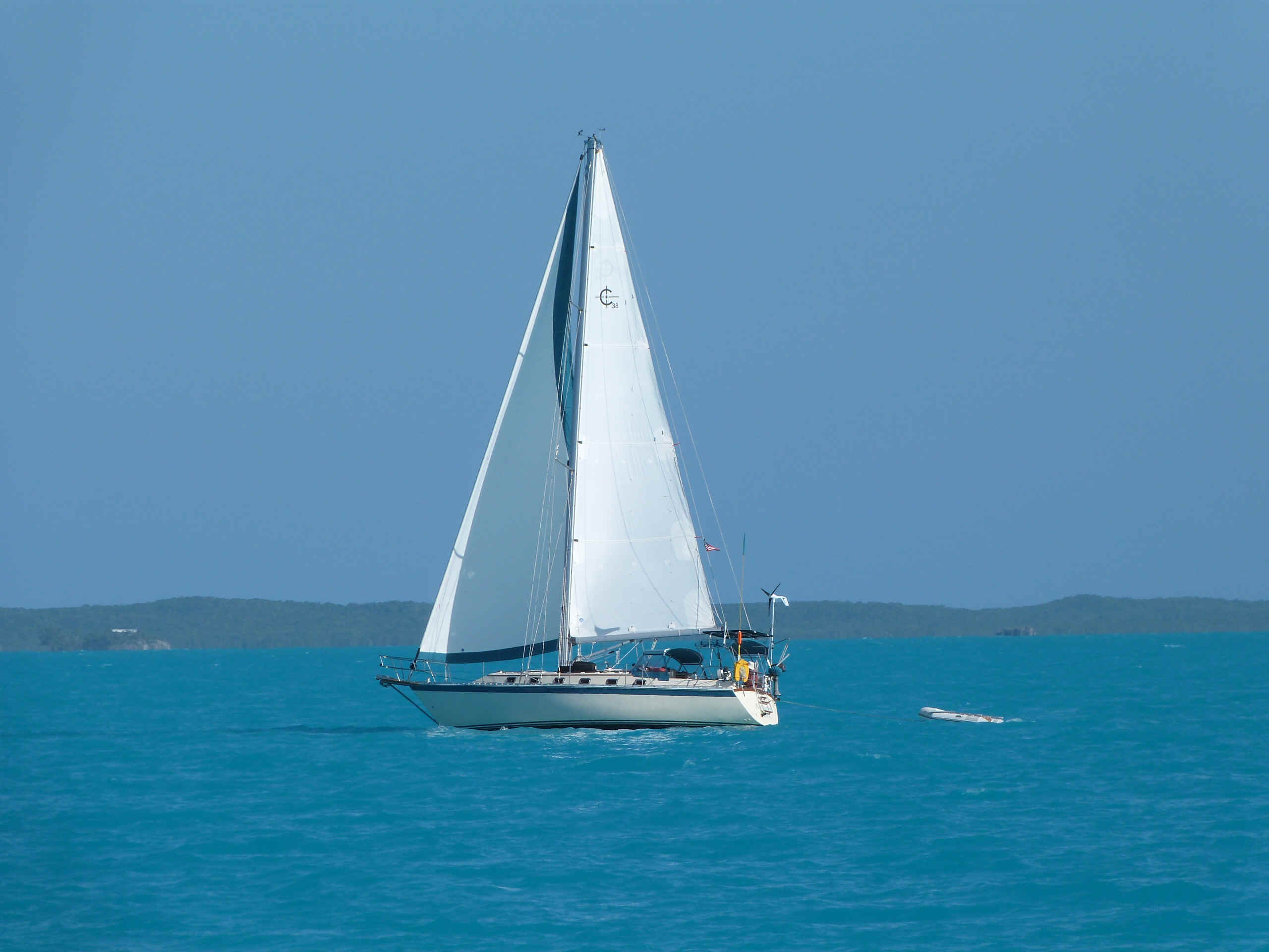
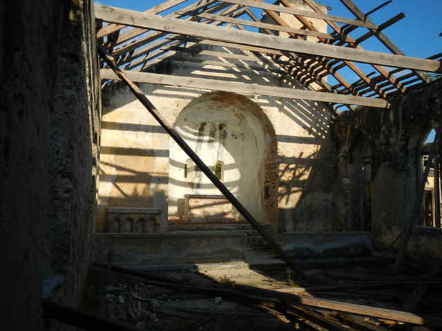
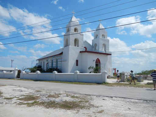
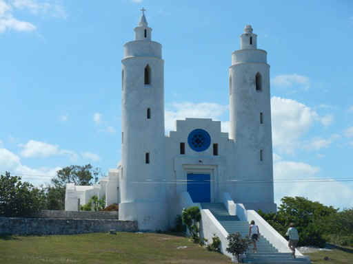
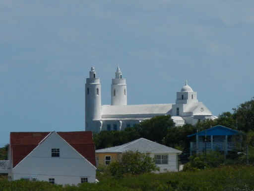
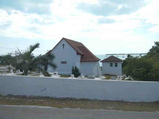 Church overlooking
Thompson Bay. There are no windows overlooking the bay. Guess the clerics don't want
the parishioners distracted by the bequtiful view.
Church overlooking
Thompson Bay. There are no windows overlooking the bay. Guess the clerics don't want
the parishioners distracted by the bequtiful view.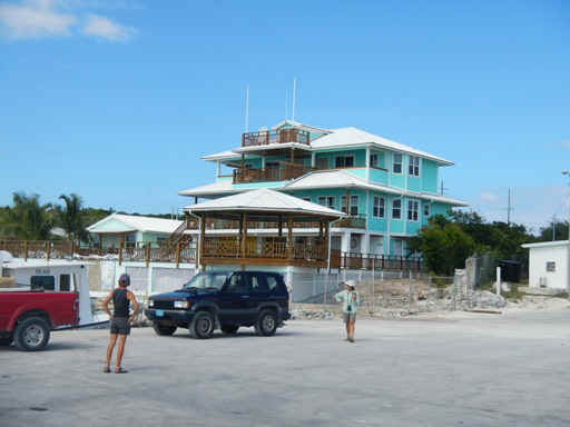
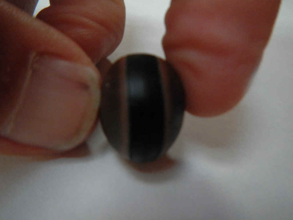
 This last seed found on
the beaches doesn't look like much. However, if you find one that rattles when you
shake it then it is supposed to bring you luck.
This last seed found on
the beaches doesn't look like much. However, if you find one that rattles when you
shake it then it is supposed to bring you luck.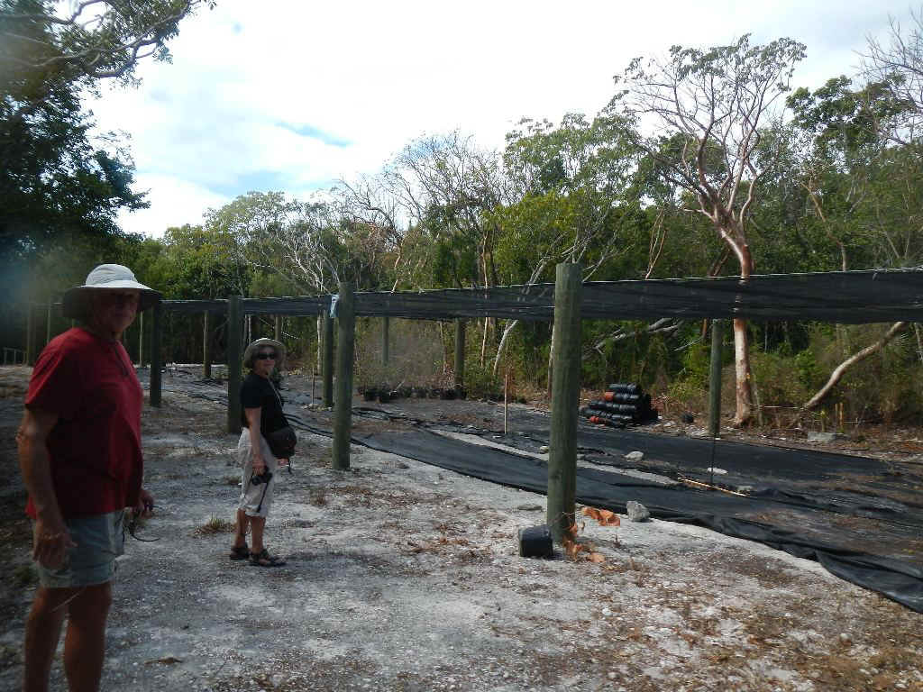
 .
.