| Andante's Sailing
Blog December 2012 BLOG Table of Contents |
|
| Back to November 2012 Ahead to January 2013 | |
| November 28 - November 29, 2012 Fernandina Beach, FL | |
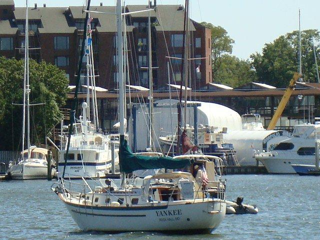 My friend
Wolfgang Linke, the owner of "Yankee" (pictured at the left) one of the boats in
Swan Creek Marina, came down to Charleston to go sailing. On 11/28 we left for Fernandina
Beach. Dock to mooring was 155 nautical miles in 27 hours. That works out to
over 6.2 knots average speed. The first two thirds of the trip we were mototrsailing
with the genoa. Finally for the last third we could turn off the motor for a broad
reach and run under genoa alone. The wind had picked up so much that we were well
over 6 knots for six hours with just the 130% genoa. That is great speed when on a
run for Andante. Being able to share the passage and get a few zzzzz's through the
night was great. Early in the AM the seas were very rough with 4 foot rollers coming
in from the port quarter. At one point I was below in the galley when a big one
rolled under us and I was thrown across the cabin and into the doorframe of the
quarterberth. No harm to me since I was wearing my Mustang survivor vest with lots
of padding. My friend
Wolfgang Linke, the owner of "Yankee" (pictured at the left) one of the boats in
Swan Creek Marina, came down to Charleston to go sailing. On 11/28 we left for Fernandina
Beach. Dock to mooring was 155 nautical miles in 27 hours. That works out to
over 6.2 knots average speed. The first two thirds of the trip we were mototrsailing
with the genoa. Finally for the last third we could turn off the motor for a broad
reach and run under genoa alone. The wind had picked up so much that we were well
over 6 knots for six hours with just the 130% genoa. That is great speed when on a
run for Andante. Being able to share the passage and get a few zzzzz's through the
night was great. Early in the AM the seas were very rough with 4 foot rollers coming
in from the port quarter. At one point I was below in the galley when a big one
rolled under us and I was thrown across the cabin and into the doorframe of the
quarterberth. No harm to me since I was wearing my Mustang survivor vest with lots
of padding.On the way into the St Mary's River we were greeted by the US Coast Guard and US Navy as they were escorting a submarine through the channel and out to see. It was pretty crowded in the channel where we crossed paths. And very awesome to see. About 25 years ago when we were taking our Pearson 31 "Colonel Buck" through Long Island Sound to New England we crossed paths with a submarine leaving Connecticut. On that occasion the sub was miles away so we could see only its conning tower and marvel at its speed. This time was the first occasion to see a submarine up close and personal. No pictures of the event since I didn't want to chance having a lengthy discussion with the Coast Guard. Another startling event as we came into Fernandina Beach was that the engine started to behave as though it was starving for fuel. This could be a dirty filter or water in the fuel. It was terribly nerve wracking since we needed to make it to the mooring field and pick up a ball in an area that includes the ship channel and a lot of other sailboats close together. By judicious manipulation of the throttle we kept the engine running until it finally settled down to an even running speed. Nonetheless we had the anchor windlass turned on in the event that we might need to put down the anchor on short notice. |
|
| November 30 - December 3, 2012 | |
| We are on a mooring off
Fernandina Harbor Marina. It is confirmed that I have a hernia. On 12/3 I go in for
my outpatient indoctrination and on 12/4 it will be repaired. In the meantime Wolfgang noticed that when I flew across the cabin I broke the door frame. We have spent some time repairing that. It isn't quite good as new, but most observers wouldn't notice the repair. All that remains is to put in some teak bungs where the screws have been put in and then do some varnishing. |
|
| December 4 - 12, 2012 Fernandina Beach, FL | |
|
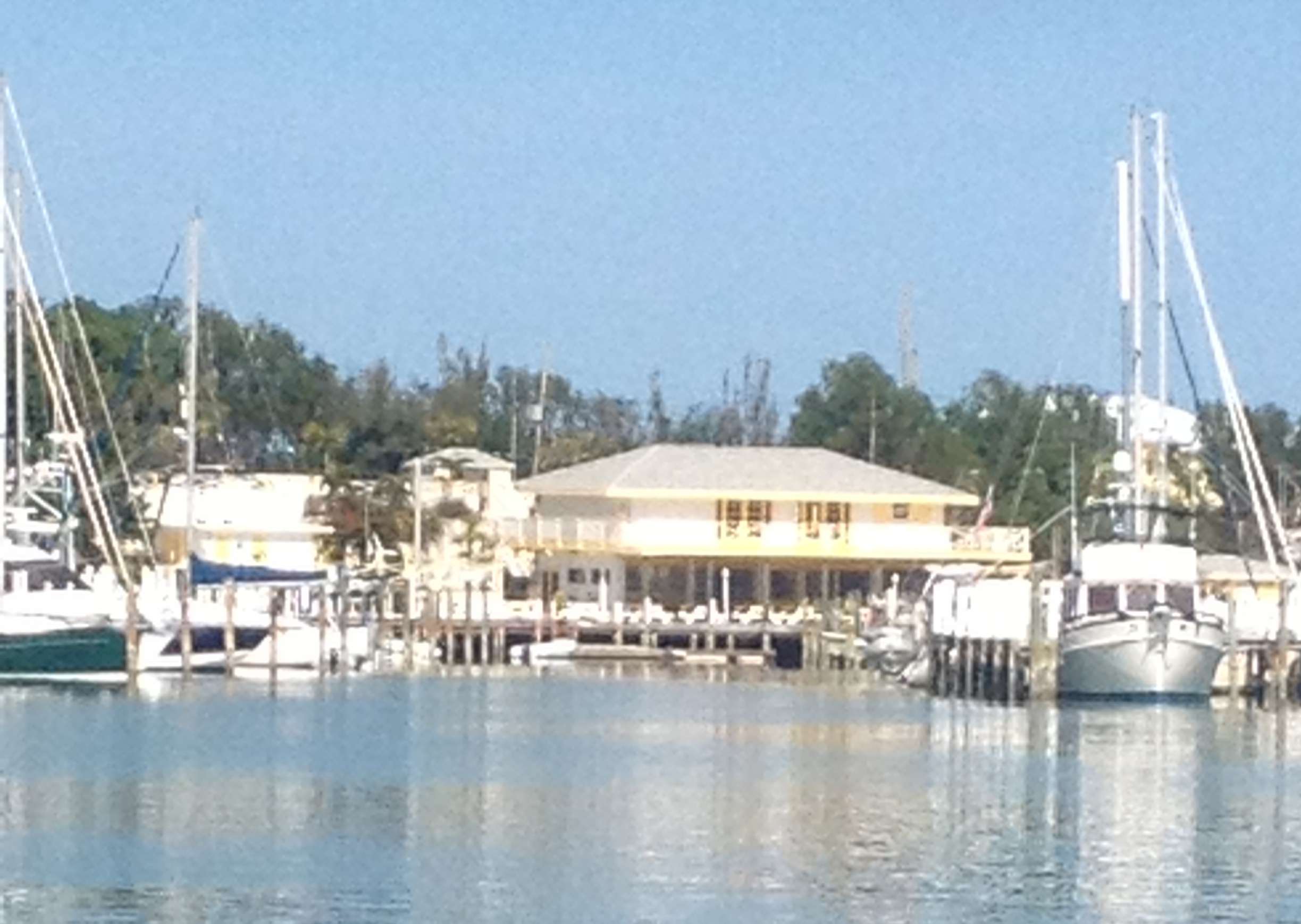
The hernia repair took place on Tuesday, 12/4/2012 at Baptist Medical Center - Nassau and was performed by Yash P. Sangwan. The folks at BMC were reassuring and helpful My only complaint is that post-op they gave me too much pain medication that really knocked me out for a couple more hours. You can see a youtube video animation of the procedure by clicking here. By clicking here you can see pix of what the surgeon did to me. This set of seof-portraits is NSFW (not suitable for work) and you must be over 18 to view them. The first day of recovery, Wednesday, was arduous. I was able to go for a short walk in the AM and walked a bit further in the PM. The walks were uncomfortable and tiring. In the afternoon of the same day I supervised while Wolfgang worked on replacing the fuel filter. The fuel in the bowl was very cloudy. All the rolling at sea on 11/29 must have stirred up all the dirt at the bottom of the fuel tank. In addition Wolfgang found that a piece inside the filter had been broken by the last person to install a filter element (not me). We have a new one on order. Fortunately the design of the filter assembly is such that even with the broken part the primary filter was doing its job. Nevertheless, we will replace the secondary element on the engine. The second day saw a great improvement so I took a shower, but I am still not walking very far or for long. As of today, 12/8 Saturday, I have finally been able to go to the bathroom. Those of you who have had surgery will know what I am talking about. In addition, the pain from the operation is almost entirely gone. In fact, I was pain free enough that I had not been taking the Hydrocodon w/ Tylenol for two days so last night I had wine for the first time since last Sunday. Today Wolfgang (with me looking over his shoulder) finished the job of replacing the fuel filters. Dirty fuel and water came out of both filters. In spite of our hopeful pondering it would seem that the broken primary filter did allow the bad stuff to get past it. It amazes that the diesel kept running the day we came into Fernandina Beach. Kudos to Yanmar for building such a robust engine. In any event all is well that ends well. Lastly today, Ron and Dawn Hughes (on Dawntreader, Caliber 40) sent out an email that they are leaving Lake Worth, FL today for the Bahamas. If I had been healthy during the last week we'd be down there and leaving with them. Oh, frustration. A couple of photos of those sharing the marina with us, courtesy of Wolfgang. We made grouper fingers one night from fish we bought at the Atlantic Seafood Company in the background.
|
|
| December 13, 2012 -- Fernandina Beach to St Augustine | |
| On our departure from Fernandina
Beach we got lucky with the tide and rode the rising tide to the south until we got to St
John's River at Jacksonville. The strangest sight on this leg was the fisherman
using casting nets just off the ICW. If the other fisherman saw someone bring in a
big catch they would all flock to his location to get in on the action. They reminded me
of nothing more than the seagulls at the beach that all flock to the poor dope that made
the mistake of trying to feed just one bird.
We stopped for the night at St Augustine. The city had filled what was the anchorage with mooring balls. There are now just two small areas for anchoring. Given fatigue, the strong winds from the north, and the strong tidal currents we picked up one of the City mooring balls. It was, however, not a peaceful night. When the wind opposed the tidal flow the boat rode up on the mooring ball which then banged on the hull for most of six hours. |
|
| December 14, 2012 -- St Augustine to New Smyrna Beach | |
| Another long day ion our rush
south, 60 more miles. In New Smyrna we stayed at the City Marina. As
Christopher and I discovered 12 years ago there really aren't any decent anchorages here.
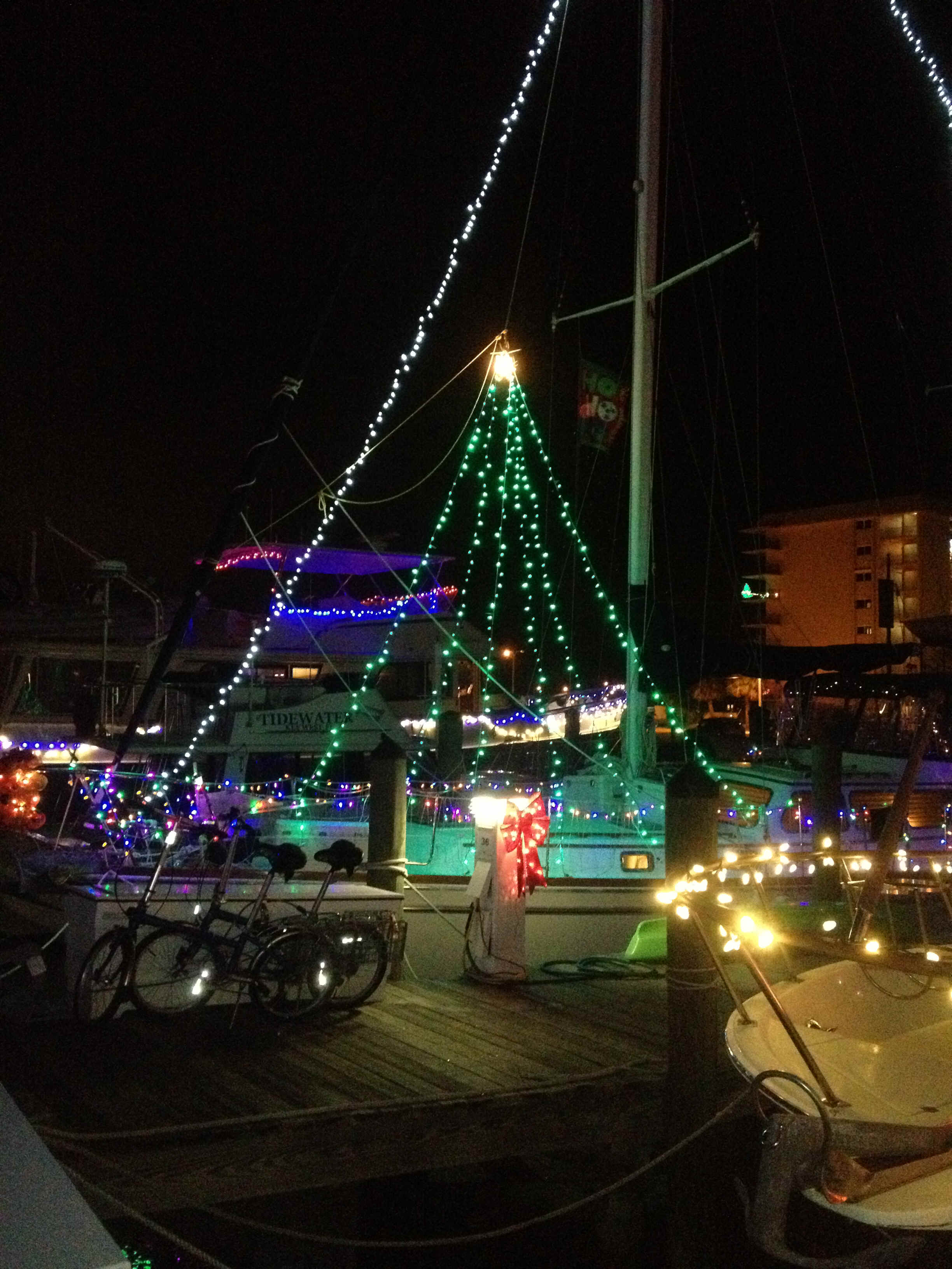
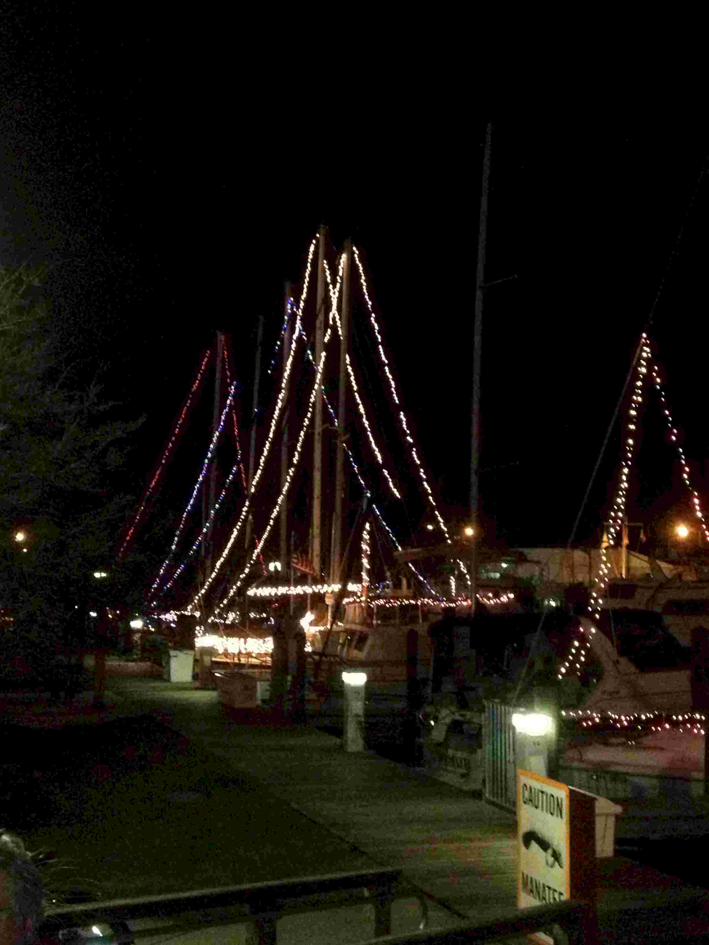
It was money well spent since we had a peaceful night. Too tired to cook we went out for
pizza. When we got back to the Marina we found most of the permanent boats decorated
for the season.
|
|
| December 15, 2012 -- New Smyrna Beach to a wide spot in the ICW south of Melbourne and near Malabar, FL | |
| About 80 miles today. A really long
distance for a sailboat. A curious event of the day occurred at Haulover Canal
between the Banana and Indian Rivers. As we approached the turn into the canal two little
runabouts raced up to get in front of us. They then slowed to a crawl as we all
approached the bascule bridge. Why they slowed was beyond me since neither one of
them needed more than 6 or 8 feet of clearance; One in particular was playing a
reverse chicken, seemingly begging us to run him over. Wasn't he aware that at such a slow
speed I have very little control of the boat? Wolfgang was ready to give him a couple of
blasts on the air horn to get him to move along. The anchorage we chose at the end of the day was quite peaceful in the lee of the barrier beach and off the ICW. The other boats that had been stalking us for the day all opted to go into the more standard anchorages. Ours was the better choice. |
|
| December 16, 2012 -- Malabar, FL to Fort Pierce, FL | |
| Relative to the last three days, this was a short day indeed; only 35 - 40 miles. In Ft Pierce we went into a marina to buy fuel. Our last, cheapest opportunity to buy diesel. After getting (free) water and fuel we anchored off the marina to prep the boat for the offshore passage to the Bahamas and to try to nap for an hour or so. | |
| December 16 - December 18 Fort Pierce, Florida to Spanish Cay, Bahamas | |
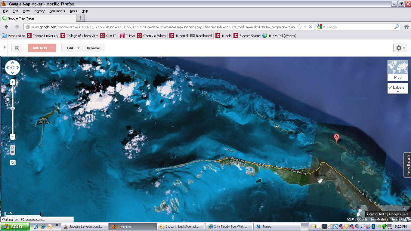
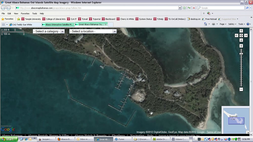
Andante, with Andy and Wolfgang on board, is now at Spanish Cay in the Bahamas. Tomorrow we’ll start working our way toward Marsh Harbour so that Wolfgang can get his flight home on Christmas Day. For the next week or so I will not have cell phone service. In Marsh Harbour I will go to the BATELCO office and get a cheap local phone. When I have picked it up I’ll email you the number. In their greed Verizon makes using my iPhone too expensive in the Bahamas. Getting a wifi connection isn’t cheap, but at least it is a daily fee for as much email and web browsing as I can produce.
The photo below zooms in on the Spanish Cay Marina on the east end of the island. The island is privately owned. To get the whole enchilada on its historyclick here. The high season is in the summer months when the sport fishrmen come here with their big power yachts to chase marlin, swordfish and sailfish. For December there is a veritable mob scene here with three sailboats and a big power yacht. The dockmaster told me that there are five or six families that own houses on the island. They fly in on their private planes!
|
|
| December 19, 2012, Wednesday, Spanish Cay -- Green Turtle Cay | |
| This was our shortest and easiest
day since leaving Fernandina Beach. And what a day it was. We sailed the
entire day, running the engine only long enough to leave the Spanish Cay Marina and then
to anchor off New Providence on Green Turtle Cay. It was a great sail that left
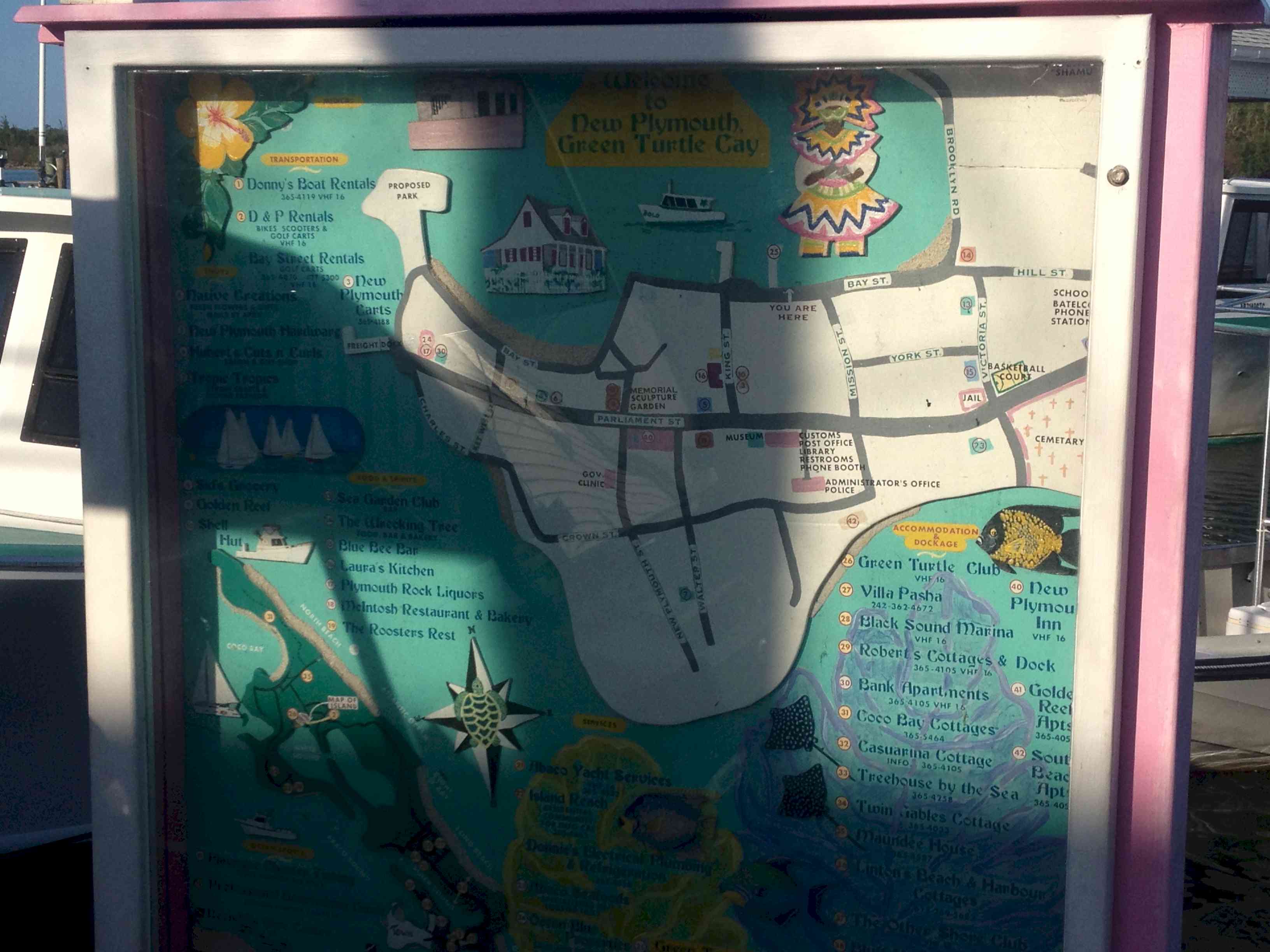
enough time for us to go sightseeing in town. Being good tourists we started with the map
of the town in order to be sure that we would not get lost in the thriving metropolis.
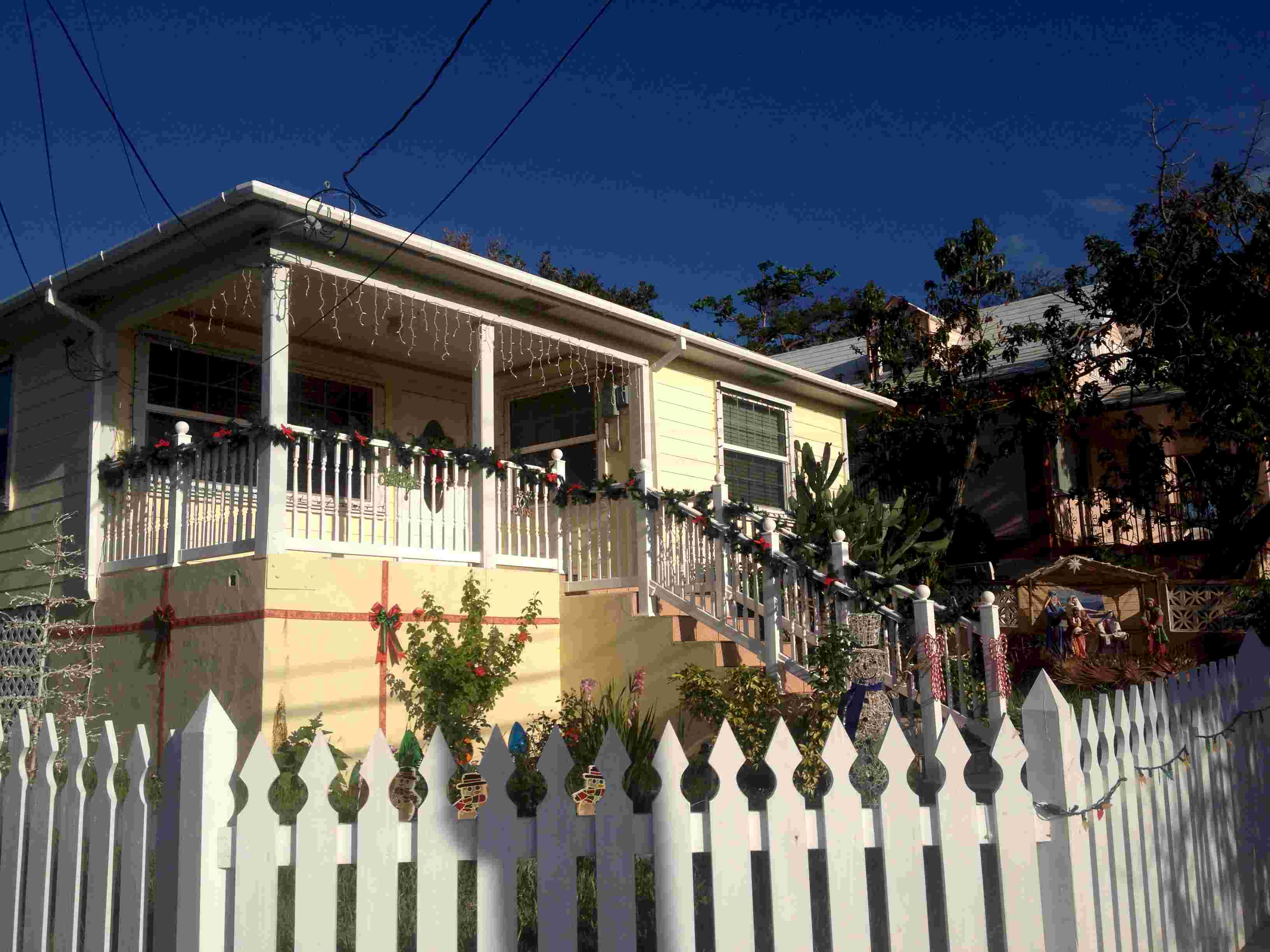
Many of the residences are decorated for Christmas. Note the ribbon around the porch of
the yellow house complete with its crech scene at the right of the picture.
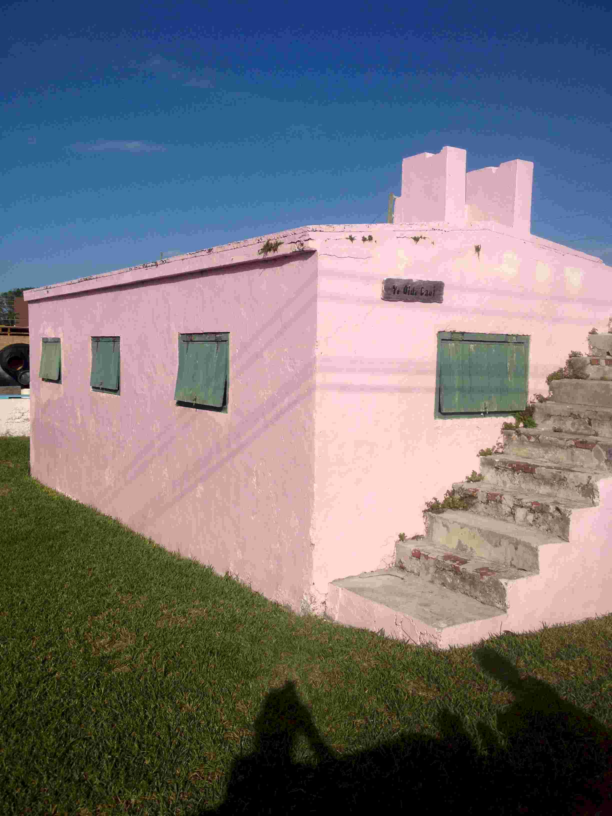
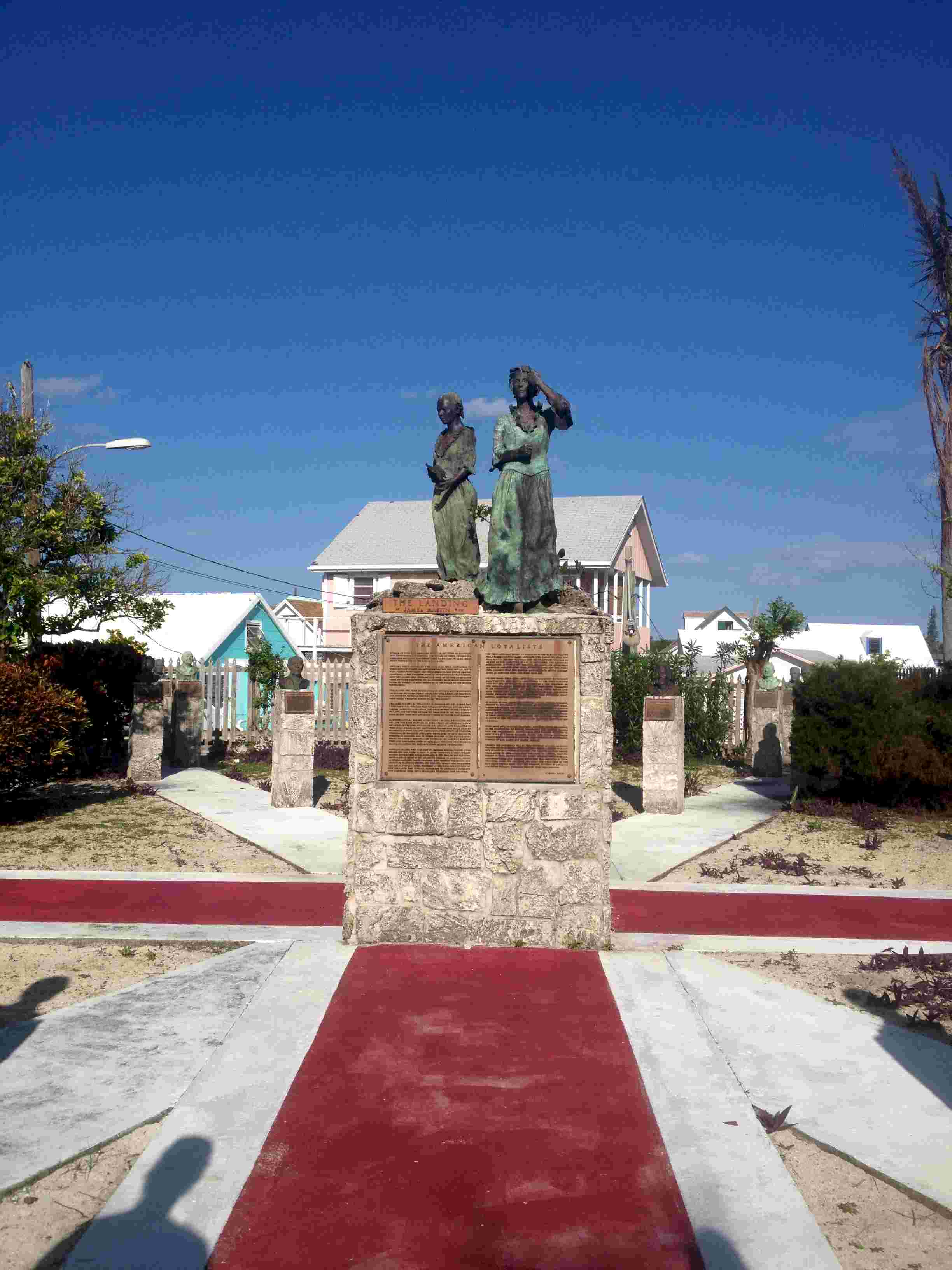
Two of the touirist highlights are ye olde jail and the sculpture garden. The bronze sculptures honor the Loyalists who fled America at the time of the revolution. The central piece in the picture is endowed with two bronze tablets inscribed with the Loyalists story from their perspective. It is quite different from the view of the American Revolution taught in American schools. One of the figures on the central pedastal is a woman of African descent. The contributions of the Africans brought from America by the Loyalists are acknowledged, but no mention is made of the fact that most of them were brought to the Bahamas as slaves.
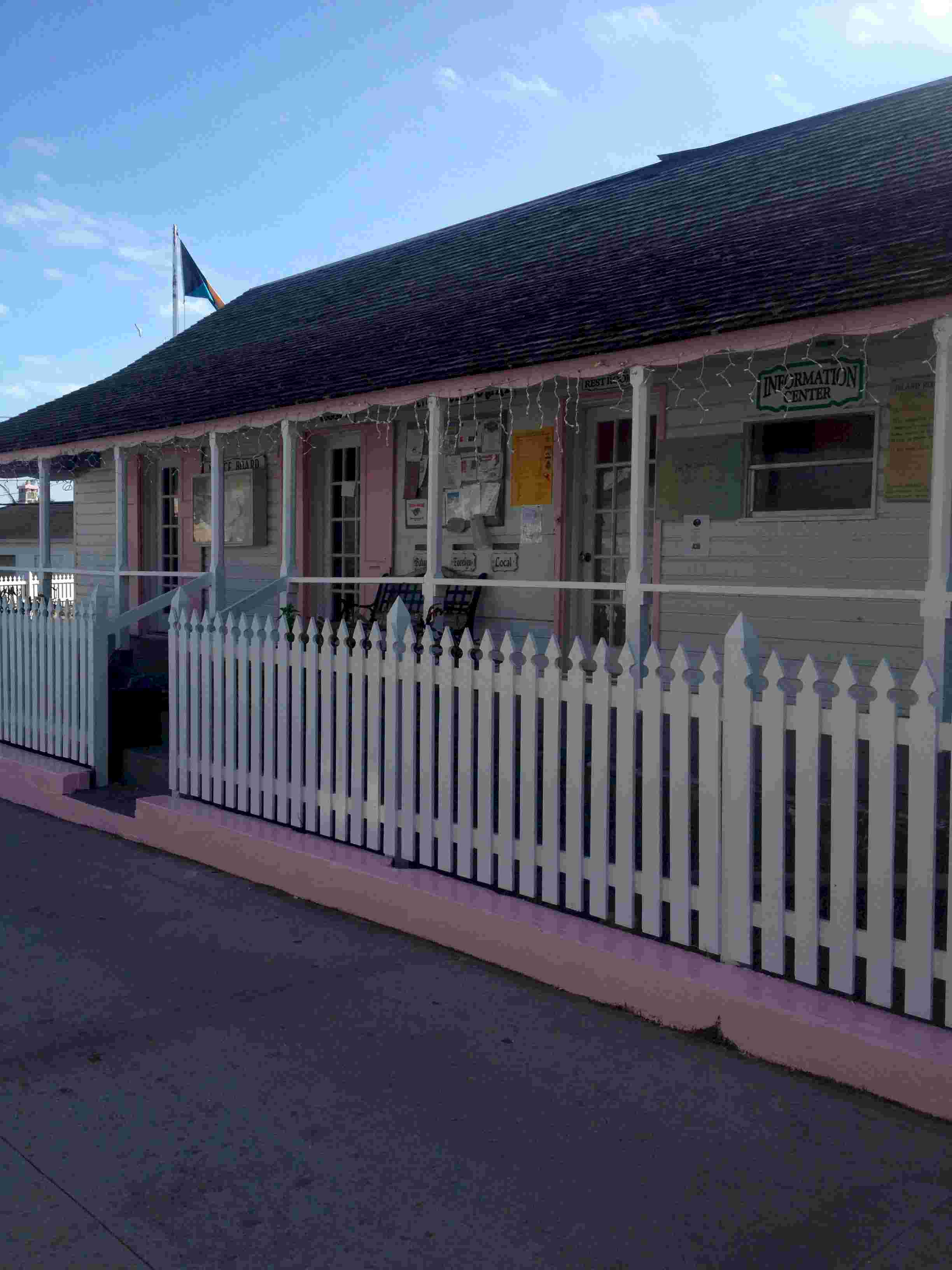
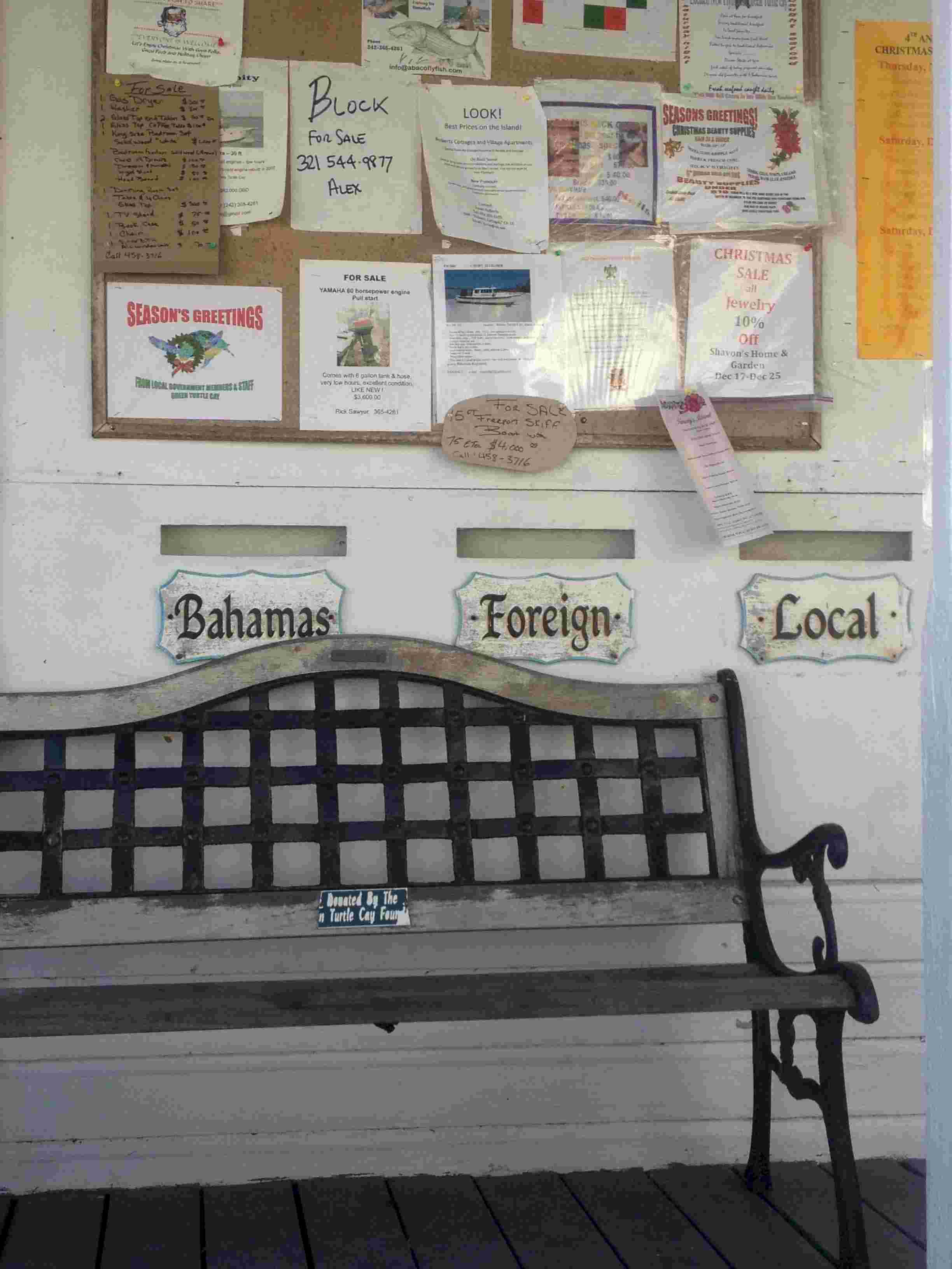
In the lower left photo you will see the seat of the local government in Green Turtle. On the porch is a bench where you can take a seat while waiting on the civil servants in the seat of government. Above the seat are three mail slots. Does the arrangement of the slots relative to the bench say something about ones treatment at the hands of government?
|
|
| December 20, 2012,Thursday, Green Turtle Cay -- Great Guana Cay | |
| Roughly speaking the Sea of Abaco
is divided into northern and southern halves by a sandbar. Getting past the bar requires
going out to sea and back in again around Whale Cay. The two inlets that one uses
can be impassable when the wind has a strong northerly component to it. In fact, the
Bahamians refer to the sea condition when the inlets are unusable as a Rage. Since
the wind was from the southeast in the morning we chose today to get around Whale Cay to
be sure that Wolfgang would be in the right end of the Sea of Abaco to get his flight out
of Marsh Harbour on Christmas Day. The original plan was to anchor off Guana Beach Resort, where I had anchored when Christopherand Tara were with me in 2007. The morning wind forecast led us to believe that this would be a good location. As the day wore on the wind built a little more than expected. We went into the resort to use their Wifi to check the weather forecast. The wind forecast now called for a very fast moving front bringing very high winds from the S and SW, making our location untenable before daybreak. As we were headed back out to the boat a couple of local kids came by in their skiff and warned us about the approaching front. With little daylight left we scurried around Delia Island to Orchid Bay Marina. The marina is a very pretty place with adequate protection from the front. We were the only people to come in. A few Moorings charter boats came in and picked up mooring balls that will believe belong to the company. |
|
| December 21, Friday, Great Guana Cay | |
| We made the right choice to come through Whale
Cay when we did and to have come into the marina. The front came through very strong
and very fast. We stayed in the marina today to let the front blow itself out. The
winds have been over 20 knots from SW through NNW. Tomorrow should show a drop in wind so
we can leave here. After the rain stopped we went on a walking tour of the area around the settlement. In recent years the whole island has seen many houses built for outsiders. A really egregious project is the development at the north end of the island at Baker Bay. The project was just getting underway when Christopher, Tara and I were here in 2007. For starters the developer was permitted to blast a channel into the interior of the island and construct a complex of canals and slip space and then build a multitude of houses. In 2007 the locals had their knickers in a twist even though the project was a fait accompli. They were not altogether convinced that the developer would make his project self contained. I.e., no garbage impact, no impact on the fresh water table, no impact on the reefs from digging our his canals and inlet. They wondered publicly if they weren't paying to high a price for local jobs. |
|
| December 22, Saturday, Great Guana Cay to Boat Harbour | |
| Boat Harbour is on the south side of the isthmus and peninsual that create March Harbour. After 48 hours of high wind we pulled out of the Orchid Bay Marina on Guana Cay to find refuge for the night so that the next day we could head around the peninsula and into March Harbour. Although it took a few tries to get the anchor to grab, this turned out to be a good location while the wind continued to have a northerly component to it. It surprises me that the charts do not show this as a viable anchorage in such winds. We came here because we felt that Marsh Harbour would be crowded since it is regarded as an all weather anchorage. | |
| December 23, Sunday, Boat Harbour to Marsh Harbour | |
| Today we sailed every point of
sail. We had a beat as we headed east toward Hope Town, a beam reach as we made the
left turn to go around the end of the peninsula, then a run and broad reach as we turned
back west toward Marsh Harbour. Diehards that we are, we didn't turn the engine on
until the boat speed finally fell to less than two knots in the diminishing winds as the
cold front finally passed through. We got in early enough that we were greeted by
Franklin who has been here for three months and informed us that the happenin' place is
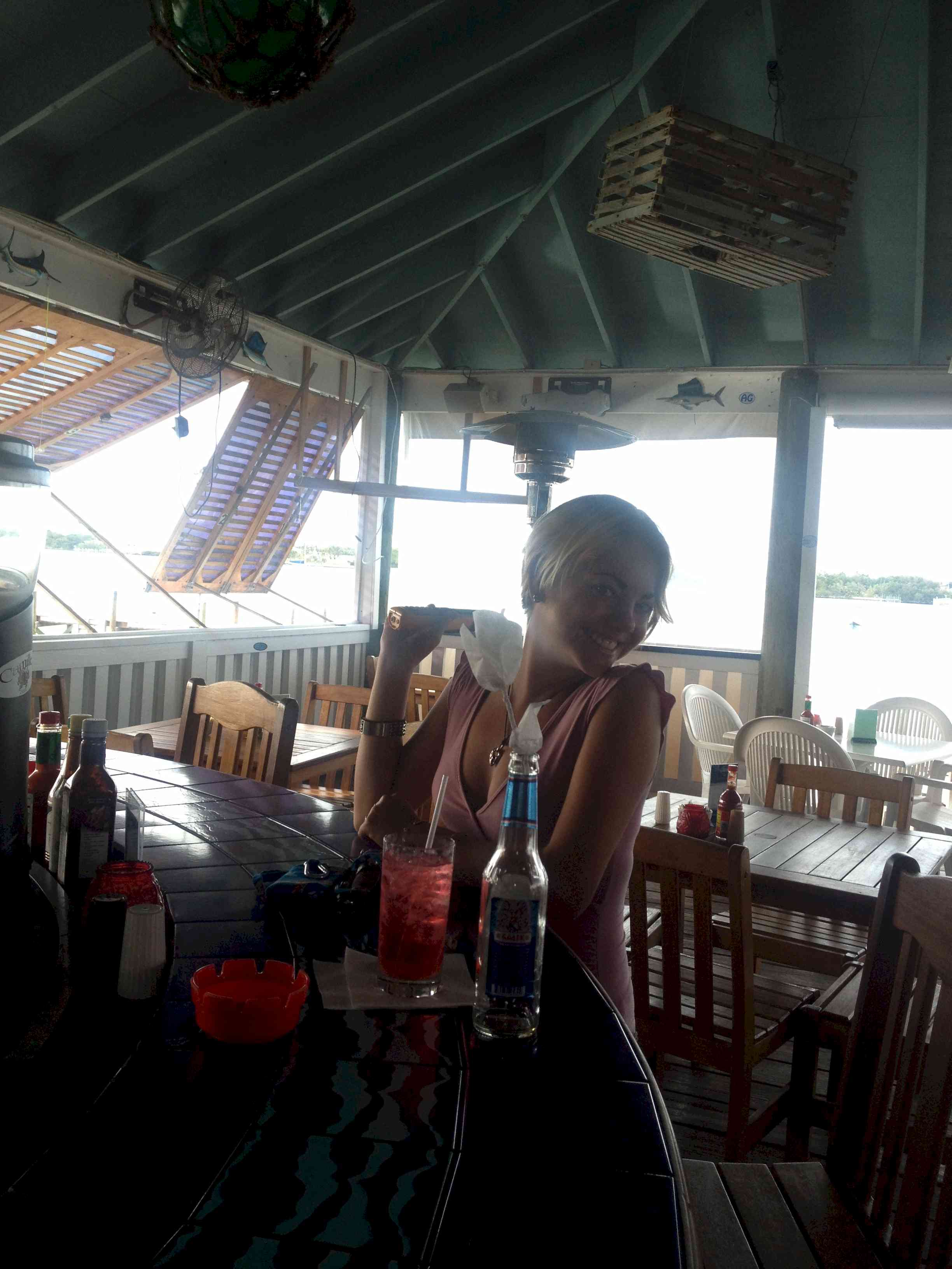
Snappa. After a stroll through town we stopped at Snappas for a beer. The
cruising community is a colorful crowd. No sooner had we sat down than a mother and
daughter came in seeking a dinghy ride out to their boat. Franklin jumped at the
chance to help mom, leaving the two old guys to look after the daughter at the bar.
Katie, the daughter, set about flirting with Wolfgang. Or maybe it was the other way
around. Anyway, she very quickly turned a paper napkin into a white rose.
Turns out that Katie's flight to Nassau had been canceled at the last minute so they were
doing a little problem solving. In addition, Franklin asked Katie whether or not she
remembered him flirting with her in Hope Town a few weeks back. Oh, to be young and
so full of nonsense.
|
|
| December 24, 2012, Marsh Harbour | |
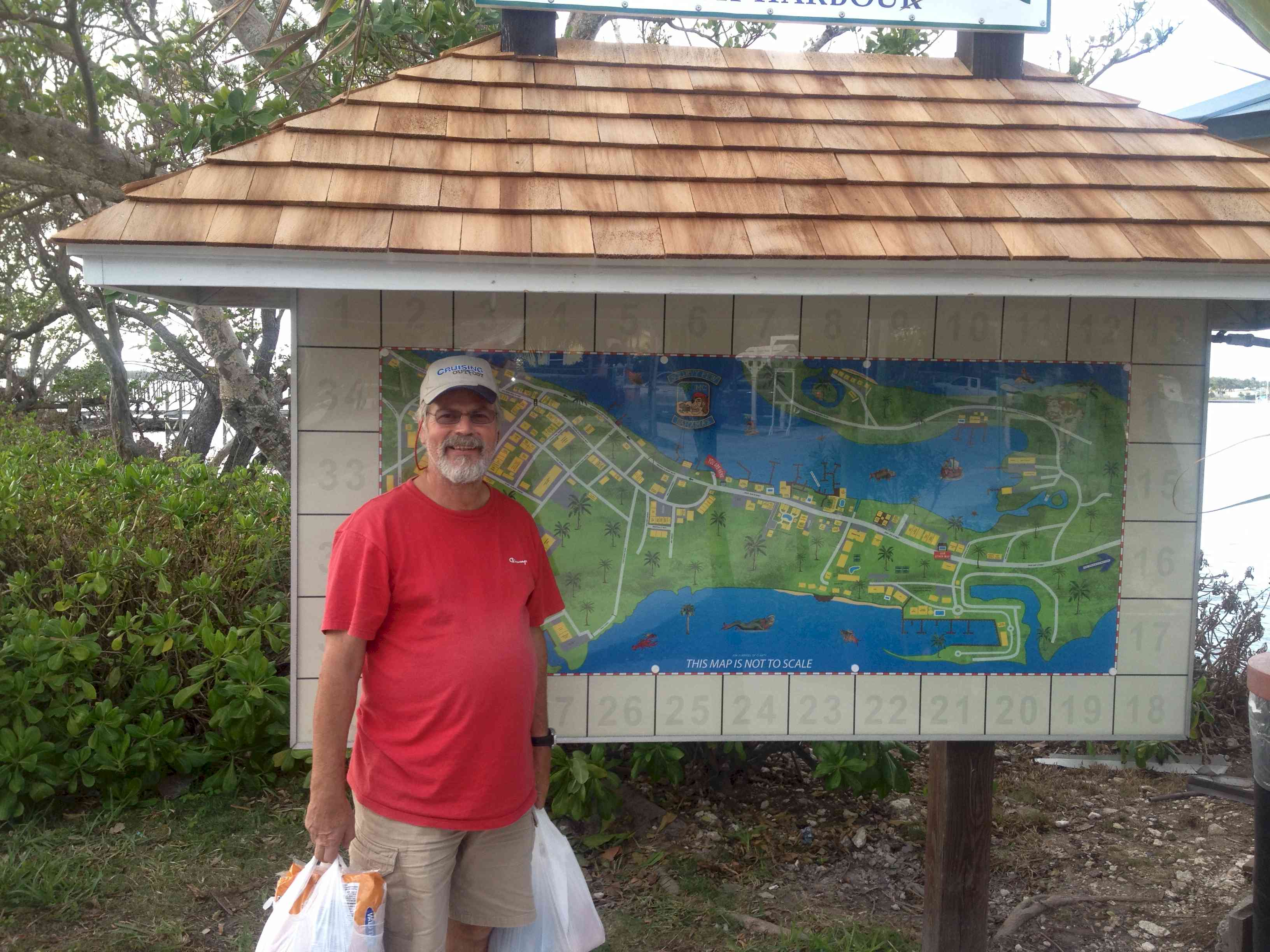
| Today we visited the grocery store
and the liquor store to pick up essential provisions. We also crawled through a few
boutiques so Wolfgang could find something to make amends with his wife after being gone
about a month, and a t-shirt for her son. On the left Wolgang is laden with the results of
the day's shopping while trying to find our location on the map of Marsh Harbour in the
background.
In the afternoon we went to an impromptu gathering of cruisers at the Marsh Harbour Marina aka the Jibroom. The marina is pictured at the right. We got an invite because I know fellow Caliber owners Ron and Dawn Hughes on DawnTreader. The crew from about five boats all contributed hors d'ouevres for a wonderful afternoon repast. There was so much food that we didn't bother with dinner when we got back to the boat! |
|
| December 25, 2012, 2012, Marsh Harbour | |
| Merry Christmas everyone.
This morning Wolfgang flew home. He was a gracious, considerate and knowledgable
crewmate. If he had not stayed on even after learning that we would be stuck in
Fernandina Beach for more than 9 days while I took care of my hernia problem, then I would
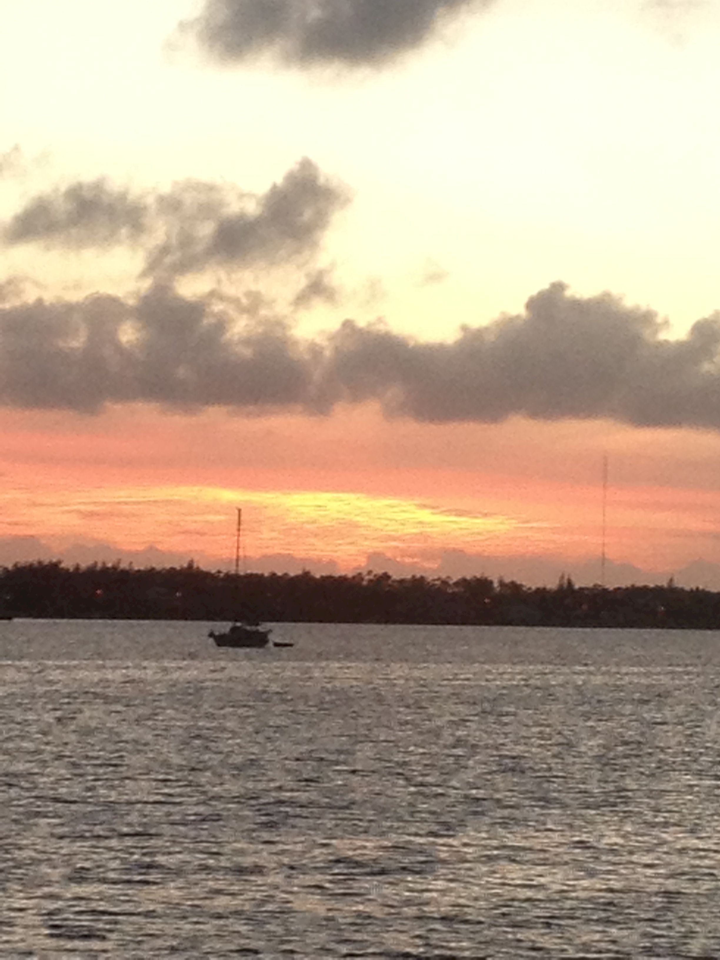
still be in the ICW somewhere between Charleston and Florida. Today in particular I am missing my family and my old life, even as I enjoy the warm sunshine and gentle breeze. To celebrate Christmas I looked after the boat. Check and top up the H2O in the batteries, check the transmission fluid, adjust the stuffing box drip rate, change engine oil, check bolts on the prop shaft - transmission coupling. The stuffing box is a gland through which the propellor shaft passes. It is packed with flax twine and it must be tightened just enough to allow about 6 - 10 drips per minute to keep too much water out and allow enough through to keep the whole thing cool. The batteries need a bit of water in each cell; this is normal with constant use. The prop shaft bolts needed tightening after 150 hours of run time. Recall that back at the NC Visitors Center on the ICW I had found that they were loose and one had fallen out. This is not usual and bears constant attention; not every day, but frequent checks. Christmas lunch was a largebowl of conch chowder and a couple of slices of multi-grain bread. For Christmas dinner I had a medley of veggies on the grill with my prime rib steak and finished it off with fruitcake. Finally, a beautiful Bahamian sunset in Marsh Harbor.
|
|
| December 26, 2012 Boxing Day, Marsh Harbour | |
| Very, very quiet today. Everyting was closed for the national holiday, even the coin operated laundromat which I had hoped to use today. | |
| December 27, 2012, Marsh Harbour to Bridges Cay across from the Little Harbour Cut. | |
| On the way east toward Hope Town I
sailed a close reach. Once I made the turn south most of the day was spent on a
broad reach and a run. Toward the end of the day a Moorings charter catamaran was
able to take a shortcut through shallow water and come up behind me. I could feel
the electro-magnetic aura given off ny the charterer: He was going to show me how a cat
can sail downwind. Struggle as he would, jibing from one borad reach to the other
and trying to imitate my wing-and-wing set of the sails, he just couldn't catch me.
In spite of what many say, the Caliber is a great sailing boat. My anchorage on the southwest side of Bridges Cay would have been perfect if not for the barking dogs on shore. |
|
| December 28, 2012 Friday -- Bridges Cay / Little Harbour Cut to Royal Island | |
 This morning I got up and left early, going through the cut even before sunrise: I wanted to be sure that I would be down at Royal Island in the middle afternoon so I could see any hard things on the bottom that I might collide with and to be sure that I found a place to anchor. It was pretty nerve wracking to go through this cut in the near dark. Once out in the ocean I was greeted by the rising sun. Neither the bottom nor the anchorage turned out to be an issue. The Royal Island anchorage is pretty large and the Eleuthera Banks are well surveyed; there are no surprises that aren't on the chart. On my way south I was sailing a close reach in 10-13 knots apparent wind. Andante was rolling along at 6.5 - 7 knots with all the telltales on both sails streaming striaght back. In spite of my fast progress two catamarans raced by me in quick succession. One was "No Rehearsal," a Catana 52 sailed by Daryl Davies and Annie Presst. At that size and point of sail it was no wonder they zoomed by. Not too much later the second cat came by. They were flying THREE sails in their fore triangle and throwing rooster tails off the sterns of the hulls. "Outsider" turned out to be another 50 footer built from the plans for the now defunct Manta line of cats. In the eveing Daryl and Annie hosted cocktails on their boat. BTW, these are BYO affairs with everyone contributing an appetizer and conviviality. The crowd included me, Ian and his wife from "Outsider," and Francie and Biob Sadler from "Barefootin." Ian and Daryl both commented on how pretty and fast Andante looked while underway. |
|
| December 29, 2012 Saturday -- Royal Island to Nassau | |
| I had been watching the weather
for the last five days. The forecast was that today the wind would be SSE and S,
meaning it would be a beat to get to Nassau. The forecast for Sunday was NW wind at
30 mph. Then beginning Monday through the end of the week the wind would mean motoring
into the wind or motoring with no wind at all. "Outsider" had already
decided that they would ride the NW wind down to Nassau to meet their daughter coming in
on Jan. 2. At 50 feet with two people on board the prospect of 30 mph of wind is not
offputting. Out on the open water I would be fine on a beam reach or close reach in
that wind, but I also have to think about what is going to happen at the destination end
of the trip. To improve my angle of attack on the wind I motored 6 miles down to Current Rock then turned to the SW. Sure enough I had to sail close hauled, and even then I had to tack twice. In the end I motored the last 5 or 6 miles to be sure I got to Nassau Harbour Club Marina before everyone went home. I have been into Nassau Harbor Club twice before: 2000 when we came here with Adagio and in 2010 when I crewed for Margo Roark on Baja Beagle. Not much has changed over the years. There is a hotel on the premises and they do have guests, but not many. There are also facilities for a bistro and a restaurant, but neither was open in 2010 and neither is open now. On the plus side there is a strip mall across the street with a fabulous Fresh Market grocery store. It's like stepping into a stateside grocery, albeit at Bahamian prices! |
|
| December 30, 2012 | |
| Laundry! I have enough clean clothes to last two weeks, so when I do it I have a mega load and the dirty laundry bag, which is mesh and hangs near my bed, is pretty rank. The washing machines here at NHCM are about the best since I left Rock Hall. | |
| Back toNovember 2012 Ahead to January 2013 | |
 While I have been weeping and wailing about my medical problem my
daughter-in-law, the lovely Tara Lewis Buck, was hard at work bringing my granddaughter
into the world. Jaiden Elizabeth Buck was born on 12-10-2012 and weighed in at 7 lbs
4 ozs. Jaiden's great-grandmother has dubbed me Grampy, perhaps because it sounds
very much like grumpy? In the top photo you can see Christopher and Tara already
have a book open behind the baby's head. Give the girl a break, she still has a few
years before she has to start prepping for admission to university! All kidding
aside, I am greatly moved to find myself a grandfather and can't wait to get to
Massachusetts to see Jaiden and her parents.
While I have been weeping and wailing about my medical problem my
daughter-in-law, the lovely Tara Lewis Buck, was hard at work bringing my granddaughter
into the world. Jaiden Elizabeth Buck was born on 12-10-2012 and weighed in at 7 lbs
4 ozs. Jaiden's great-grandmother has dubbed me Grampy, perhaps because it sounds
very much like grumpy? In the top photo you can see Christopher and Tara already
have a book open behind the baby's head. Give the girl a break, she still has a few
years before she has to start prepping for admission to university! All kidding
aside, I am greatly moved to find myself a grandfather and can't wait to get to
Massachusetts to see Jaiden and her parents.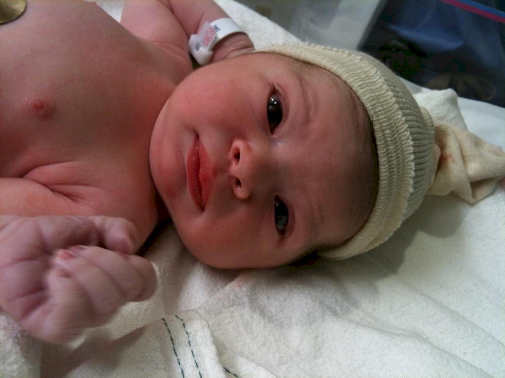
 This
attack shrimp lives on the dock at the Fernandina Harbor Marina. Fernandina Beach
and the St Mary's River claim to be the place where the American shrimping industry got
its start. By the city's own admission the shrimping industry here is a shadow of
its former self. Nevertheless that have an annual shrimp festival in May. On
the morning of January 2, 2013 the marina will start accepting reservations for the
festival. The dockmaster told us that they will be sold out by the eveining of
January 2! Moreover, they estimate that 100,000 folks will come into town for the
festival. Now that is a popular festival.
This
attack shrimp lives on the dock at the Fernandina Harbor Marina. Fernandina Beach
and the St Mary's River claim to be the place where the American shrimping industry got
its start. By the city's own admission the shrimping industry here is a shadow of
its former self. Nevertheless that have an annual shrimp festival in May. On
the morning of January 2, 2013 the marina will start accepting reservations for the
festival. The dockmaster told us that they will be sold out by the eveining of
January 2! Moreover, they estimate that 100,000 folks will come into town for the
festival. Now that is a popular festival.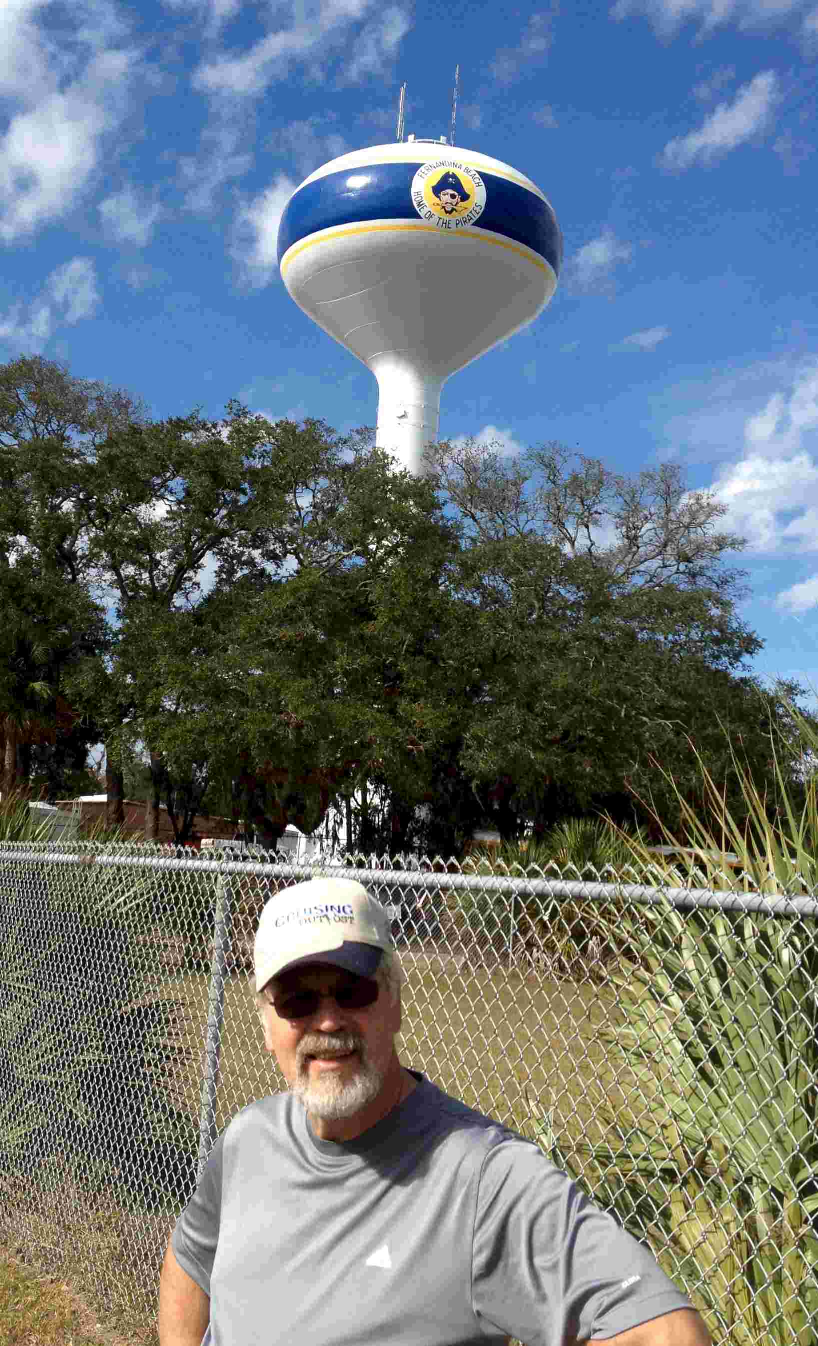
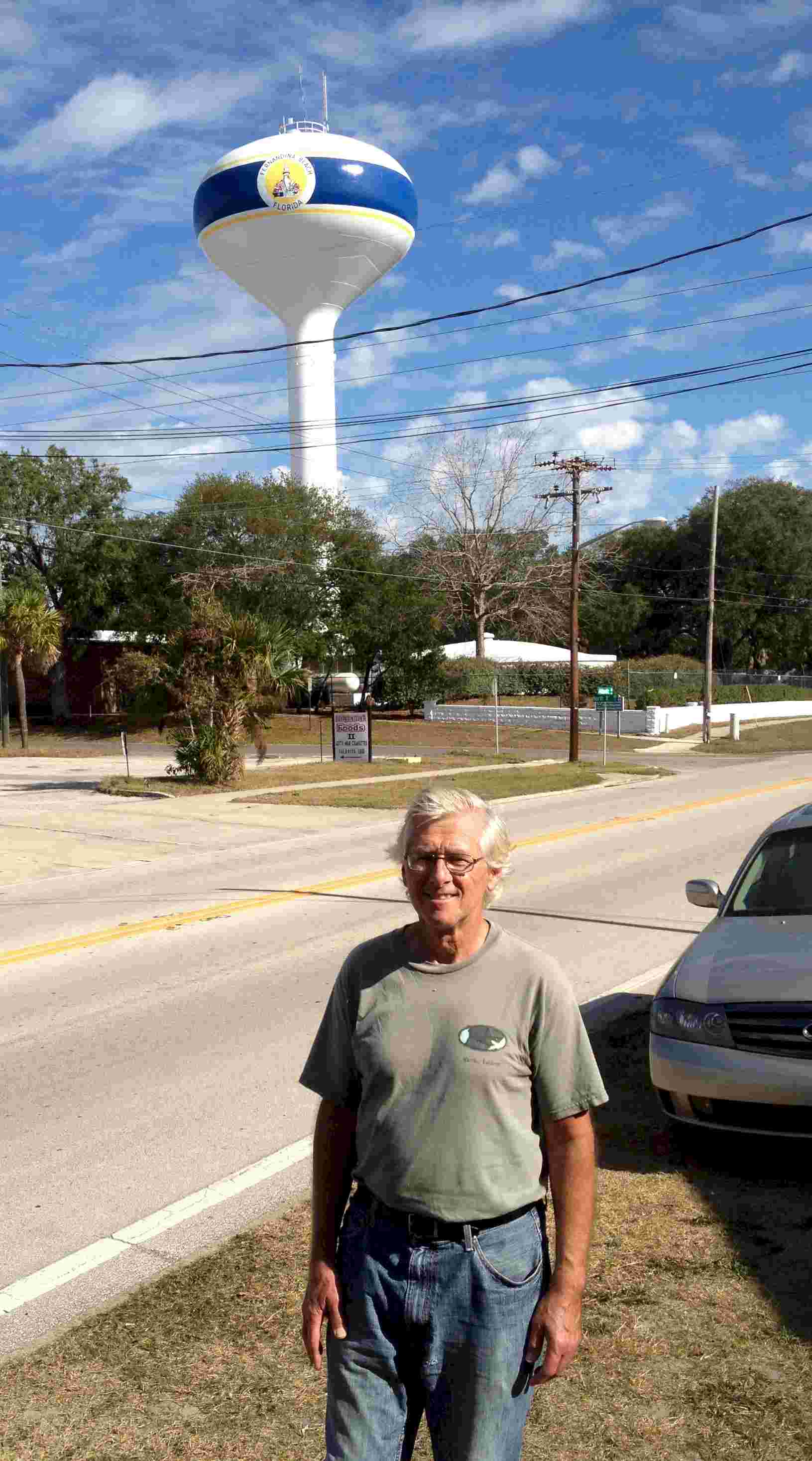 This pair of photos is of the sam water tower. On
one face, over Wofgang's head, it displays a rendering of the local high school mascot; a
buccaneer. On the opposite face it displays a rendering of the Fernandina Beach light
house. Ani interesting case of split presonality.
This pair of photos is of the sam water tower. On
one face, over Wofgang's head, it displays a rendering of the local high school mascot; a
buccaneer. On the opposite face it displays a rendering of the Fernandina Beach light
house. Ani interesting case of split presonality.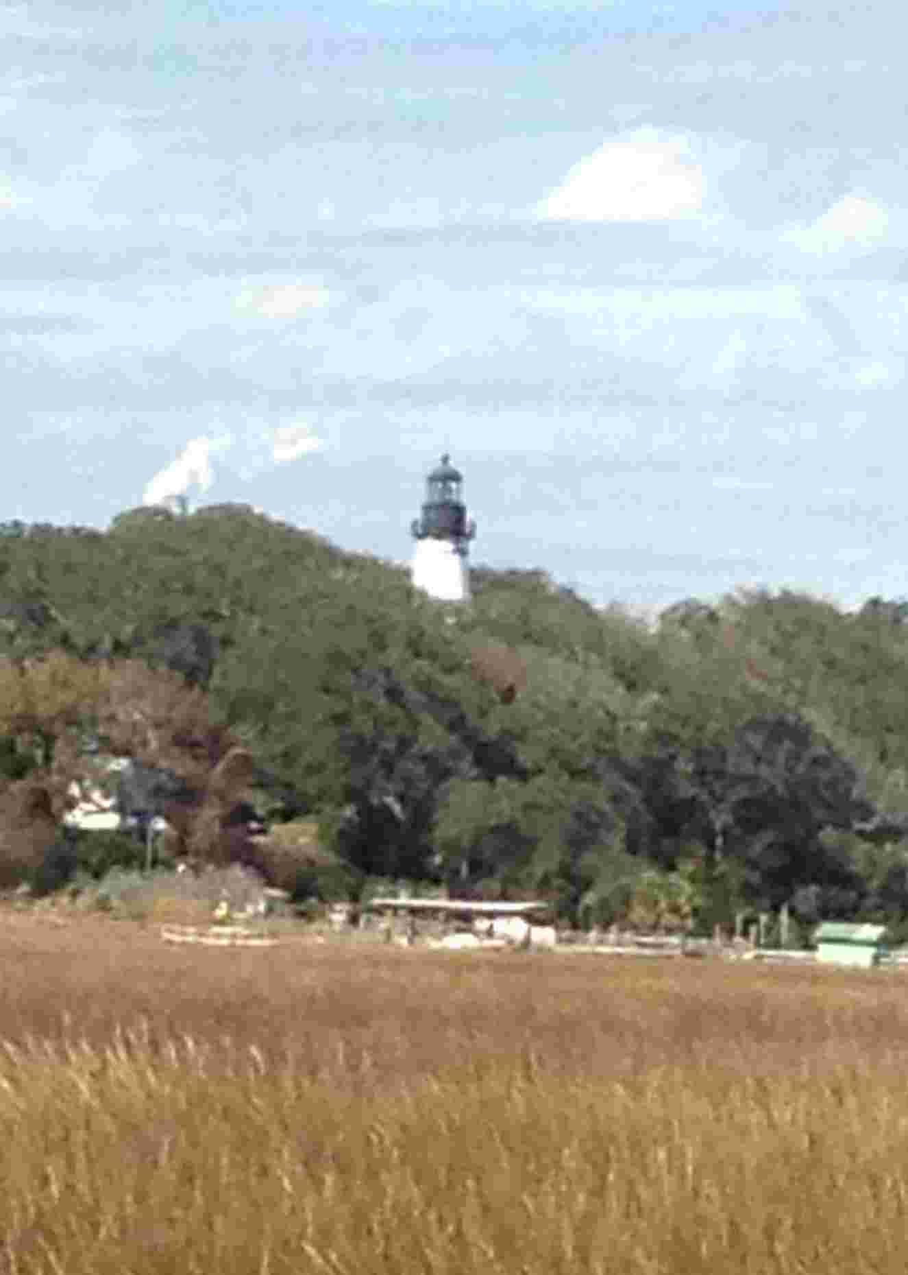 The Amelia
Island light house is now on Egan's Creek about one mile west of the beach and two miles
south of the St Mary's River inlet. When it was originally built in 1820 it was on
the north side of the river on Cumberland Island as that was the southern border of the US
and Amelia Island was under Spanish rule. In 1838, after the Spanish ceded the island to
the US the lighthouse was dismantled and moved to Amelia Island.
The Amelia
Island light house is now on Egan's Creek about one mile west of the beach and two miles
south of the St Mary's River inlet. When it was originally built in 1820 it was on
the north side of the river on Cumberland Island as that was the southern border of the US
and Amelia Island was under Spanish rule. In 1838, after the Spanish ceded the island to
the US the lighthouse was dismantled and moved to Amelia Island.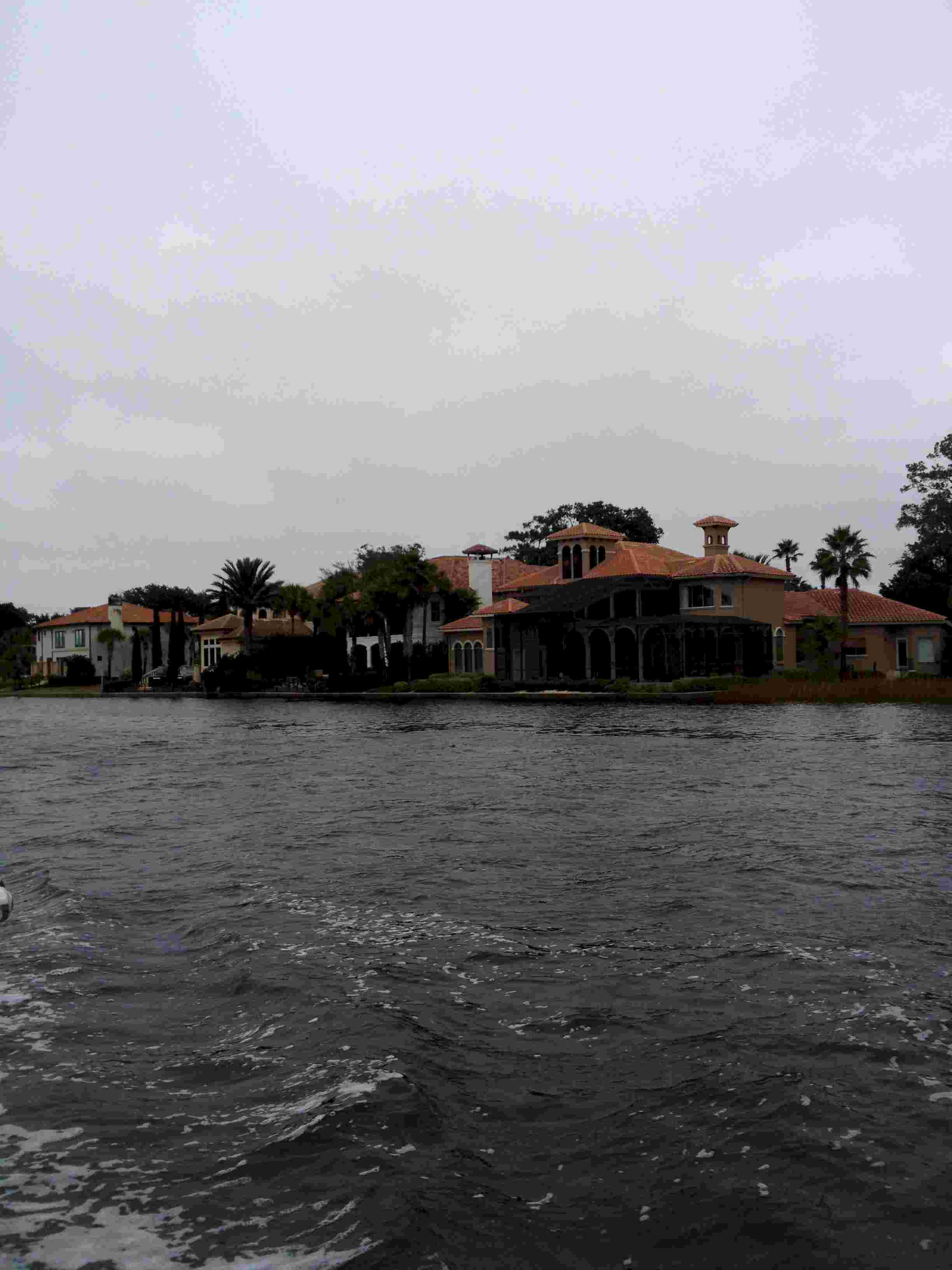 The
other noteworthy element of the leg was the number of McMansions along the waterway.
Mile after mile of them. In our rush to get as far south as possible to catch a
weather window for the Bahamas we put in 60 miles today. At the pace of a sailboat
under power that is a great distance.
The
other noteworthy element of the leg was the number of McMansions along the waterway.
Mile after mile of them. In our rush to get as far south as possible to catch a
weather window for the Bahamas we put in 60 miles today. At the pace of a sailboat
under power that is a great distance.