| Andante's Sailing Blog January 2013 Blog Table of Contents |
|||||||||||||||||
| Back to December 2012 Ahead to February 2013 | |||||||||||||||||
| January 1, 2013 - January 3, 2013 Nassau Harbor Club Marina | |||||||||||||||||
|
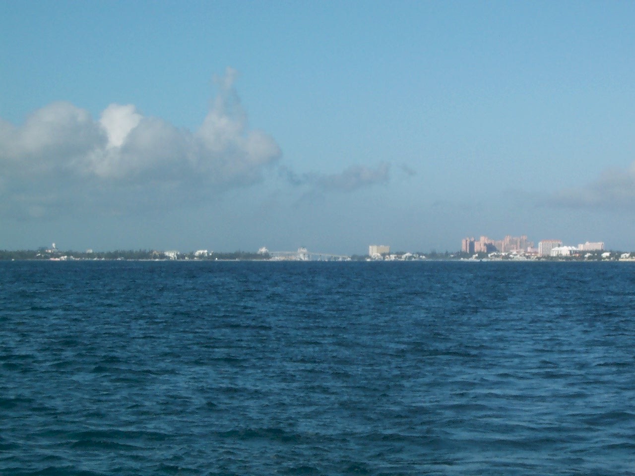
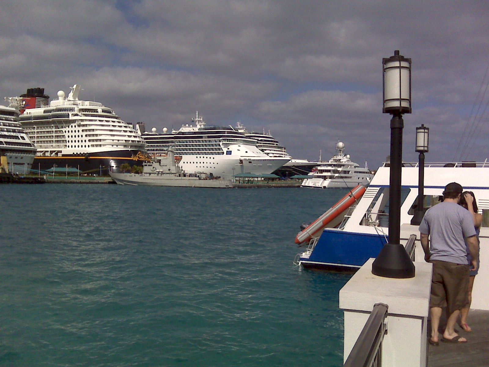
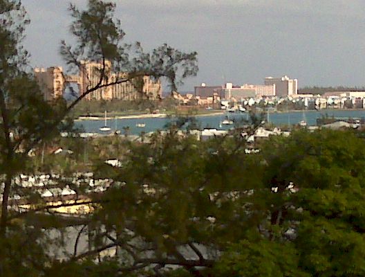
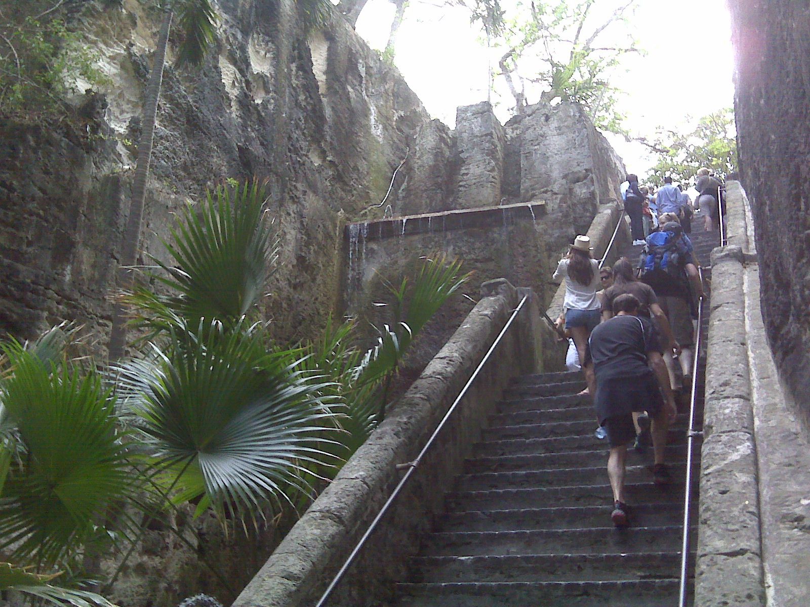
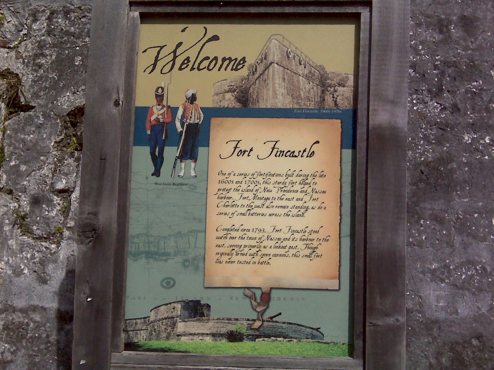
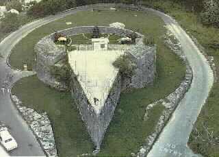
Some remarks about Nassau, past and present: There is a new Fresh Market across the street from Hassau Harbor CLub Marina. On every dimension it rivals the Fresh Market stores in the US. Except of course it is more expensive, understandably. 12 years ago we surreptitiously went onto the Atlantis property to see the aquarium and go on the water slide; all with no challenge. A young couple here at NHCM tried that subterfuge to enter the grounds of Atlantis and were unsuccessful. Since the resort now charges $200 for a day pass they are very vigilant about who is coming and going. All by way of saying that I have not bothered to walk over there. The straw market in Nassau is 'famous.' No straw hat. In defiance of a fellow cruiser's recommendation some weeks ago I still have not gotten a haircut so I did contemplate getting my hair braided. When I was here for an academic conference many years ago and had Christopher with me we both had braids put in our hair. Being older and wiser I exercised some restraint. I did walk up the Queen's Steps and visit Fort Fincastle at the top. Spectacular views. See the above pictures. 12 years ago there were only ever two cruise ships in the harbor at once. As I was approaching Nassau on my way over from Eleuthera I heard many loud blasts on a ships horn and there seemed to be a lot of voice traffic with the Nassau Harbor Control officer. Yesterday I walked over to the cruise ship pier to see what had produced all that commotion. There were 4, yes four, huge cruise ships on the pier. See the above photo. Nassau was crowded with tourists. Given the general state of neglect still to be seen I am wondering where all the cruise ship and tourist money is going. |
|||||||||||||||||
| January 3, 2013 -- Nassau | |||||||||||||||||
| Diana arrived today. We went to the grocery
store and to Potter's Cay. Potter's Cay is an area beneath one of the bridges to Paradise
Island. It sole existence is to provide sustenance to those adventurous enough to
brave what surely would not pass muster with any restaurant inspector in an American city.
If you want conch fritters or conch salad then this is the place to go. Unfortunately I don't think Diana's stomach was strong enough to handle the concho fritters. No problem for me, mon. Across the street from Nassau Harbor Club is a new Fresh Market. This grocery is a taste of home, but the prices are all at least 50% higher. Guess you can't expect less since everything has to be brought in by boat or plane. |
|||||||||||||||||
| Friday January 4 - Saturday January 5, 2013 Nassau to Allan's Cay | |||||||||||||||||
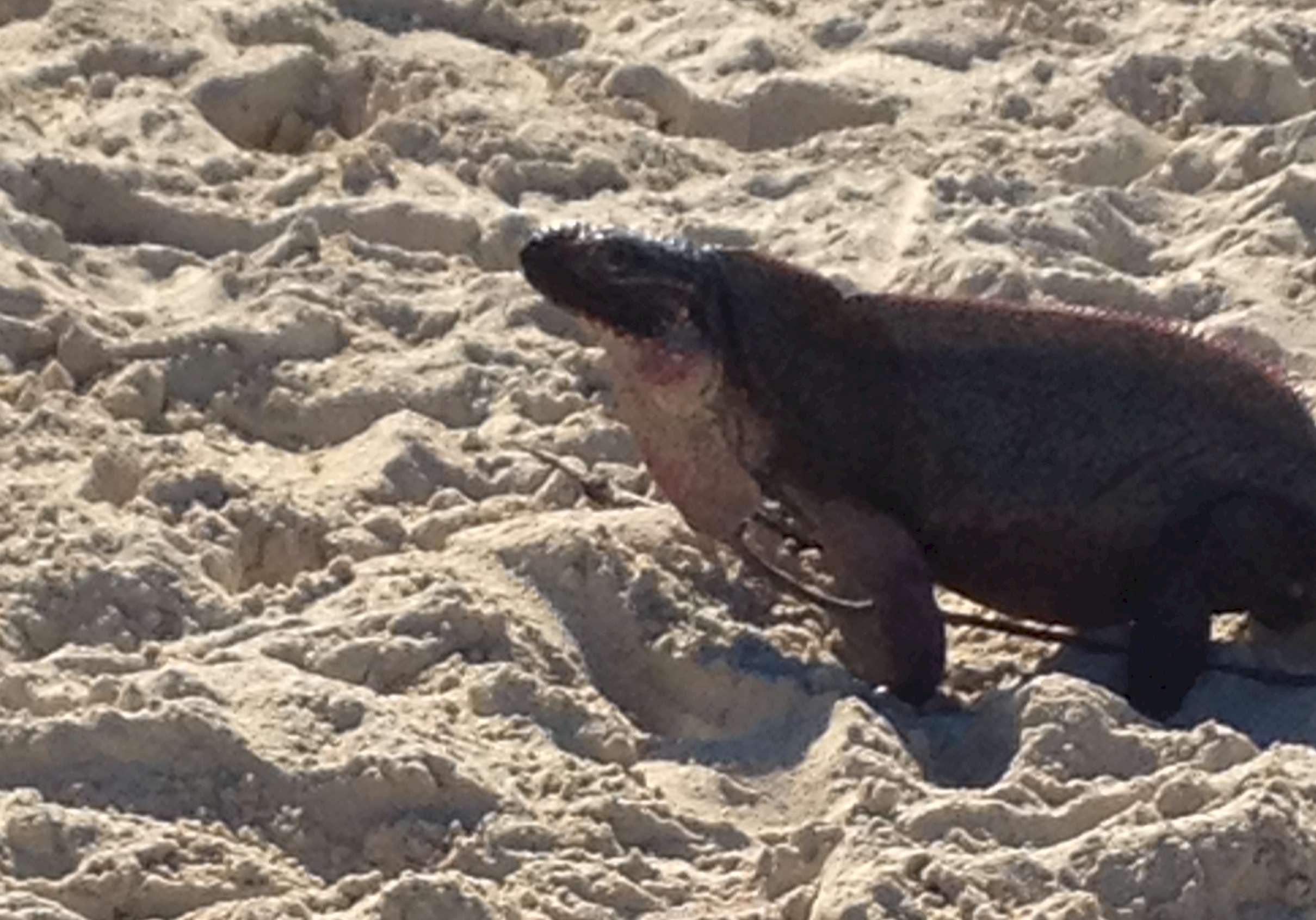
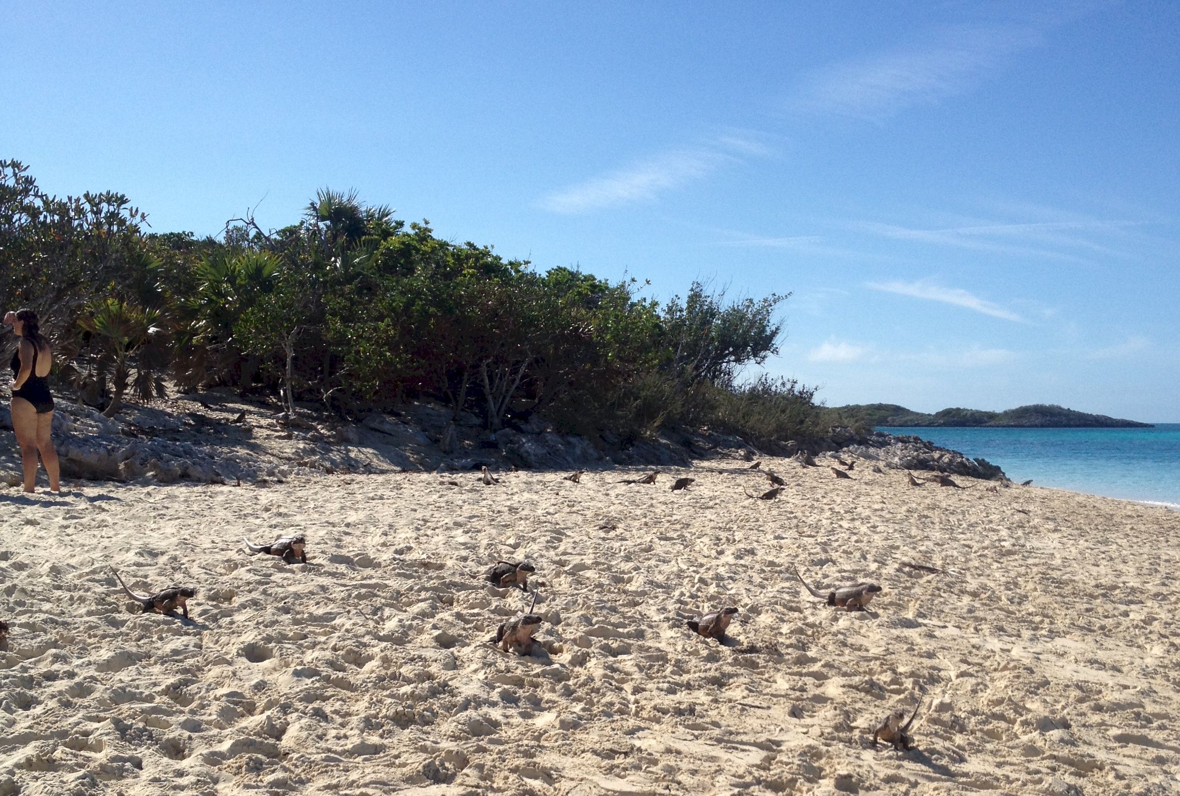
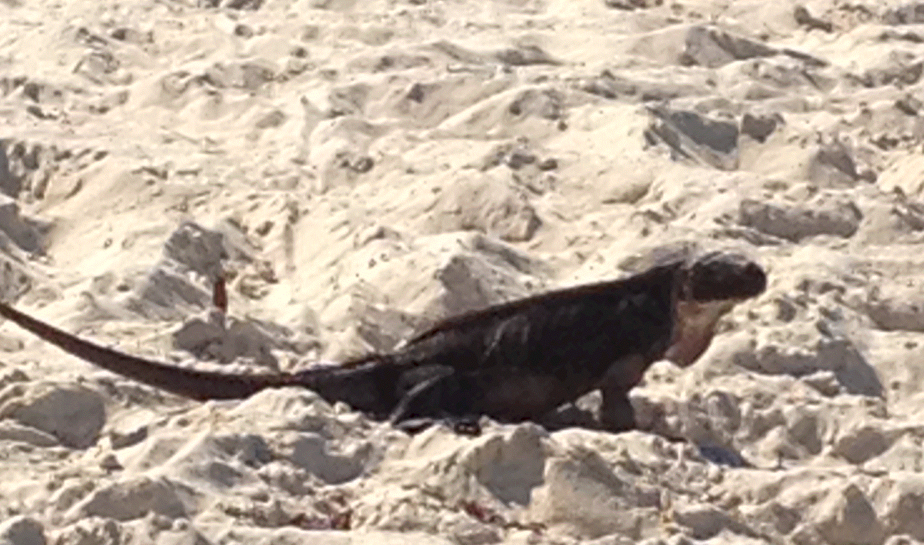
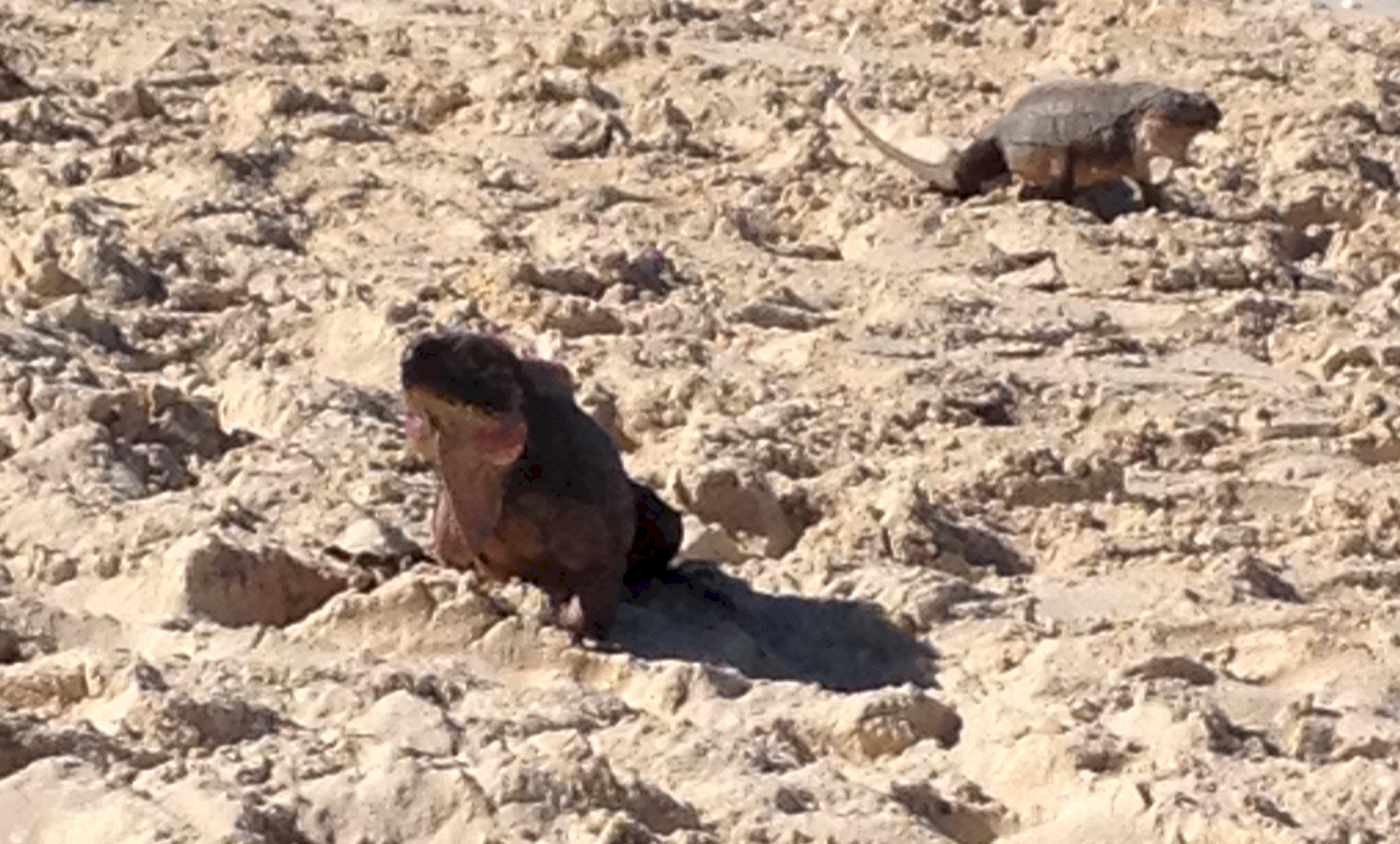
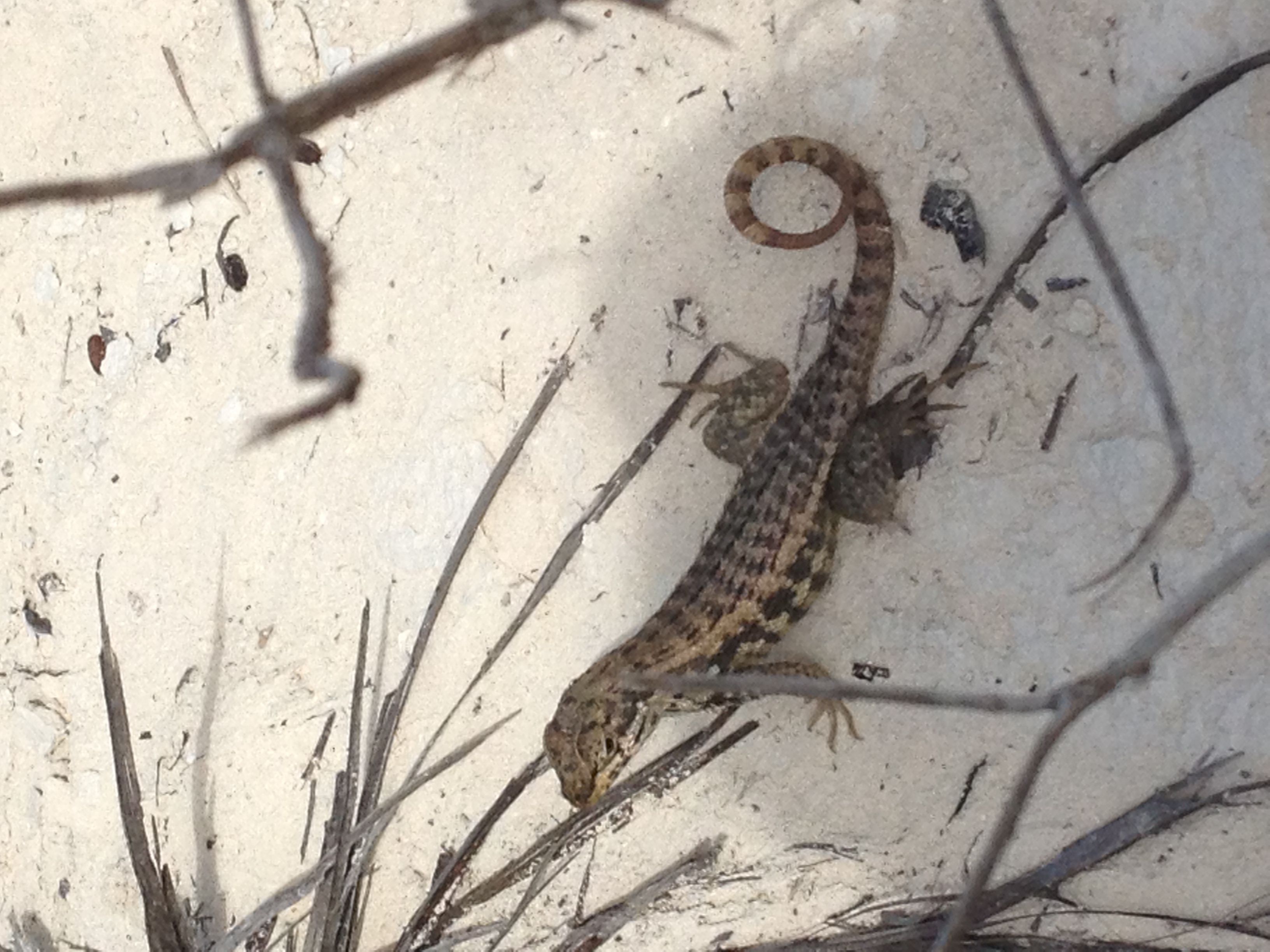
 This picture was taken as we were exiting Nassau Harbour and headed east to Allan's Cay. In the center of this picture is one of the bridge spans between Nassau and Paradise Island. In the center of the span there is a white rectangular object. That object is a cruise ship. They are huge. The perspective makes them seem almost as large as some of the high rise hotels on Paradise Island. This was our first stop in the Exuma chain. There was little wind and from the east so we had to motor the 28 miles. Upon arrival we were greeted by 12 other boats, making this small anchorage pretty cozy. In the distance I could see the roads (as in the anchorage for a harbor, kind of like Road Harbor, BVI or Hampton Roads, VA) for Highborne Cay. There were seven mega-yachts lined up out there. When we got to our destination I dove on the anchor to be sure that we were connected to the bottom. Back in Nassau I had seen Paul from San Pecaro swimming under his boat. On inquiring what he was doing he told me that he had noticed his shaft zinc was gone, so he got in the water to replace it. Once he was down there he also could see that his cutless bearing had slid out of its home and down the shaft. With this in mind i decided I would take a look at my shaft zinc as long as I was already in the water; and besides, I had checked on since I was in Swan Creek four months ago. To my shock my zinc was also missing. To my greater horror, while replacing the zinc I found that my shaft strut was loose! With my socket wrenches and vice grip I got the strut back up into its socket and got it tight. I then moved on to check on the propeller shaft -- trnasmission coupling bolts which I had found to be loose back in NC, and which I had had to tighten again 150 engine hours later. I fear all of this goes back to 2010 when the boatyard in FL insisted that I allow them to recenter the propeller shaft and align the engine. At the time they were convincing, but once again the old adage may have proven to be correct: If it ain't broke don't fix it. When I go home next week I will bring back the right wrenches and a set of feeler gauges to get everything tight and check on the alignment. If I can't get it right then I will have to find a yard down here that can do it all from start to finish. This cay is known for its resident iguana population. There are signs on the beach asking that visitors not feed the iguanas. When the mega-yachts bring their guests over in their skiff the guests immediately take out their bags of orange peels and lettuce to feed the iguanas. The result is that the iguana populaton spends the day on the beach waiting for visitors to land.
While here at Allen's Cay we explored tiny Leaf Cay, home to the iguanas, and snorkeled on the reefs just to the north of the anchorage. These reefs are pretty modest, but it was a nice introduction to snorkeling in the Bahamas. There were some small fish and no lairs in which lobster might be hiding. |
|||||||||||||||||
| Sunday January 6 - Monday January 7 -- Allan's Cay to Shroud Cay | |||||||||||||||||
| As with the previous entry this was a travel
day and then a lay day to visit the site.
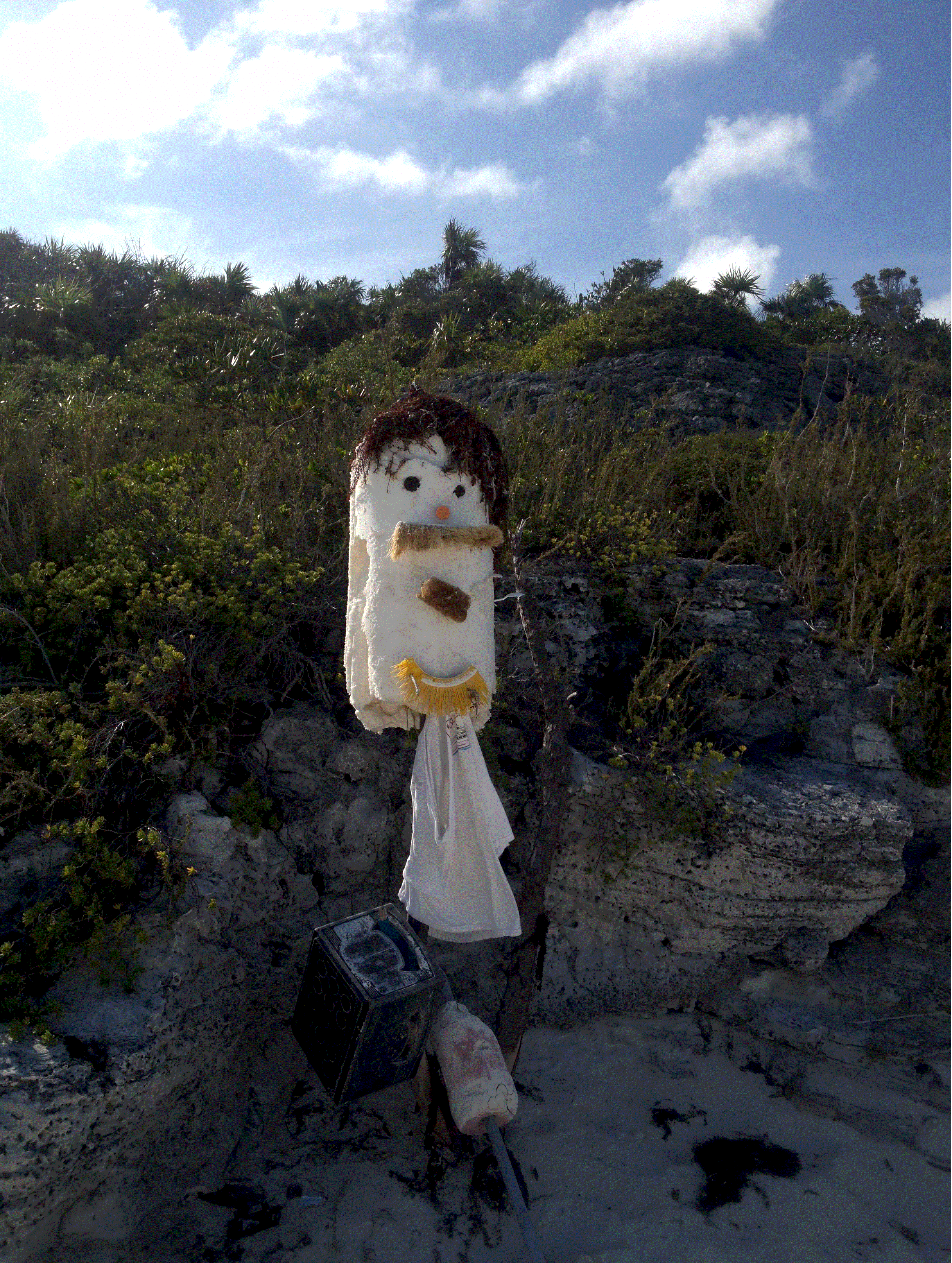
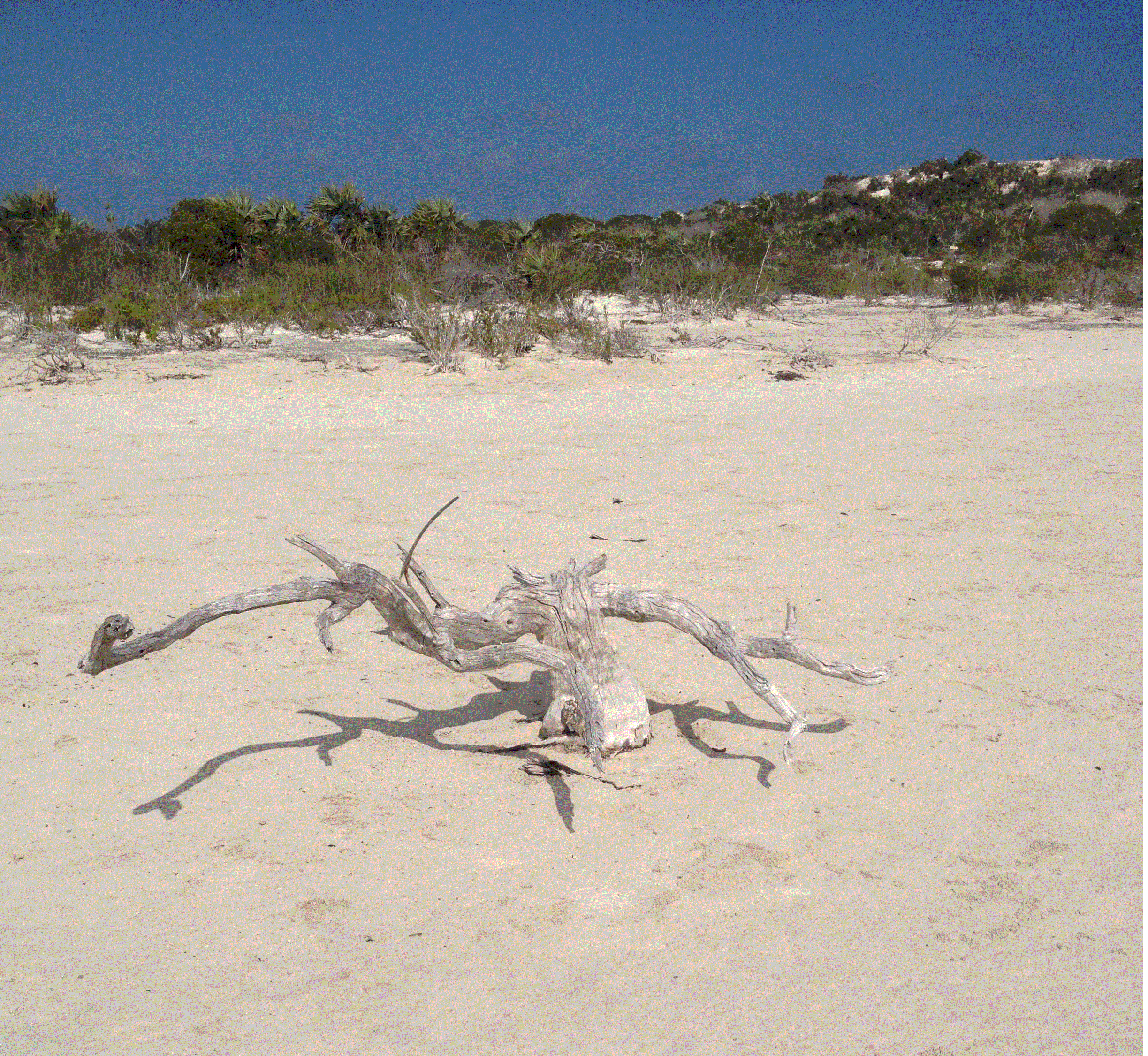
Some enterprising visitors have tried to preserve the Camp Driftwood legacy by erecting these totems on the beach at the base of the hill. They will surely be washed away since they are on the Exuma Sound side of the island. We made the trip over here in the afternoon with Tom from sv Juno. The idea is that one rides the rising tide through the creeks of the mangrove swamp and then get in the water and drift out slowly to get a view of the baby fish swimming amongst the mangrove roots. The intent was there, but high tide was so late in the afternoon that we couldn't do the drift part of the trip. While here we also visited the fresh water well on island. This is a natural well that was used by fisherman and spongers when they were working in the area. Now that Shroud Cay is part of the protected land and sea park I am sure that the only visitors to the well are cruisers. I believe that the 'well' is really a fresh water lens. Rain water seeps through the rock and sand into a void. Since it is less dense than the sea water it cumulates in the void and floats on top of the salt water. Pretty cool phenomenon. |
|||||||||||||||||
| Tuesday January 8 - Wednesday January 9 -- Shroud Cay to Warderick Wells | |||||||||||||||||
| On the first part of the trip to Exuma Park we
sailed on a close reach and then close hauled. Eventually we had to turn on the
motor since the island chain bends to ESE, putting us direclty into the 20 knot wind.
Between the wind and the tidal current I have never motored at such a slow speed
over the ground. This made me somewhat nervous because of the strut problem. While
on the mooring in Warderick Wells I dove on the strut and it seemed tight; getting
everything tight the other day may have cured the situation, or it could just be that
things haven't yet vibrated loose. This issue will require constant vigilance for the
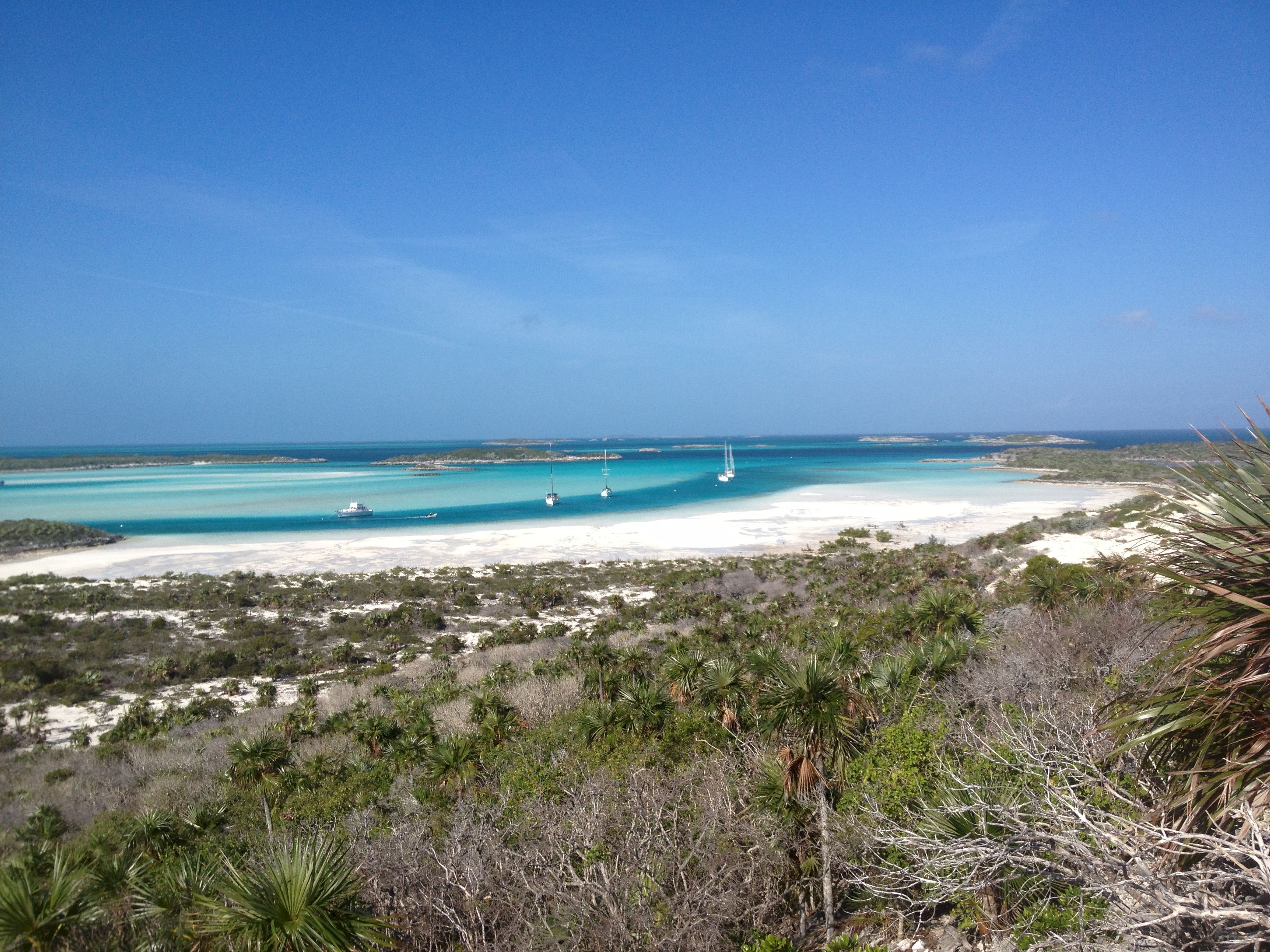
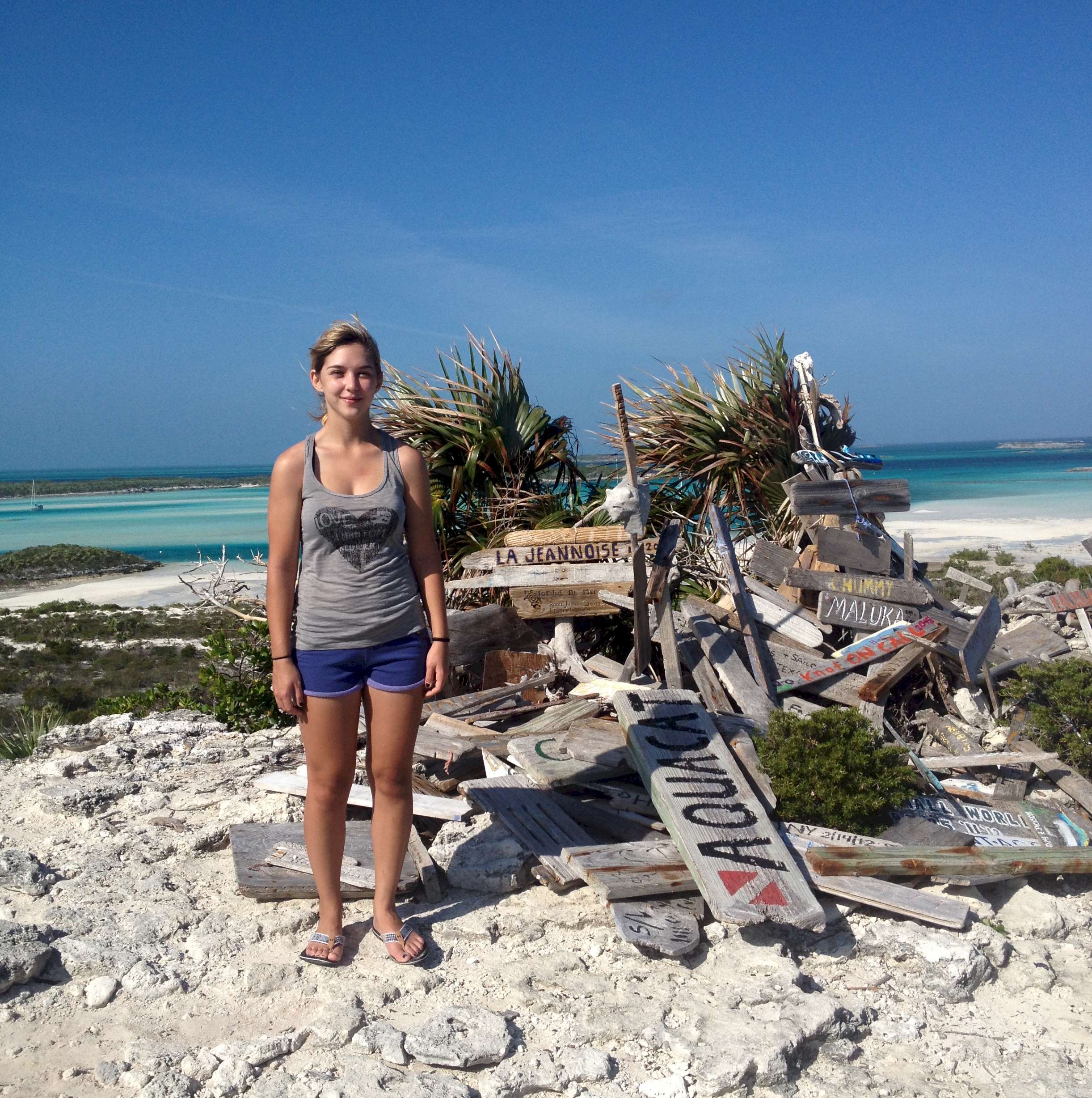
foreseeable future. During our lay day on 1/9 we visited Boo Boo Hill in the morning. The legend is that a schooner came to grief on the rocks below the hill on the Exuma Sound side of the island and all hands were lost. Now, when the wind and moon are just right you can hear the wails of the lost souls. Actually I think it is the wind rushing from the blow holes in the nearby rocks. On the top of Boo Boo Hill there is a cairn, or pile, of offerings to the lost souls from that schooner. Passing yachts leave a memento of there visit. The oldest dated board that we found was from about 15 years ago. A few boards record the repeated visits of the given boat. You can see the cairn with Diana standing next to it in the photo on the below right. The pile is in fact bigger than it appears. The photo on the below left is an iconic image. Every cruising visitor takes a picture of the anchorage shaped like a fish hook with the boats moored in the dark blue water. The lighter colored water is over a sand bar that nearly dries at low water. Another iconic photo that I have not included is the whale skeleton on the beach by the anchorage. The plaque by the whale explains that this particular leviathan met its demise as a result of ingesting plastic. We also snorkeled on the Coral Garden below the ranger's office. Since all the life forms within the park are protected the fish are large and friendly. When I got in the water to check the strut a bunch swam by to see if I was going to feed them. Speaking of large, we found quite a few lobster in their dens in the big rocks and coral heads. How big were they? A warm water lobster doesn't have claws like a Maine lobster. Instead they have long antennae. You can find a picture of a warm water lobster on wikipedia. Suffice it to say that the lobster in the park are so big that their spiny antennae were as long as my forearms and their bodies were as big around as my calfs. When I swam in close to get a good look they just chuckled and waved their antennae at me knowing full well that I could look but not touch. We also found a LARGE lion fish. These fish were introduced to the Bahamas and Caribbean when a tropical fish store in Miami was destroyed in a hurricane and the fish escaped into Biscayne Bay. The lion fish have no natural predators in this part of the world and so they are multiplying at an alarming rate and devastating life on the reefs. When I reported the lion fish in the ranger's office I was told that they could do nothing about it since all fish are protected within the park. Our final activity at Warderick Wells was to go on a long hike that we thought would take us down to the ruins of a former settlement. We never madeit because we started too late in the day and wasted some precious time trying to find a path that had flooded and grown over. The Exuma Land and Sea Park is also home to a rare, prehistoric form of algae that was instrumental in the formation of life on earth and the building of the early reefs. on this short visit we didn't have time to go snorkeling and take a look at these early life forms.
|
|||||||||||||||||
| Thursday, January 10 -- Warderick Wells to Norman's Cay | |||||||||||||||||
| Today we started out on a broad reach and then
slowly went to close hauled in over 15 knots of apparent wind. The change in sail
trim was a combination of course changes and wind shift. You can read about Norman's Cay and the infamous Felix Lehder on Wikipedia. Because the wind was so strong from the east we decided that the traditional anchorage nearby the partially submerged airplane would be untenable. Instead we anchored on the Exuma Banks side, to the west, of Norman's Cay. By the time we got there and settled in it was too late to try to get the dinghy set up for the run down to MacDuff's hamburger stand on the beach, about two miles away. We just spent the last few hours of day light reading. And, oh yes, checking the shaft coupling and strut once again. During the night the wind howled from the east and ESE, but our anchorage was pretty flat. The ten boats anchored down by MacDuff's probably didn't have it so good since they didn't have a hill or trees in from of them and I am reasonably sure the wind driven and tidal current wrapped aroung the south end Norman's and into their anchorage. So many boats choosing to anchor down there is part of the herd mentality that often takes hold in the cruising crowd. |
|||||||||||||||||
| Friday, January 11 -- Norman's Cay back to Nassau and Saturday in Nassau again. | |||||||||||||||||
| Started out as a broad reach, then the wind
backed and we went to a beam reach. We sailed the beam reach until very close to
Nassau when the wind went further north and we had to sai lclose hauled. We did over
thirty miles in about five hours. That is a pretty fast average speed. On the down
side there was a swell coming in from the ocean producing a roll on the stern quarter
which made the boat roll constantly. For most of the day the combination of the high
wind and the roll necessitated hand steering. I am not sure if the autopilot is just being
over powered, is too sensitive for the sea state, or because it too is now going on the
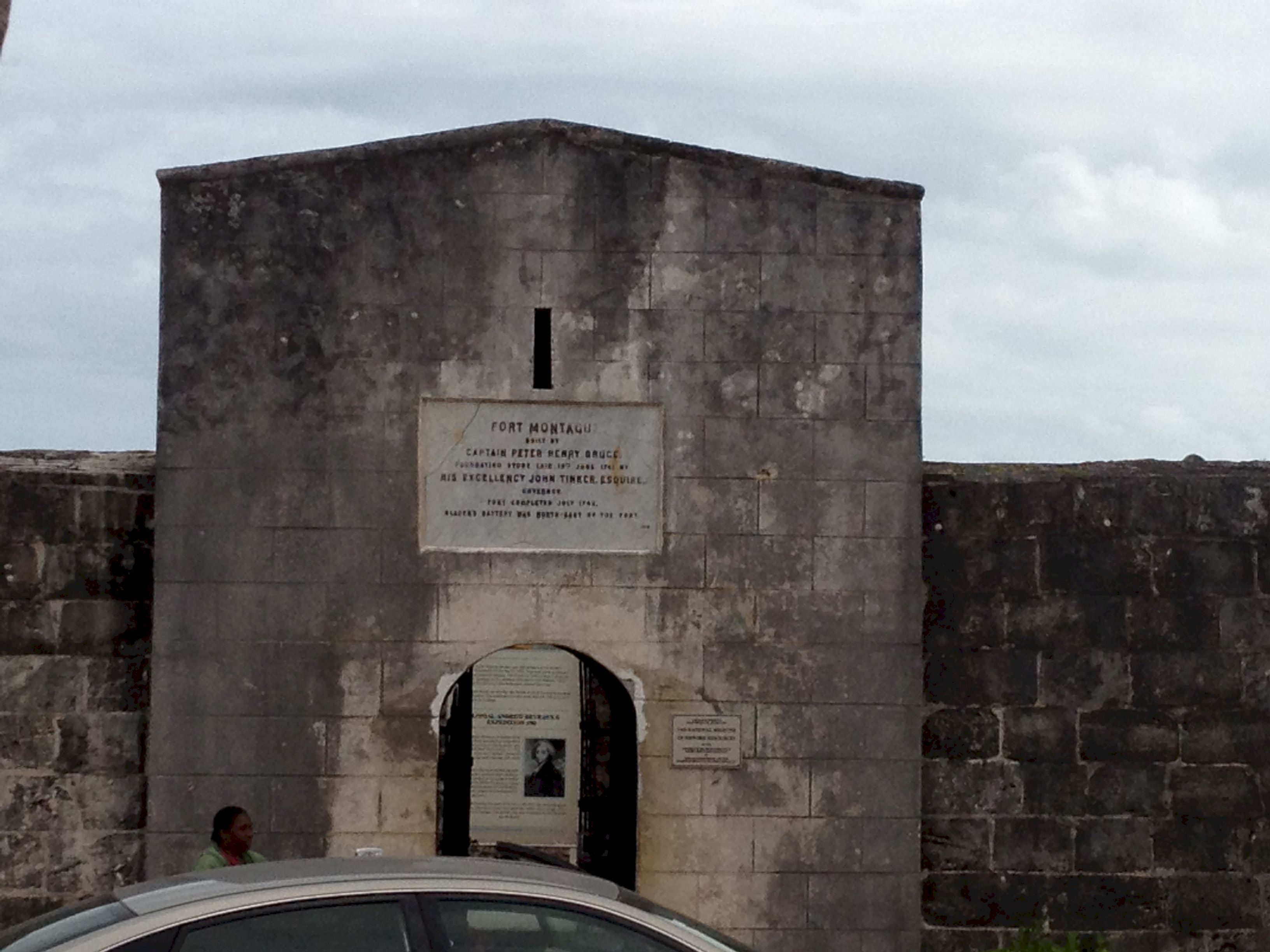
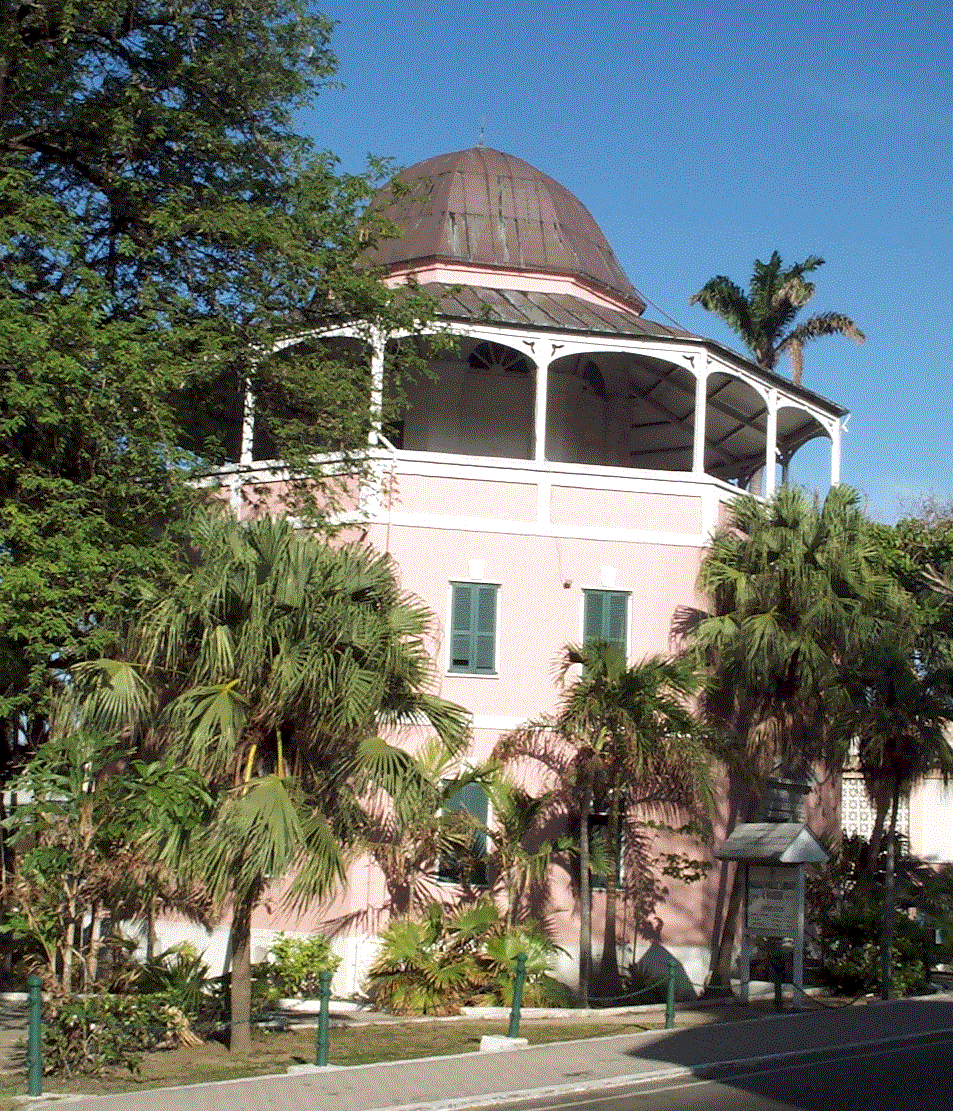
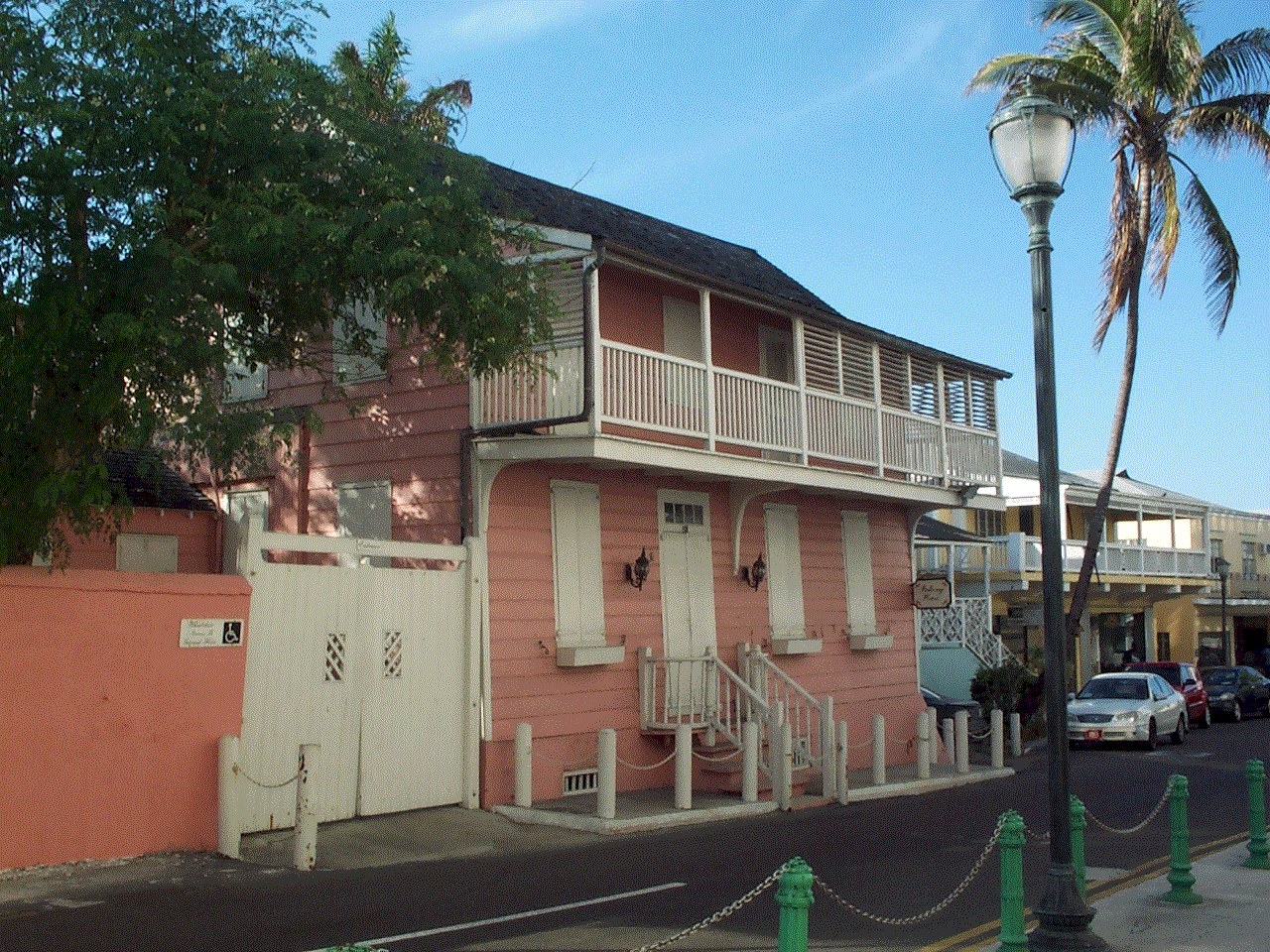
blink. Below left is a photo of Fort Monatgue, built to protect the eastern entrance of Nassau Harbour. Further to the east of Fort Montqague is an outdoor fish market. Loads of fresh lobster, conch and varieties of fish. Small numbers of tourists arrived in small vans to stroll the market. We didn't make any purchases: Conch is too hard to clean, Diana is not too keen on lobster (can you believe that?) and one of them was too much for just me. Nearby was a section where one could by a variety of cooked on the spot local foods. We bought some conch fritters, but Diana gave them a pass after experience at the beginning of the week. I might add that after buying conch fritters on three occasions they have not lived up to my recollection and expectations; too greasy and not enough conch in the fritter. On the other hand, the conch salad at Potter's Cay was great! Below right is the public library. I am sure that it would be delightful to sit on the 3rd story veranda and enjoy the breeze while reading a book. It was closed the day we were there so I guess I'll never know for sure.
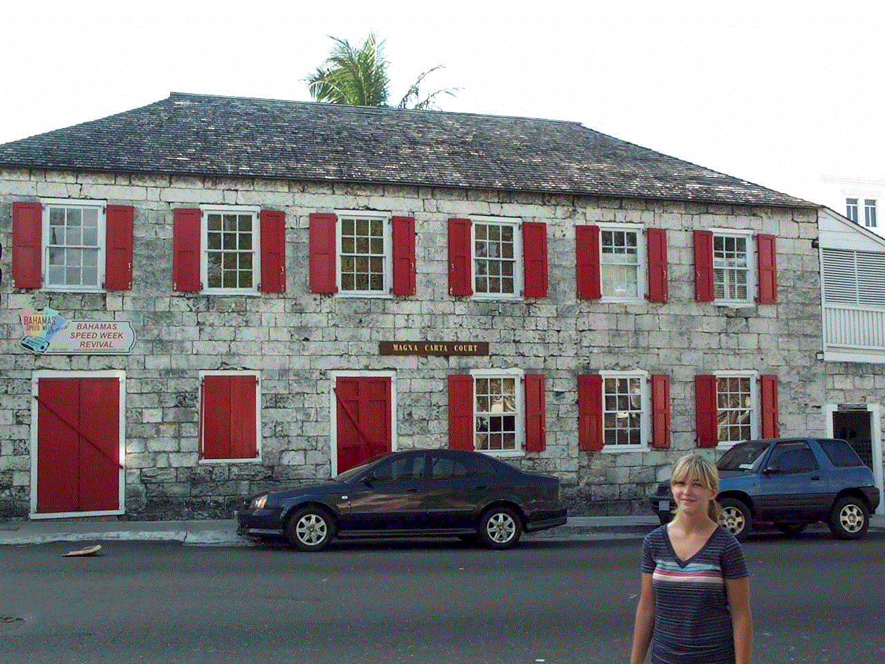
Below left is Magna Carta Hall, home to law offices on the square that includes the Supreme Court and Parliament. On the right is the Veranda Museum, one of several we tried to visit and found closed on Saturday afternoon.
|
|||||||||||||||||
| Sunday, January 13 -- Nassau to Coral Harbor | |||||||||||||||||
| On departure from Nassau Harbour we went past
Oasis of the Seas, the biggest cruise ship in port. Her life boats are bigger than
Andante. Also, on our departure a fifth cruise ship came in. The greatest and most
economically profound economic impact of the cruise ships occurs within just a few square
blocks of the wharf. Can't the local gov't and the cruise ships do something to spread the
wealth around a little more? Once out of the Harbour we sailed a broad reach at well over 6 knots. Obviously lots of wind from the east. As we turned the corner at West End Bay we went to a beam reach. We tried sailing close hauled as we turned again to port toward Coral Harbour on the south coast, but 18 knots apparent and a contrary current was too much. The engine went on and we still needed the main to get enough lift to make any headway against wind and current until we were well around the west end of New Providence. The boat will be in Nick Wardle's back yard on a canal off Coral Harbor. The canal is perfectly placid with just the lightest breeze. Andante will be very safe and secure here while I am in the States. |
|||||||||||||||||
| Monday, January 14 -- January 21 Back in the US, back in the US, back in the USSR. Oops, that
isn't quite right. I am back in the good ole US of A doing the grandfather thing and
trying to get paid for the work that I did for the firefighter's union in Stamford, CT.
With my strut problem and another semester of Berkeley bills for Diana I really need this
money. Below are some pictures of the next generations. Jaiden, Tara, Christopher, Slate and with Grand Dad in the mix. There are also a cat and some fish in the family, but it was hard to get them to pose.
Leaving after my short visit was hard to do. The time that I spent with them passed very quickly and I could have easily spent days cuddling with Jaiden. Alas, I have to get back to my hard life on Andante trying to make the best of the steady winds, the sandy beaches, and the shades of turquoise water. |
|||||||||||||||||
| January 21, Monday, Philly to Coral Harbour | |||||||||||||||||
| Flew back to the Bahamas today. I was
met at the airport by Nick Wardle who brought me back to Andante in Coral Harbor where she
was docked in his backyrad for the week. How is that for a runon sentence. My
high school teachers would be proud. For those of you planning to leave your boat in Nassau while returning home for more than a few days you can contact Nick on VHF 72 with the call name "Ranger." His phone number is 242-362-1574 and his his email is cwardle@batelnet.bs. Lastly, if all else fails you can find him by searching either cruisersforum.com or the Seven Seas Cruising Association web site. |
|||||||||||||||||
| January 22, Tuesday, Coral Harbour to Nassau | |||||||||||||||||
| On departure from Coral Harbour there was some
wind from the SW, making for a reach to the west. Once I was around West Bay on New
Providence the wind dropped and dropped. I tried flying the spinnaker, but the light
shifty wind made it too hard to get it on the right tack and still get around the reefs to
make Nassau Harbour. In the end I doused the spinnaker and motored on to Nassau
Harbour Club Marina. Once there I got in the water and checked the strut. All
OK. I also climbed into the cockpit locker to check the shaft coupling. I
backed off all the bolts in anticipation of using my new feeler gauges to check the gap
for galling within tolerance, which is in the thousandths of an inch. Once the bolts
were back off enough to turn them in my fingers there was still not gap in the coupling.
This is good news, but I'll still be checking on the strut and coupling in the
weeks to come. As I was coming into Nassau I was hailed on the radio by Patti Haase on board Lutra. She had guests and was headed for the Exumas. We might cross paths in a week or more at Farmer Cay. |
|||||||||||||||||
| January 23, Nassau | |||||||||||||||||
| This was a layday to prepare for the coming
weeks in the Exuma Cays. On the to-do list were: spare zincs, new line for the
anchor snubber and run it through the hook, check strut and coupling (done yesterday),
grocery shopping, fill up with diesel and gas (done yesterday), fill water tanks, wash
boat, check on possibility of using the Blackberry as a wireless modem with my computer
(bad news, the Blackberry is 3g and the Bahamas are now 4G.) At the end of the day I
was invited on board one of the mega yachts (90+ feet) for cocktails. The yacht was
$7 million new, and six years later would now sell for $3 million; gosh, where's my
checkbook? On the downside it cost $750,000/year to run a boat this size. The captain of the mega yacht had also been planning to get in the water and check his propellers and other underwater appendages. Before doing so his mate happened to mention having seen a shark swimming just off the yacht. Captian G went and looked and later described the shark to one of the dock boys. In the ensuing discussion G learned that there are some bull sharks (very dangerous) that live in harbour. Why not? The local fisherman clean the their catch and drop the entrails in the harbour, giving the sharks a free lunch. Gosh I'm g;lad I learned this after swimming under the boat. |
|||||||||||||||||
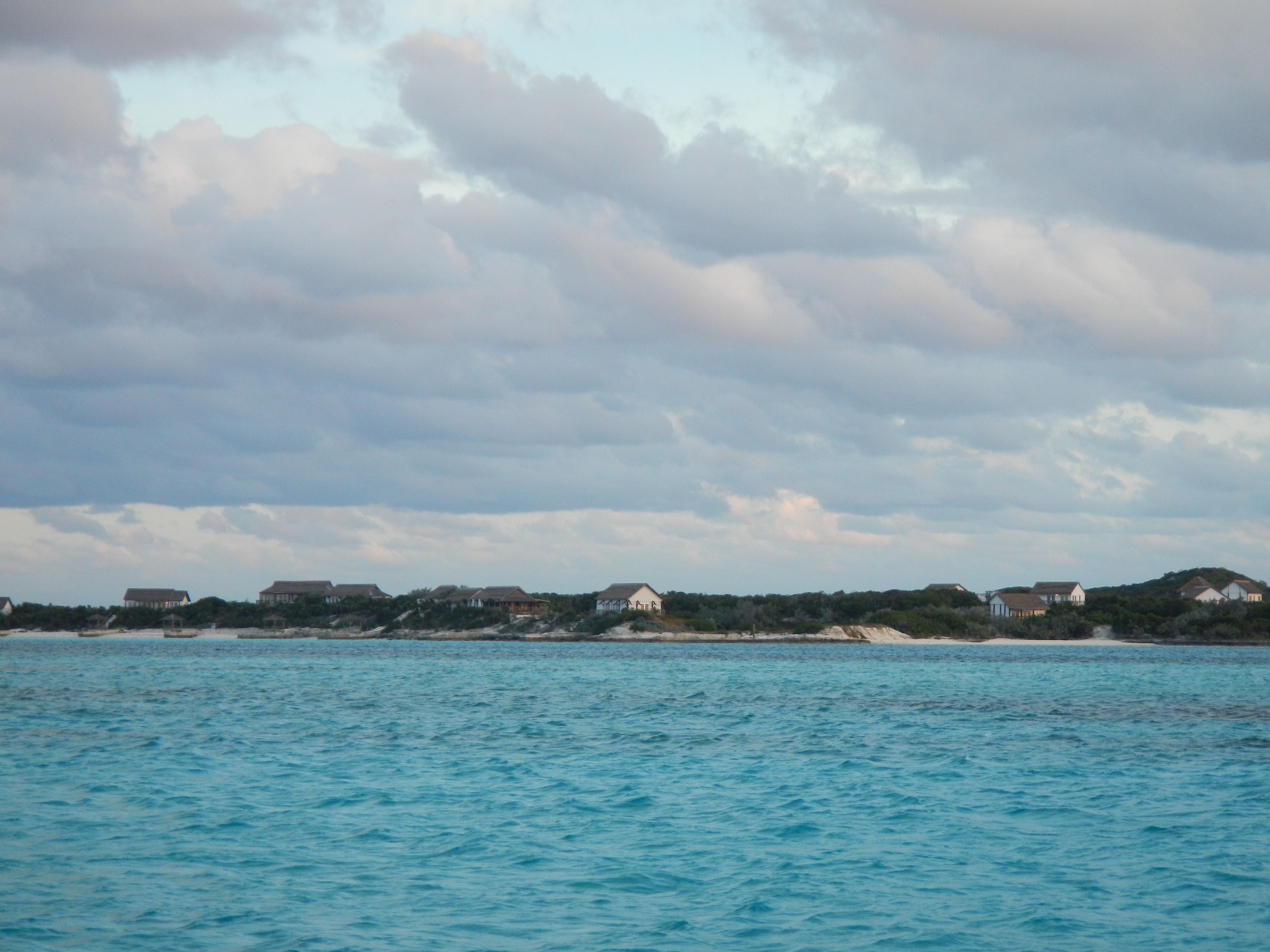
| January 24, Thursday, Nassau to Norman's Cay | |||||||||||||||||
| What a great sailing day. The wind was
from the NE at 15 - 17 knots, making for a beam reach most of the day. My boat speed
was 6.6 - 7.3 knots almost the entire day. This sure made the 43 mile trip easier
and more enjoyable. On arrival there are only 8 boats here in the Normans Cay
anchorage. Compared to 12 years ago this is a small number. Other changes can
be seen in the two following photos. The first photo is Wax Cay, to the SE of the
anchorage. I don't remember all of these houses in this location. There also
seem to be more houses on Normans Cay and the airstrip seems to be in use once again.
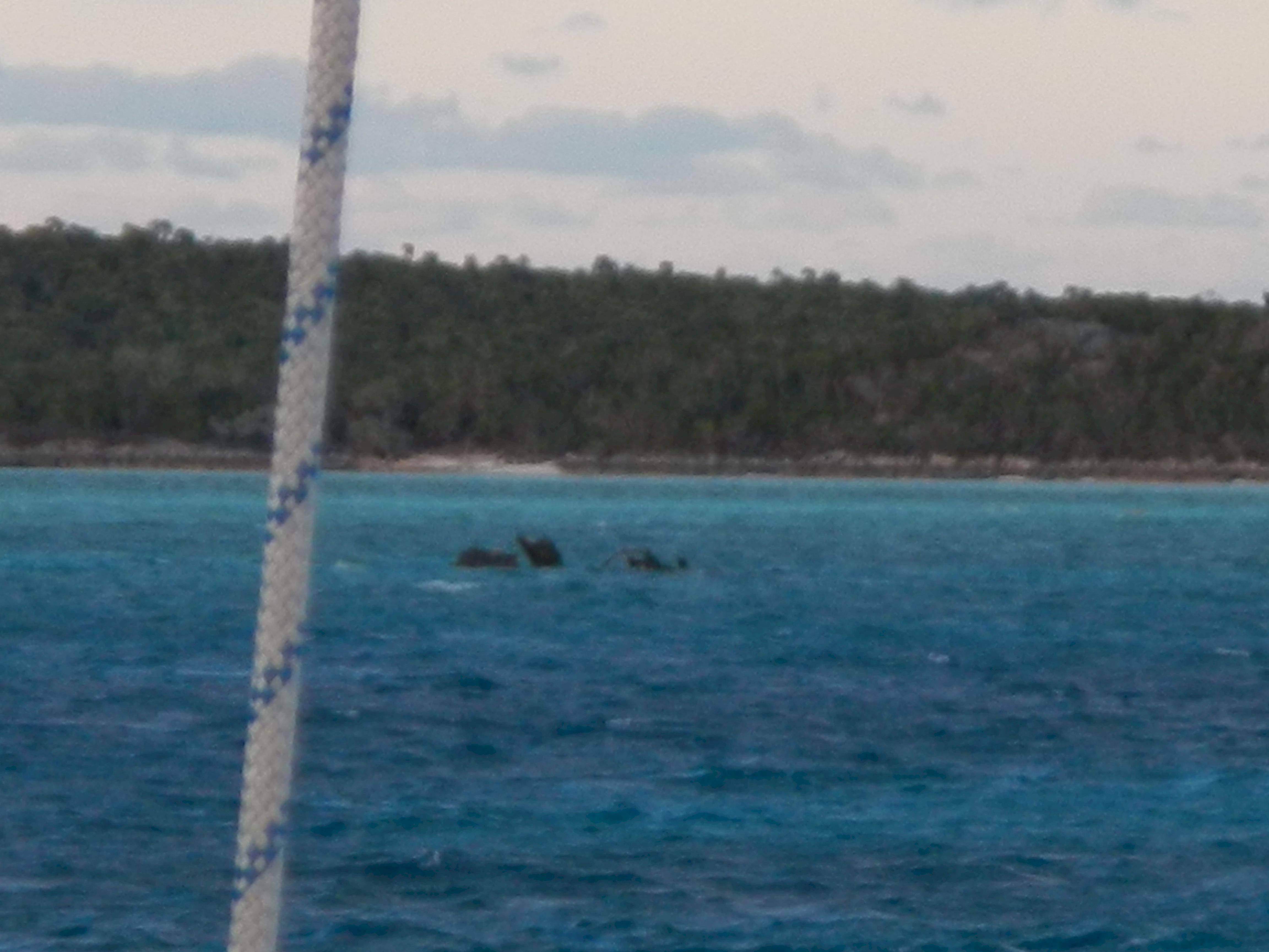
In this second picture we have the plane that landed in the water during the days of Felix Lehder's drug running enterprise. The plane is almost completely dissolved by the salt water environment. Twelve years ago there was more of the plane: the body, part of the tail, most of the wing.
This mornig for the first time I was able to hear some of Chris Parker and all of Nick Wardle's weather forecast on my SSB receiver. This is good news for me. Part of the problem seems to be that even after running through my inverter my 12v circuit is dirty and disrupts the radio reception. Running the radio from batteries improved things substantially. As a side note, folks with transmitters also advise Nick of their position and the weather they are experiencing. Someone in George Town said that their are 160 boats in Elizabeth Harbor. This is about half what we experienced in that location 12 years ago. The recession and Hurrican Sandy took a huge bite out of the number of southbound boats. |
|||||||||||||||||
| Janaury 25 - 26 , 2013 -- Norman's Cay | |||||||||||||||||
| On 1/25 i tired to follow the dinghy route
that Pavlidis shows in his "The Exuma Guide" that leads from the Norman's Cay
airplane anchorage up to the pond at the north end of the island. I took my snorkel
gear because I wanted to check out the caves up there. To make a long story short,
his sketch chart is no longer accurate. It shows a route with 2 feet or more at
spring low tide that runs inside the eastern shore of the island. I had to drag the
dinghy across stretches of sandbar that only had about 9 inches of water. I never
did make it up to the pond, but spent a few hours on the project. The water was just
too shallow and my outboard motor was starting to act up. Indeed, by the time I got
back to the boat it would not run at idle. This is bad news; another critical piece
of equipment that is not reliable. The outboard had been behaving this way in Charleston.
After taking apart the fuel line, and spilling some gas from it in the process, the
problem was cleared up. The motor is behaving as though it is starved for duel.
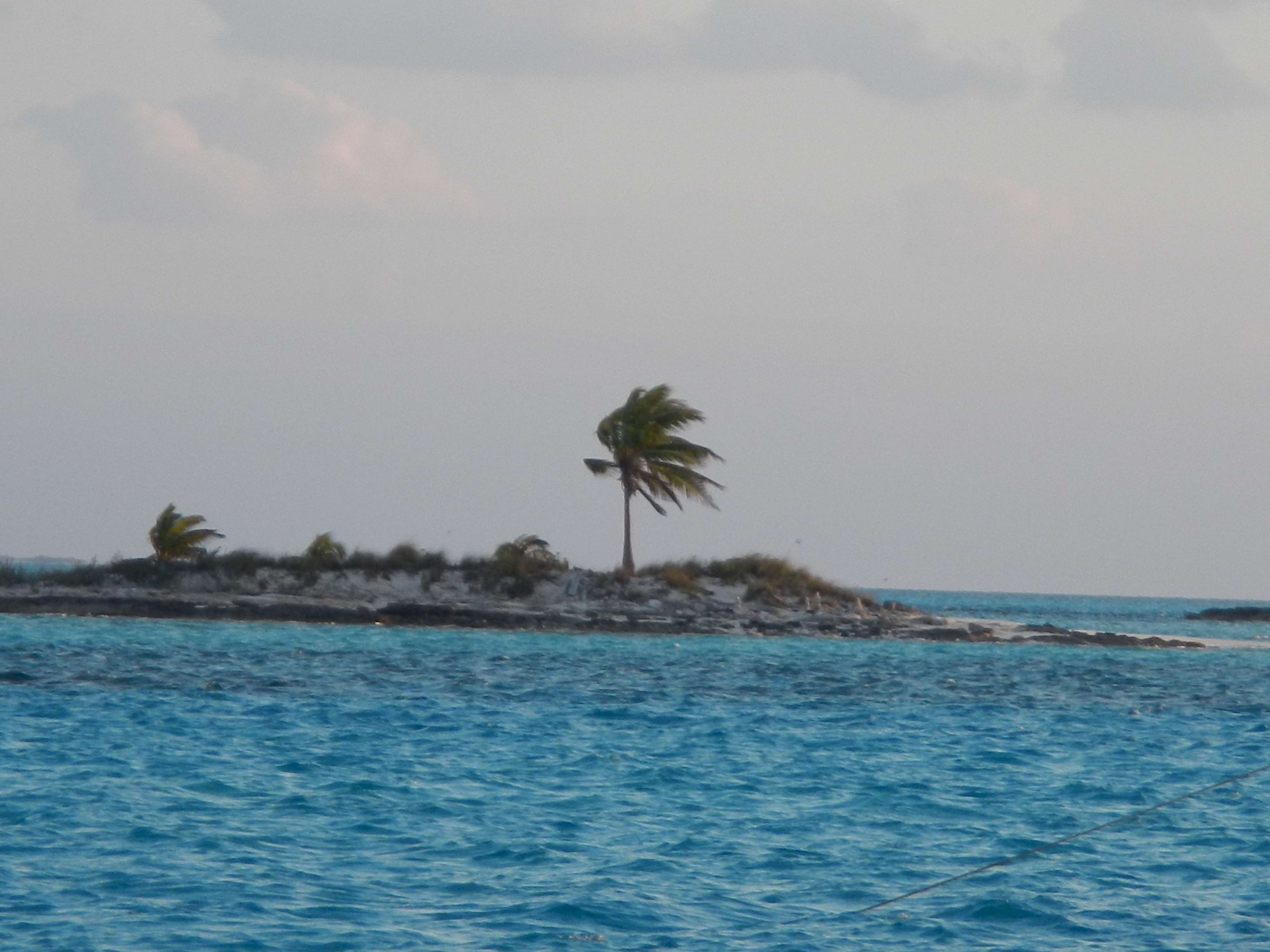
It could be due to water in the fuel or dirt in the filter. On a more positive note, this morning I was able to catch the tail end of Chris Parker's weather net and also Nick Wardle's SSB weather broadcast. This morning, 1/26, I was able to get both weather broadcasts. Looks like I will be staying at Norman's Cay for a few days while winter storm goes by. Keep in mind that a winter storm here is light rain, cooler temperatures, but lots of wind. More wind than I want, so it is better to stay buttoned up. The traditional airplane anchorage was very rolly today due to the easterly wind so I moved around to the west side of Norman's and anchored off MacDuff's beach. This was a nerve wracking trip of just a few miles because there is a warning in the chartbook that this is to be done in good weather with sun, niether of which I had. My hope was that the electromioc chart showed the correct location of the coral heads. Later in the day several boats came in across stretches of the reefs and sandbores that I would never have attempted. They are braver souls than me! Below is an iconic scene from the Bahamas: a lone palm tree on a tiny island. One sees this throughout the cays.
|
|||||||||||||||||
| January 27 - 28, Sunday and Monday, Norman's Cay to Hawksbill Cay | |||||||||||||||||
| Left Norman's Cay on 1/27 for the short sail
down to Hawksbill Cay. Close reach and close hauled in the neighborhood of 7 knots
over the ground with full main and the second reef in the genoa. Made the trip in about 2
hours anchor to anchor. There are some big weather systems over the US and Canada that are giving us very strong winds from the east, but thankfully the wind is steadily from that direction so it makes planning a little easier. On the 27th, upon arrival, I spent a couple of hours fooling around with the outboard again. In the end I replaced a weak spring clip type hose clamp with the kind that has a screw in it and added one where there had not been one previously. Also turned in all the way a jet adjustment above the choke. The outboard engine seems to run at idle now. In the coming days I will see whether I can rely on it. After spending time with the outboard I went ashore. Hawksbill Cay is a part of Exuma Park. According to Pavilidis there are ruins near the hill overlooking the north anchorage. I went up the hill to see if I could find the ruins, which date from the 18th and 19th century. No luck finding them, but then I didn't look long or hard. There were no obvious paths and no obvious break in the foliage. There is a path across the island to the Exuma Sound side which I followed. Depending on the vegetation through which one is walking the smell changes; very subtle and delightful fragrances. The Sound looked beautiful: cobalt blue water with white caps.
On the 28th I started the day with listening to the weather then had my name added to the Exuma Park mooring field waitlist for arrival Tuesday. This is important to me since the wind is supposed to shift around through the south Wednesday and there are not too many places to shelter from this direction. Should be a challenge picking up the mooring alone. |
|||||||||||||||||
| January 29, 2013, Tuesday, Hawksbill to Exuma Land and Sea Park | |||||||||||||||||
| On leaving the anchorage I was sailing a beam
reach, then close reach. These points of sail are very fast for me. On taking
up a heading to the southeast I was close hauled and my speed dropped to 5.5-5.8 knots in
17 - 20 knots apparent.. Finally for the last three miles, dead into the wind I
turned on the engine. My heart always picks up a few bpm as I stress out about the
coupling and strut issue. The first thing I did on arrival was to check the coupling
and strut since I hadn't done so for five days, about 12 engine hours. Everything is
A-OK. In the afternoon I went snorkeling with the Nikon AW100 that I bought on my recent trip back to the US. The underwater photos follow.
|
|||||||||||||||||
| January 30, Wednesday - January 31, Thursday, 2013 -- Exuma Cays Land and Sea Park | |||||||||||||||||
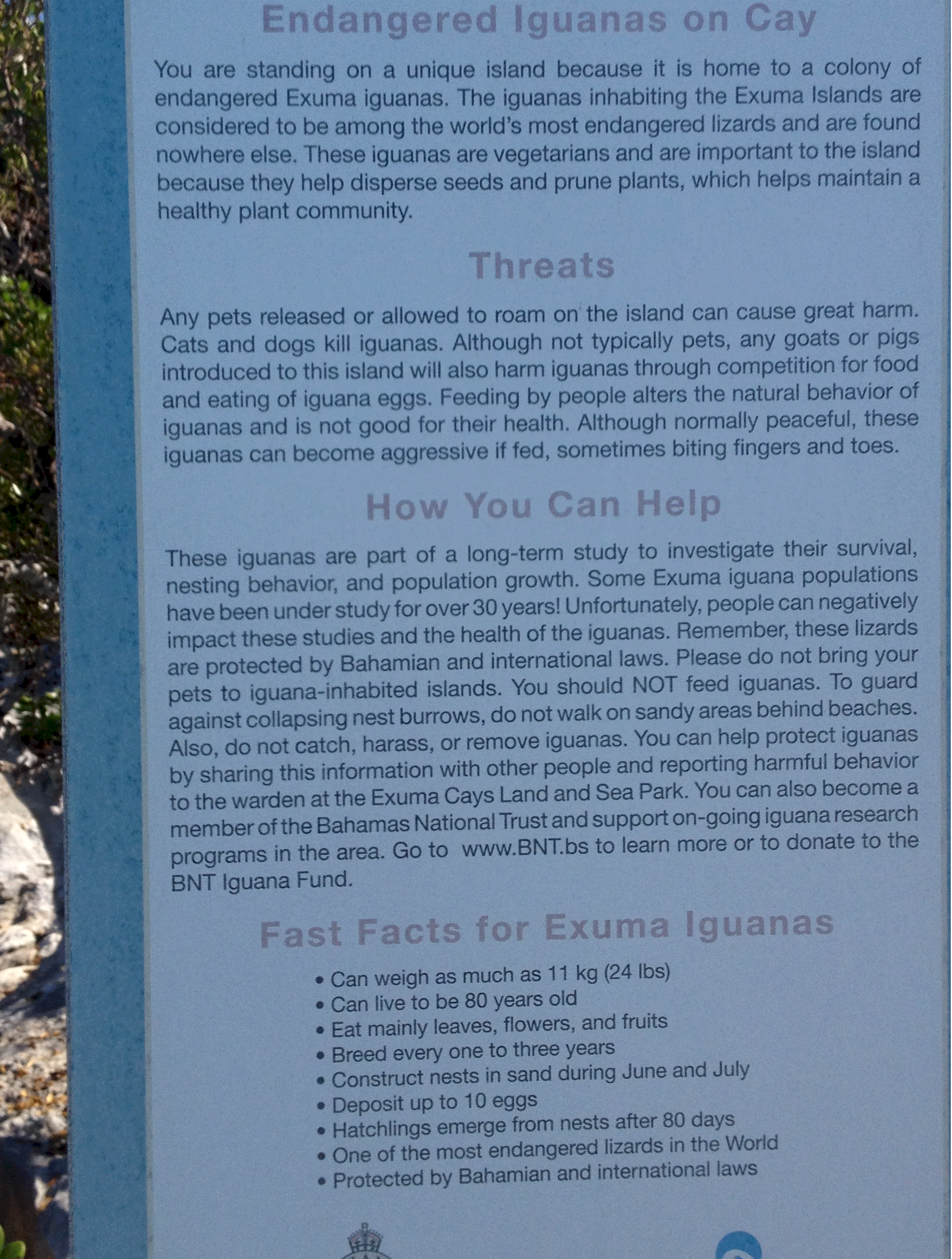
| This is my fourth visit to the Park in a dozen years. The Park is a great natural resource that has only a skeleton staff and limited financial resources. The mooring fees are nominal and I am sure do not even begin to cover the expenses of the Park. Volunteer labor and financial contributions to the Bahamas National Trust (BNT) keep the place running. In recent years I have made small contributions to the BNT. As an inducement to get cruisers to volunteer to work in the park the quid pro quo for a day's labor is a free night on the mooring. So, on this my fourth visit I have decided to engage in a bit of modern day indentured servitude. On Wednesday morning I offered my strong back and weak mind. The staff took the offer quite literally and asked me to repair a small sea wall on the beach by their workshop. The sea wall had been damaged in Hurricane Sandy. The job involved securing some retaining boards about 25 feet in running length, then filling in behind them with stone. The trench to be filled with stone was about 2 -3 feet deep and 4 feet wide. The pile of stone to be used was at some remove from the work site and had to be hauled in a wheelbarrow. The job took me the better part of two days, moving about 4 wheelbarrow loads per hour. I'll leave it to you to figure out how many tons of rock I moved. The second day Jeff and Sally finished their morning assignment early and came by and helped with a couple of loads. I think they were glad to have spent the morning on a couple of painting jobs. At the end of the day the three of us went out to "Fuel Island" to dissamble some stainless steel cabling so that it could be used on the new tanks that have been installed just recently. | |||||||||||||||||

 Lorem
Lorem 
 The link to
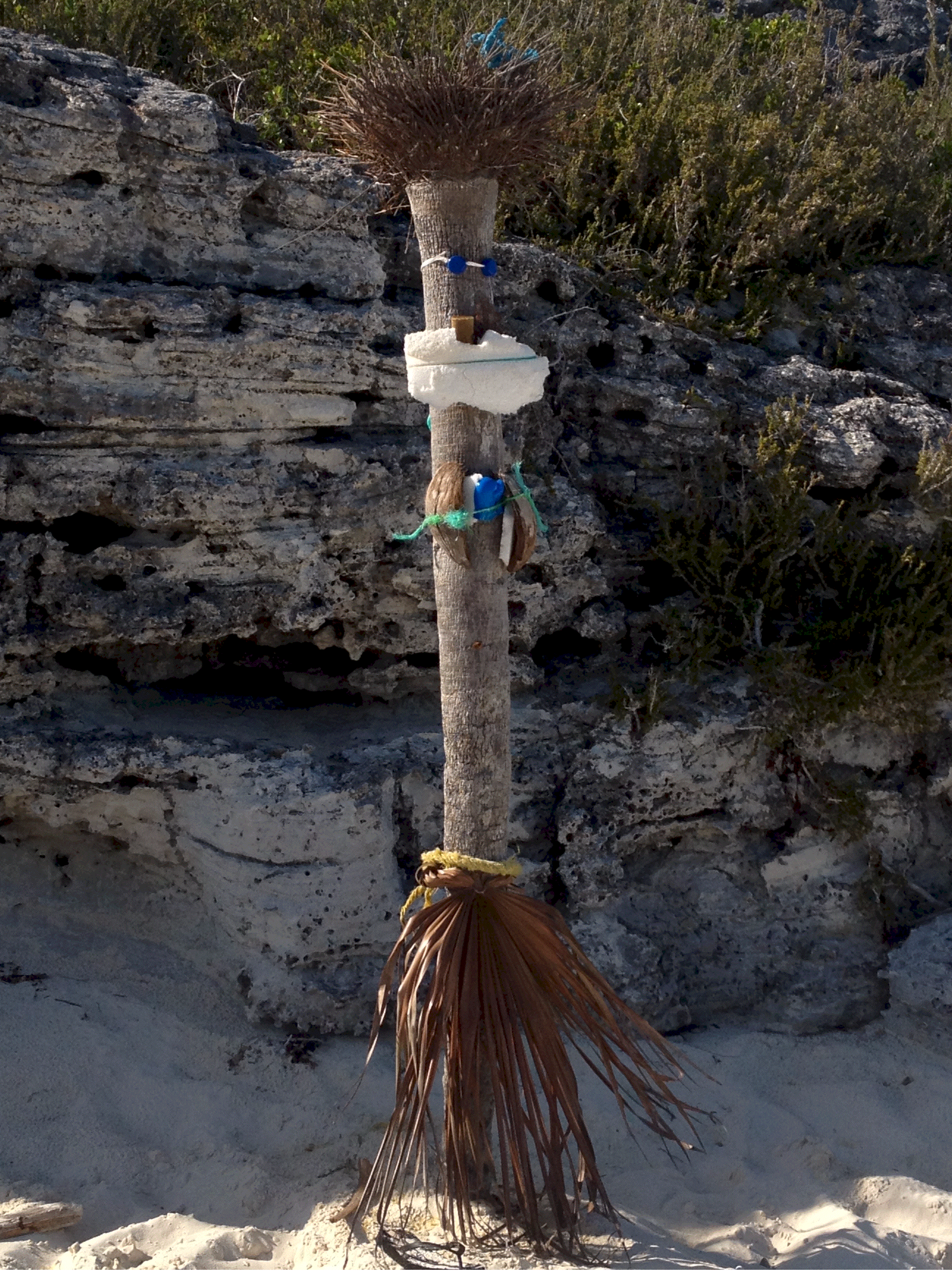
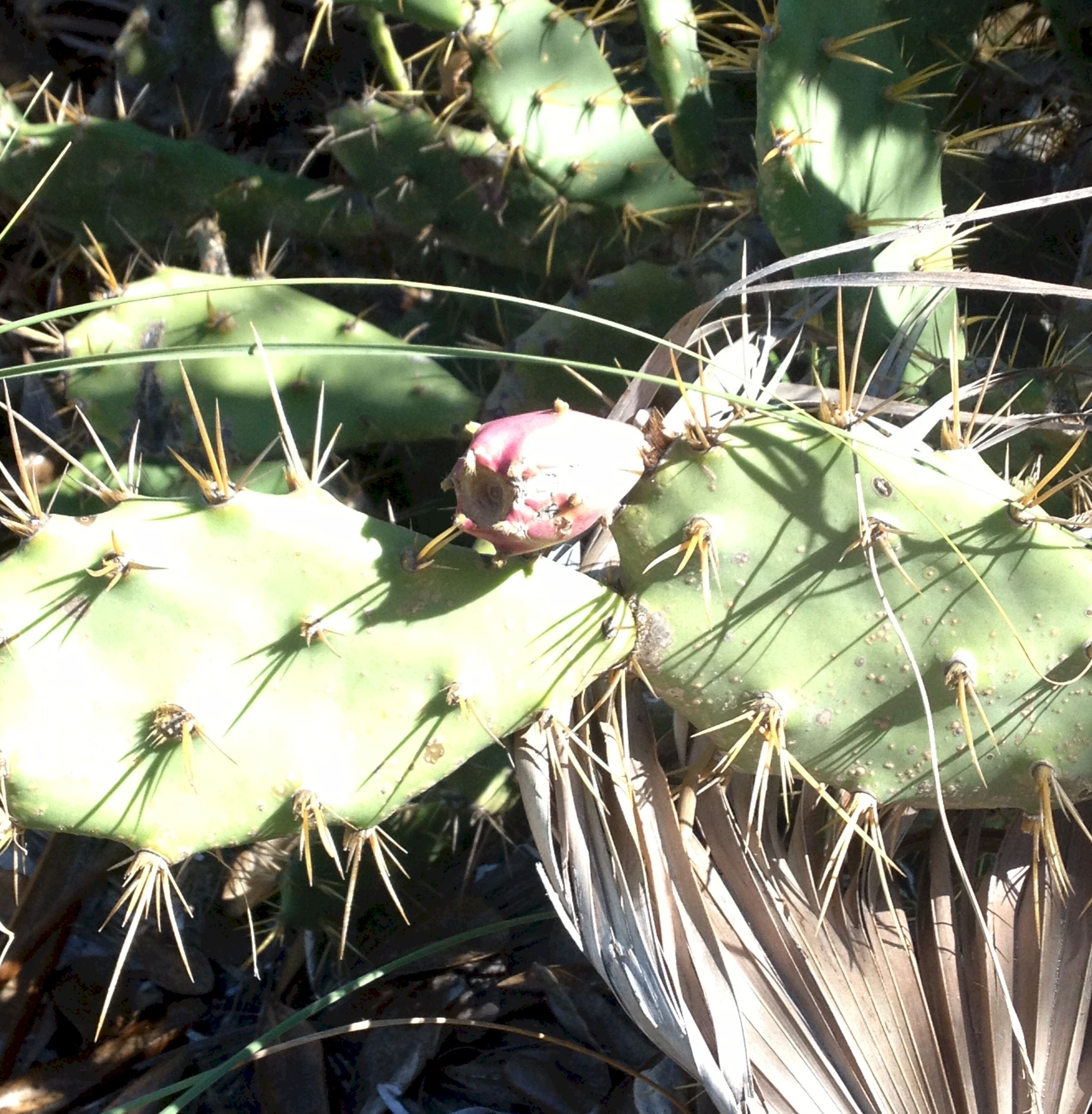
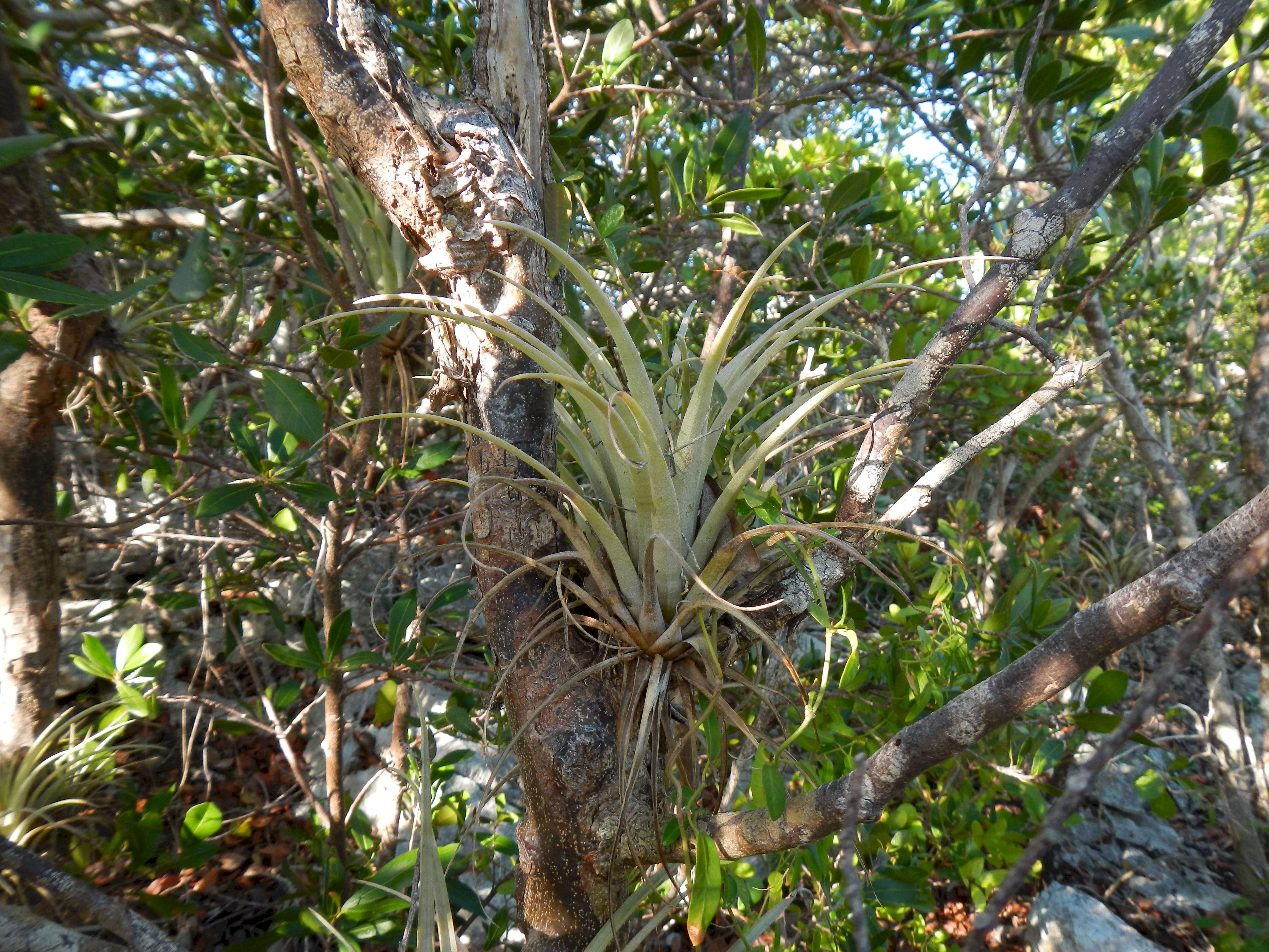 I went for a hike on Hawksbill looking for the ruins
dating from the late 18th century. Along side the path I found this succulent growing in
the crook of the tree.
I went for a hike on Hawksbill looking for the ruins
dating from the late 18th century. Along side the path I found this succulent growing in
the crook of the tree.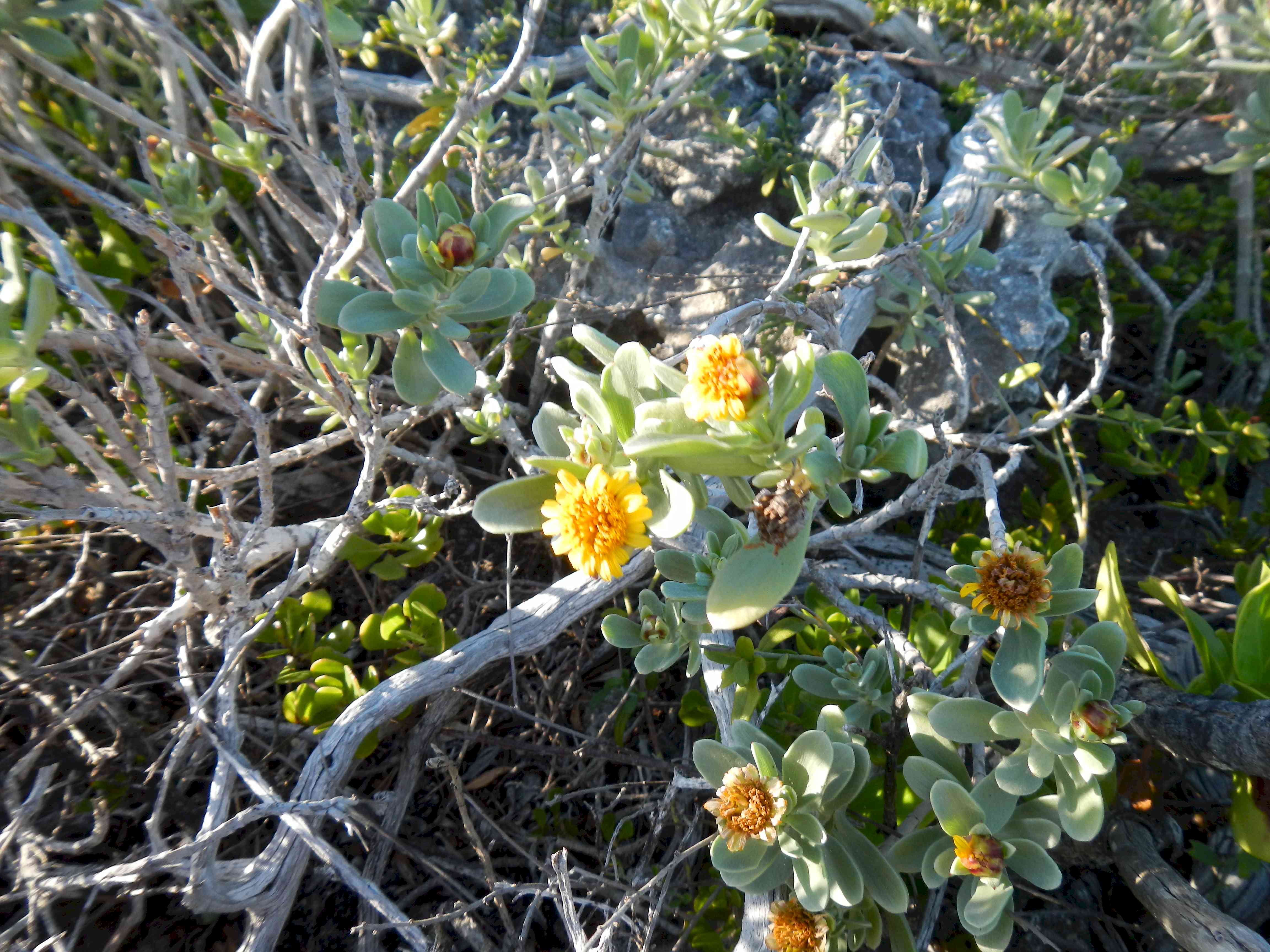 Just some pretty flowers at trail side. Hawksbill is part
of Exuma Park. AT Warderick Wells, park headquarters, the plant life is all labelled with
trail side markers. Since Hawksbill is a little remote there is not as great an effor to
label things.
Just some pretty flowers at trail side. Hawksbill is part
of Exuma Park. AT Warderick Wells, park headquarters, the plant life is all labelled with
trail side markers. Since Hawksbill is a little remote there is not as great an effor to
label things.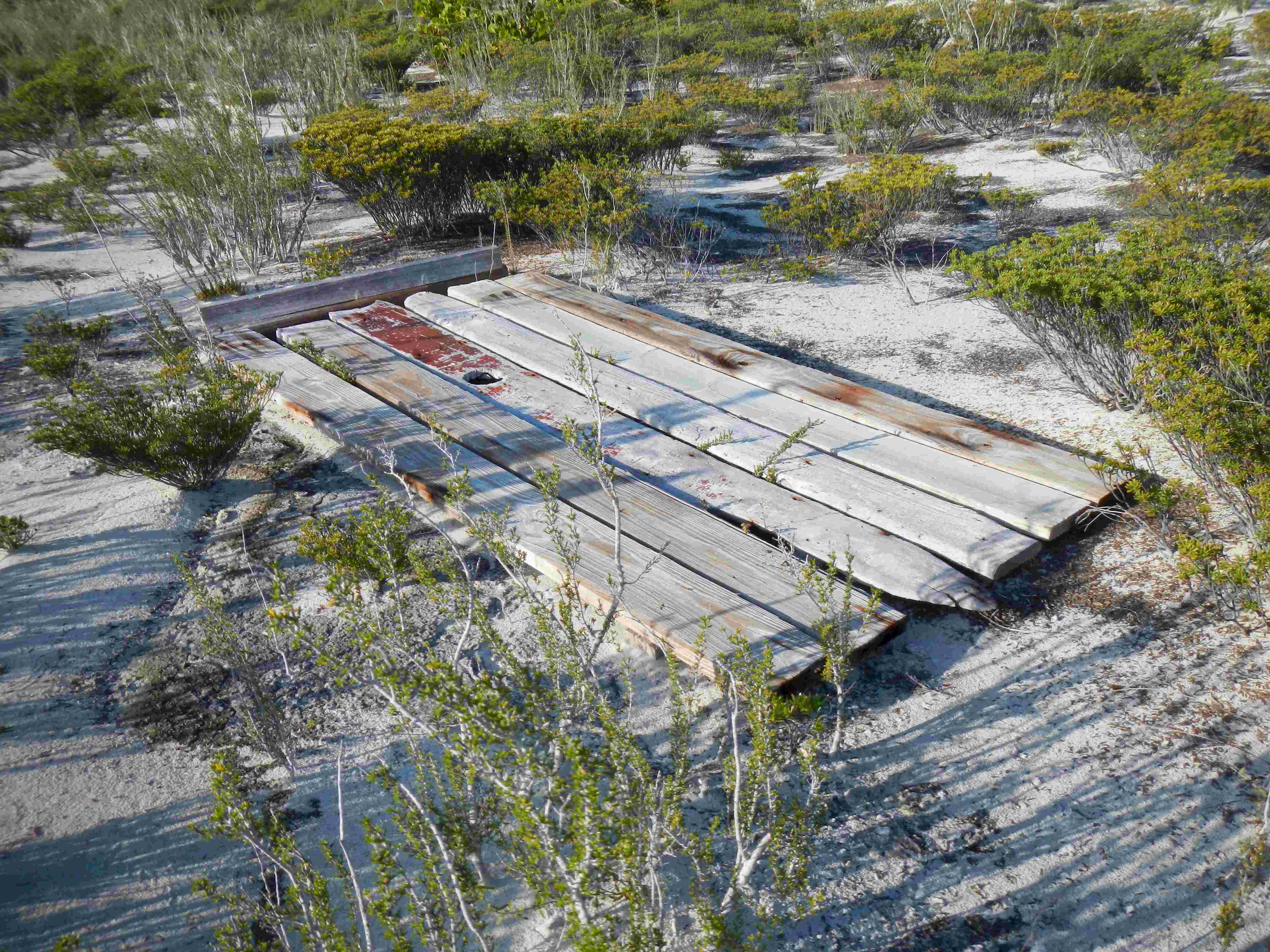 This door, or Huck Finn raft,
was up on the beach by the anchorage.
This door, or Huck Finn raft,
was up on the beach by the anchorage.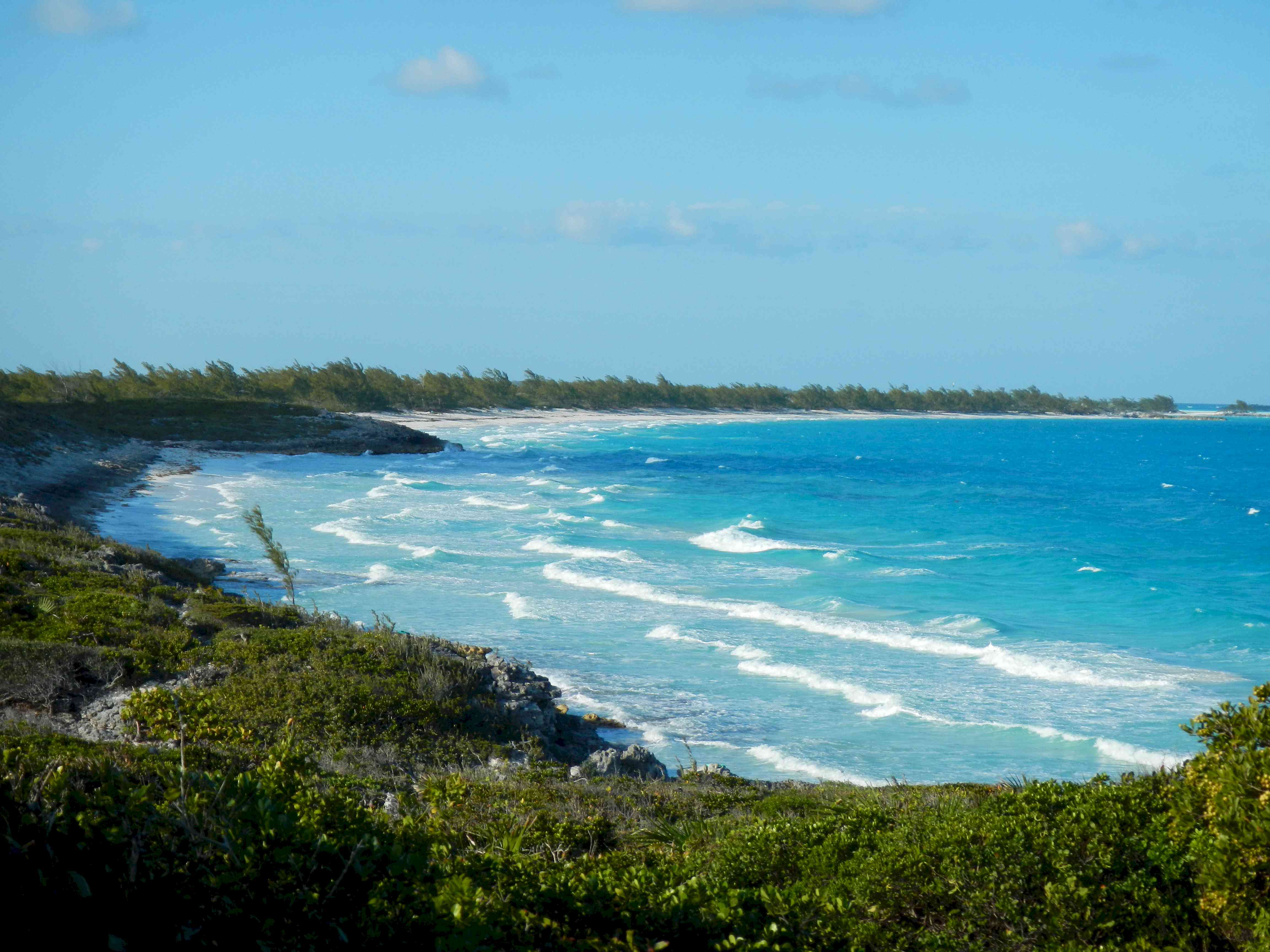 I hiked across the island.
This is a view of the Exuma Sound.
I hiked across the island.
This is a view of the Exuma Sound.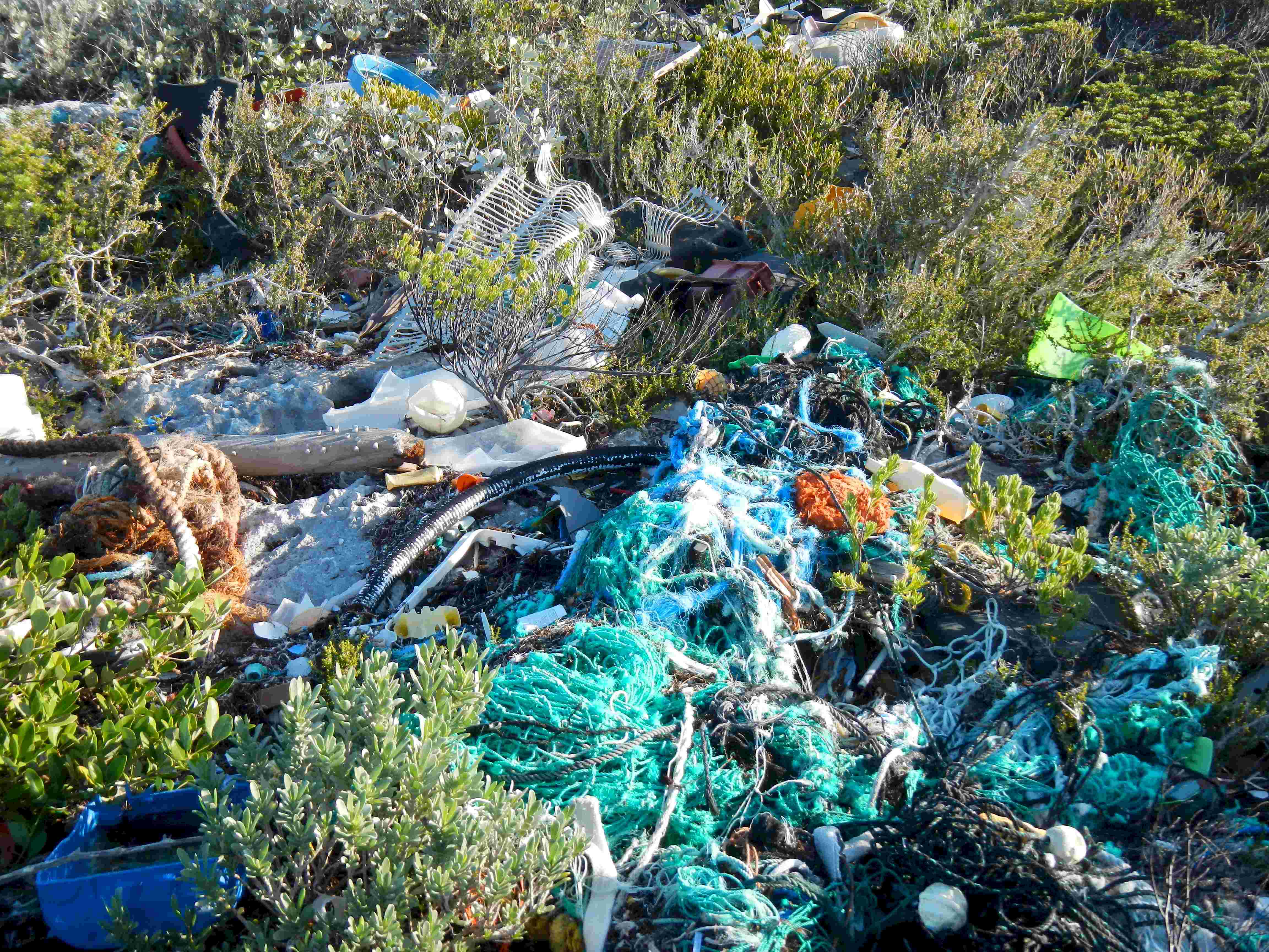 Of course the Sound beaches
always are littered with the plastic detritus of mankind.
Of course the Sound beaches
always are littered with the plastic detritus of mankind.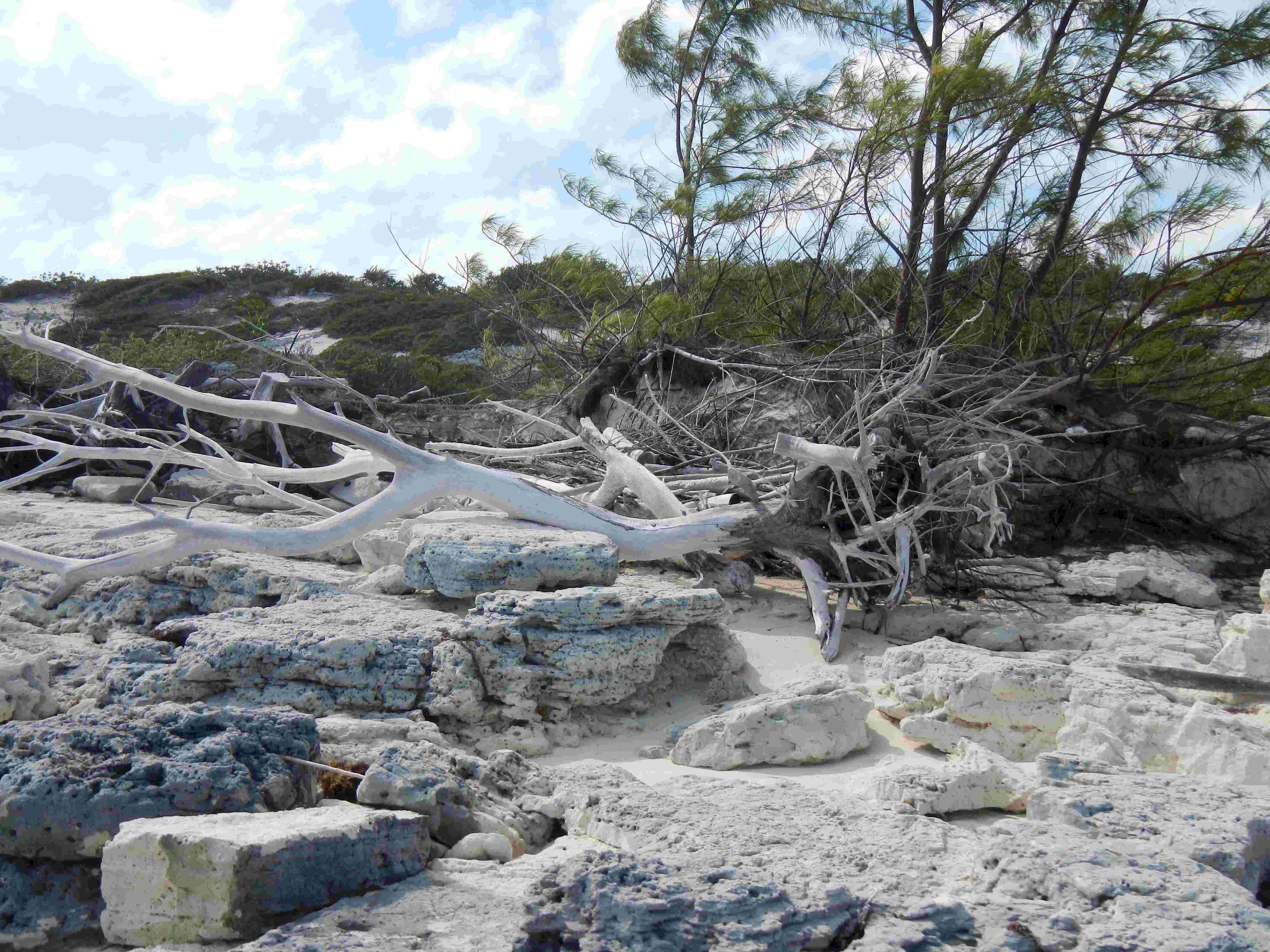 Fallen and sun bleached tree
on the Sound beach.
Fallen and sun bleached tree
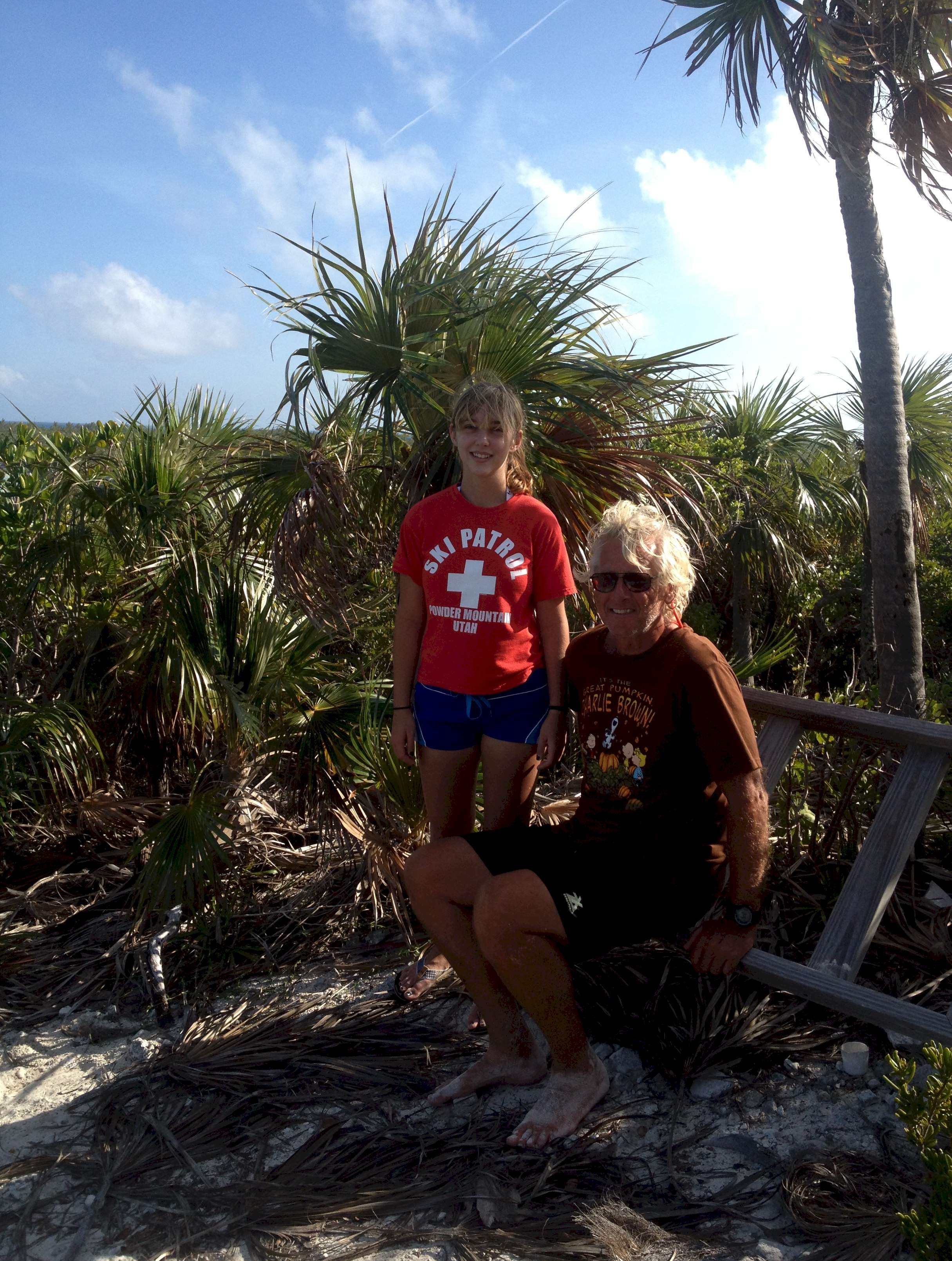
on the Sound beach.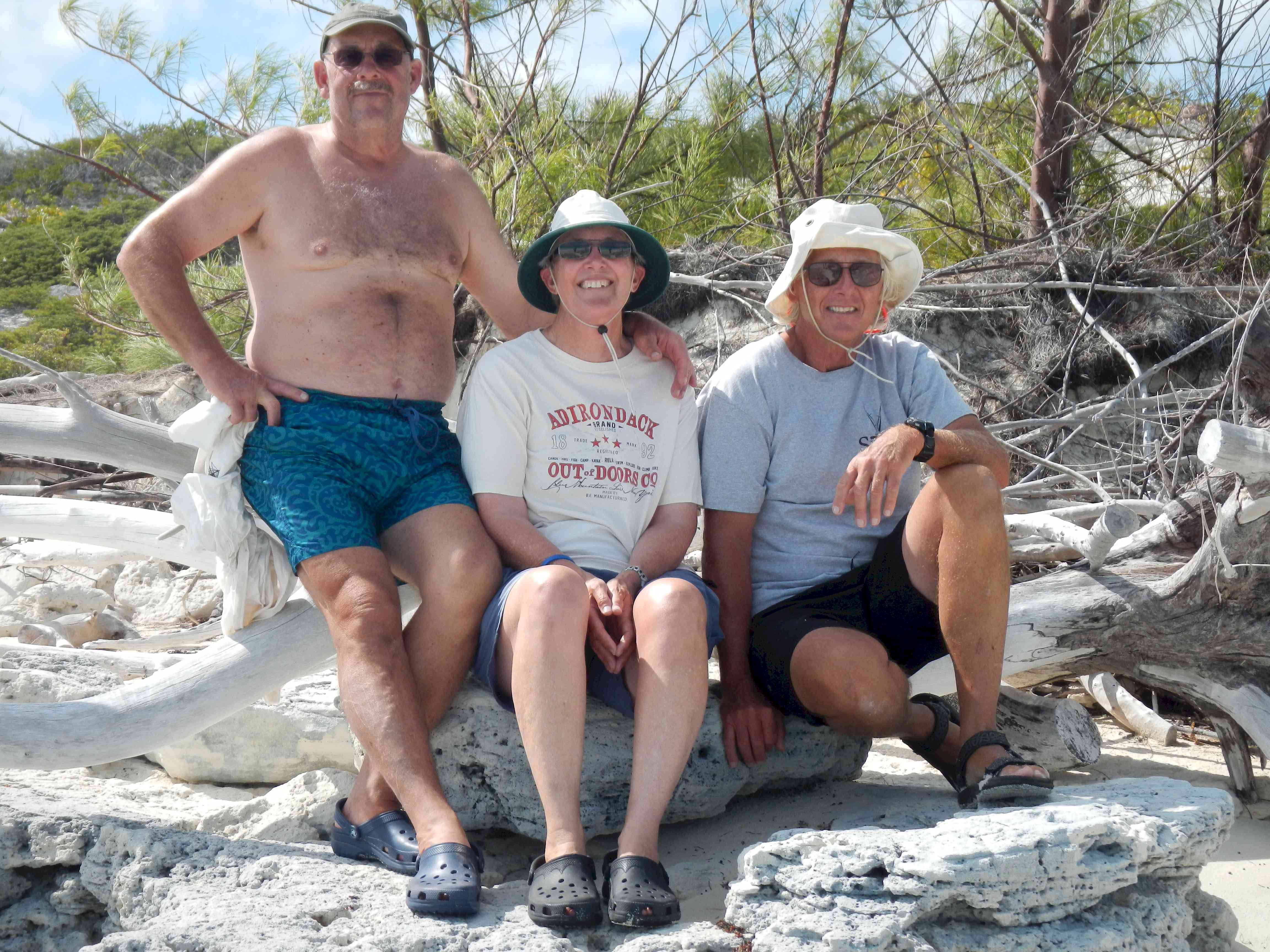 Jeff and Sally from
'Adirondack.'
Jeff and Sally from
'Adirondack.'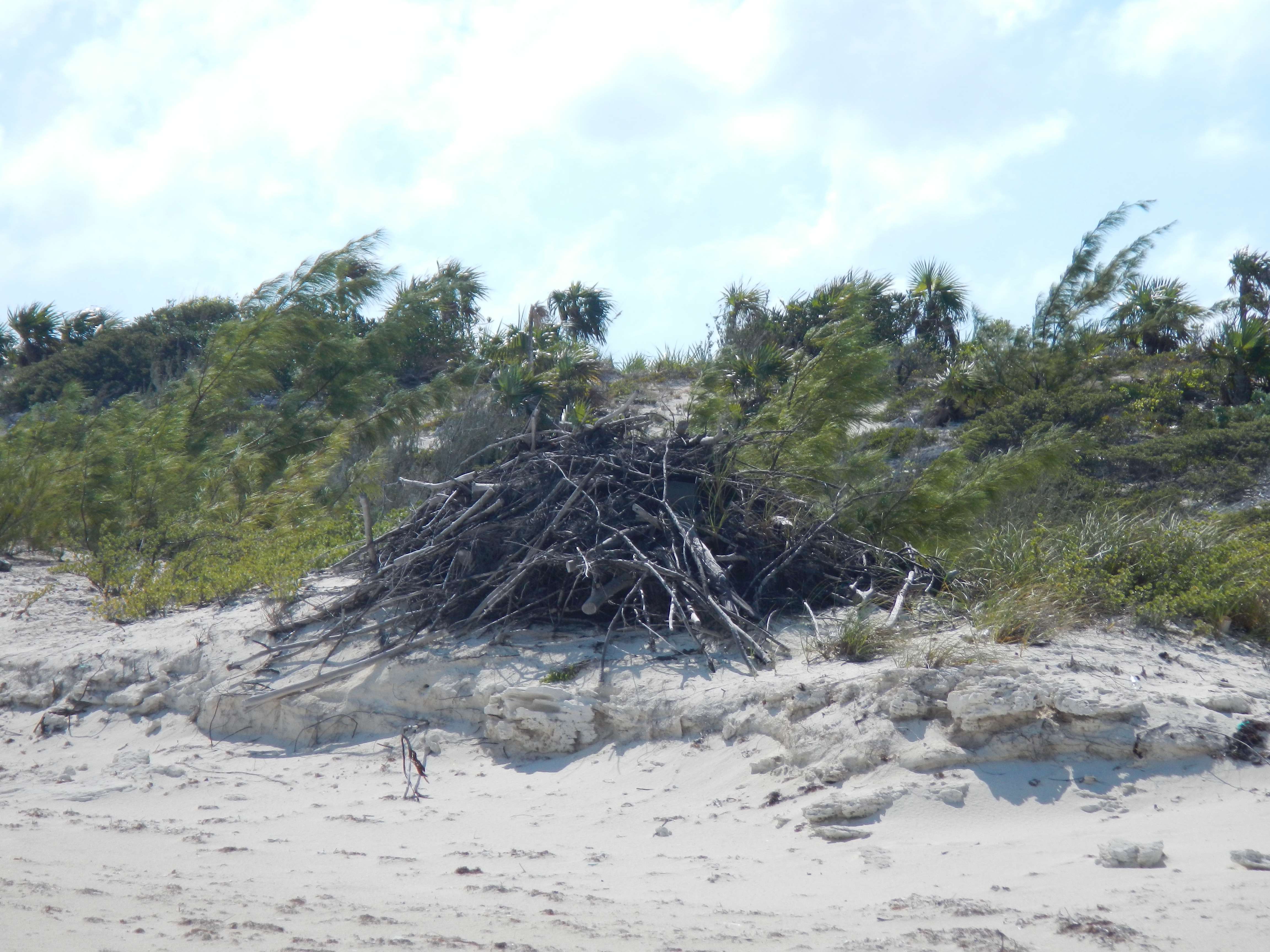 The park uses volunteers
from the cruising community to do things like clean up the beaches. Along one of the
Sound side beaches the crews had collected and stacked the driftwood in these affairs
reminiscent of beaver mounds.
The park uses volunteers
from the cruising community to do things like clean up the beaches. Along one of the
Sound side beaches the crews had collected and stacked the driftwood in these affairs
reminiscent of beaver mounds.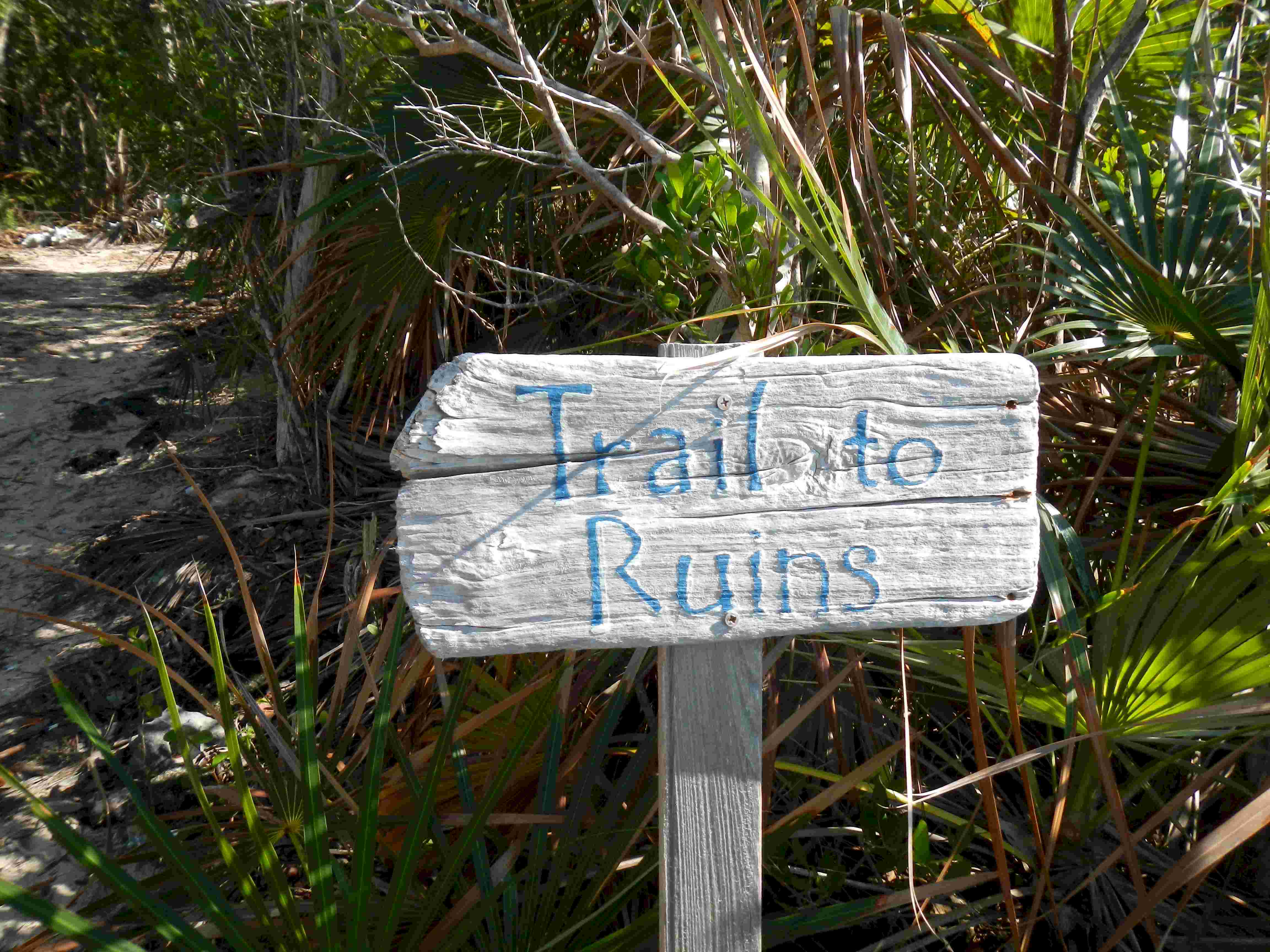 Thanks to Jeff and Sally I
learned where to find the path to the ruins. The Pavlidis sketch chart would lead one to
believe that the path was off the anchorage beach. Instead it was on one beach north. The
group of ten houses date from about 1785 and were built by Loyalists that left the US
expecting to recreate their lives in the Bahamas. They must have been sorely disappointed
by the poor soil and lack of rain. According to the cruising guide the little settlement
was continuously inhabited and farmed into the 20th sentury.
Thanks to Jeff and Sally I
learned where to find the path to the ruins. The Pavlidis sketch chart would lead one to
believe that the path was off the anchorage beach. Instead it was on one beach north. The
group of ten houses date from about 1785 and were built by Loyalists that left the US
expecting to recreate their lives in the Bahamas. They must have been sorely disappointed
by the poor soil and lack of rain. According to the cruising guide the little settlement
was continuously inhabited and farmed into the 20th sentury.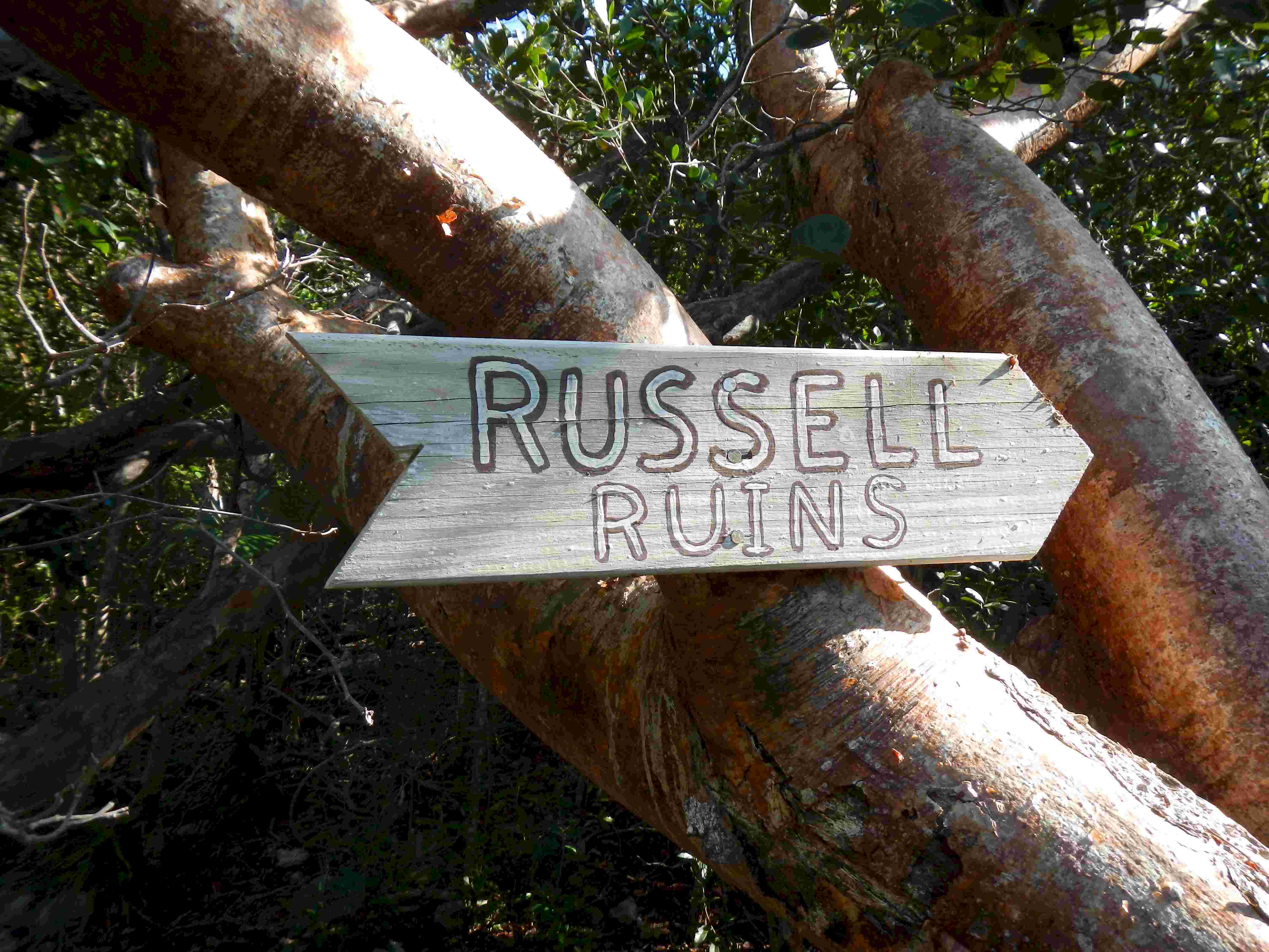
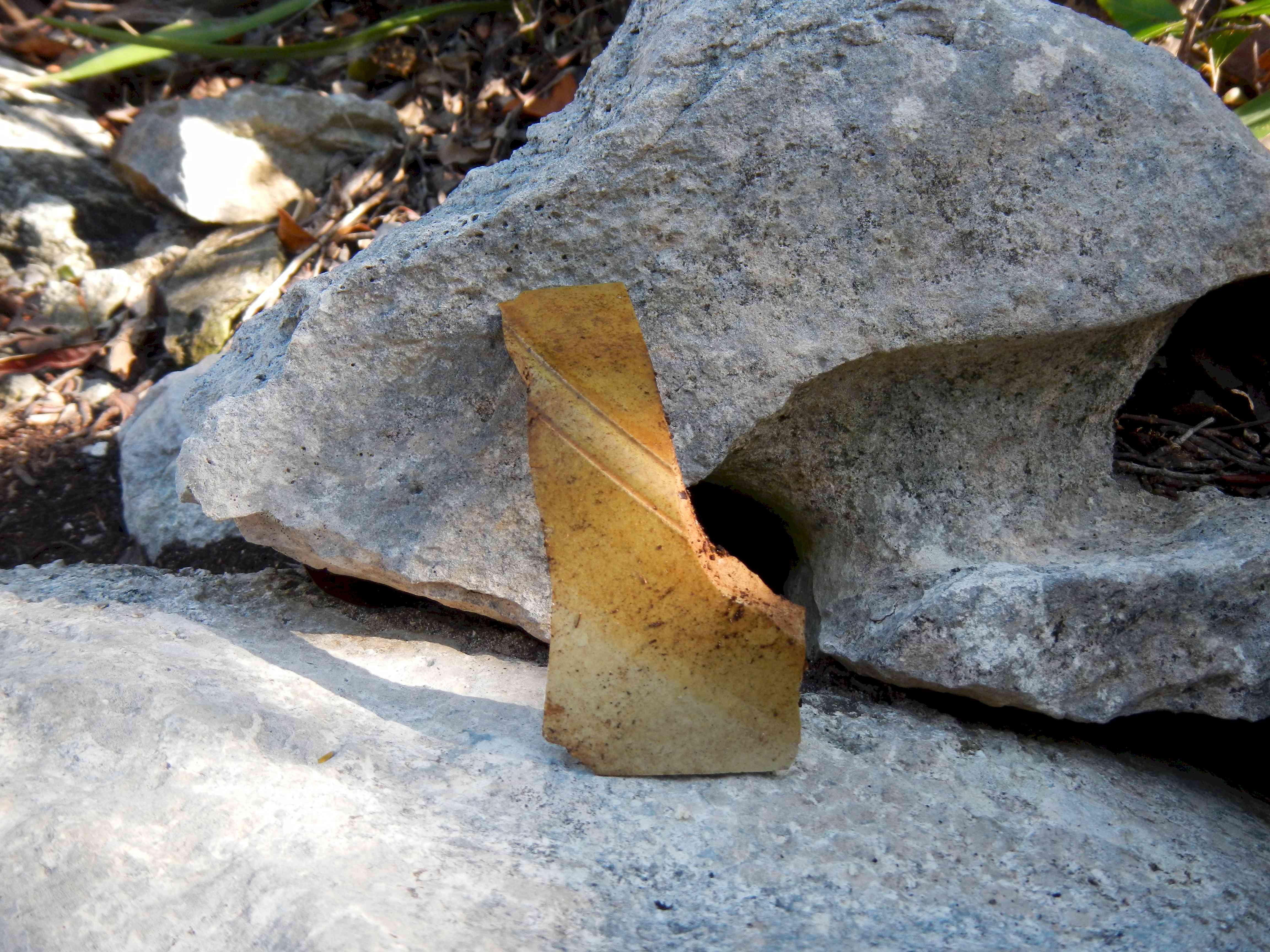 Could this pottery shard
date from the early days of the settlement?
Could this pottery shard
date from the early days of the settlement?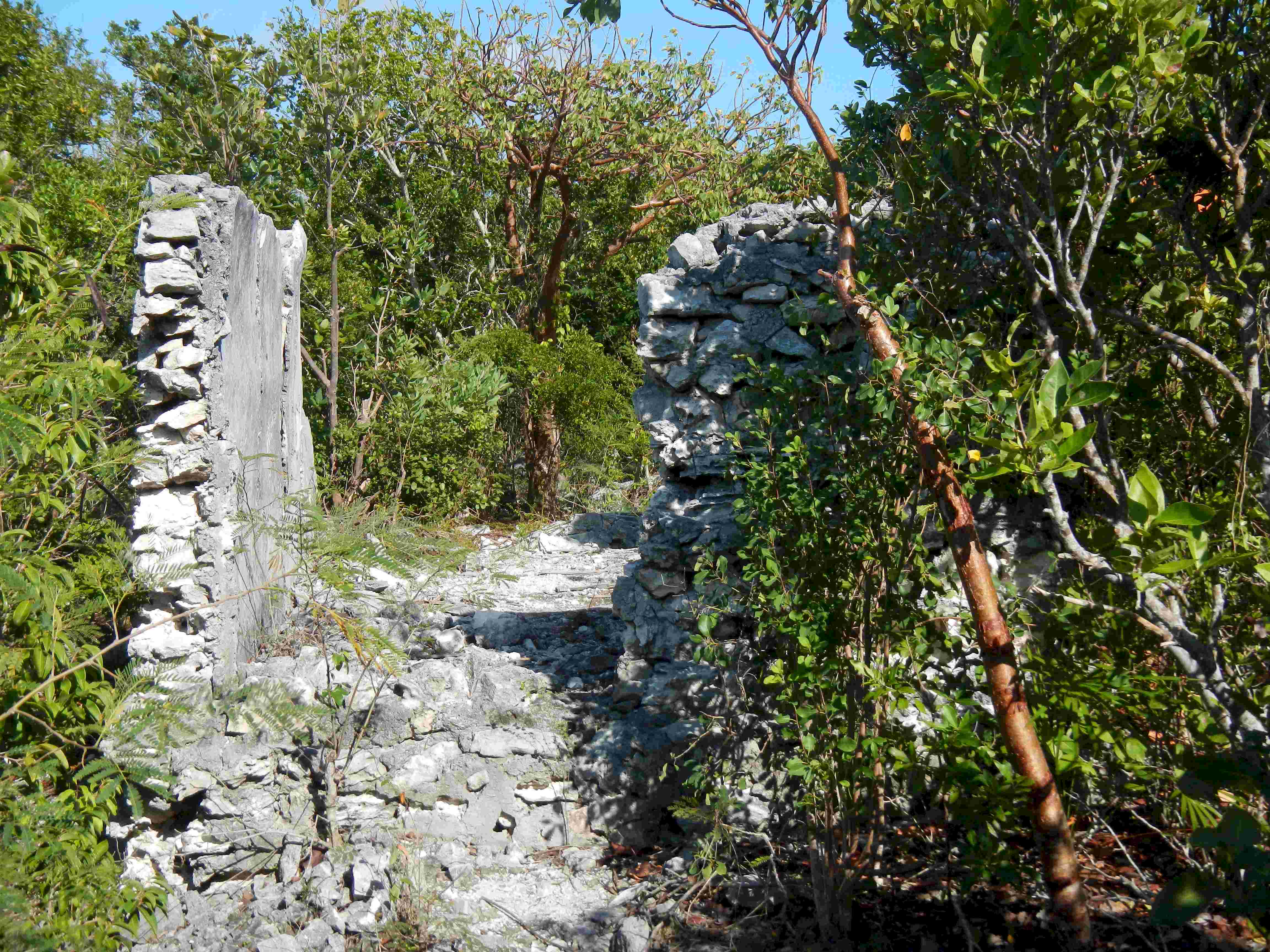 One of the original ten
houses.
One of the original ten
houses.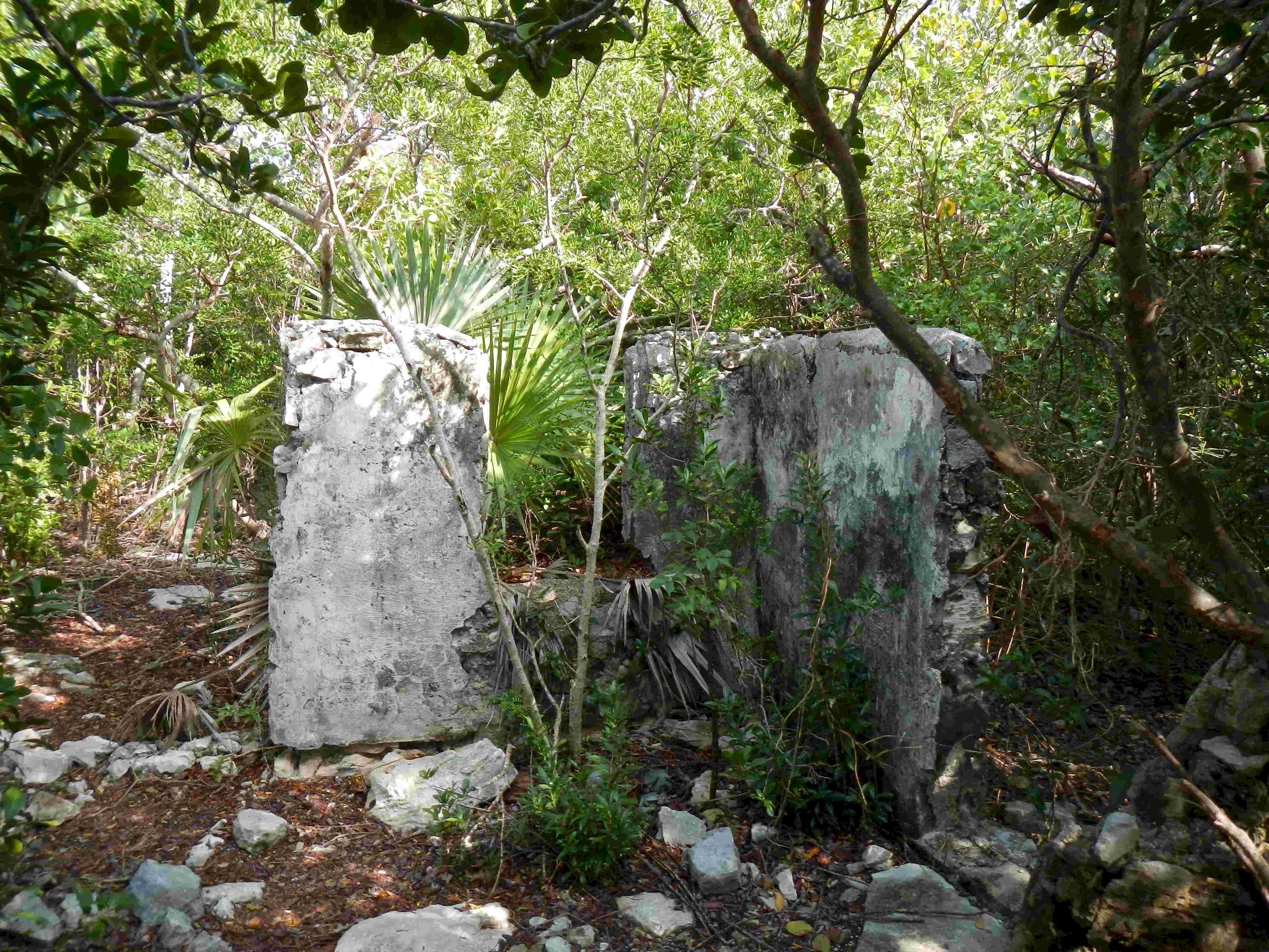 All that's left of one of the
houses.
All that's left of one of the
houses.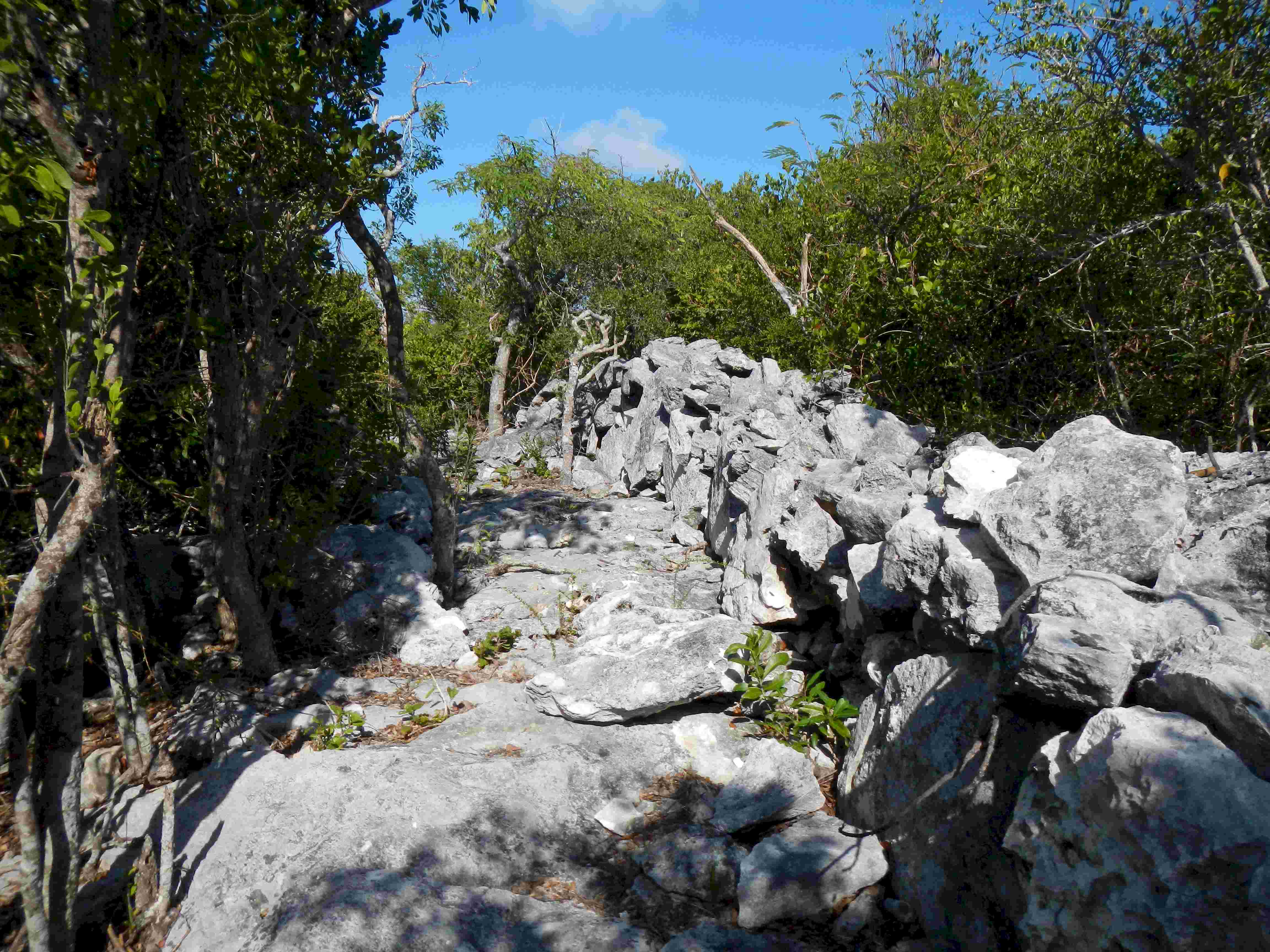 The Loyalist settlers here at
Hawksbill must have gotten some lessons in stone wall building from the farmers of New
England.
The Loyalist settlers here at
Hawksbill must have gotten some lessons in stone wall building from the farmers of New
England. A photo for the naturalists
in the crowd.
A photo for the naturalists
in the crowd.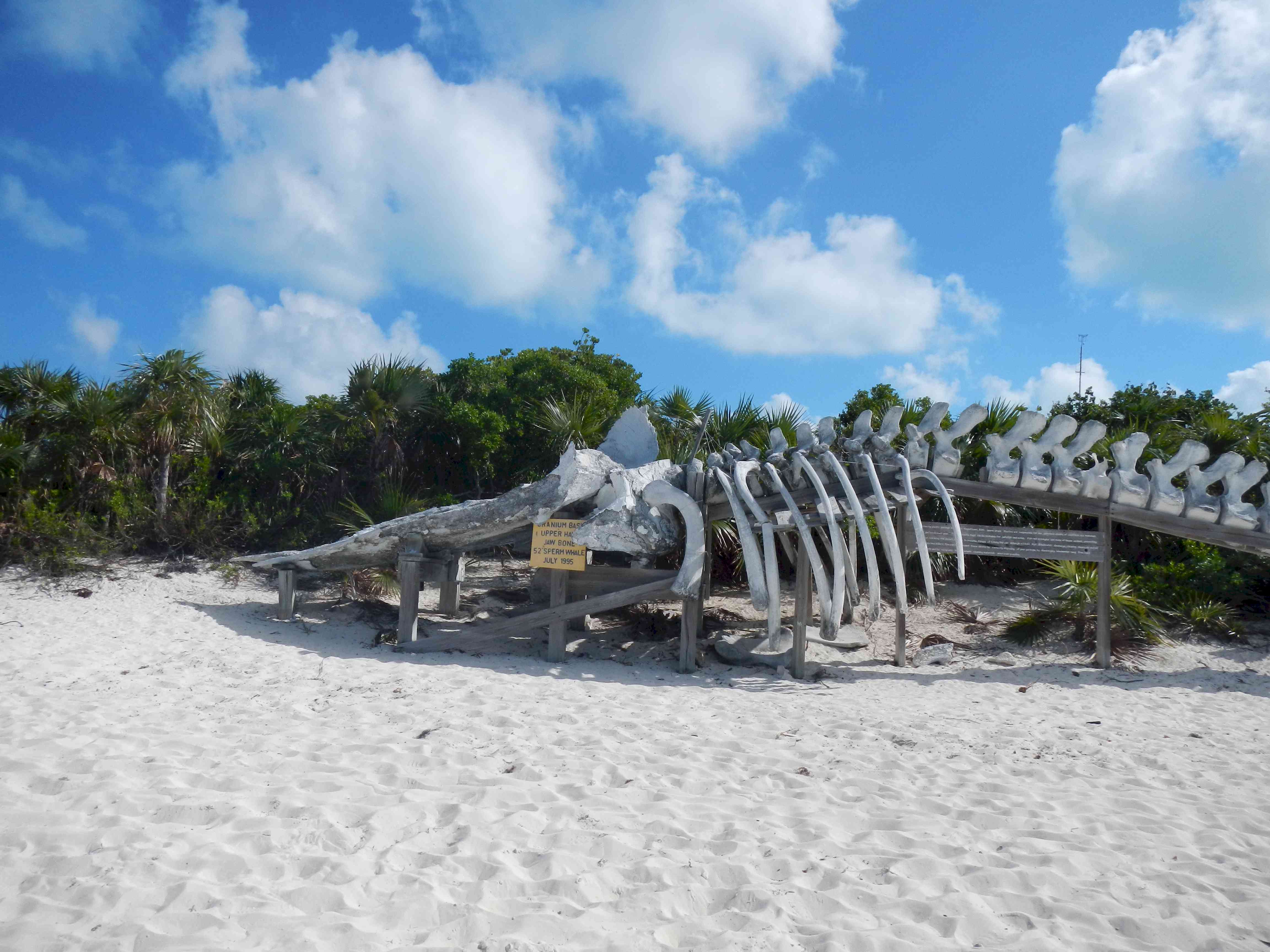 Another iconic picture.
Everyone visiting Exuma Park includes this whale in their blog.
Another iconic picture.
Everyone visiting Exuma Park includes this whale in their blog. My beautiful Andante in the
north anchorage of Exuma Park.
My beautiful Andante in the
north anchorage of Exuma Park.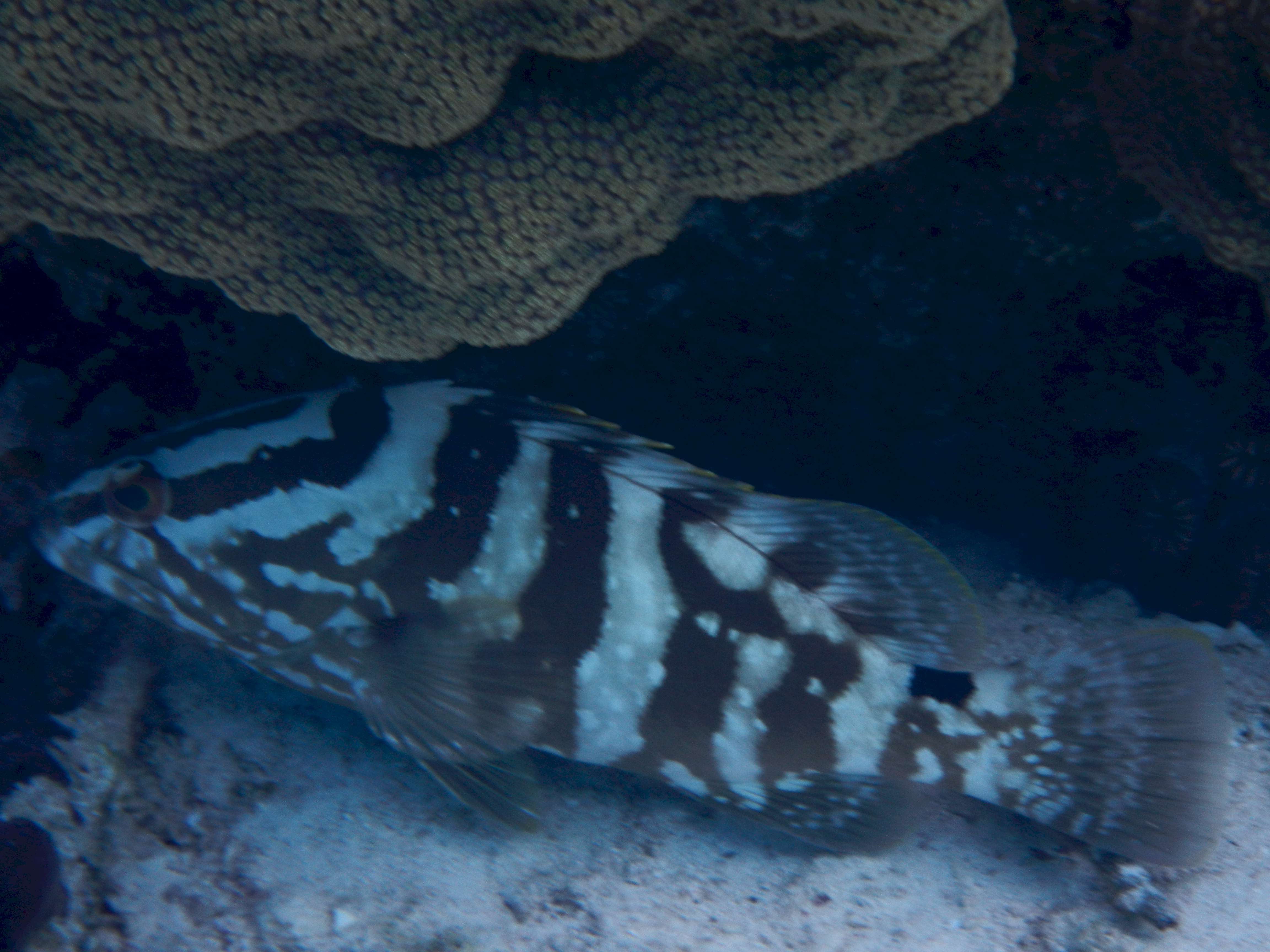 One of the many grouper to be
found in the coral Garden at Exuma Park.
One of the many grouper to be
found in the coral Garden at Exuma Park.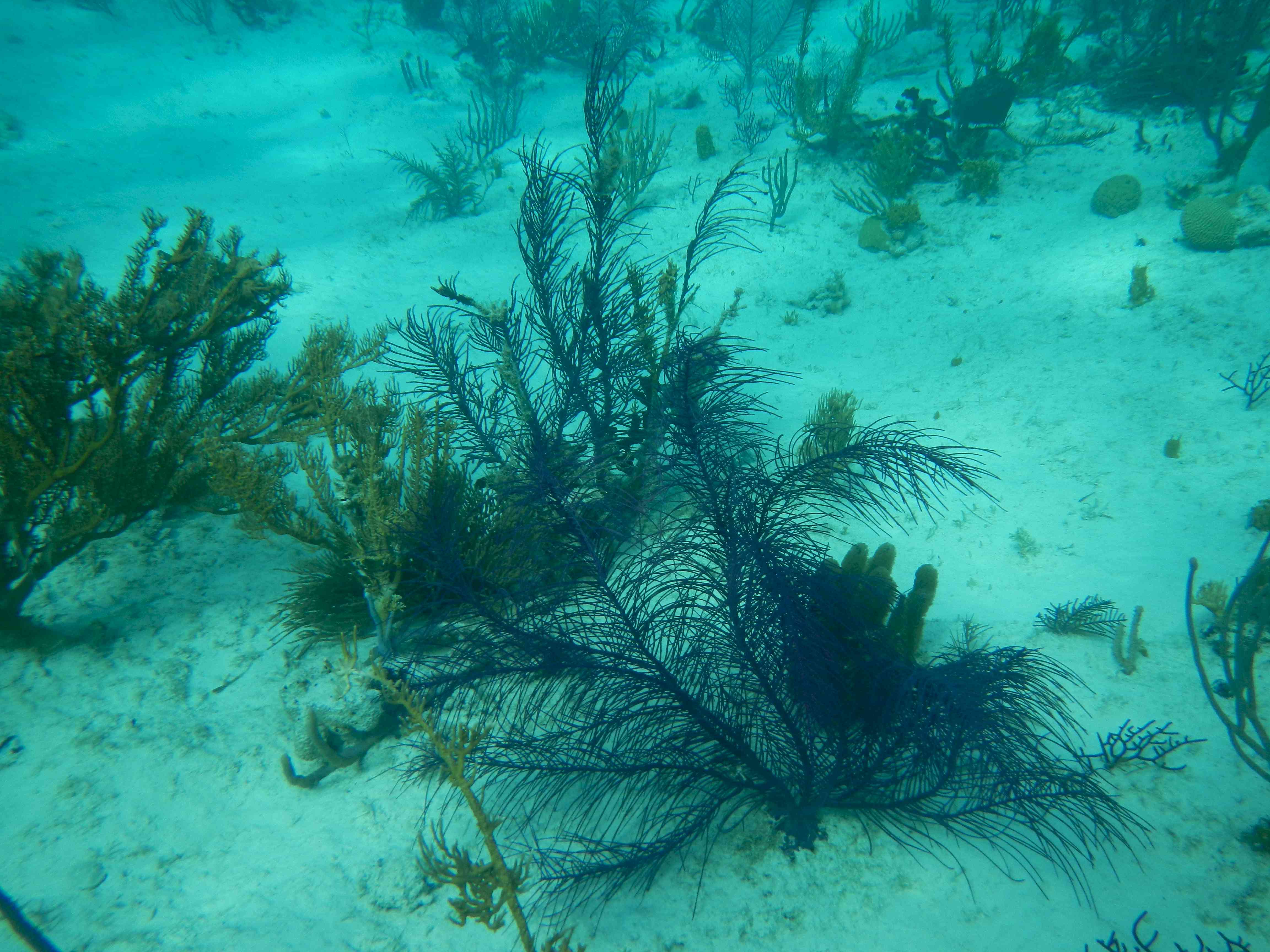 The color didn't reproduce
well, but the lacy coral is a brilliant purple.
The color didn't reproduce
well, but the lacy coral is a brilliant purple. 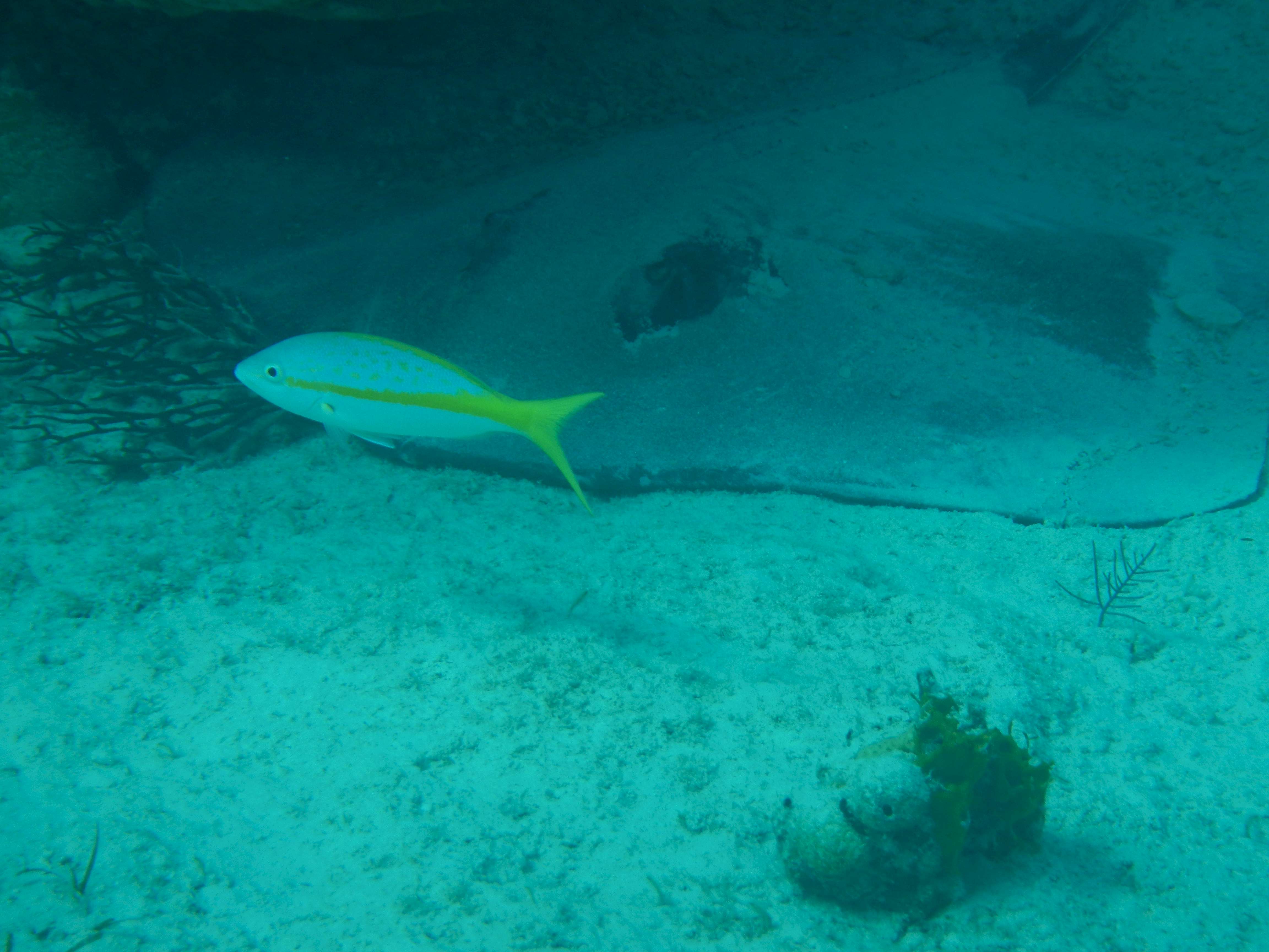 The purpose of this photo was
not to get the jack, but the ray behind him. If you look carefully you can see the ray's
leading edge. The dark ovals on top are his eyes.
The purpose of this photo was
not to get the jack, but the ray behind him. If you look carefully you can see the ray's
leading edge. The dark ovals on top are his eyes.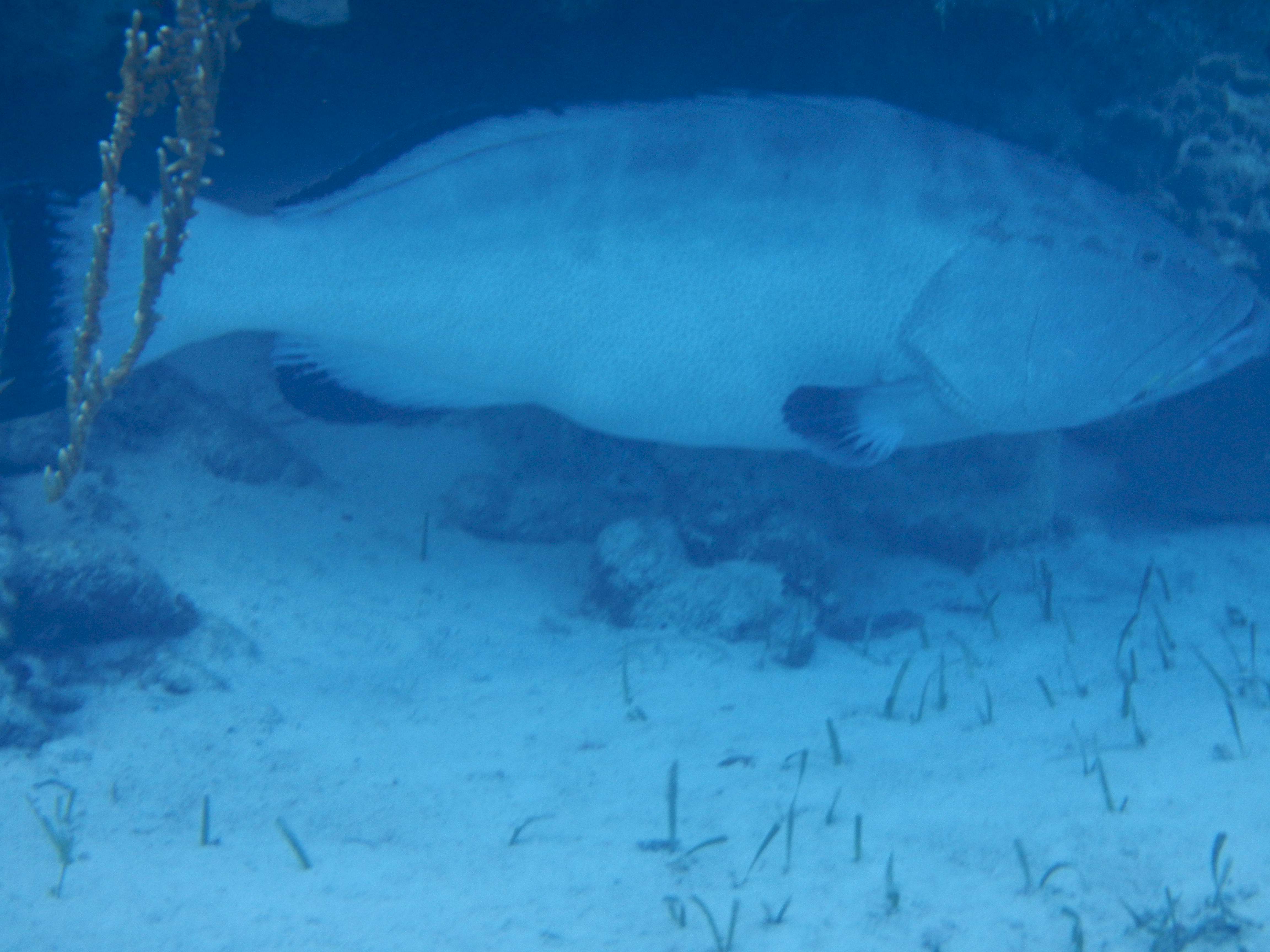 This grouper appeared to be
about three feet long. In the park the fish feel very secure. He was so calm
that I felt I could have swum up and petted him.
This grouper appeared to be
about three feet long. In the park the fish feel very secure. He was so calm
that I felt I could have swum up and petted him.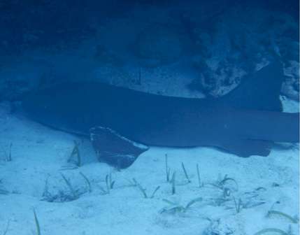 This is Shiela the nurse
shark. She was resting on the bottom while being watched over by the BIG grouper in
the previous row.
This is Shiela the nurse
shark. She was resting on the bottom while being watched over by the BIG grouper in
the previous row.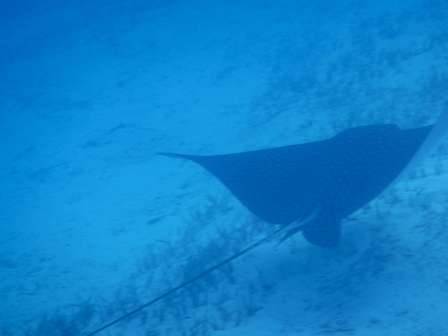 This is a huge spotted ray that
was crusing through the coral garden while I was in the water. His/her wing span was
easily 6 feet. And unless you want to end up like the Australian guy on Wild
Kingdom, stay clear of that tail.
This is a huge spotted ray that
was crusing through the coral garden while I was in the water. His/her wing span was
easily 6 feet. And unless you want to end up like the Australian guy on Wild
Kingdom, stay clear of that tail.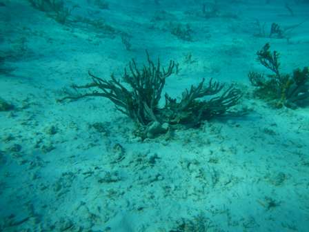 Just another pretty coral
formation. Of course the colors are much sharper in the water. Real underwater
photographers must have some sort of flash to bring out the colors.
Just another pretty coral
formation. Of course the colors are much sharper in the water. Real underwater
photographers must have some sort of flash to bring out the colors.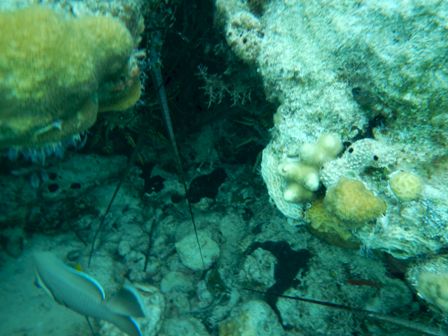 The long pointy objects are
the antennae of the lobster hiding under this rock and coral formation. If you follow the
antenna in the center of the picture back to the top edge you can see his head. It is
tough to photograph these guys since they are on the bottom and hidden in caves
necessitating some hang time while the camera focuses. The hang time is the hard
part since in my fatitude I am pretty bouyant and I also don't want to hit the other coral
with my flippers or stir up the bottom.
The long pointy objects are
the antennae of the lobster hiding under this rock and coral formation. If you follow the
antenna in the center of the picture back to the top edge you can see his head. It is
tough to photograph these guys since they are on the bottom and hidden in caves
necessitating some hang time while the camera focuses. The hang time is the hard
part since in my fatitude I am pretty bouyant and I also don't want to hit the other coral
with my flippers or stir up the bottom.