| Andante's Sailing
Blog October 2012 |
|
Go back to table of contents |
Unlike the vast majority of blogs which post entries in
reverse chronology, Go Ahead to November 2012 |
| October 1 - 7, 2012 Rock Hall, MD | |
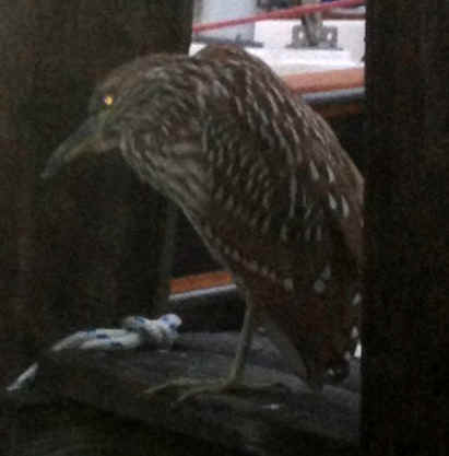
| This post is a smorgasbord of matter. Some recent history: Last fall I broke something at the masthead. To repair it the mast was taken out this spring. Once out of the boat it was found that the bottom seven feet of the mast was cracked. To see a photo montage of the mast installation click here. More history: I wound down my career, sold my house (and its rehab) and moved aboard. The career part was easy. Selling the house was not so easy. I had a great agent, Carol Young from Keller Williams, who got my asking price the first weekend. Believe me when I tell you it was a great price, 15% higher than the other agents I interviewed had suggested. To get to the point of listing the house I put in untold hours of work which included doing exactly what I was told by my home staging consultant, Linda at OnCue Homes. Once there was a contract, then the work started. Getting out of a 3400 square feet home into a boat of 300 square feet is a job. I moved aboard at the end of June 2012. In 2011 and 2012 I completed many projects to make the boat more livable and to repair some damage resulting from some improper prior maintenance. For 2011 click here and for 2012 click here. Between the house and the boat most of 2012 was grueling. Anticipating all of the projects to be done over the summer I had my compound mitre saw, my portable table saw, my jigsaw, my shop vac and all the rest of my hand tools living on the boat with me. It was a crowded and dusty summer. A web page of Caliber owners headed south in 2012. So, now here we are at the end of the summer. The osprey which have been plaguing some boat owners all summer seem to have moved on. You can see some close-ups of these magnificent birds by going to my Scenes of the Chesapeake page. Twelve years ago I had a boat here. By comparison there are now far more osprey in the area. So, although the birds perch in the rigging to eat their dinner and make deposits on the deck, it is a good sign that there are more of them. Rock Hall is also in the flyway for Bald Eagles. In the last month I have seen several of them hunting for fish and small game. Sorry, no pictures. My old Kodak digital camera and iPhone just don't have powerful enough lenses to zoom in that far. The presence of the eagles is also a change from 12 years ago when I knew the location of a nest, but never saw the birds. On the other hand, nature has not been bountiful all around. This year there was a lot less crabbing going on in Swan Creek by comparison to even the prior two years. Moreover, 12 years ago you could walk down the dock and see the beautiful swimmers clinging to the pilings. I have been told by some of the locals that the crabbing has been very good further south on the Bay. This morning I woke to find the bird pictured below on the
end of the finger dock outside my bedroom window. He was hunting and stood perfectly
motionless for at least ten minutes, until I went out on deck to get a better picture of
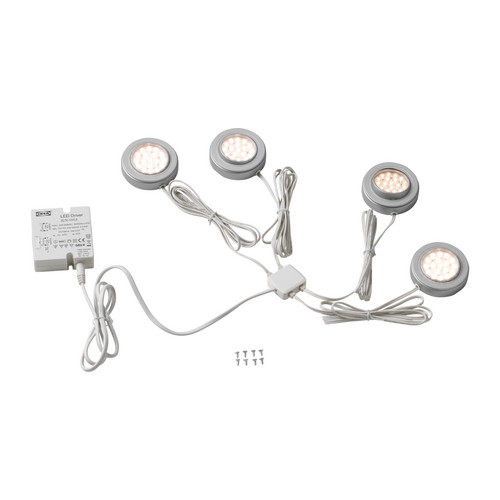
him. This week I have spent more than $500 on victuals, or provisions in modern parlance. No infested hardtack or rancid meat, but plenty of grog. I have also changed my Verizon account so that my iPhone is now a personal hotspot. Another communications upgrade has been a high gain WIFI antenna from Island Time so that I can pick up more distant access points. Between the iPhone and open wifi networks I should be in good shape for the foreseeable future. On Thursday I am making my first trip to the Annapolis boat show. Everyone assures me that this should be an experience. Post script: While there I talked to the makers of the ECH2O Tec water maker, which I would love to own. Unfortunately, even though Travelers Insurance was fabulous, the mast project and all of the other jobs that were spun out of it plus other budgeted items resulted in hemorrhaging money this summer. No water maker this year. I did buy a new Third Reef foul weather jacket from West Marine. The last one I bought from them lasted more than a decade before it let more water through than it kept out. The only other thing I bought was two LED arrays from Cruising Solutions. These arrays will go in my overhead dome lights. For a discussion of the LED issue keep reading. Last winter I came across a boating blog in which the owner had found a product at IKEA that had 4 hockey puck LED dome lights in the system (INREDA).
Since the power block stepped the voltage down to 12v he just snipped out the pucks and put them inside of his boat's dome lights. At $40 for the four, it seemed like a good deal. Then I started reading about all the caveats posted by readers of cruisersforum.com. There is a lot of discussion about the fact that voltage and current variations will produce some heat which is the death knell for LEDs. There is also a lot of discussion about light quality; harsh white of the LED versus the more mellow yellow of an incandescent bulb.The LED propaganda tells us that these 'bulbs' will last tens of thousands of hours. With all that in mind I am running a side-by-side test of the LED arrays versus those I bought from Cruising Solutions, which were designed explicitly for a boating application. So far the IKEA arrays have a more pleasing color, but they don't produce the same number of lumens; and no I haven't looked at the wattage ratings of the two arrays. For those who might be in the market for foul weather gear, let me share my thoughts. I compared the jackets from WM, Henri Lloyd and Gill. What I found was that at the same 'coastal' quality level the WM is made by HL. WM and Gill are very similar, but the WM had positive closures on both of the outside pockets. The inside lining of the Gill seems to be more breathable. All through seem to have the same outside fabric. In the end it came down to price. Friday I took back the car that I borrowed from Maria. Lending me one of her cars has been gracious and a Godsend. How many of you can say that your ex-spouse would do this for you? Thank you, thank you, thank you. My Nissan Maximaborghini died ten days ago and was rendered unto Salvation Army. I will get a tax deduction, but I was counting on the cash. The quality of life on Andante improved markedly over the last few days. In recent weeks I had been toying with the idea of changing my Verizon account and getting a Verizon MyFi or Jetpack to create an internet access point on the boat over the cell network. In the end, after some discussion with a Verizon sales rep, I opted to just make my iPhone a personal hotspot. As such it serves as a wireless modem for my PC while running on the cell phone network. In addition I bought a high gain antenna/radio from Island Time PC.
This increases the distance over which I can find household or business wifi hotspots. When I took Maria's car back I picked up my household wireless router. Mine, as does yours, has a power brick that steps down the 110 v AC to 12v DC in my case. I wired the Island Time radio/antenna to the router and now I have a wireless ethernet on the boat.
In making this possible I had to get rid of the piece of crap USB Cisco radio/antenna that I bought from the man who does the wifi here at Swan Creek Marina and restart the radio/antenna that was built into my PC. In so doing I found that my Bluetooth is now operational as well. With operational Bluetooth I am now able to drive my Jawbone Jambox speaker from my PC, on which resides my entire music collection. The Jambox measures about 2 x 6 x 1.5 inches but puts out a big sound wirelessly, which gives me audio out in the cockpit without cutting holes in the cockpit as so many other boaters do. Today, Sunday 10/7, we are feeling the effects of the most recent cold front that has come through. Over the last month or so there has been one almost every week. This week we are to have three. Today's high temp is to be 54 degrees, but right now in the early afternoon it is 52 F. This is quite a change from earlier in the week when it was warm enough and sunny enough on Monday for me to spend a couple of hours scraping my bottom. Er, I mean scraping the growth off Andante's bottom. |
|
| October 8, 2012 Rock Hall, MD | |
| Neque porro quisquam est qui dolorem ipsum quia dolor sit amet,
consectetur, adipisci velit.... Today was to have been departure day and I am still in Rock Hall. It is about 45 F outside and intermittent rain. No, I am not a masochist. On the contrary, I would love to be further south. Unfortunately I am still waiting for the rigger to finish up his job. On the other hand I can use today to work on a consulting project to replenish some of the blood (ooops, money) that I hemorrhaged this summer. |
|
| October 9, 2012 Rock Hall, MD | |
Upon my retirement a former grad student and
friend gave me a Nook Color  so that, inter alia, I can read on
the go. For the month or so before I moved down to the boat I was using the Nook quite a
bit, reading mostly classics that were in the public domain and made available by the
Gutenberg Project. so that, inter alia, I can read on
the go. For the month or so before I moved down to the boat I was using the Nook quite a
bit, reading mostly classics that were in the public domain and made available by the
Gutenberg Project. |
|
| October 10 - 11, 2012 Rock Hall, MD to the Rhode River below Annapolis on the 10th and Rhode River to Solomons on the 11th | |
| On Wednesday I finally took leave of the dock
at Swan Creek. As much as I liked everyone there, it was time to leave. The
boat was done, the weather was turning cold. That day I had a beautiful sail down to the Rhode River,
with very pleasant breeze. It has been more than a few years since I last sailed
past the Thomas Point Light.
Almost as soon as I had the anchor down and it turned dark the wind piped up. Much to my chagrin I had not put out much scope, so it was a nervous night. While at anchor I could hear a cow lowing and hear some folks on a nearby boat having a grand time. On Thursday morning I was slow to get up and out on the Bay
as I wanted to be out on the water to see the big schooners racing down the
Bay. Alas, the wind didn't cooperate with me or the schooners. In the AM it was
fantabulous sailing, but the schooners were just departing Baltimore for their 1:30 PM
start below the Bridge. There was such good wind that on a broad reach I made as
much as 8.5 knots. |
|
October 12, 2012 |
|
I spent the day in at my office on Back Creek in Solomons,
MD. The view from all my windows was great, but I especially like the view out the
back door. 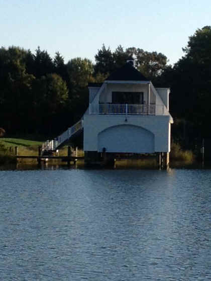 This little boat house with apartment over it
is attached to a very large, well manicured property. While enjoying the sunshine
and gentle breeze I worked on my project for the firefighters of Stamford, CT. Not a
bad way to spend a day at the office. This little boat house with apartment over it
is attached to a very large, well manicured property. While enjoying the sunshine
and gentle breeze I worked on my project for the firefighters of Stamford, CT. Not a
bad way to spend a day at the office.For lunch I went down to CD's Cafe with Mike and Maryellen from sv Coaster. My crabcake sandwich was exquisite, if over-priced.
|
|
October 13, 2012 Solomons to St Mary's City on the north side of the mouth of the Potomac |
|
As much as it pained me to do so, I left Solomons today in
anticipation of light winds from the east. Things went swimmingly for awhile,
sailing on a beam reach towards the Potomac. Of the boats leaving Solomons this
morning I was the last to turn on the motor. Akong the way I passed a light house that is
more representative of the style seen on the Bay.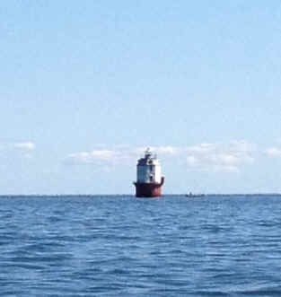 Apart from the screw pile houses like
the one shown above, our lighthouses don't rival those in New England. Not too long after
the lighthouse the USN Apache appeared from nowhere throwing a huge bow wave and a big
rooster tail out the back. Apart from the screw pile houses like
the one shown above, our lighthouses don't rival those in New England. Not too long after
the lighthouse the USN Apache appeared from nowhere throwing a huge bow wave and a big
rooster tail out the back. 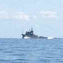 A few hours later I was into the Potomac headed toward
The Glebe on the south shore of the Potomac. About half way across the river the
wind came up from the southeast enough to make it worth setting the sails and turning off
the motor. For a time I sailed a broad reach when, of course, the wind started to
drop. Since the water was flat at this point and there was no counter current to
speak of, I decided to give the spinnaker another try. Sorry to bore you with
another spinnaker photo so soon but... A few hours later I was into the Potomac headed toward
The Glebe on the south shore of the Potomac. About half way across the river the
wind came up from the southeast enough to make it worth setting the sails and turning off
the motor. For a time I sailed a broad reach when, of course, the wind started to
drop. Since the water was flat at this point and there was no counter current to
speak of, I decided to give the spinnaker another try. Sorry to bore you with
another spinnaker photo so soon but... 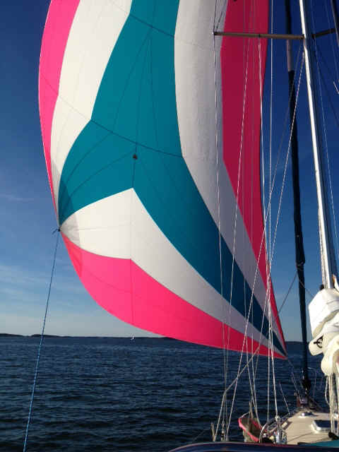 I will be in the St Mary's River probably until Tuesday when there will be some north wind to head south. The plan for today is to visit the restored and reproduction colonial city here on Sunday then spend Monday, when it is supposed to rain, in my office. |
|
October 14, 2012 St Mary's River, MD |
|
It is Sunday, the church bells are ringing on the college
campus and I'm going site seeing. Oops, it seems it was the campanilla on campus. Every
college campus has a campanilla it seems. 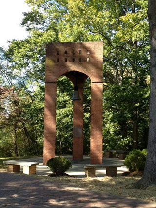 What do places like Phoenix Univ do for a campanilla? And
that is not to mention the water feature which now seems to be mandatory on college
campuses. With the lighting and my iPhone this is the best I could doi for showing off the
little fountain by the student union. What do places like Phoenix Univ do for a campanilla? And
that is not to mention the water feature which now seems to be mandatory on college
campuses. With the lighting and my iPhone this is the best I could doi for showing off the
little fountain by the student union.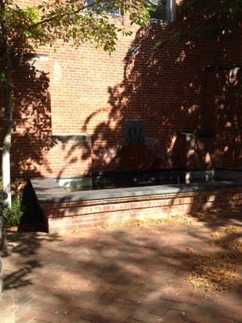 After a short walk
through the college I went for a walk through the living history museum of St Mary's City.
The city was settled in the ealry 17th century .
|
|
October 15, 2012 Monday, St Mary's River |
|
| Today was to have been a work day, but between Temple University and the Microsoft kidz in Redmond and the folks who build hardware that use WIndows it just didn't happen. Without going into a lot of details Temple has a chnage management problem when it comes to upgrades and maintenanceon their system. Ther network people think that all they have to do is implement the changes they deem necessary and then let the user community adapt. Also, without going into detail, the 12v adapter I bought for use with my HP doesn't work quite right. Of course HP built the freakin' machine with a 19v platform; what nonsense. And of course they use Windows to manage the power applied to the machine. So I got some readiong and other small tasks finished up. All while waiting for the forecasted rain. There were a couple of boats that left St Mary's River this morning to slog into the head wind to the accompaniment of rainInstead of work-work I did some small boat chores, whipping the ends of lines for example, and reading. | |
October 16, 2012 St Mary's City to Fishing Bay on the Piankatank River south of the mouth of the Rappahonock River |
|
As forecasted the wind built in from the NW today and
brought with it some chilly air. Today I sailed 54 nautical miles from the St Mary's river
to the Piankatank River just off the southern cape of the Rappahonock River. Most of the
day was on a broad reach with a few stints sailing wing-and-wing.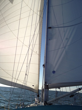 with the mainsail to one side of the centerline
of the boat and the genoa to the other side. This is a very difficult point of sail to
mainain as any seas at all will slew the stern past the eye of the wind and cause an
accidental jibe. I am the first to admit that I am not the greatest sail trimmer and
helmsman in the world, but today was a great day to sail. Nevertheless there were a bunch
of boats that went by me like I was standing still. I think they were cheating and were
motor sailing because they didn't have the patience to hand steer and keep the sails full
as the boat rolled with the confused seas on the Bay. Come to think of it, any time there
is any wind to speak of, especially from the north, the sea state on the Bay is confused.
First you've got the wind driven waves, then you've got the waves driven by the tidal
current, then you've got the current produced by the fact that Chesapeake Bay is really
just a collection of drowned rivers. At any givenmoment the boat is being rocked and
rolled from all different directions and forces. All that said, it was a great sailing
day. with the mainsail to one side of the centerline
of the boat and the genoa to the other side. This is a very difficult point of sail to
mainain as any seas at all will slew the stern past the eye of the wind and cause an
accidental jibe. I am the first to admit that I am not the greatest sail trimmer and
helmsman in the world, but today was a great day to sail. Nevertheless there were a bunch
of boats that went by me like I was standing still. I think they were cheating and were
motor sailing because they didn't have the patience to hand steer and keep the sails full
as the boat rolled with the confused seas on the Bay. Come to think of it, any time there
is any wind to speak of, especially from the north, the sea state on the Bay is confused.
First you've got the wind driven waves, then you've got the waves driven by the tidal
current, then you've got the current produced by the fact that Chesapeake Bay is really
just a collection of drowned rivers. At any givenmoment the boat is being rocked and
rolled from all different directions and forces. All that said, it was a great sailing
day.
|
|
|
|
| A long boring day of motoring. As I got out onto the Bay I could count about a dozen boats motoring south. Along the way a few peeled off or got far enough ahead that I couldn't see them any longer. By the time the snow birds reached Thimble Shoals the count was down to six or eight boats. Then it became a race as though there surely would not be enought space for all of these boats headed throughout the Hampton Roads area. This mentality we observed to be commonplace when we went south in fall 2000. | |
|
|
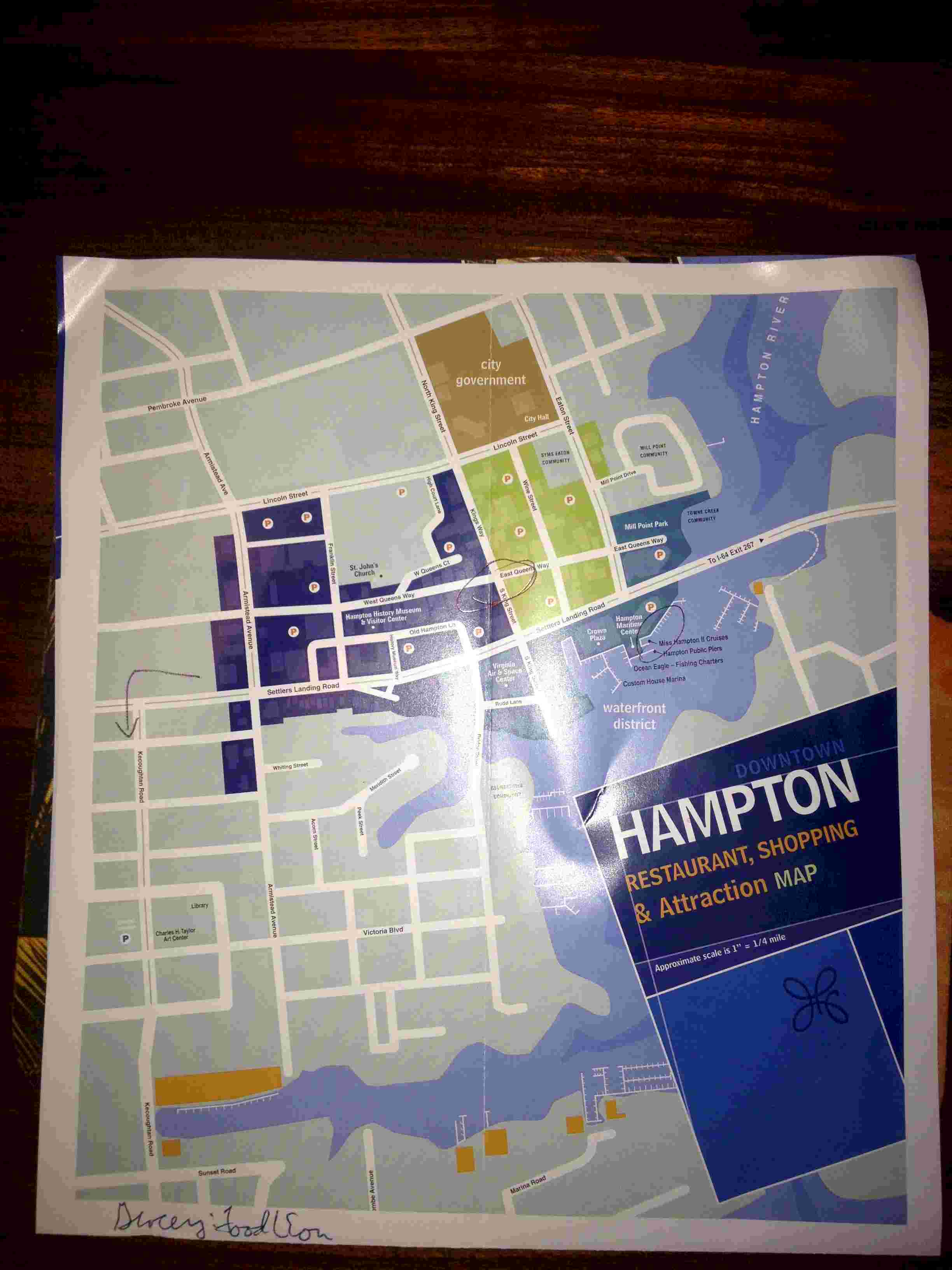
 Just some photos as I
walked around Hampton. This is a cute little town. It has gone through many metamorphoses
has it has alternatley been occupied and/or burned by the oringinal settlers, the British
and then both sides during the Amrican Civil War. Otherer transformations have been driven
by the rise and decline as a seaport, a fishing port, home of the Army Air Corps and
Langely, then the early days of aviation research and then NASA. Just some photos as I
walked around Hampton. This is a cute little town. It has gone through many metamorphoses
has it has alternatley been occupied and/or burned by the oringinal settlers, the British
and then both sides during the Amrican Civil War. Otherer transformations have been driven
by the rise and decline as a seaport, a fishing port, home of the Army Air Corps and
Langely, then the early days of aviation research and then NASA.
After my walking tour I returned to the boat to find that I was aground! Early in the day I got in the dinghy to measure depths with my handlheld depth sounder I didn't account for the range of the tide. But I did check the wind forecast. Of course the tidal range was about twice what I had figured and the wind died so the boat swung on its anchor and settled in the mud. So that I could get off as the tide came in I put out my second anchor from the stern toward the channel and deeper water. Late in the day, when it was too late to do anything about it, the Swiss couple on the boat next to me had their knickers in a twist claiming that because they would swing on their anchor and I would not that they would hit me. I pointed to the lay of my rode and told them there was no problem. They were insistent. I ignored them, hoping that I was right. In the end I WAS right. |
|
October 19, 2012 |
|
| Today after the Swiss boat left I brought in my second anchor and moved the boat more toward the middle of the river. What a mess. The river bottom is a gooey, sticky, black mud. It covered the last dozen feet or so of chain where it dragged across the bottom. And, since I had to bring the anchor up on deck at the stern of the boat, that mess got all over me and the boat. Yuck. I gave the boat a washing with water from the river so that I wouldn't track the mud all over everything. After cleaning up I spent the balance of the day on my project for the firefighters in Connecticut., | |
October 20, 2012 |
Hampton Public Piers |
| Today I came into the marina. They are running a special for BoatUS members: 3 nights for the price of 2. By the end of the day I had washed the boat with fresh water and soap, done two weeks worth of laundry, and scrubbed my body. (Yes, I have bathed since leaving Rock Hall on 10/10, but in river water or a sponge bath.) In the evening there was a little reception sponsored by the Seven Seas Cruising Association at a nearby bar. I met a few people headed south. Way down the road I may bump into them again since they don't seem to have my insurance restriction or family obligations that will keep them north. Many hope to be in Florida by Thanksgiving, while I will be in Charleston at that point. | |
October 21, 2012 |
Hampton Public Piers |
| The plan for today is to work on my consulting project and make a trip to the grocery store. I am hoping that my mail will come tomorrow so that I can leave here on Tuesday for the two day trip down to Elizabeth City, NC. I will be there until the end of the month when the insrance company says that it is OK for me to head further south. | |
| October 22, 2012 | Still in Hampton |
 Well, yesterday was
a bust as far as working was concerned. I spent the entire day trying to find
electronic charts for the Bahamas and eastern Caribbean that would be compatible with my
older Garmin GPSmap 492 chartpotter. The unit came pre-loaded with the charts
availbale for free from NOAA. When the unit was still being produced any new charts
had to be purchased from Garmin on their proprietary data card. At some point Garmin
worked with Explorer Charts to produce these really great charts of the Bahamas.
When I crewed for Margo Roark from Nassau
to Staniel Cay she had these on her GPS. At the time I figured I would wait to buy
them until I was ready to go south. Mistake. The Readers' Digest version is
that Garmin and Explorer have not maintained a transparent relationship, Garmin has
vacillated on the degree to which it would support its own proprietary data card, and
Garmin does a terrible job of managing all of the legacy page on its web site. By
the end of the day all I had accomplished was to confuse myself regarding the availability
and compatibility of new releases of Garmin charts. And then I went to the grocery
store; a worthwhile endeavor. And, oh yes, my mail did come today. But of
course, while I am still in the PNC Bank market area, they don't have any branches
accessible by any means of transportation other than a car. Well, yesterday was
a bust as far as working was concerned. I spent the entire day trying to find
electronic charts for the Bahamas and eastern Caribbean that would be compatible with my
older Garmin GPSmap 492 chartpotter. The unit came pre-loaded with the charts
availbale for free from NOAA. When the unit was still being produced any new charts
had to be purchased from Garmin on their proprietary data card. At some point Garmin
worked with Explorer Charts to produce these really great charts of the Bahamas.
When I crewed for Margo Roark from Nassau
to Staniel Cay she had these on her GPS. At the time I figured I would wait to buy
them until I was ready to go south. Mistake. The Readers' Digest version is
that Garmin and Explorer have not maintained a transparent relationship, Garmin has
vacillated on the degree to which it would support its own proprietary data card, and
Garmin does a terrible job of managing all of the legacy page on its web site. By
the end of the day all I had accomplished was to confuse myself regarding the availability
and compatibility of new releases of Garmin charts. And then I went to the grocery
store; a worthwhile endeavor. And, oh yes, my mail did come today. But of
course, while I am still in the PNC Bank market area, they don't have any branches
accessible by any means of transportation other than a car. |
|
| October 23, 2012 | Hampton to Hospital Point Norfolk |
| Today I made the long journey from Hampton across Hampton Roads, past the Norfolk Navy Yard, to the small achorage at Hospital Point just above Plymouth. 12 years ago when we made the trip as a family we took a slip in Norfolk so that we could do some sightseeing, get groceries and do laundry. On this trip I spent the afternoon at anchor and put in 4 hours working on my project for the Stamford Firefighters. When we were kids our Dad was a Lieutenant in the USNR so had to do two weeks of active duty every summer. He came down here and now the names of places on the chart have some meaning to me: Norfolk, Little Creek, Newport News. | |
| October 24, 2012 | Hospital Point to the Dismal Swamp Canal Visitors Center at Mile 28 of the ICW |
|
|
From here on there is a lot of motoring; some requiring that one
pay attention and some exceedling boring and tedious. This morning I departed the
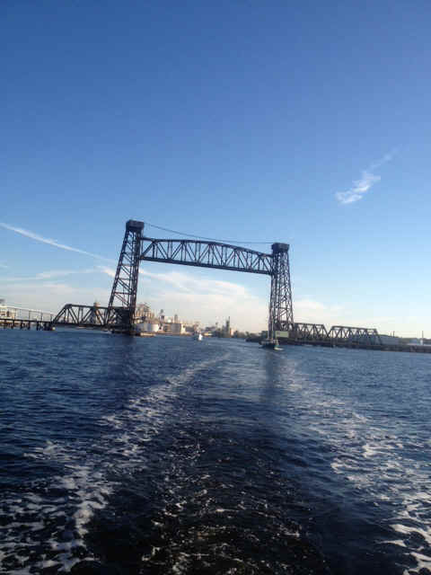
ancharage about 0815 so that I could arrive at the Gilmerton Bridge for its 0930 opening.
And the race was on! Along the way a large number of boats jonied the parade toward the
bridge. A bunch were totally clueless about the timing and were trying to rush ahead
in the queue. By the time we got to the bridge there were about 15 boats waiting for
the opening. the more clueless skippers made it difficult for those of us who were
trying to take it slow so that we would not have to come to a complete stop, at which
point one really cannot control the boat. As we approached a narrow bridge with a
north bound tug and barge coming at us several impatient power boaters and a catamaran
began to risk life and limb. I was concentrating so hard on keeping Andante and
myself safe that I cruised right on past the turnoff for the dismal swamp canal.
Yes, my first navigational error. Within a quarter mile as the boats were stacking
up to wait for a bridge opening I realized something was wrong, checked the chart and
turned around to make the channel for the Dismal Swamp Canal section of the ICW.
Two photos of the mornings passage through the industrial heart of Norfolk:
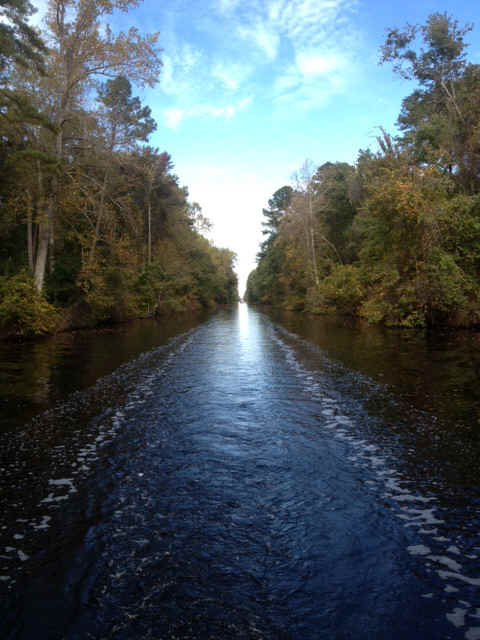
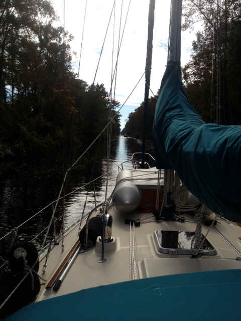
By my reckoning the Dismal Swamp route is the better choice. No power boats to rock and roll you as the roar past, or ask you to slow up so that they cango by slower and throw off a smaller wake. This gets very tiring very quickly. On the Chesapeake and Albemarle Canal route there are long expanses of very shallow open water with a long narrow channel through that requires lining up range marks both fore and aft. Finally, the C&A route is used by comercial barge traffic, and they have the absolute right of way! The Dismal Swamp route is quieter and prettier, even if it is more boring. The following two pictures show my view fo the world for about three hours today.
In the picture below you can see the five boats that chose the Dismal Swamp route out of about 20 that headed out of Norfolk this morning. Andante is in the foreground with her cream hull and teal canvas.
At cocktail hour this evening there was much discussion of the tropical storm Sandy brewing in the Atlantic. Excalibur and a couple of others are planning to rush past Elizabeth City so that they can make Bellhaven before there is a possibility of the storm making mischief for them. The docks and marinas in Elizabeth City are untenable in a Noreaster. I plan to anchor on the canal side of the Pasquotank River at Elizabeth City and just use my dinghy to get into town. I am sure I will be protected from any wind at the location I plan to use. Once I have gotten a letter I am waiting for, storm Sandy has decided what she will do, and the 'back door' cold front from New England has passed through then I will proceed on to Bellhaven myself. |
| October 25, 2012 Thursday |
Dismal Swamp Canal Visitors' Center to Elizabeth City, NC |
| As I wrote, yesterday evening the crews of the five boats in the
above picture had much discussion of the coming of Hurricane Sandy. Running Free
(Carl and Joyce Berdie) would be headed for Elizabeth City. Excalibur (Helen and
Keith Dreett) would be putting in a long day and pressing all the way to Belhaven.
Kabria (Corky and Anna Stewart) were headed at least as far as Elizabeth City.
Stormy Petrel (Ron and Kathy Minchin) didn't offer an intention, at least not that I
heard. Because I had to be in Elizabeth City for mail my choice was clear. Since I was outside of Excalibur at the dock, I got up early with them and Kabria followed close behind. Once clear of the canal and into the upper reaches of the Pasquotank River I could see Excalibur ahead being paid a visit by either the NC Marine Police, the Navy or the Coast Guard. They was no boarding, but both boats slowed while there was a conversation. I am dying to catch up with Keith and Helen to find out what it was all about.
At the end of the day I saw Suki and crew from s/v Mary T in their dinghy, the boat that had anchored behind me in the horseshoe, and repeated the message from the bridge tender. I think they too moved, but I don't know where they went. This evening I went to Thumpers for their Thursday night burger special. Cheese and msuhrooms on the burger with frenc fries on the side. Can't think when I last had a burger that I didn't cook for myself.
|
|
| October 26, 2012 Friday |
Elizabeth City, NC |
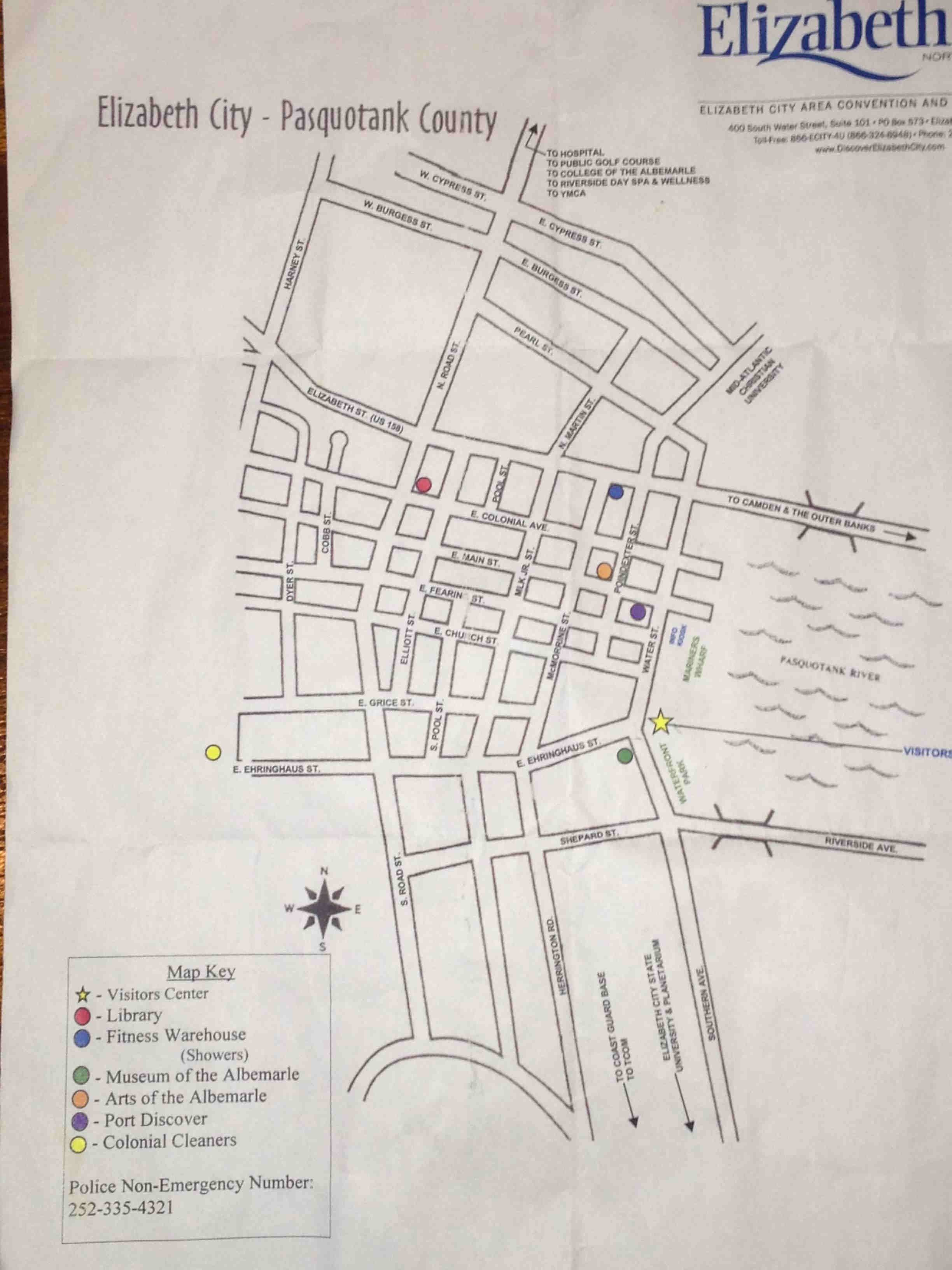
| Went to Fitness Warehouse for a hot shower; worth every penny of the $5. Had the rib eye steak dinner special at Thumpers with Carl and Joyce. | |
| October 27, 2012 Saturday |
Elizabeth City, NC |
| Spent the day getting ready for Hurricance Sandy and stressing out
about whether or not the decision to stay at the City Dock was the right one. In the
afternoon I worked on my project for the Stamford Firefighters. Four or five Canadian boats that were here at the City docks went north up the Pasquotank River to a place called Goat Island which is purported to offer good protection from bad weather. I had looked at the chart on Thursday and decided that it was not for me. The chart shows 5-6 feet at the entrance and 6 feet inside, although the cruising guide says 6 to 10 feet. Too shallow for my tastes since I now draw 5'2" |
|
| October 28, 2012 Sunday | Elizabeth City, NC |
| Sitting on the boat listening to the rain and wind. I should note
that 12 years ago when we came through here we were stuck for several days as we waited
out a storm. Once that storm went through we had great weather the rest of the way
down to Miami. Let's hope the same is true this year.
The tidal range here is normally about 1 - 1.5 feet. In this storm, with the wind from the NE and N, the concern is not a rise in the water level, but water blowing out of the navigable channel. The water level here at the docks has dropped 3-4 feet. I wonder how the folks up behind Goat Island are making out . |
|
| October 29 - October 31, 2012 | Elizabeth City, NC |
| On the 29th it was still stormy and not fit out for man nor beast.
Nevertheless I ventured as far afield as Carl and Joyce on running free. We
had a jambalaya with shrimp and hot sausage. I supplied the dessert. It had
been so cold that I ran the oven and made pumpkin bread just so that I could take off some
of the chill in the cabin. On the 30th the flock of Canadian geese (south bound boats) came back to the city docks from their hideout up the Pasquotank. They avowed that it was windy, but the water was flat.
On the 31st Carl and Joyce started the trek south, but I remained behind so that I could go to the supermarket, do laundry, and try to find some apparatus that can suck the oil out of my engine through the dip stick tube. At the end of the day I indulged in a hot shower at a nearby fitness club. Unlimited hot water. Yippee. In all my planning to meet my refrigeration and electricity needs I never thought about hot water. When away from the dock my only source of hot water is the engine's cooling system; The engine coolant is cycled through the hot water heater like a heat exchanger, it makes hot water and helps keep the engine cool. All-in-all Elizabeth City has been a pleasant interlude. If you're ever in Elizabeth City be sure to go to Thumpers restaurant and bar. Good prices and an interesting clientele. |
|
| Back to Table of Contents Ahead to November 2012 | |
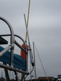 The antenna and radio are integral and mounted to the frame for my
solar panels.
The antenna and radio are integral and mounted to the frame for my
solar panels.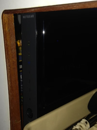 The router is inside one of the galley cabinets where it is accessible
and relatively safe.
The router is inside one of the galley cabinets where it is accessible
and relatively safe.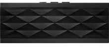
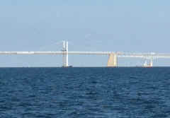 Leaving the
Chesapeake Bay Bridge behind.
Leaving the
Chesapeake Bay Bridge behind.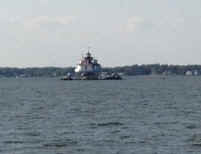 This is one of the last octagonal screw pile lights left on the Bay.
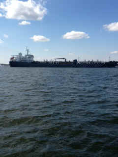
Along the way I shared the Bay with some other users. The big ships headed for Baltimore
require vigilance even if you think they aren't moving. Here are two reasons to watch
closely.
This is one of the last octagonal screw pile lights left on the Bay.
Along the way I shared the Bay with some other users. The big ships headed for Baltimore
require vigilance even if you think they aren't moving. Here are two reasons to watch
closely.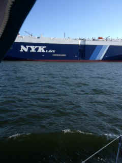
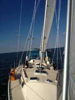 Such a good thing was not to last. By 11 the wind was dropping quickly. For
the first time ever I decided to wrestle with the spinnaker that I bought last
season. It took me quite awhile to get everything rigged correctly.
Such a good thing was not to last. By 11 the wind was dropping quickly. For
the first time ever I decided to wrestle with the spinnaker that I bought last
season. It took me quite awhile to get everything rigged correctly. 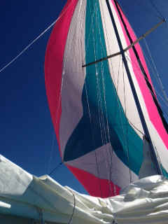 The spinnaker is beautiful
and pulls nicely in light air. Unfortunately that too was not to last. The wind died
altogether about 1:30 PM. The motor came on and off I went in order to make Solomons
before cocktail hour. En route I spied my next yacht.
The spinnaker is beautiful
and pulls nicely in light air. Unfortunately that too was not to last. The wind died
altogether about 1:30 PM. The motor came on and off I went in order to make Solomons
before cocktail hour. En route I spied my next yacht. 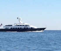 This little cabin cruiser uses more fuel in a
day than I can conceive of using on Andante over the next ten years. Final
destination was Solomons, MD.
This little cabin cruiser uses more fuel in a
day than I can conceive of using on Andante over the next ten years. Final
destination was Solomons, MD.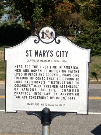 It served as the 'Capitol' of Maryland until that function was
transferred to Annapolis in 1695 The City as such survived for only another 45 years when
the area reverted to farm land.
It served as the 'Capitol' of Maryland until that function was
transferred to Annapolis in 1695 The City as such survived for only another 45 years when
the area reverted to farm land.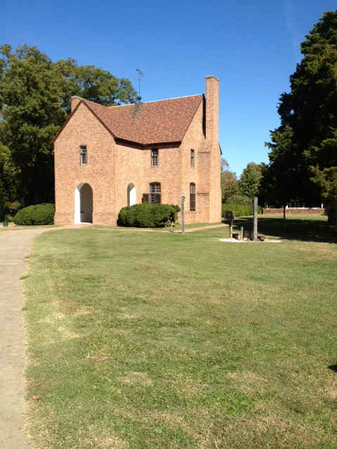 This is the state house or
seat of government. Notice the stocks for the purpose of disciplining miscreants.
This is the state house or
seat of government. Notice the stocks for the purpose of disciplining miscreants.
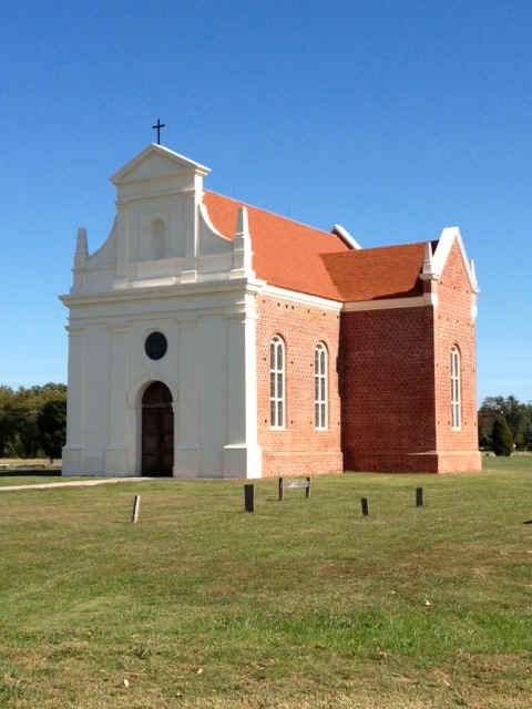 This Catholic Church is a
reconstruction of the 17th century church that once stood on this spot. The Maryland
colony was to have originally been organized along the lines of separation of church and
state. This didn't last long. Eventually the Catholics found it pretty tough
slogging once the Anglicans took things over. St Mary's even had a little episode
when the English Civil War found its way to the colonies. At the time the Maryland
capitol was still in St Mary's. An Anglican militia took over the state house in
order to impose proper non-Catholic rule. The takeover didn't last long and order
was soon restored. However, the Church continued in decline in the coming century.
This Catholic Church is a
reconstruction of the 17th century church that once stood on this spot. The Maryland
colony was to have originally been organized along the lines of separation of church and
state. This didn't last long. Eventually the Catholics found it pretty tough
slogging once the Anglicans took things over. St Mary's even had a little episode
when the English Civil War found its way to the colonies. At the time the Maryland
capitol was still in St Mary's. An Anglican militia took over the state house in
order to impose proper non-Catholic rule. The takeover didn't last long and order
was soon restored. However, the Church continued in decline in the coming century.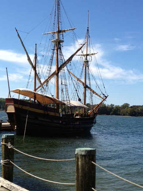 The Dove is an icon of St Mary's City. This is a reproduction of the
boat that the colonists from England used to come to the new world.
The Dove is an icon of St Mary's City. This is a reproduction of the
boat that the colonists from England used to come to the new world. 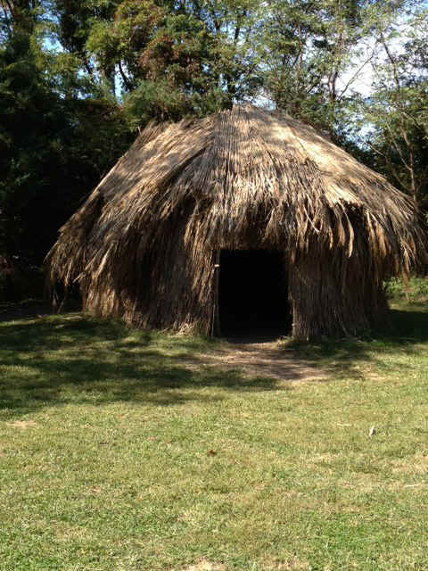 New since the last
time I was here with the family more than 20 years ago is a reproduction of an Indian
village that the English colonists would have found when they settled the area. As
usual, initially the native Americans accepted the Europeans with equanimity, but the
colonists soon demonstrated their covetous streak and their perfidy.
New since the last
time I was here with the family more than 20 years ago is a reproduction of an Indian
village that the English colonists would have found when they settled the area. As
usual, initially the native Americans accepted the Europeans with equanimity, but the
colonists soon demonstrated their covetous streak and their perfidy.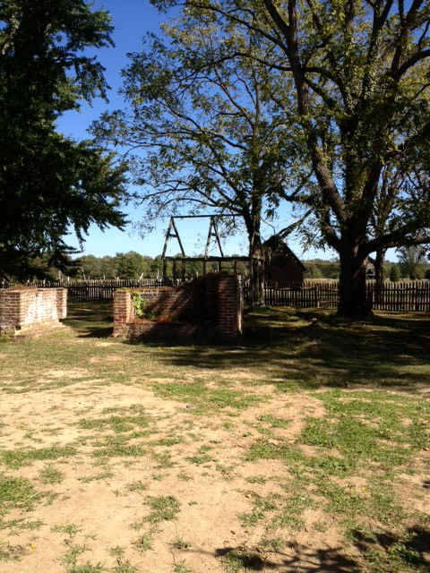 In this photo we
see the three modes of living history restoration. The brickwork in the foreground
is the remains of a wall and foundation of a colonial era home on the property. In
the middle ground is a framing of a structure that is once thought to have stood on the
spot. In the background is a reproduction of a colonial era farm building thought to have
occupied the same spot.
In this photo we
see the three modes of living history restoration. The brickwork in the foreground
is the remains of a wall and foundation of a colonial era home on the property. In
the middle ground is a framing of a structure that is once thought to have stood on the
spot. In the background is a reproduction of a colonial era farm building thought to have
occupied the same spot.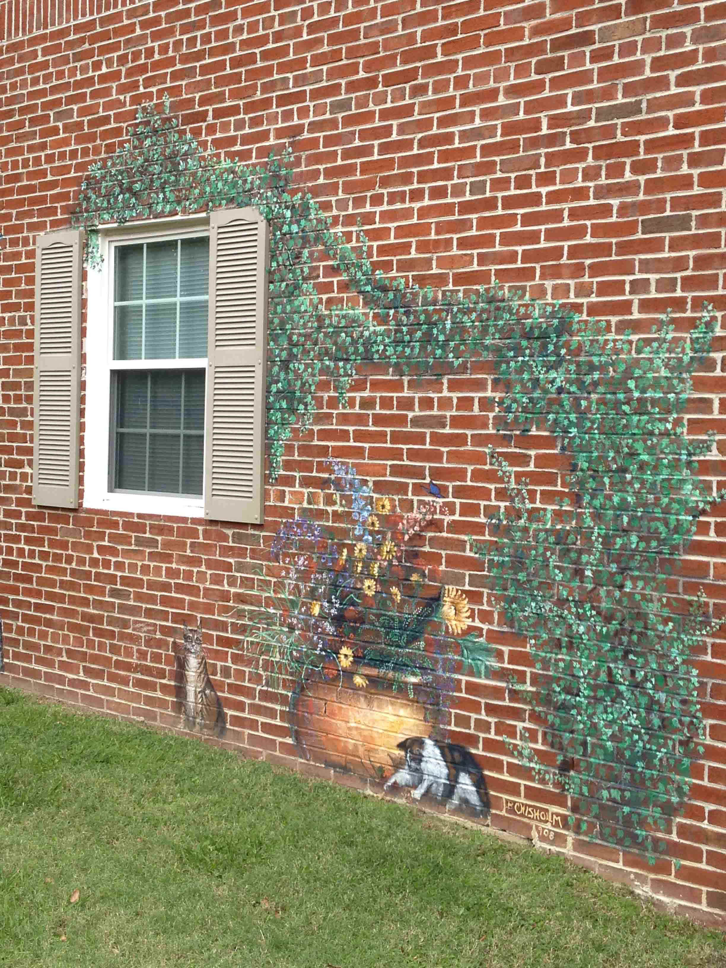
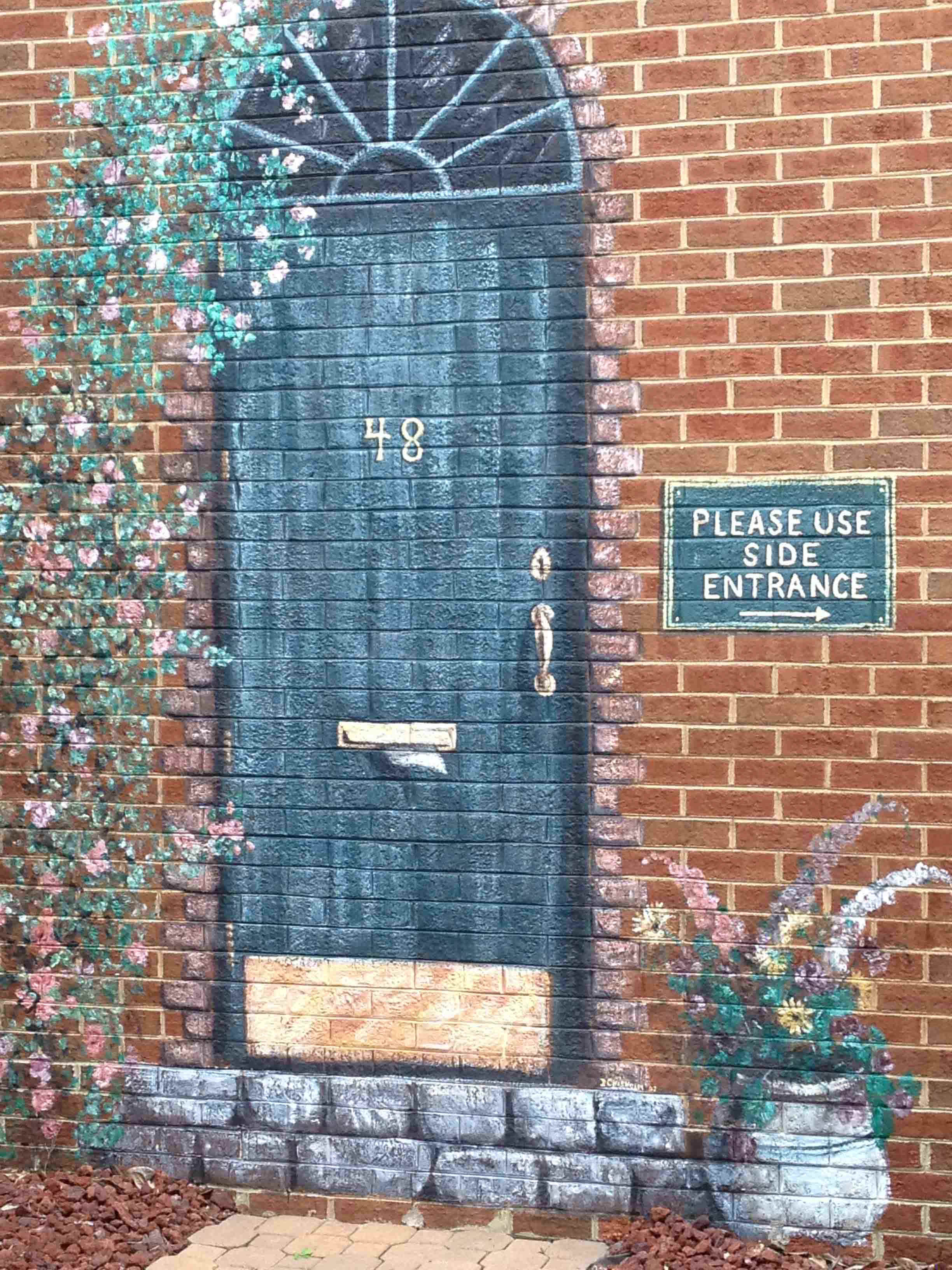
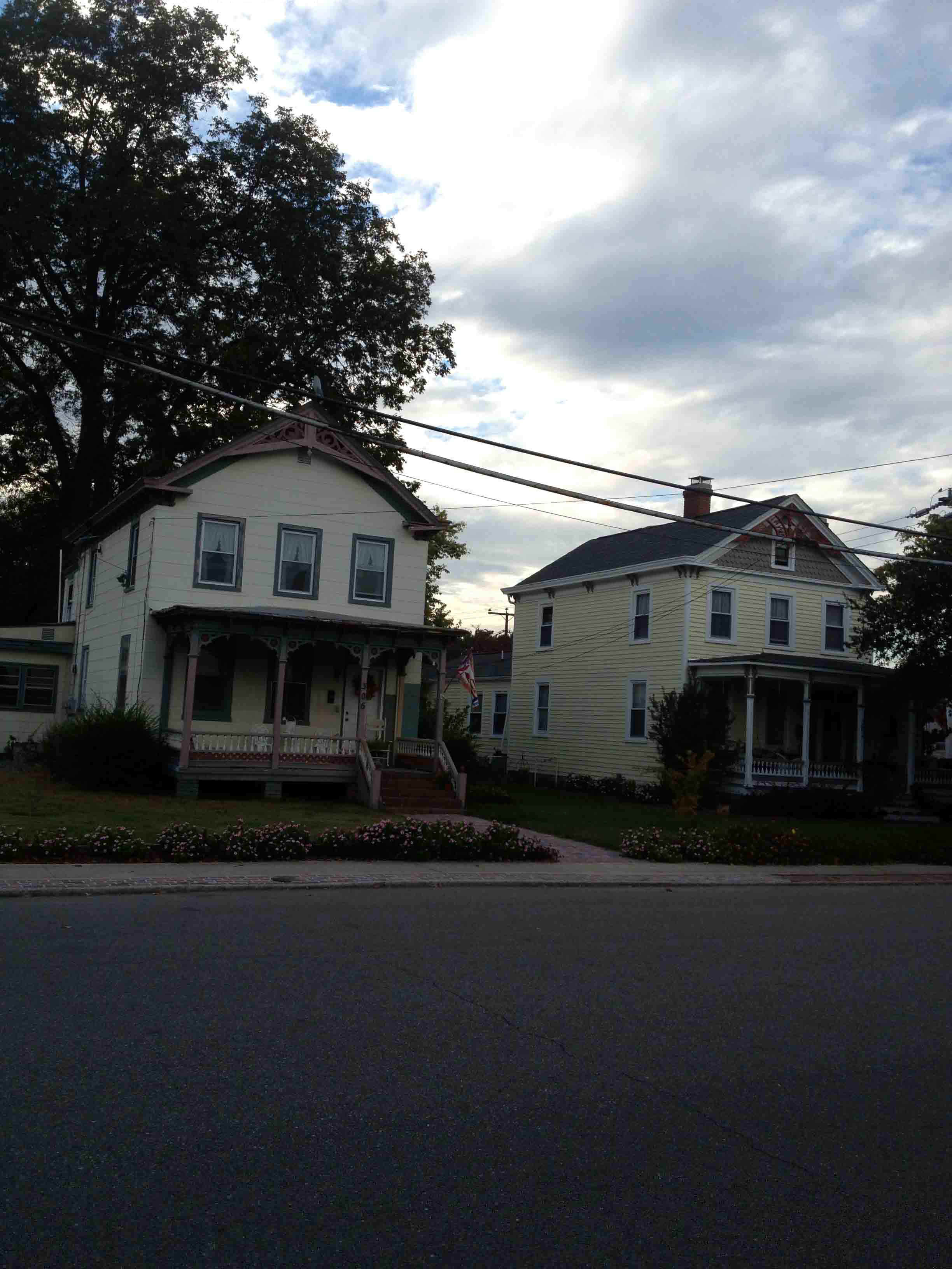 There is a section of
Hampton known as Little England, replete with Victorian style homes similar to those one
would find in Cape May, NJ. These are two humble examples of such homes to be found in the
Little England neighborhood.
There is a section of
Hampton known as Little England, replete with Victorian style homes similar to those one
would find in Cape May, NJ. These are two humble examples of such homes to be found in the
Little England neighborhood.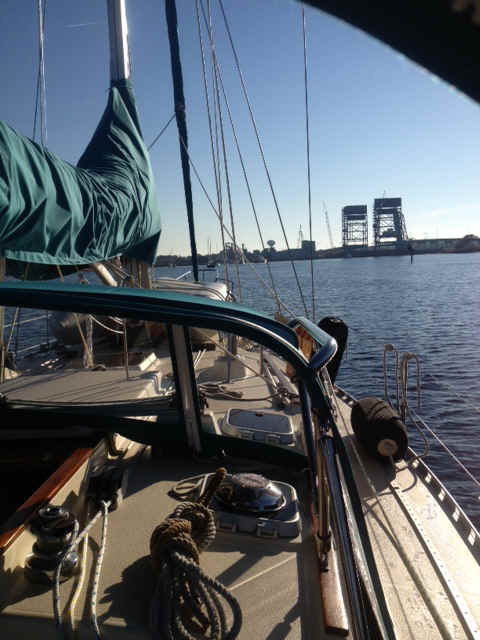
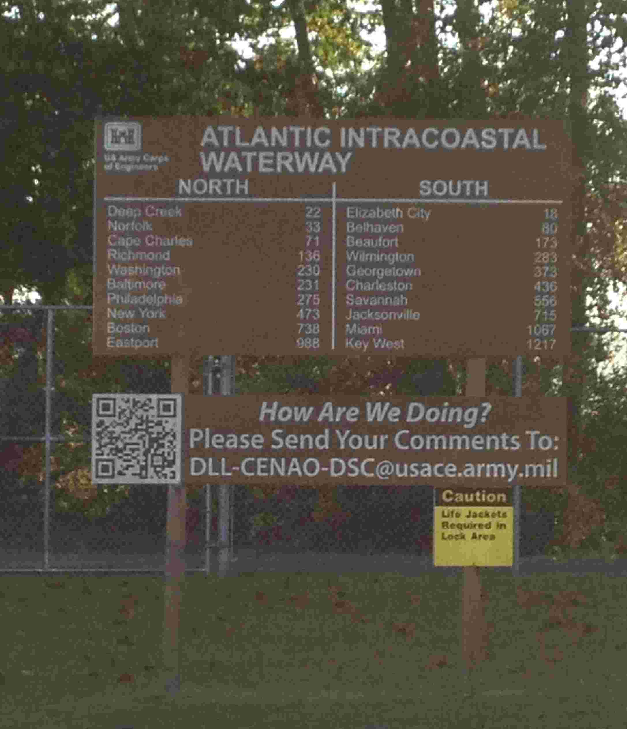 At both the Deep Creek
and South Mills locks there are mile markers so that the boaters can see how far they have
come and how far they are going. The distance winner in our group of five was
Running Free. They were in Nova Scotia this summer.
At both the Deep Creek
and South Mills locks there are mile markers so that the boaters can see how far they have
come and how far they are going. The distance winner in our group of five was
Running Free. They were in Nova Scotia this summer.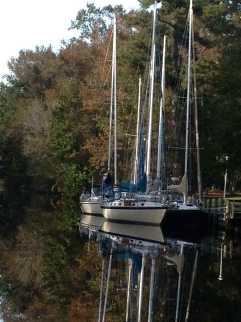
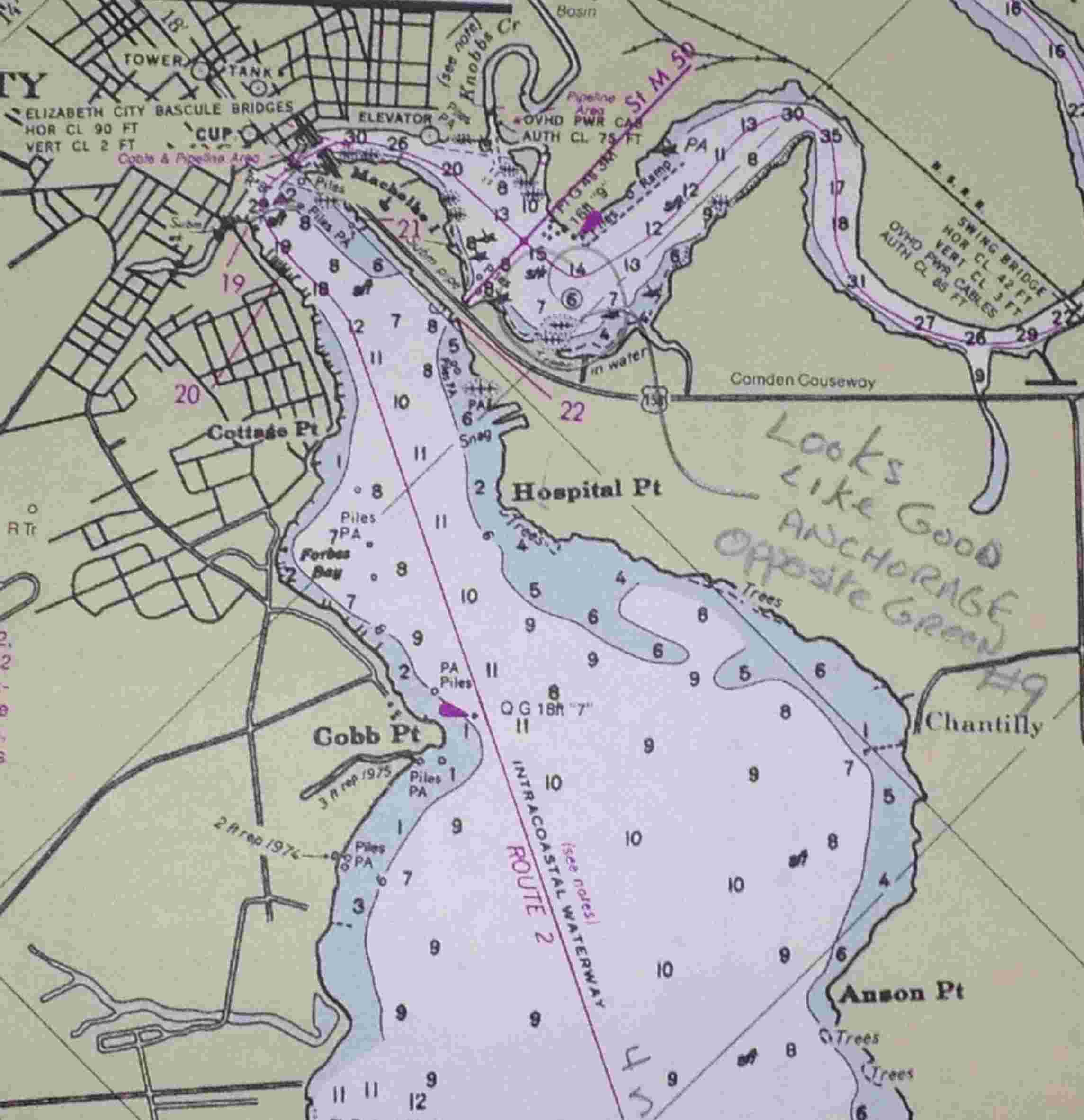 This is an image
of the chart for Elizabeth City. My approach was from the upper right edge of the
image. The magenta line marks the ICW. From the trip north two years ago you can see
my note about an anchorage in the horseshoe bend. With the forecast wind from the NE
I decided to anchor further to the northwest. Below the symbol for the
G"9" day mark go to the NW to find the depths 14, 15 then 8. My plan was
to anchor on the 8, which would be in the lee when the wind came in from the E, then NE,
then N. I had the anchor down by noonish, then made a trip in to town to
visit the post office. Another boat that anchored in the southern end of the horseshoe
bend came and anchored behind me.About 4 PM a local came by in their sailboat and informed
me that the Elizabeth City Bridge tender wanted me to call him on VHF 13. The bridge
operator suggested that I was in a very bad location since a barge and tug came through my
location to serve the wood chip mill. You can see the dashed line marking that
channel as the hockey stick shape just above the 8 ft depth spot. Discretion being
the better part of valor, I upped anchor and headed in to the city dock. Free, but
no water or electricity.
This is an image
of the chart for Elizabeth City. My approach was from the upper right edge of the
image. The magenta line marks the ICW. From the trip north two years ago you can see
my note about an anchorage in the horseshoe bend. With the forecast wind from the NE
I decided to anchor further to the northwest. Below the symbol for the
G"9" day mark go to the NW to find the depths 14, 15 then 8. My plan was
to anchor on the 8, which would be in the lee when the wind came in from the E, then NE,
then N. I had the anchor down by noonish, then made a trip in to town to
visit the post office. Another boat that anchored in the southern end of the horseshoe
bend came and anchored behind me.About 4 PM a local came by in their sailboat and informed
me that the Elizabeth City Bridge tender wanted me to call him on VHF 13. The bridge
operator suggested that I was in a very bad location since a barge and tug came through my
location to serve the wood chip mill. You can see the dashed line marking that
channel as the hockey stick shape just above the 8 ft depth spot. Discretion being
the better part of valor, I upped anchor and headed in to the city dock. Free, but
no water or electricity.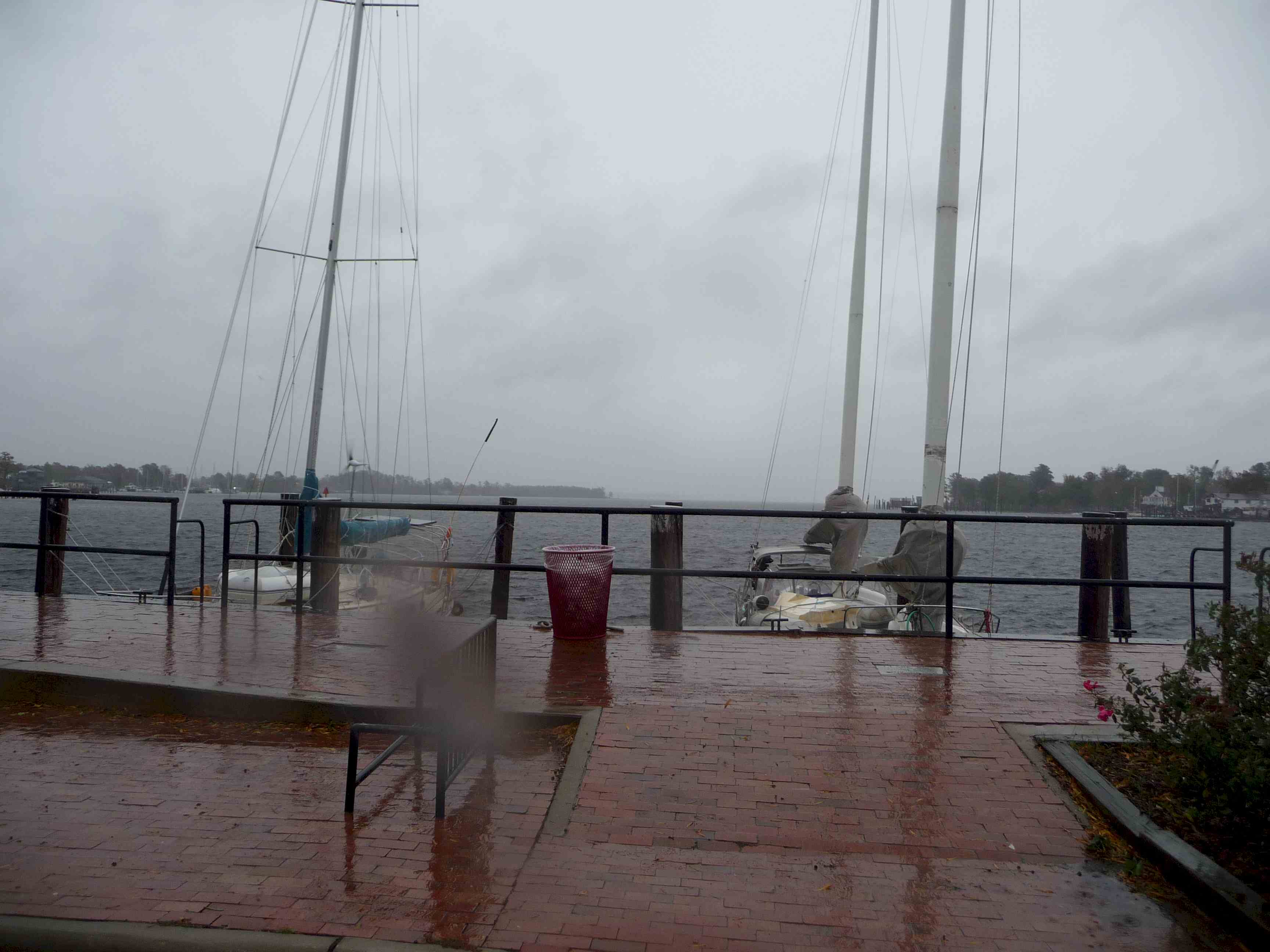 At the left are Andante and Running Free, from left to
right. In the photo you can see that Andante is heeled to port from the wind. on the
port quarter you can see the man-overboard pole bending to the wind. This pole is
ususally perfectly vertical.
At the left are Andante and Running Free, from left to
right. In the photo you can see that Andante is heeled to port from the wind. on the
port quarter you can see the man-overboard pole bending to the wind. This pole is
ususally perfectly vertical.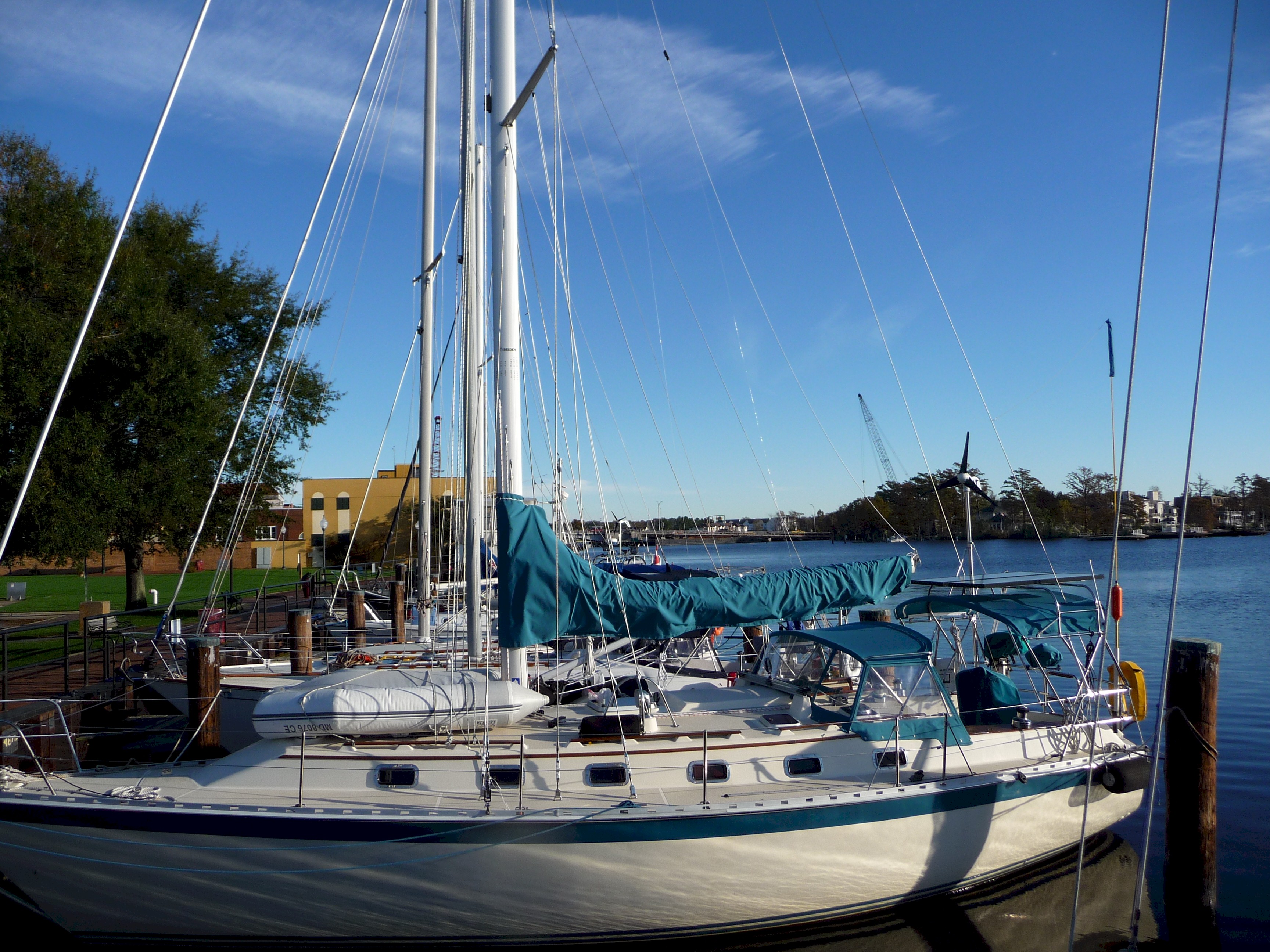 The same dock after the storm had passed.
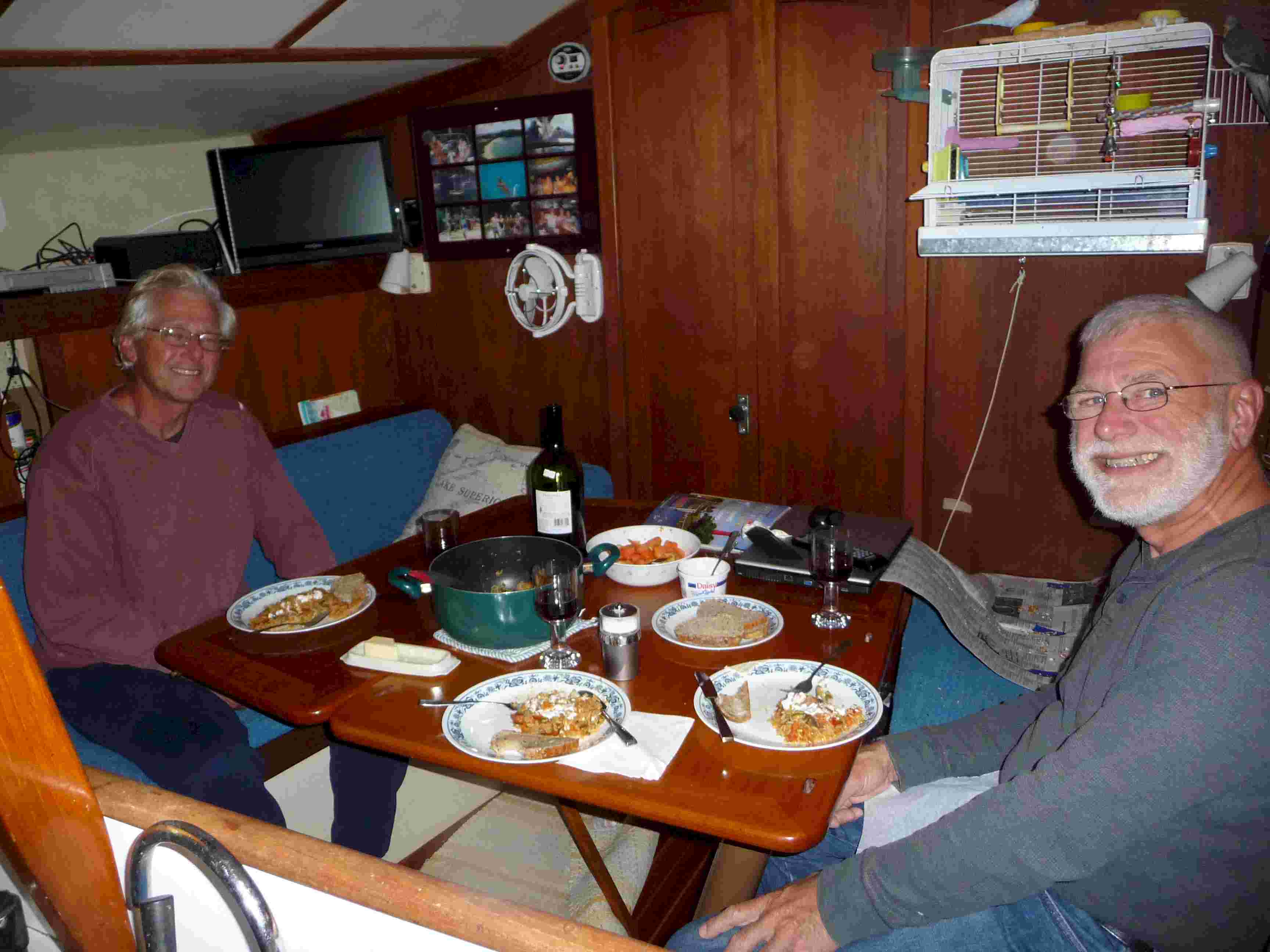 Dinner
with Carl and Joyce (she is snapping the photo) on board their Freedom 40 "Running
Free." A delicious jambalaya with salad. Earlier in the day I had baked
pumpkin bread in order to warm up the cabin of Andante so we had that for dessert.
Dinner
with Carl and Joyce (she is snapping the photo) on board their Freedom 40 "Running
Free." A delicious jambalaya with salad. Earlier in the day I had baked
pumpkin bread in order to warm up the cabin of Andante so we had that for dessert. 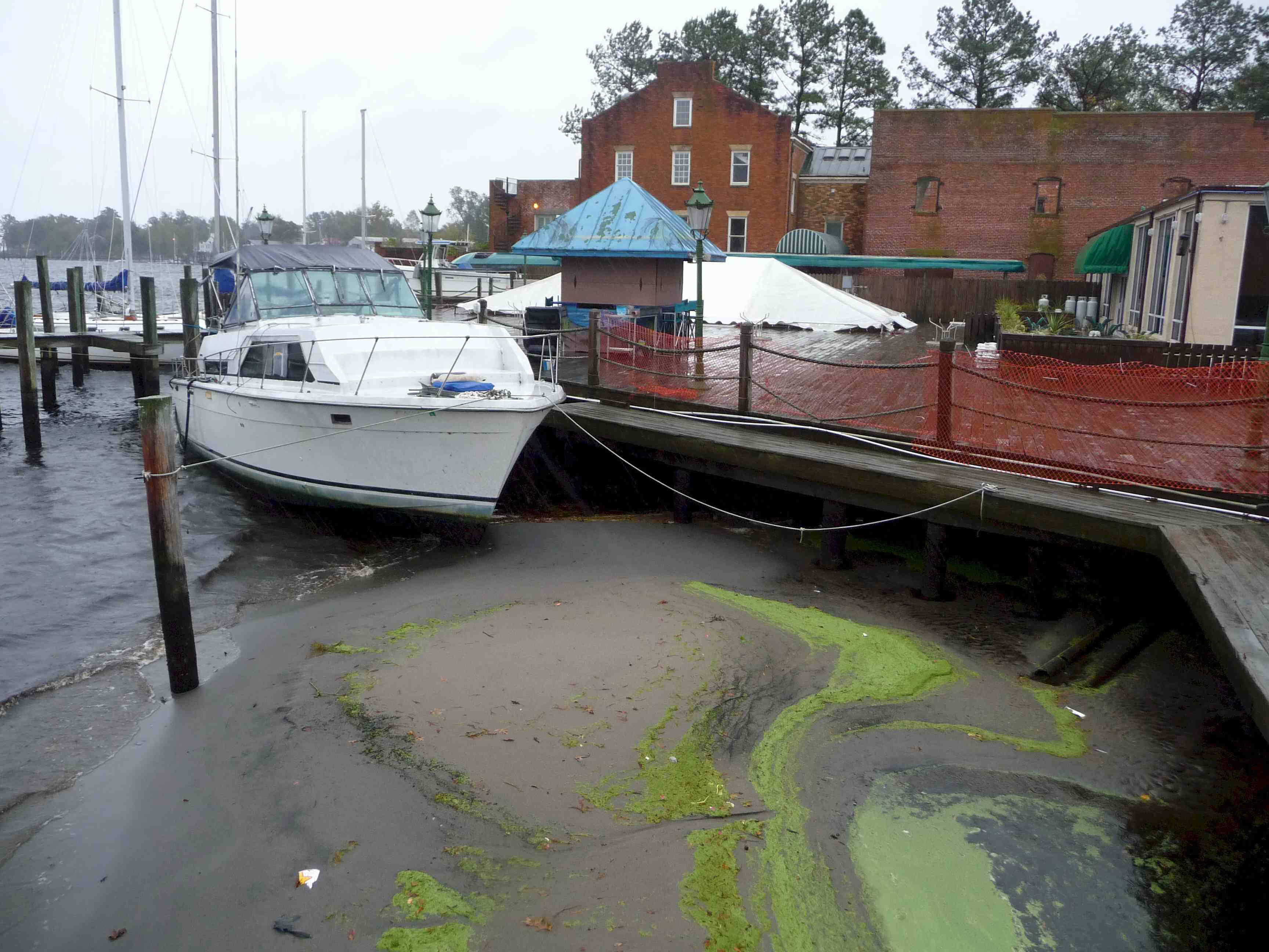 In this photo
the bow of the small power boat is aground. This is definitely not normal. To
add some more persepctive look again at the above picture. Until this morning
Andante's bow pulpit was above the lip of the bulkhead and it was a simple step off the
boat. As I write this Andante's deck is now about 4 feet below the level of the lip
of the bulkhead.
In this photo
the bow of the small power boat is aground. This is definitely not normal. To
add some more persepctive look again at the above picture. Until this morning
Andante's bow pulpit was above the lip of the bulkhead and it was a simple step off the
boat. As I write this Andante's deck is now about 4 feet below the level of the lip
of the bulkhead.